Woëvre on:
[Wikipedia]
[Google]
[Amazon]

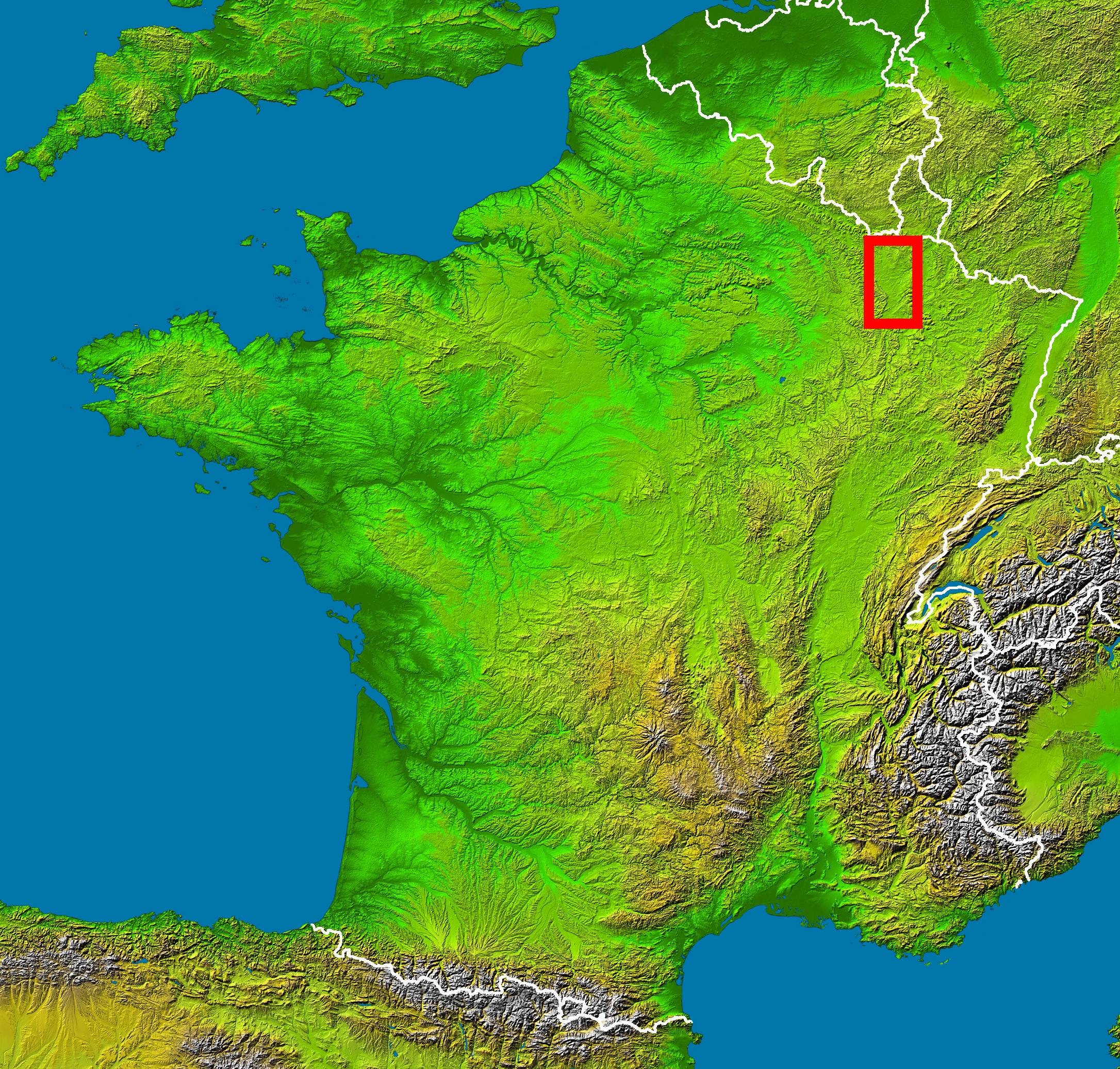
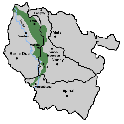
 The Woëvre () (German: ''Waberland'') is a

 The Woëvre () (German: ''Waberland'') is a
 natural region
A natural region (landscape unit) is a basic geographic unit. Usually, it is a region which is distinguished by its common natural features of geography, geology, and climate.
From the ecological point of view, the naturally occurring flora an ...
of Lorraine
Lorraine , also , , ; Lorrain: ''Louréne''; Lorraine Franconian: ''Lottringe''; german: Lothringen ; lb, Loutrengen; nl, Lotharingen is a cultural and historical region in Northeastern France, now located in the administrative region of Gra ...
in northeastern France
France (), officially the French Republic ( ), is a country primarily located in Western Europe. It also comprises of Overseas France, overseas regions and territories in the Americas and the Atlantic Ocean, Atlantic, Pacific Ocean, Pac ...
. It forms part of Lorraine plateau and lies largely in the department of Meuse
The Meuse ( , , , ; wa, Moûze ) or Maas ( , ; li, Maos or ) is a major European river, rising in France and flowing through Belgium and the Netherlands before draining into the North Sea from the Rhine–Meuse–Scheldt delta. It has a ...
. Along with the Côtes de Moselle, the Woëvre is one of the areas in Lorraine that receives the least rainfall; nonetheless, its river system is very important and feeds into the Lac de Madine.
Location
It lies on the right bank of the riverMeuse
The Meuse ( , , , ; wa, Moûze ) or Maas ( , ; li, Maos or ) is a major European river, rising in France and flowing through Belgium and the Netherlands before draining into the North Sea from the Rhine–Meuse–Scheldt delta. It has a ...
, from the valley of the Chiers
The Chiers (; lb, Kuer, german: Korn) is a river in Luxembourg, Belgium and France. It is a right tributary of the Meuse. The total length of the Chiers is aproxamately , of which in France.
The source of the Chiers is near Differdange, i ...
in the north to the town of Neufchâteau in the south. To the west, the region follows the Meuse, and to the east, it extends into the neighboring department of Meurthe-et-Moselle
Meurthe-et-Moselle () is a department in the Grand Est region of France, named after the rivers Meurthe and Moselle. It had a population of 733,760 in 2019.Lac de Madine lies in the Woëvre, like does the western part of the
Parc naturel régional de Lorraine
Lorraine Regional Natural Park (French: ''Parc naturel régional de Lorraine'') is a protected area of pastoral countryside in the Grand Est region of northeastern France, in the historic region of Lorraine. The park covers a total area of . The ...
. Neighboring natural regions include the Côtes de Meuse on the left bank of the Meuse, the Barrois to the south and the Côtes de Moselle to the east. The part French, part Belgian Gaume
Gaume () is a region in the extreme southeast of Belgium. At a lower altitude than the Ardennes, it borders the French region of Lorraine to the south (although some consider the bordering parts of Lorraine to be Gaume française), the Land of ...
region lies to the north.
Features
Since theMiddle Ages
In the history of Europe, the Middle Ages or medieval period lasted approximately from the late 5th to the late 15th centuries, similar to the post-classical period of global history. It began with the fall of the Western Roman Empire ...
, inhabitants along part of this system have used earthen levees to create ponds used for aquaculture
Aquaculture (less commonly spelled aquiculture), also known as aquafarming, is the controlled cultivation ("farming") of aquatic organisms such as fish, crustaceans, mollusks, algae and other organisms of value such as aquatic plants (e.g. lot ...
, which now provide important refuges for migratory birds.
The region's soil includes layers of sandstone
Sandstone is a clastic sedimentary rock composed mainly of sand-sized (0.0625 to 2 mm) silicate grains. Sandstones comprise about 20–25% of all sedimentary rocks.
Most sandstone is composed of quartz or feldspar (both silicat ...
and limestone
Limestone ( calcium carbonate ) is a type of carbonate sedimentary rock which is the main source of the material lime. It is composed mostly of the minerals calcite and aragonite, which are different crystal forms of . Limestone forms w ...
aquifers
An aquifer is an underground layer of water-bearing, permeable rock, rock fractures, or unconsolidated materials (gravel, sand, or silt). Groundwater from aquifers can be extracted using a water well. Aquifers vary greatly in their characterist ...
separated by impermeable clay. It is particularly forested, particularly with oak trees.
Two small pieces of land are still heavily contaminated from WWI and are designated part of Zone Rouge
The ''Zone Rouge'' (English: Red Zone) is a chain of non-contiguous areas throughout northeastern France that the French government isolated after the First World War. The land, which originally covered more than , was deemed too physically ...
.
Conservation
Certain areas are designated as " Zones naturelles d'intérêt écologique, faunistique et floristique", or ZNIEFFs, which marks them as particularly important to the preservation of France's ecological heritage either because of the plants or animals they support, their ecological role or their local or national importance. The "Conservatoire des sites lorraines" was created to protect endangered species, and it purchased most of the areas in 1994. Parts of the Woëvre have been designated as a protectedRamsar site
A Ramsar site is a wetland site designated to be of international importance under the Ramsar Convention,8 ha (O)
*** Permanent 8 ha (P)
*** Seasonal Intermittent < 8 ha(Ts)
**
References
* ''Lorraine'', Encyclopédies Bonneton, Christine Bonneton Éditeur, 2002, Geography of Grand Est Natural regions of France Ramsar sites in Metropolitan France {{GrandEst-geo-stub