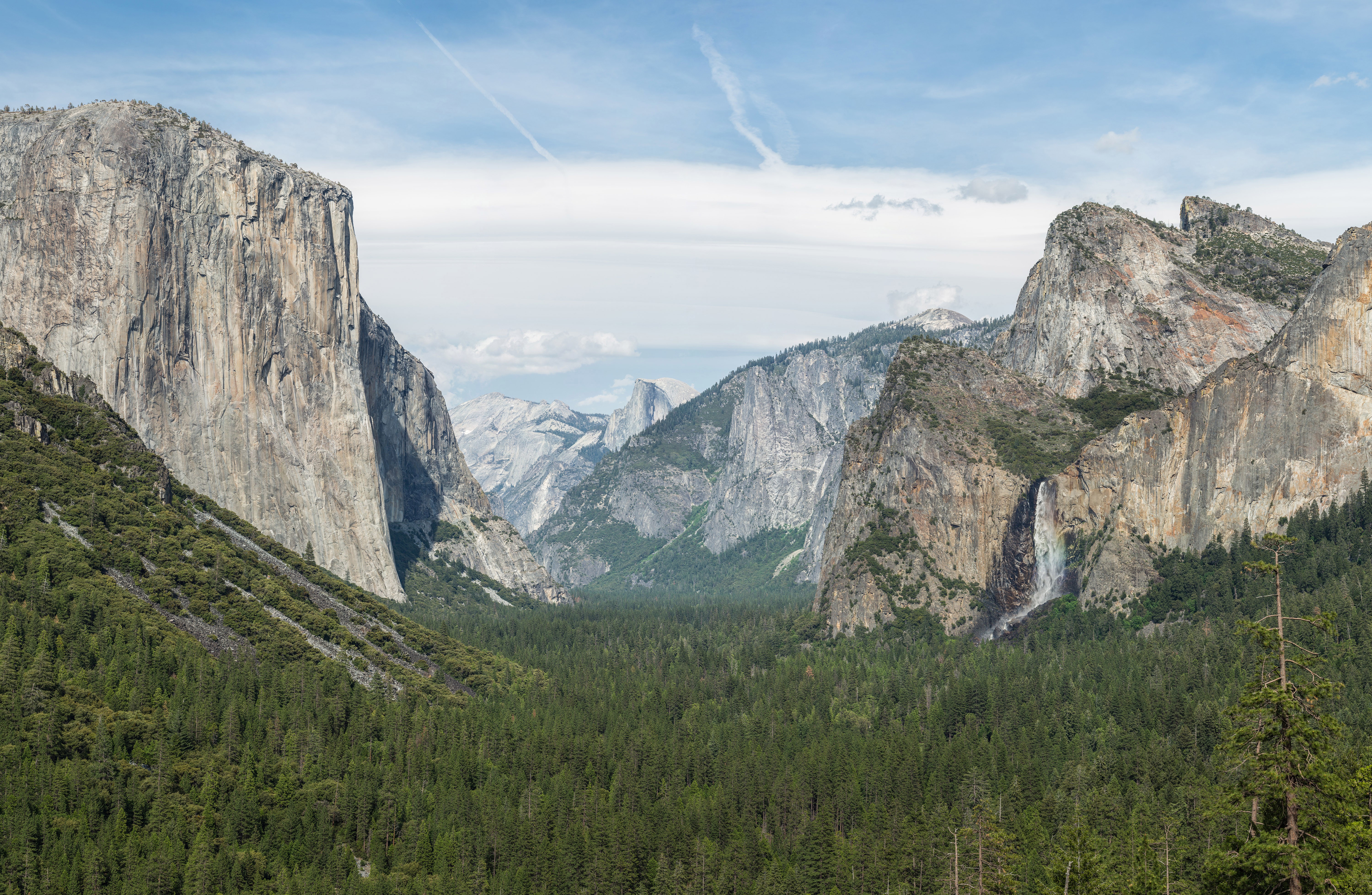
Tunnel View on:
[Wikipedia]
[Google]
[Amazon]
 Tunnel View is a
 Tunnel View is a
 scenic viewpoint
A scenic viewpoint – also called an observation point, viewpoint, viewing point, vista point, lookout, scenic overlook,These terms are more commonly used in North America. etc. – is an elevated location where people can view scenery (often w ...
on California State Route 41
State Route 41 (SR 41) is a state highway in California, connecting the Central Coast with the San Joaquin Valley and the Sierra Nevada. Its western terminus is at the Cabrillo Highway ( SR 1) in Morro Bay, and its eastern terminus is at SR ...
in Yosemite National Park
Yosemite National Park ( ) is an American national park in California, surrounded on the southeast by Sierra National Forest and on the northwest by Stanislaus National Forest. The park is managed by the National Park Service and covers an ar ...
. Visitors have seen and documented the iconic and expansive views of Yosemite Valley
Yosemite Valley ( ; ''Yosemite'', Miwok for "killer") is a U-shaped valley, glacial valley in Yosemite National Park in the western Sierra Nevada (U.S.), Sierra Nevada mountains of Central California. The valley is about long and deep, surroun ...
from the overlook since its opening in 1933.
The large viewpoint area is located directly east of the Wawona Tunnel
The Wawona Tunnel is a highway tunnel in Yosemite National Park. It, and Tunnel View just beyond its east portal, were completed in 1933.
Wawona Tunnel is named after the community of Wawona but its name origin is not known. A popular story clai ...
portal, as one enters Yosemite Valley from points south. The view looks eastward into Yosemite Valley, and includes surrounding features, such as the southwest face of El Capitan
El Capitan ( es, El Capitán; "the Captain" or "the Chief") is a vertical Rock formations in the United States, rock formation in Yosemite National Park, on the north side of Yosemite Valley, near its western end. The El Capitan Granite, granit ...
on the left, Half Dome
Half Dome is a granite dome at the eastern end of Yosemite Valley in Yosemite National Park, California. It is a well-known rock formation in the park, named for its distinct shape. One side is a sheer face while the other three sides are smooth ...
on axis, and Bridalveil Fall
Bridalveil Fall is one of the most prominent waterfalls in the Yosemite Valley in California.
The waterfall is in height and flows year round.
Geology
The glaciers that carved Yosemite Valley left many hanging valleys that spawned the waterfa ...
on the right.
For many arriving by road, this is the stunning first view, upon suddenly exiting the long and dark tunnel, of Yosemite Valley and its setting. A turn out with parking lot accommodates leaving vehicles behind, to take it all in. The trailhead, for the hiking trail up and south to Inspiration Point, is located here.
See also
*National Register of Historic Places listings in Yosemite National Park
This is a list of the National Register of Historic Places listings in Yosemite National Park.
This is intended to be a complete list of the properties and districts on the National Register of Historic Places in Yosemite National Park, California ...
* Index: Yosemite National Park
References
History of Mariposa County, California Tourist attractions in Mariposa County, California National Park Service rustic in Yosemite National Park 1933 establishments in California {{Yosemite-stub