Semberija on:
[Wikipedia]
[Google]
[Amazon]
 Semberija ( sr-Cyrl, Семберија, ) is a geographical region in north-eastern
File:Biblioteka u Bijeljini.JPG, National Library in Bijeljina
File:Strojice ispred crkve.jpg,
SKUD Semberija BijeljinaSemberija folk fest: Ritam Evrope
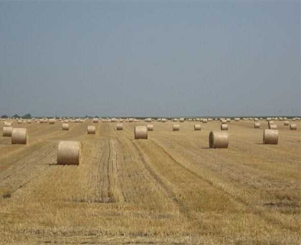
Fields of Bosnia and Herzegovina Regions of Bosnia and Herzegovina
 Semberija ( sr-Cyrl, Семберија, ) is a geographical region in north-eastern
 Bosnia and Herzegovina
Bosnia and Herzegovina ( sh, / , ), abbreviated BiH () or B&H, sometimes called Bosnia–Herzegovina and often known informally as Bosnia, is a country at the crossroads of south and southeast Europe, located in the Balkans. Bosnia and H ...
. The main city in the region is Bijeljina
Bijeljina ( sr-cyrl, Бијељина) is a city and municipality in Bosnia and Herzegovina. It is the provincial center of Semberija, a geographic region in the country's northeast. Administratively, Bijeljina is part of the Republika Srpska ...
. Semberija is located between the Drina
The Drina ( sr-Cyrl, Дрина, ) is a long Balkans river, which forms a large portion of the border between Bosnia and Herzegovina and Serbia. It is the longest tributary of the Sava River and the longest karst river in the Dinaric Alps whi ...
and Sava
The Sava (; , ; sr-cyr, Сава, hu, Száva) is a river in Central and Southeast Europe, a right-bank and the longest tributary of the Danube. It flows through Slovenia, Croatia and along its border with Bosnia and Herzegovina, and finally t ...
rivers and Majevica mountain. Most of the region is administratively situated in the entity of Republika Srpska
Republika Srpska ( sr-Cyrl, Република Српска, lit=Serb Republic, also known as Republic of Srpska, ) is one of the two entities of Bosnia and Herzegovina, the other being the Federation of Bosnia and Herzegovina. It is locat ...
, and the smaller part in the entity of Federation of Bosnia and Herzegovina.
Semberija has a very rich history. It was first mentioned in 1533 during the Ottoman rule. The name Semberija is of Hungarian origin and probably related to the time of the 12th-16th centuries when this area was occasionally held by the Hungarian Kingdom. Today about 200,000 people live in the area of Semberija, most in the municipality of Bijeljina.
Municipalities
Municipalities in the region of Semberija: *Bijeljina
Bijeljina ( sr-cyrl, Бијељина) is a city and municipality in Bosnia and Herzegovina. It is the provincial center of Semberija, a geographic region in the country's northeast. Administratively, Bijeljina is part of the Republika Srpska ...
107,715 inhabitants
*Čelić
Čelić ( sr-cyrl, Челић) is a town and municipality located in Tuzla Canton of the Federation of Bosnia and Herzegovina, an entity of Bosnia and Herzegovina.
Čelić was part of the municipality of Lopare prior to the war in Bosnia and He ...
12,083 inhabitants
*Lopare
Lopare ( sr-cyrl, Лопаре) is a town and municipality located in Republika Srpska, an entity of Bosnia and Herzegovina. It is situated in the Majevica region. As of 2013, the town has a population of 2,709 inhabitants, while the municipality ...
15,357 inhabitants
*Ugljevik
Ugljevik ( sr-cyrl, Угљевик) is a town and municipality located in Republika Srpska, an entity of Bosnia and Herzegovina. As of 2013, it has a population of 15,710 inhabitants, while the town of Ugljevik has a population of 4,155 inhabitan ...
15,710 inhabitants
Gallery
Serbian traditional clothing
Serbian traditional clothing, also called as Serbian national costume or Serbian dress ( sr, / , plural: / ), refers to the traditional clothing worn by Serbs living in Serbia, Croatia, Bosnia and Herzegovina, Montenegro, and the extende ...
from Semberija
References
External links
SKUD Semberija Bijeljina
Fields of Bosnia and Herzegovina Regions of Bosnia and Herzegovina
Semberija
Semberija ( sr-Cyrl, Семберија, ) is a geographical region in north-eastern Bosnia and Herzegovina. The main city in the region is Bijeljina. Semberija is located between the Drina and Sava rivers and Majevica mountain. Most of the regio ...
{{BosniaHerzegovina-geo-stub