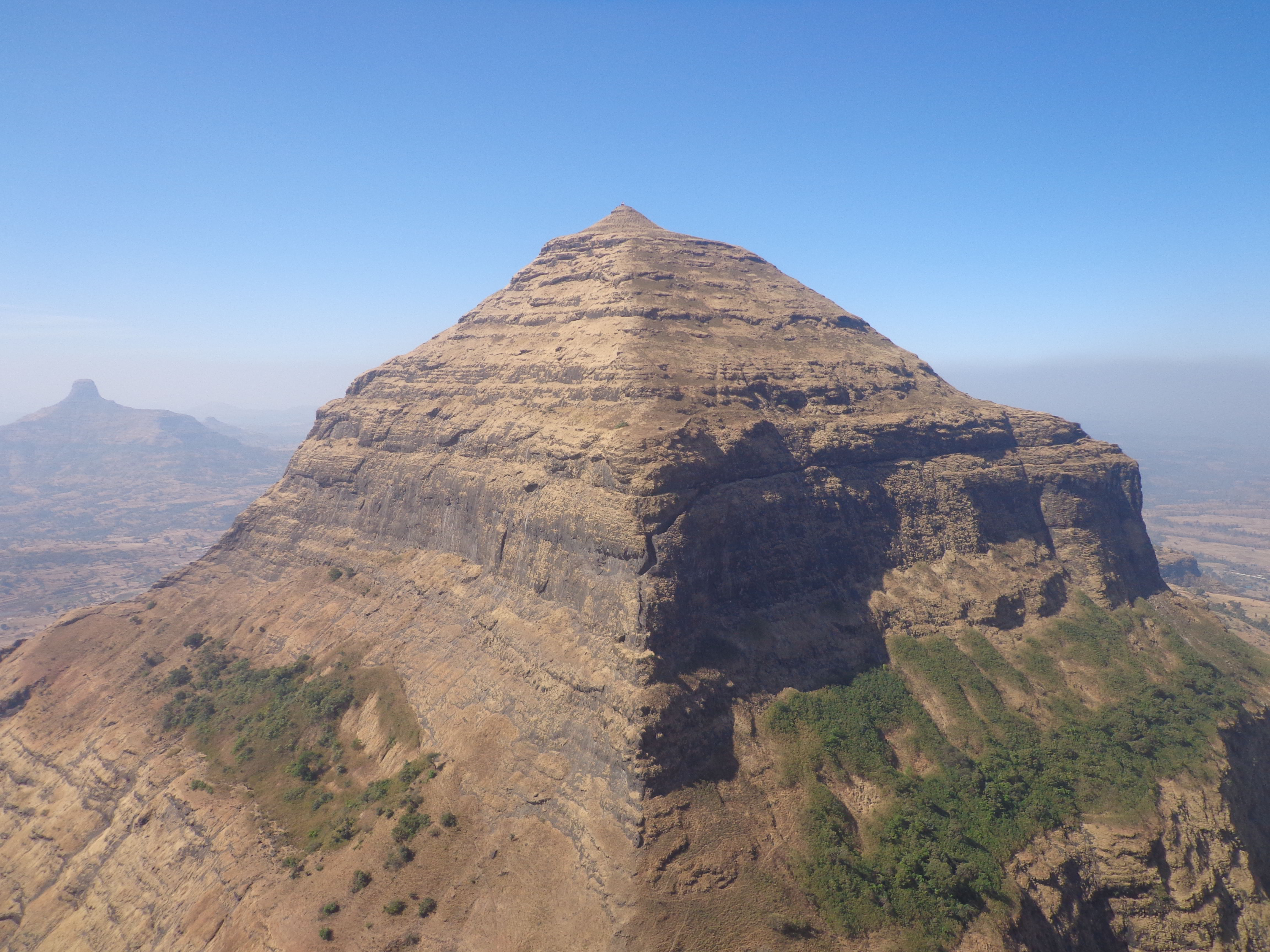
Selbari Range on:
[Wikipedia]
[Google]
[Amazon]
Selbari is a mountain range located in Nashik District in Maharashtra,

 Additional peaks in the Silbari-Dholbari range:
India
India, officially the Republic of India (Hindi: ), is a country in South Asia. It is the seventh-largest country by area, the second-most populous country, and the most populous democracy in the world. Bounded by the Indian Ocean on the so ...
. Spanning east-west the hills form the northernmost extent of the Sahyadris and serve as a natural boundary between Nashik District and Dhule district
Dhule district (Marathi pronunciation: ̪ʰuɭeː is a district of Maharashtra, India. The city of Dhule is the administrative headquarters of the district. It is part of North Maharashtra.
The Dhule district previously comprised tracts o ...
. The range is gifted with a number of peaks including the only two-pinnacled peak of Mangi-Tungi
Mangi-Tungi is a prominent twin-pinnacled peak with plateau in between, located near Tahrabad about 125 km from Nashik, Maharashtra, India. Mangi, high above sea level, is the western pinnacle and Tungi, high, the eastern. Mangi-Tungi ...
rising to a considerable height of up to 1,331 meters.
Traditionally, the range is limited to the hills sprawling north of the Mausam River
The Mausam River (Mosam River, Mokshaganga River) is a river in Nashik District in Maharashtra, India., United States National Geospatial-Intelligence Agency It is a left tributary of the Girna River.
Course
The Mausam River arises in the Weste ...
but extended definitions also include those south of the Mosam river which are connected to the former in a semi-circular loop. This shorter southern extension is known as the Dolbhari hills named after a village settlement around their base. To avoid disambiguity, sources refer to this agglomeration as the Selbari-Dholbari range.
Geology
The mountain range was formed by the same historical events that gave birth to the Western Ghats. Resting on the Deccan Plateau geologically identified as a large igneous province, it consists of solidified Flood basalt dating back to the Cenozoic era.Geography
The peaks progressively lose altitude towards the east, with westernmost peaks being twice as tall as those at the eastern end. East of this hill is situated the Selbari pass facilitating road communication in the depression caused by the headward erosion across this range by the Salvar nala, a tributary of the Panjhra river ofDhule district
Dhule district (Marathi pronunciation: ̪ʰuɭeː is a district of Maharashtra, India. The city of Dhule is the administrative headquarters of the district. It is part of North Maharashtra.
The Dhule district previously comprised tracts o ...
. Further east are situated the Hindabari pass and Thermal fort. Near the eastern extremity of this range within the district is situated the Galna fort, which has given its name to this line of hills, commanding a pass route from south to north. The western edge falls gently to the Dang region in Gujarat
Gujarat (, ) is a state along the western coast of India. Its coastline of about is the longest in the country, most of which lies on the Kathiawar peninsula. Gujarat is the fifth-largest Indian state by area, covering some ; and the ninth ...
.
List of notable peaks
The Highest list in the Selbari range (excluding Dholbari) is theMangi-Tungi
Mangi-Tungi is a prominent twin-pinnacled peak with plateau in between, located near Tahrabad about 125 km from Nashik, Maharashtra, India. Mangi, high above sea level, is the western pinnacle and Tungi, high, the eastern. Mangi-Tungi ...
peak with its higher pinnacle Mangi rising up to 4360 feet. If one includes the Dholbari range then, the tallest peak would be Salher
Salher is a place located near Waghamba in Satana tehsil in Nashik district of Maharashtra, India.The old name of Salher was Gavalgarh, which was based on the name of the local Bhil king named Gaval Bhil, he was the discoverer of this place. I ...
which is also the highest fort and the second highest peak in Maharashtra.

 Additional peaks in the Silbari-Dholbari range:
See also
*Satmala Range
Satmala (pronunciation: ɐtmaːla is a mountain range which runs across Nashik District, Maharashtra. They are an integral part of the Sahyadris range within Nashik. These peaks are visible from a greater part of the district and form prominen ...
* List of mountain peaks of Maharashtra
Maharashtra has an extensive mountain range running parallel to its 750 km long coastline. This range is geographically part of the Sahyadris or the Western Ghats which forms a crest along the western edge. of the Deccan plateau separating i ...
References
{{Western Ghats Nashik district