Satelit on:
[Wikipedia]
[Google]
[Amazon]


 Satelit ( sr, Сателит) is a small urban neighborhood of the city of
Wetpaint.com
Satelit
Bgnekretnine.net
Detailed map of Novi Sad and Satelit
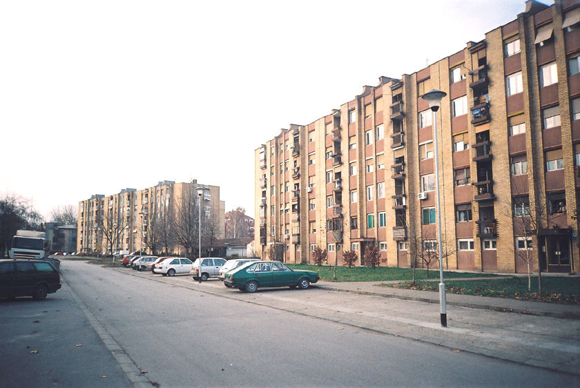
Satelit03.JPG, Satelit, Futoški put (Futog Road)
Satelit04.JPG, Satelit, Antuna Urbana Street
Satelit05.JPG, Satelit, Stevana Momčilovića Street
Satelitska pijaca.JPG, Satelit Market
Fk mladost ns.jpg, FK Mladost football stadium
{{Novi Sad
Novi Sad neighborhoods
Populated places established in 1957


 Satelit ( sr, Сателит) is a small urban neighborhood of the city of
 Novi Sad
Novi Sad ( sr-Cyrl, Нови Сад, ; hu, Újvidék, ; german: Neusatz; see below for other names) is the second largest city in Serbia and the capital of the autonomous province of Vojvodina. It is located in the southern portion of the Pan ...
, Serbia. In English it translates as “Satellite
A satellite or artificial satellite is an object intentionally placed into orbit in outer space. Except for passive satellites, most satellites have an electricity generation system for equipment on board, such as solar panels or radioi ...
”. It is part of the larger Bistrica urban area and neighborhood.
Borders
The southern border of Satelit is Futoški put (Futog Road), the western border is Bulevar Kneza Miloša (Knez Miloš Boulevard),the eastern border is Bulevar Slobodana Jovanovića (Slobodan Jovanović Boulevard) and the northern border is Bulevar Jovana Dučića (Jovan Dučić Boulevard).Neighbouring settlements
The neighbouring settlements of Satelit are: Telep on the south, Novo Naselje on the north and east andVeternik
Veternik ( sr-cyr, Ветерник) is a suburban settlement of the city of Novi Sad, Serbia. Its population numbers 17,454 (2011 census) and most of its inhabitants are ethnic Serbs. Over the years, especially in the 1990s, it grew with size and ...
on the west.
Parts of Satelit
Some of the parts of Satelit are: Stari Satelit (Old Satelit) and Mali Satelit (Tozinovac).History
The construction of Satelit began in 1957, when the first houses were built in the area now known as Tozinovac. Mass construction between 1976 and 1980 merged Satelit into the New Neighborhood (Novo Naselje), later named Bistrica. Between 2000 and 2020, most of Tozinovac was dismantled to make way for the Bate Brkića Boulevard extension, connecting it with Futoša street. Several new apartment buildings were constructed in the southern parts of Bate Brkića.Features
Some of the important features of Satelit are: Satelit Market (Satelitska pijaca), "Autokop" (a factory for production of idle parts for cars), and a stadium of " Mladost" football club. There is also an elementary school "Miloš Crnjanski" in the settlement.Notable citizens
*Dara Bubamara
Radojka Adžić ( sr-cyr, Радојка Аџић; born 21 May 1976), better known as Dara Bubamara ( sr-Cyrl, Дара Бубамара, lit=Dara the Ladybug), is a Serbian singer from Novi Sad.
Early life
Radojka Adžić was born on 21 May 197 ...
(Rada Adžić), a popular Serbian turbo-folk singer, grew up in Satelit.
See also
*Bistrica (Novo Naselje)
Bistrica ( sr-Cyrl, Бистрица), also known as Novo Naselje ( sr-Cyrl, Ново Насеље), is an urban neighborhood of the city of Novi Sad, Serbia. Bistrica (including Satelit) is one of the most populated urban areas of the city.
Names ...
*Neighborhoods of Novi Sad
This is a list of the neighbourhoods and suburbs of Novi Sad.
Neighbourhoods on the left bank of the Danube
* Stari Grad (Old City, City Centre)
* Bulevar
* Liman (Liman I, Liman II, Liman III, Liman IV)
* Almaški Kraj
* Podbara
** Indus ...
References
*Jovan Mirosavljević, Brevijar ulica Novog Sada 1745–2001, Novi Sad, 2002. *Zoran Rapajić, Novi Sad bez tajni,Beograd
Belgrade ( , ;, ; names in other languages) is the capital and largest city in Serbia. It is located at the confluence of the Sava and Danube rivers and the crossroads of the Pannonian Plain and the Balkan Peninsula. Nearly 1,166,763 million ...
, 2002.
External links
Wetpaint.com
Satelit
Bgnekretnine.net
Detailed map of Novi Sad and Satelit