River Lyd, Gloucestershire on:
[Wikipedia]
[Google]
[Amazon]


 The Lydney Canal is a one-mile canal in
 The Lyd is a small
Satellite image from Google Maps Historical Account of the Navigable Rivers, Canals, and Railways, Joseph Priestley
* {{Transport in Gloucestershire Canals in Gloucestershire Ports and harbours of Gloucestershire Canals linked to the River Severn Lydney Canals opened in 1813 1Lydney


 The Lydney Canal is a one-mile canal in
 Gloucestershire
Gloucestershire ( abbreviated Glos) is a county in South West England. The county comprises part of the Cotswold Hills, part of the flat fertile valley of the River Severn and the entire Forest of Dean.
The county town is the city of Gl ...
that runs inland from the River Severn
, name_etymology =
, image = SevernFromCastleCB.JPG
, image_size = 288
, image_caption = The river seen from Shrewsbury Castle
, map = RiverSevernMap.jpg
, map_size = 288
, map_c ...
to Lydney
Lydney is a town and civil parish in Gloucestershire, England. It is on the west bank of the River Severn in the Forest of Dean District, and is 16 miles (25 km) southwest of Gloucester. The town has been bypassed by the A48 road since 199 ...
. It was opened in 1813 to trans-ship iron and coal from the Forest of Dean
The Forest of Dean is a geographical, historical and cultural region in the western part of the county of Gloucestershire, England. It forms a roughly triangular plateau bounded by the River Wye to the west and northwest, Herefordshire to ...
. It was once connected by a horse-drawn tramroad to Pidcock's Canal which brought materials down to the wharves by tub-boat.
In the 1960s imported wood was still being brought in by barge from Avonmouth
Avonmouth is a port and outer suburb of Bristol, England, facing two rivers: the reinforced north bank of the final stage of the Avon which rises at sources in Wiltshire, Gloucestershire and Somerset; and the eastern shore of the Severn Es ...
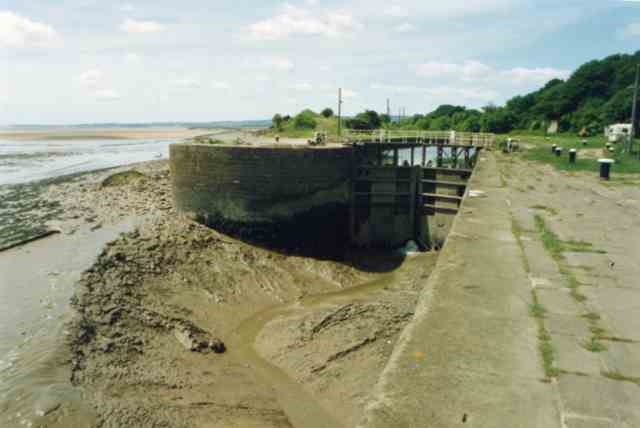
. It remained in commercial use until the 1980s. The entrance to the canal consists of an outer tidal gate opening into a wide basin. From there a lock opens into the one-mile canal cut. Immediately above the lock, a pair of gates points the other way as protection against a high tidal flood in the estuary. There is one swing bridge across the canal.
The docks were restored between 2003 and 2005, using money from the Heritage Lottery Fund
The National Lottery Heritage Fund, formerly the Heritage Lottery Fund (HLF), distributes a share of National Lottery funding, supporting a wide range of heritage projects across the United Kingdom.
History
The fund's predecessor bodies were ...
and others, to create a marina and harbour area for seagoing yachts and motor boats. In 2015 the outer lock gates failed in the open position and are inoperable. Consequently the harbour has become silted up from River Severn mud and is out of use.
Timeline
* 1809 – The Lydney and Lydbrook Railway Act enabled construction of atramroad
A plateway is an early kind of railway, tramway or wagonway, where the rails are made from cast iron. They were mainly used for about 50 years up to 1830, though some continued later.
Plateways consisted of "L"-shaped rails, where the flange ...
from Lydbrook to Lydney
Lydney is a town and civil parish in Gloucestershire, England. It is on the west bank of the River Severn in the Forest of Dean District, and is 16 miles (25 km) southwest of Gloucester. The town has been bypassed by the A48 road since 199 ...
.
* 1810 – A second act changed the company name to the "Severn & Wye Railway and Canal Company" and (amongst other things) authorises the building of the canal to the River Severn
, name_etymology =
, image = SevernFromCastleCB.JPG
, image_size = 288
, image_caption = The river seen from Shrewsbury Castle
, map = RiverSevernMap.jpg
, map_size = 288
, map_c ...
at Nass Point.
* 1810 – Josias Jessop (son of William Jessop
William Jessop (23 January 1745 – 18 November 1814) was an English civil engineer, best known for his work on canals, harbours and early railways in the late 18th and early 19th centuries.
Early life
Jessop was born in Devonport, Devon, the ...
) was appointed consulting engineer and designed plans for the canal.
* 1811 – Thomas Sheasby (son of Thomas Sheasby senior) was taken on as resident engineer.
* 1813 – The canal was opened by the Severn and Wye Railway and Canal Company.
* 1821 – The outer harbour was completed and the tramway extended all the way down.
* 1825 – The north pier was extended to aid ships' passage into the harbour.
* 1868 – The tramway was converted to broad gauge.
* 1872 – Converted to standard gauge.
* 1893 – Severn and Wye Railway and Canal Company went bankrupt.
* 1894 – Purchased by the Great Western and Midland Railways and administered by a Joint Committee of the two companies.
* 1948 – The railway and docks passed to the Western Region of the Railway Executive on nationalization.
* 1950 – Transferred to the Docks and Inland Waterways Executive.
* 1960 – The last coal was shipped from the harbour.
* 1977 – The harbour was closed.
* 1985 – The section from the swing bridge to the Severn was scheduled as an Ancient Monument
* 1988 – The swing bridge was scheduled as a Grade II listed building.
* 1996 – The Environment Agency took over management of the docks.
* 1997 – Inner gates collapsed and were replaced by a dam to reduce flood risk.
* 1998 – The Lydney Docks Partnership was established to create a sustainable future for the canal.
* 2005 – Re-opened after a two-year project of restoration and enhancement.
* 2015 – Outer lock gates became stuck in the open position leaving the harbour tidal and inaccessible.
River Lyd
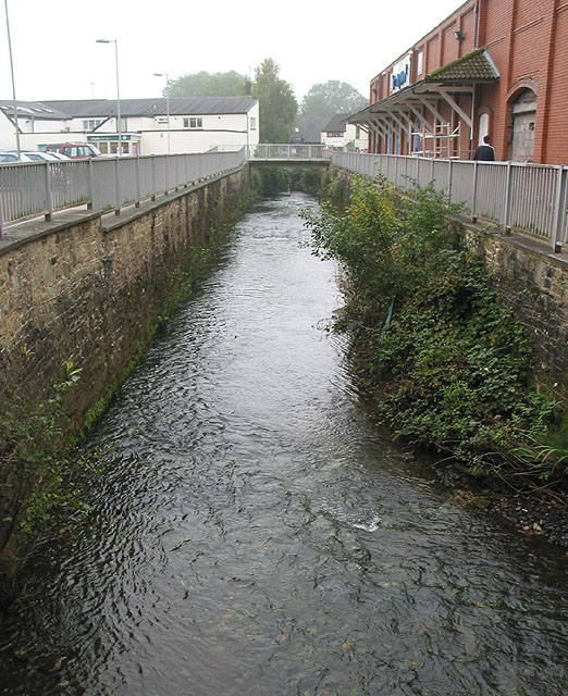
 The Lyd is a small
 river
A river is a natural flowing watercourse, usually freshwater, flowing towards an ocean, sea, lake or another river. In some cases, a river flows into the ground and becomes dry at the end of its course without reaching another body of w ...
in the Forest of Dean
The Forest of Dean is a geographical, historical and cultural region in the western part of the county of Gloucestershire, England. It forms a roughly triangular plateau bounded by the River Wye to the west and northwest, Herefordshire to ...
in Gloucestershire
Gloucestershire ( abbreviated Glos) is a county in South West England. The county comprises part of the Cotswold Hills, part of the flat fertile valley of the River Severn and the entire Forest of Dean.
The county town is the city of Gl ...
, England
England is a country that is part of the United Kingdom. It shares land borders with Wales to its west and Scotland to its north. The Irish Sea lies northwest and the Celtic Sea to the southwest. It is separated from continental Europe b ...
.
The Lyd flows into the River Severn
, name_etymology =
, image = SevernFromCastleCB.JPG
, image_size = 288
, image_caption = The river seen from Shrewsbury Castle
, map = RiverSevernMap.jpg
, map_size = 288
, map_c ...
via the canal
Canals or artificial waterways are waterways or engineered channels built for drainage management (e.g. flood control and irrigation) or for conveyancing water transport vehicles (e.g. water taxi). They carry free, calm surface flo ...
in Lydney
Lydney is a town and civil parish in Gloucestershire, England. It is on the west bank of the River Severn in the Forest of Dean District, and is 16 miles (25 km) southwest of Gloucester. The town has been bypassed by the A48 road since 199 ...
.
See also
*Canals of Great Britain
The canals of the United Kingdom are a major part of the network of inland waterways in the United Kingdom. They have a varied history, from use for irrigation and transport, through becoming the focus of the Industrial Revolution, to today's r ...
* History of the British canal system
References
External links
Satellite image from Google Maps
* {{Transport in Gloucestershire Canals in Gloucestershire Ports and harbours of Gloucestershire Canals linked to the River Severn Lydney Canals opened in 1813 1Lydney