Nomans Land on:
[Wikipedia]
[Google]
[Amazon]
 Nomans Land (
 In 1602, during the British ship ''Concord''s exploration of
  The eastern third of the island has been managed by the
Blocks 3059 and 3060, Block Group 3, Census Tract 2004, Dukes County
United States Census Bureau
Nomans Land Island National Wildlife Refuge
at the U.S. Fish & Wildlife Service site
James W. Mavor Jr.: The Nomans Runestone & Skywatching Shrines
NEARA {{authority control Islands of Dukes County, Massachusetts Uninhabited islands of Massachusetts Geography of Martha's Vineyard Buildings and structures in Dukes County, Massachusetts Coastal islands of Massachusetts Wampanoag tribe
 Nomans Land (
Wampanoag
The Wampanoag , also rendered Wôpanâak, are an Indigenous people of the Northeastern Woodlands based in southeastern Massachusetts and historically parts of eastern Rhode Island,Salwen, "Indians of Southern New England and Long Island," p. ...
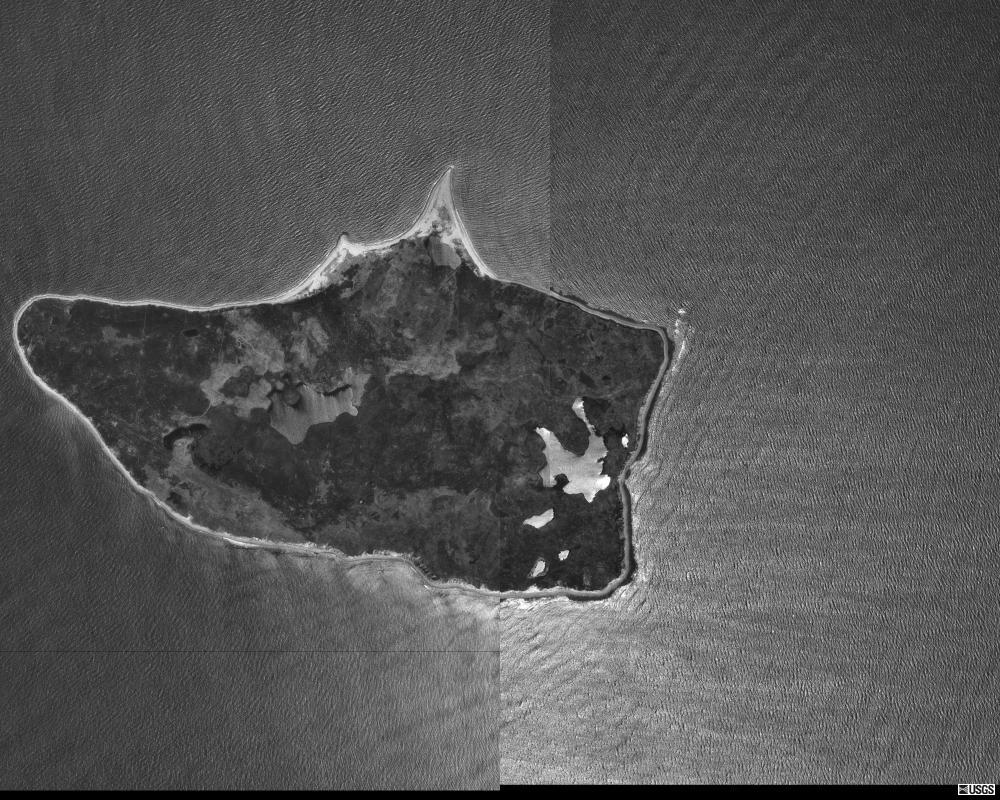
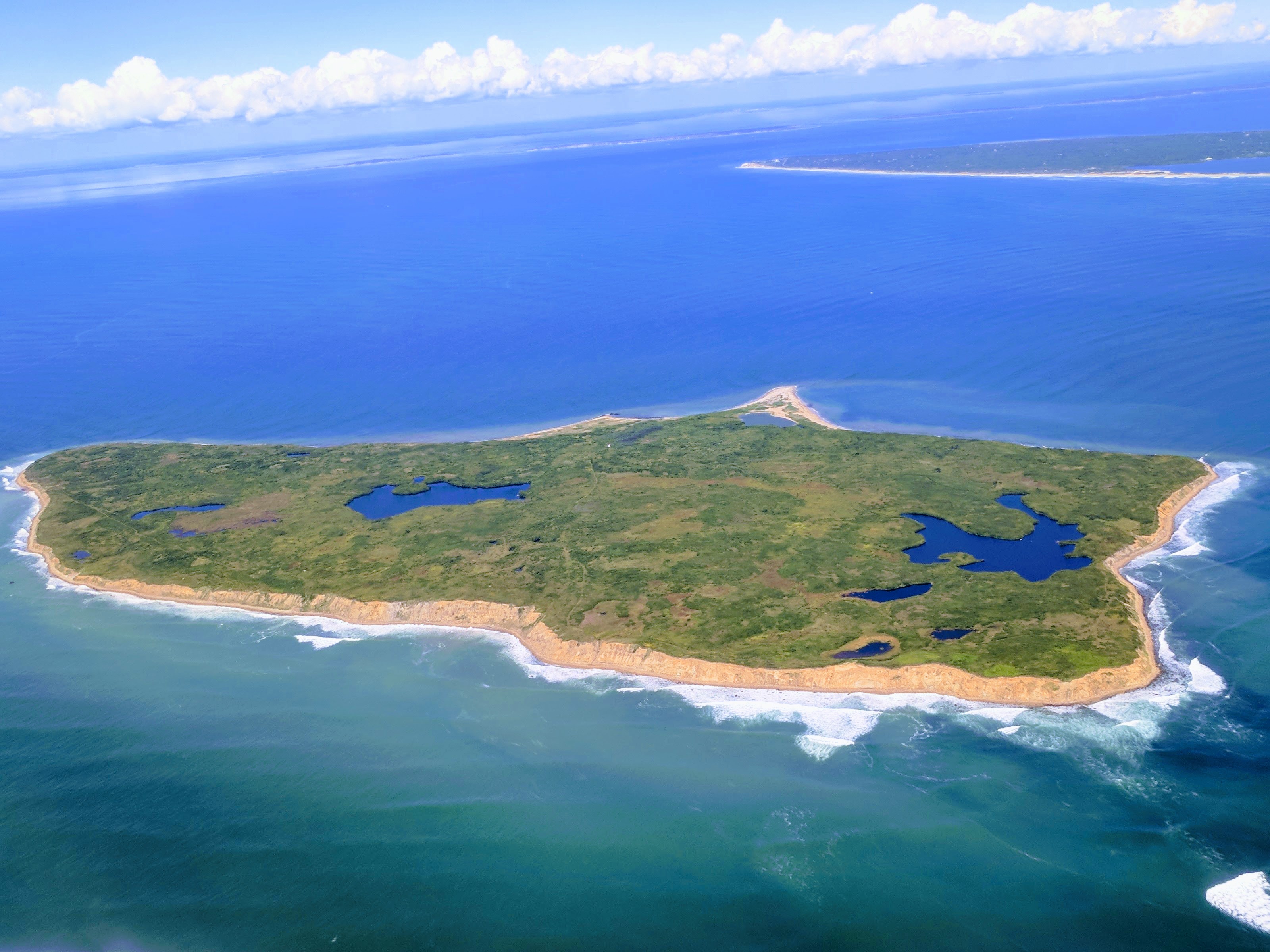
: ;; also mapped "No Man's Land," "No Mans Land," or "No Man's island"), is an uninhabited island 612 acres (248 ha) in size, located in the town of Chilmark, Dukes County, Massachusetts
Massachusetts (Massachusett: ''Muhsachuweesut Massachusett_writing_systems.html" ;"title="nowiki/> məhswatʃəwiːsət.html" ;"title="Massachusett writing systems">məhswatʃəwiːsət">Massachusett writing systems">məhswatʃəwiːsət'' En ...
. It is situated about 3 miles (4.8 km) off the southwest corner of the island of Martha's Vineyard
Martha's Vineyard, often simply called the Vineyard, is an island in the Northeastern United States, located south of Cape Cod in Dukes County, Massachusetts, known for being a popular, affluent summer colony. Martha's Vineyard includes the ...
.
The island was used by the United States Navy
The United States Navy (USN) is the maritime service branch of the United States Armed Forces and one of the eight uniformed services of the United States. It is the largest and most powerful navy in the world, with the estimated tonnage ...
as a practice bombing range from 1943 to 1996. In 1998, the Navy transferred the island to the United States Fish and Wildlife Service
The United States Fish and Wildlife Service (USFWS or FWS) is an agency within the United States Department of the Interior dedicated to the management of fish, wildlife, and natural habitats. The mission of the agency is "working with othe ...
for use as an unstaffed wildlife refuge, which now forms Nomans Land Island National Wildlife Refuge. Due to safety risks from unexploded ordnance and its value as a wildlife habitat, the island is closed to all public use.
History
 In 1602, during the British ship ''Concord''s exploration of
 Cape Cod
Cape Cod is a peninsula extending into the Atlantic Ocean from the southeastern corner of mainland Massachusetts, in the northeastern United States. Its historic, maritime character and ample beaches attract heavy tourism during the summer mont ...
, Captain Bartholomew Gosnold named Nomans Land "Martha's Vineyard" after his eldest daughter, Martha. However, the name was later transferred to the larger island currently known as Martha's Vineyard
Martha's Vineyard, often simply called the Vineyard, is an island in the Northeastern United States, located south of Cape Cod in Dukes County, Massachusetts, known for being a popular, affluent summer colony. Martha's Vineyard includes the ...
, which is located northeast of Nomans Land.
The island was probably named "Nomans Land" after a Martha's Vineyard Wampanoag
The Wampanoag , also rendered Wôpanâak, are an Indigenous people of the Northeastern Woodlands based in southeastern Massachusetts and historically parts of eastern Rhode Island,Salwen, "Indians of Southern New England and Long Island," p. ...
sachem
Sachems and sagamores are paramount chiefs among the Algonquians or other Native American tribes of northeastern North America, including the Iroquois. The two words are anglicizations of cognate terms (c. 1622) from different Eastern Al ...
, Tequenoman, who had jurisdiction over the island when the English came in the early 17th century: named from "''Teque''Noman's Land" (figurative phrase).
An entail of 1695 mentions that William Nicoll of Islip Grange, Long Island
Long Island is a densely populated island in the southeastern region of the U.S. state of New York, part of the New York metropolitan area. With over 8 million people, Long Island is the most populous island in the United States and the 18 ...
, New York, owned the Island of Normans Land near "Martins Vineyard" recalling the fact that on December 19, 1685, Governor Dongan, Lord of the Manor of Martha's Vineyard (including Normans Land) had made Nicoll his Steward there.
In 1914, Joshua Crane
Joshua Crane (October 24, 1869 – December 7, 1964) was an American athlete who participated in a number of sports, including court tennis, golf, and polo. He was a four time United States court tennis champion and was on the team that made the ...
purchased the island for use as a private game preserve. Crane kept pheasants, cattle, and hogs on the island and a caretaker and his family lived on the property year round. During Prohibition
Prohibition is the act or practice of forbidding something by law; more particularly the term refers to the banning of the manufacture, storage (whether in barrels or in bottles), transportation, sale, possession, and consumption of alcoholi ...
, the waters off Nomans Land became a hot spot for rum-running
Rum-running or bootlegging is the illegal business of smuggling alcoholic beverages where such transportation is forbidden by law. Smuggling usually takes place to circumvent taxation or prohibition laws within a particular jurisdiction. The ...
.
During World War II
World War II or the Second World War, often abbreviated as WWII or WW2, was a world war that lasted from 1939 to 1945. It involved the World War II by country, vast majority of the world's countries—including all of the great power ...
, the Crane family leased the island to the United States Navy
The United States Navy (USN) is the maritime service branch of the United States Armed Forces and one of the eight uniformed services of the United States. It is the largest and most powerful navy in the world, with the estimated tonnage ...
. An airfield was constructed by the U.S. Navy on the southern edge of the island between November 1942 and May 1944, and the island was used, beginning in World War II
World War II or the Second World War, often abbreviated as WWII or WW2, was a world war that lasted from 1939 to 1945. It involved the World War II by country, vast majority of the world's countries—including all of the great power ...
, as Nomans Land Range
The Noman’s Land Range was a former naval bomb range for aviators, located on Nomans Land, in Chilmark, Massachusetts.
History
An airfield was constructed by the U.S. Navy on the southern edge of the island between November 1942 and May 1944, ...
for 53 years (1943–1996). In 1952, the island was sold by the Cranes to the Navy. The airfield was abandoned by the Navy sometime between 1945 and 1954, though usage as a bombing range continued until 1996.
 The eastern third of the island has been managed by the
 United States Fish and Wildlife Service
The United States Fish and Wildlife Service (USFWS or FWS) is an agency within the United States Department of the Interior dedicated to the management of fish, wildlife, and natural habitats. The mission of the agency is "working with othe ...
since 1975. Following an effort to clear the island of ordnance in 1997 and 1998, the rest of the island was transferred to the Fish and Wildlife Service for use as a wildlife refuge, primarily for migratory birds.
Rune stone
A stone covered inrunes
Runes are the letters in a set of related alphabets known as runic alphabets native to the Germanic peoples. Runes were used to write various Germanic languages (with some exceptions) before they adopted the Latin alphabet, and for specialised ...
mentioning the Viking
Vikings ; non, víkingr is the modern name given to seafaring people originally from Scandinavia (present-day Denmark, Norway and Sweden),
who from the late 8th to the late 11th centuries raided, pirated, traded and se ...
explorer Leif Erikson
Leif Erikson, Leiv Eiriksson, or Leif Ericson, ; Modern Icelandic: ; Norwegian: ''Leiv Eiriksson'' also known as Leif the Lucky (), was a Norse explorer who is thought to have been the first European to have set foot on continental Nort ...
, believed to be the first European to set foot in North America, was reportedly discovered in 1926 and photographed near the coast of the island. While this suggests that Vikings might have traveled as far south as present-day Massachusetts, and that it is the true location of the settlement of Vinland
Vinland, Vineland, or Winland ( non, Vínland ᚠᛁᚾᛚᛅᚾᛏ) was an area of coastal North America explored by Vikings. Leif Erikson landed there around 1000 AD, nearly five centuries before the voyages of Christopher Columbus and John ...
, archaeologists have considered it a hoax. Translations of the runes on the stone contained unusual grammar as well as Roman numerals
Roman numerals are a numeral system that originated in ancient Rome and remained the usual way of writing numbers throughout Europe well into the Late Middle Ages. Numbers are written with combinations of letters from the Latin alphabet, ...
, which has led to skepticism about its credibility. Undetonated bombs on and around the island have prevented further investigations.
Sources
*Blocks 3059 and 3060, Block Group 3, Census Tract 2004, Dukes County
United States Census Bureau
References
External links
Nomans Land Island National Wildlife Refuge
at the U.S. Fish & Wildlife Service site
James W. Mavor Jr.: The Nomans Runestone & Skywatching Shrines
NEARA {{authority control Islands of Dukes County, Massachusetts Uninhabited islands of Massachusetts Geography of Martha's Vineyard Buildings and structures in Dukes County, Massachusetts Coastal islands of Massachusetts Wampanoag tribe