Midlands (Tasmania) on:
[Wikipedia]
[Google]
[Amazon]
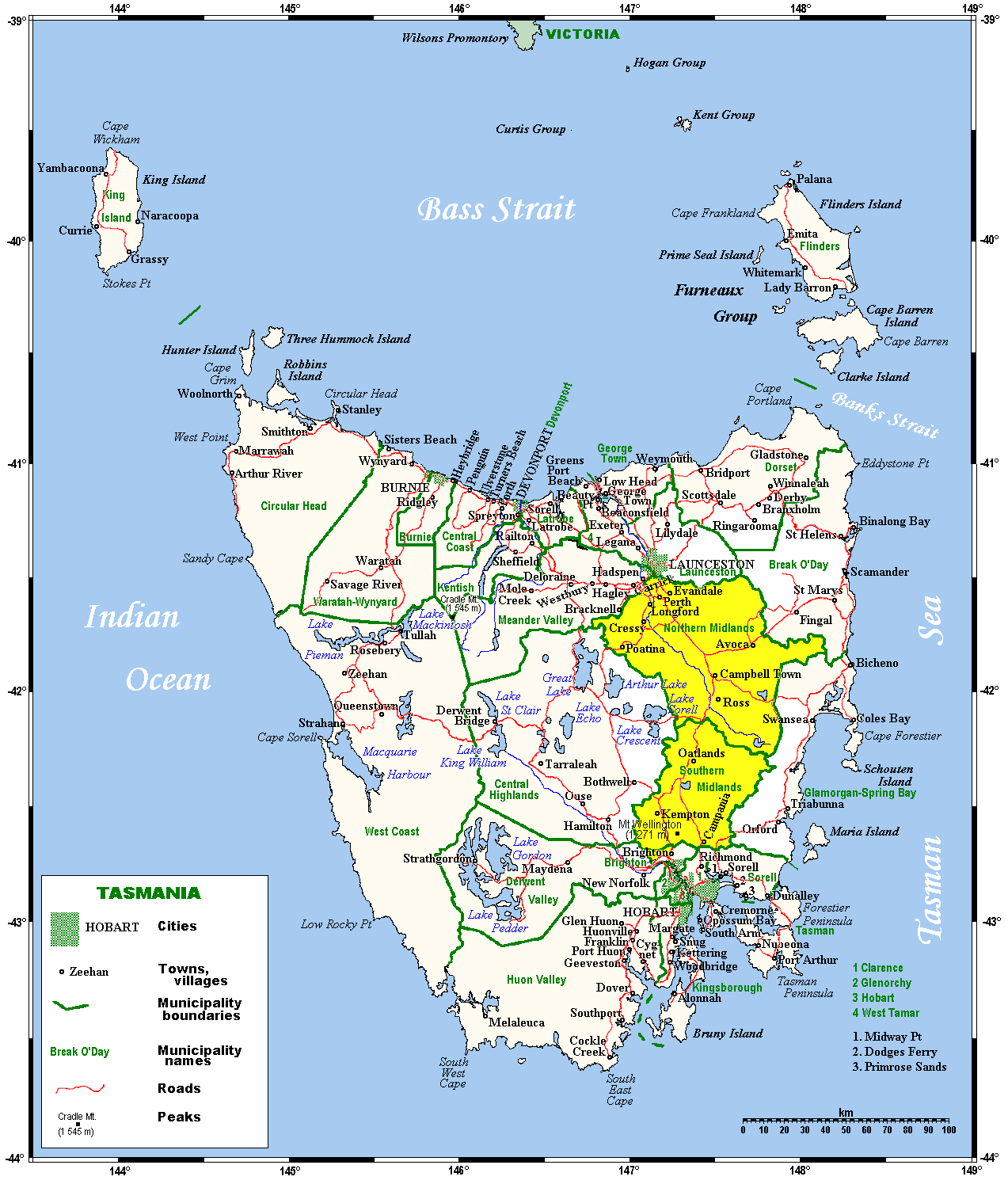
 The Midlands is a
 The climate of the Midlands is the driest in Tasmania, with annual rainfalls ranging from . Rainfall is evenly distributed throughout the year and the region is less prone to very heavy rainfalls than the eastern coast of Tasmania. Because it is not surrounded by sea, the Midlands has both the warmest summers and some of the coldest winters in Tasmania. In summer, maximum temperatures average , whilst in winter most days have
 The Midlands is a
 region
In geography, regions, otherwise referred to as zones, lands or territories, are areas that are broadly divided by physical characteristics ( physical geography), human impact characteristics ( human geography), and the interaction of humanity an ...
of Tasmania
)
, nickname =
, image_map = Tasmania in Australia.svg
, map_caption = Location of Tasmania in AustraliaCoordinates:
, subdivision_type = Country
, subdi ...
between Launceston and Hobart
Hobart ( ; Nuennonne/ Palawa kani: ''nipaluna'') is the capital and most populous city of the Australian island state of Tasmania. Home to almost half of all Tasmanians, it is the least-populated Australian state capital city, and second-small ...
. It also refers to the relatively flat, dry agricultural area, so named because it covers the region between the two cities. Its name is probably also influenced from the Midlands
The Midlands (also referred to as Central England) are a part of England that broadly correspond to the Kingdom of Mercia of the Early Middle Ages, bordered by Wales, Northern England and Southern England. The Midlands were important in the In ...
in the United Kingdom. It lends its name to the Southern Midlands Council, Northern Midlands Council
Northern Midlands Council is a local government body in Tasmania, extending south of Launceston into the northern region of the Tasmanian central midlands. Northern Midlands is classified as a rural local government area and has a populatio ...
, and the Midland Highway. The region is sometimes conflated or confused with the adjacent region of the Central Highlands—with the added term ''Tasmania's heartland''.
Geography
Most of the Midlands is a region of relatively low plains drained mostly by tributaries of the Tamar River in the north andJordan River
The Jordan River or River Jordan ( ar, نَهْر الْأُرْدُنّ, ''Nahr al-ʾUrdunn'', he, נְהַר הַיַּרְדֵּן, ''Nəhar hayYardēn''; syc, ܢܗܪܐ ܕܝܘܪܕܢܢ ''Nahrāʾ Yurdnan''), also known as ''Nahr Al-Shariea ...
in the south. The natural vegetation was predominantly grassland, but all of it is either grazed by cattle and sheep or cleared for growing better pasture species. On the eastern side it rises into low, unglaciated dolerite
Diabase (), also called dolerite () or microgabbro,
is a mafic, holocrystalline, subvolcanic rock equivalent to volcanic basalt or plutonic gabbro. Diabase dikes and sills are typically shallow intrusive bodies and often exhibit fine-grain ...
hills and mountains, largely covered with dry sclerophyllous forests, but on the west lies the high doleritic Lake Country
Lake Country is a district municipality with a population of approximately 15,000 in the Okanagan Valley region of British Columbia, Canada. It is a part of the Central Okanagan Regional District, and of the Kelowna metropolitan area. The city ...
, which was extensively glaciated during Quaternary glacial periods and is covered with large numbers of lakes consequently carved into the very hard and erosion-resistant rock.
 The climate of the Midlands is the driest in Tasmania, with annual rainfalls ranging from . Rainfall is evenly distributed throughout the year and the region is less prone to very heavy rainfalls than the eastern coast of Tasmania. Because it is not surrounded by sea, the Midlands has both the warmest summers and some of the coldest winters in Tasmania. In summer, maximum temperatures average , whilst in winter most days have
 frost
Frost is a thin layer of ice on a solid surface, which forms from water vapor in an above-freezing atmosphere coming in contact with a solid surface whose temperature is below freezing, and resulting in a phase change from water vapor (a g ...
s, sometimes severe. The lowest temperature in the region is around in 1902, when snow fell in Hobart city.
Owing to the relatively low rainfall and the presence of recently eroded fertile dolerite rocks, the soils are the most fertile in all of Tasmania. Most of them are quite close to the chernozem
Chernozem (from rus, чернозём, p=tɕɪrnɐˈzʲɵm, r=chernozyom; "black ground"), also called black soil, is a black-colored soil containing a high percentage of humus (4% to 16%) and high percentages of phosphorus and ammonia compou ...
s of Asia and North America, and consequently the Midlands is rich grazing land supporting intensive rearing of sheep. Some grain crops are also grown, though the summers are rather cool for them.
See also
* Regions of Tasmania * North-west and west coast councilsReferences
Further reading
* Jetson, Tim (1991) ''History of the Midlands-Central Plateau region : printed sources'' Hobart: Centre for Tasmanian Historical Studies, University of Tasmania (Series: Historical bibliographies of Tasmania ; no. 2) {{coord missing, Tasmania