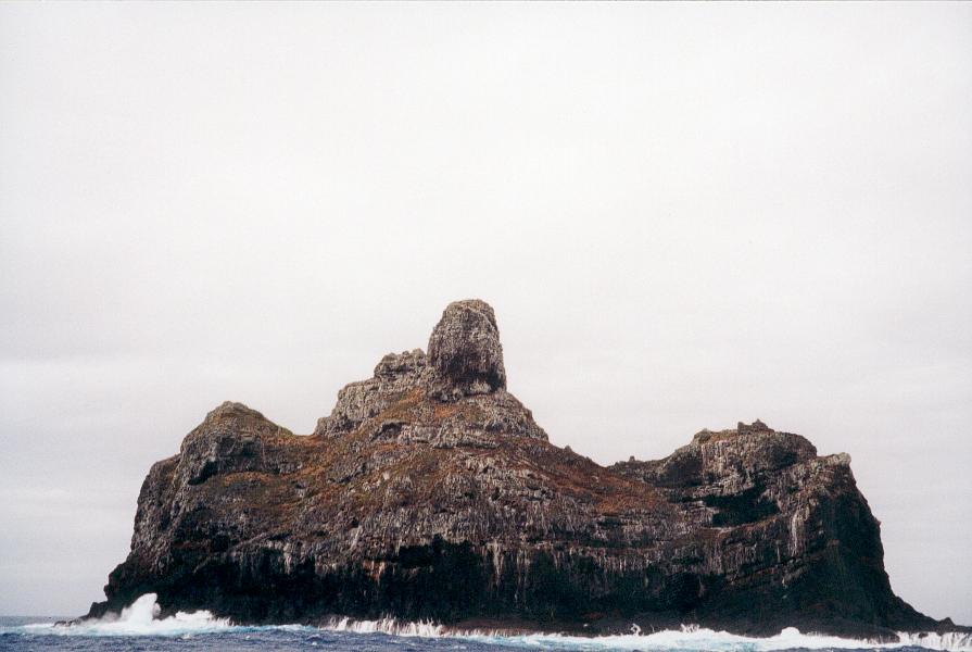
Marotiri (Austral Islands) on:
[Wikipedia]
[Google]
[Amazon]
 Marotiri is a group of four uninhabited
 Marotiri is a group of four uninhabited
 volcanic
A volcano is a rupture in the crust of a planetary-mass object, such as Earth, that allows hot lava, volcanic ash, and gases to escape from a magma chamber below the surface.
On Earth, volcanoes are most often found where tectonic plat ...
rocks protruding from the sea (and several submerged rocks), forming the southeastern end of the Austral Islands
The Austral Islands (french: Îles Australes, officially ''Archipel des Australes;'' ty, Tuha'a Pae) are the southernmost group of islands in French Polynesia, an overseas country of the French Republic in the South Pacific. Geographically, t ...
of French Polynesia
)Territorial motto: ( en, "Great Tahiti of the Golden Haze")
, anthem =
, song_type = Regional anthem
, song = "Ia Ora 'O Tahiti Nui"
, image_map = French Polynesia on the globe (French Polynesia centered).svg
, map_alt = Location of French ...
. Marotiri is also known as Bass Rocks (''Îlots de Bass'' in French), maybe according to the name of the European explorer George Bass
George Bass (; 30 January 1771 – after 5 February 1803) was a British naval surgeon and explorer of Australia.
Early years
Bass was born on 30 January 1771 at Aswarby, a hamlet near Sleaford, Lincolnshire, the son of a tenant farmer, George ...
. Marotiri is very isolated, located about west-south-westward of Pitcairn Island
Pitcairn Island is the only inhabited island of the Pitcairn Islands, of which many inhabitants are descendants of mutineers of HMS ''Bounty''.
Geography
The island is of volcanic origin, with a rugged cliff coastline. Unlike many other ...
. The closest island is Rapa Iti
Rapa, also called Rapa Iti, or "Little Rapa", to distinguish it from Easter Island, whose Polynesian name is Rapa Nui, is the largest and only inhabited island of the Bass Islands in French Polynesia. An older name for the island is Oparo. The ...
, 75 km farther northwest, but separated from it by an ocean depth of more than 1,500 meters.According to the French hydrographic office
A hydrographic office is an organization which is devoted to acquiring and publishing hydrographic information.
Historically, the main tasks of hydrographic offices were the conduction of hydrographic surveys and the publication of nautical cha ...
(SHOM
The Naval Hydrographic and Oceanographic Service (french: Service hydrographique et océanographique de la Marine or SHOM) is a French public establishment of an administrative nature (french: établissement public à caractère administratif) adm ...
) nautical chart
A nautical chart is a graphic representation of a sea area and adjacent coastal regions. Depending on the scale of the chart, it may show depths of water and heights of land ( topographic map), natural features of the seabed, details of the co ...
s 6607, there is a depth of 1,646 meters midway between Rapa and Marotiri. The rocks are part of the municipality
A municipality is usually a single administrative division having corporate status and powers of self-government or jurisdiction as granted by national and regional laws to which it is subordinate.
The term ''municipality'' may also mean the ...
of Rapa.
The climate is wet temperate. The lower rocks are almost devoid of vegetation - although there is some vegetation on the upper slopes and summits. They are important as a seabird rookery. Fish abound in the adjacent waters. The rocks emerge from a submarine platform 100 meters deep and 5 km in diameter. They lie at a distance between 1.5 and 3 km from one another. The total land area is 43,100 m2, which is broken down as follows by the individual rocks:
The southern rock is the largest, with a height of 113 meters at its highest point.
See also
*Desert island
A desert island, deserted island, or uninhabited island, is an island, islet or atoll that is not permanently populated by humans. Uninhabited islands are often depicted in films or stories about shipwrecked people, and are also used as stereo ...
* List of islands
This is a list of the lists of islands in the world grouped by country
A country is a distinct part of the world, such as a state, nation, or other political entity. It may be a sovereign state or make up one part of a larger state. F ...
References
Islands of the Austral Islands Volcanic plugs of Oceania Uninhabited islands of French Polynesia {{FrenchPolynesia-geo-stub