Lungoteveri on:
[Wikipedia]
[Google]
[Amazon]
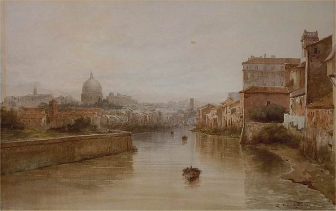
 Lungotevere (Italian for ''Tiber Waterfront'') is an alley or boulevard running along the river
Tiber
The Tiber ( ; it, Tevere ; la, Tiberis) is the third-longest List of rivers of Italy, river in Italy and the longest in Central Italy, rising in the Apennine Mountains in Emilia-Romagna and flowing through Tuscany, Umbria, and Lazio, where ...
within the city of Rome
, established_title = Founded
, established_date = 753 BC
, founder = King Romulus (legendary)
, image_map = Map of comune of Rome (metropolitan city of Capital Rome, region Lazio, Italy).svg
, map_caption ...
.
The building of the Lungoteveres required the demolition of the former edifices along the river banks and the construction of retaining walls called ''muraglioni'' (massive walls).Rendina-Paradisi, p. 664

History
The Lungoteveres were built with the main goal to eliminate and dam the overflows of the Tiber, due to its recurring floods. On July 6, 1875 a law was approved, getting off the demolition of the former buildings on the banks and the achievement of boulevards flanking the river and massive retaining walls (''muraglioni''); the width of the river bed was regulated up to . The Lungoteveres, inspired by the example of Paris, were designed by the engineer Raffaele Canevari, who managed to rescue theTiber Island
The Tiber Island ( it, Isola Tiberina, Latin: ''Insula Tiberina'') is the only river island in the part of the Tiber which runs through Rome. Tiber Island is located in the southern bend of the Tiber.
The island is boat-shaped, approximately ...
adding artificial rapids to the right branch of the Tiber below the Pons Caestius.
Many artistically and historically significant buildings, structures and churches were demolished for the construction: among them, Palazzo Altoviti, the Teatro Apollo at Tor di Nona, Sant'Anna dei Bresciani, the Ripetta Harbour, the Roman Pons Cestius
, image = 2012-05-15 Roma ponte Cestio da ponte Garibaldi 1.jpg
, caption = The Pons Cestius in its modern form
The Roman bridge around 1880, before its reconstruction
, carries = pedestrians, motor vehicles
, crosses =
...
(pulled down and rebuilt with wider side arches), the already damaged Roman Ponte Rotto (of which only one arch remains), some minor gates of the Aurelian Walls flanking the left bank. The Ponte Sant'Angelo
Ponte Sant'Angelo, originally the Aelian Bridge or Pons Aelius, is a Roman bridge in Rome, Italy, completed in 134 AD by Roman Emperor Hadrian (Publius Aelius Hadrianus), to span the Tiber from the city centre to his newly constructed maus ...
was widened too, adding two more arches. Along with these structures, the erection of the Lungotevere provoked the loss of one of the most picturesque environments of the city.
The works began in 1876 and were completed in 1926; in the circumstance, several bridges were built, linking the two banks of the Tiber.
List of the Lungotevere
The list is in geographic order, from upstream to downstream.Right bank
The stretch between Lungotevere Ripa and lungotevere Portuense is named '' Porto di Ripa Grande'' (rione
A (; plural: ) is a neighbourhood in several Italian cities. A is a territorial subdivision. The larger administrative subdivisions in Rome are the , with the being used only in the historic centre. The word derives from the Latin , the 14 su ...
Trastevere).
In the quarter Portuense, a stretch of the Lungotevere della Magliana is flanked by ''Riva Pian Due Torri''.
Left bank
The stretch between Lungotevere Testaccio and Lungotevere San Paolo is named ''Riva Ostiense'' (quarterOstiense
Ostiense is the 10th ''quartiere'' of Rome, identified by the initials Q. X.
The toponym comes from the original name of the Porta San Paolo, a gate in the city walls of Rome, was , because it was located at the beginning of Via Ostiense. It n ...
).
Notes
Sources
**External links
{{commonscat-inline, Lungotevere (Rome), Lungotevere