Langtang on:
[Wikipedia]
[Google]
[Amazon]


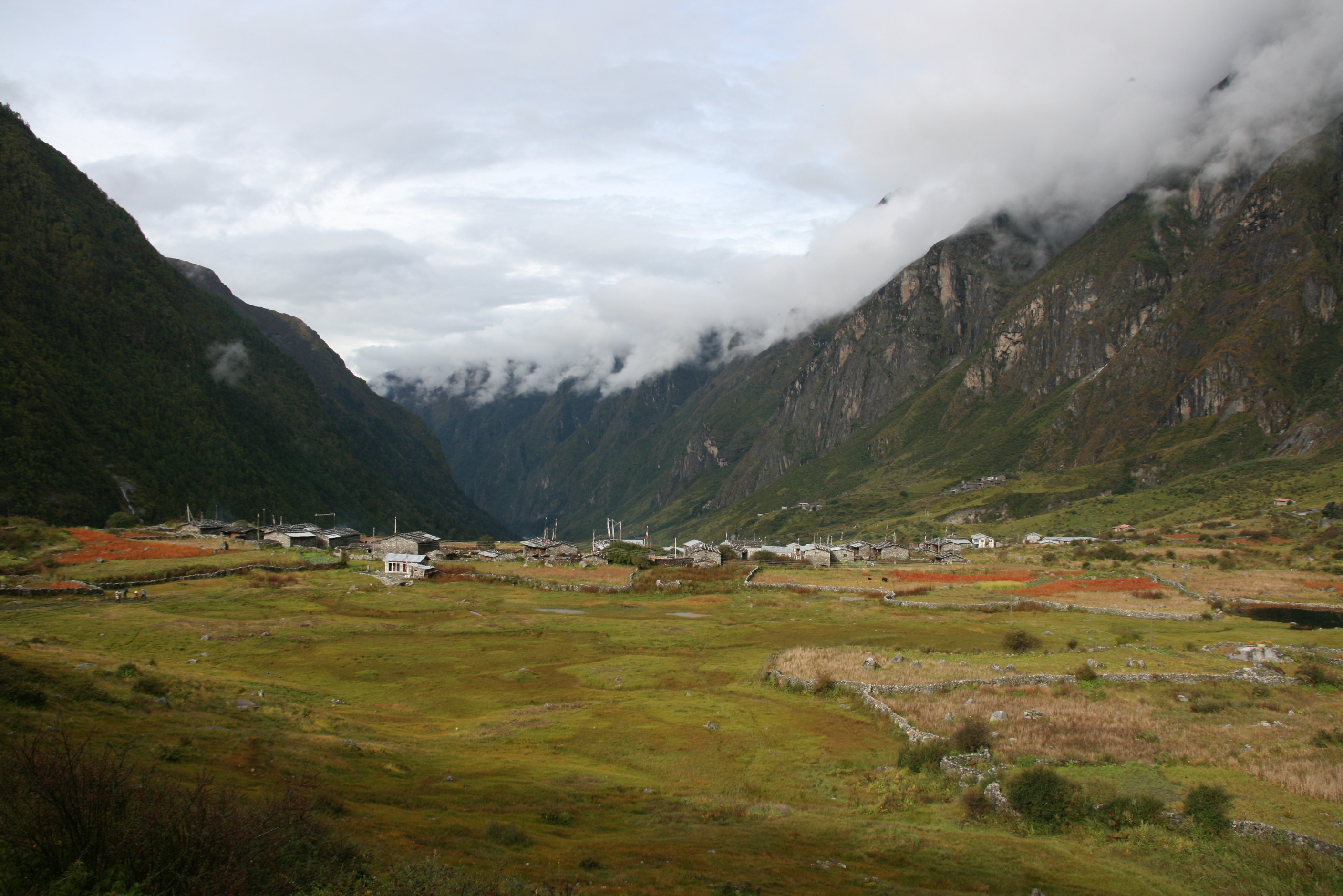
 Langtang valley is a Himalayan valley in the mountains of north-central Nepal, known for its trekking routes and natural environment.


 Langtang valley is a Himalayan valley in the mountains of north-central Nepal, known for its trekking routes and natural environment.
Administrative
The Langtang valley lies in the Rasuwa district of the Bagmati Province inNepal
Nepal (; ne, :ne:नेपाल, नेपाल ), formerly the Federal Democratic Republic of Nepal ( ne,
सङ्घीय लोकतान्त्रिक गणतन्त्र नेपाल ), is a landlocked country in S ...
. Situated 80 kilometres north of the Kathmandu Valley, the valley lies within the Langtang national park
Langtang National Park was established in 1976 as Nepal's first Himalayan national park and the country's fourth protected area. It exceeds an elevation range of and covers an area of in the Nuwakot, Rasuwa and Sindhulpalchok Districts of the ...
, which borders the Tibet autonomous region
The Tibet Autonomous Region or Xizang Autonomous Region, often shortened to Tibet or Xizang, is a province-level autonomous region of the People's Republic of China in Southwest China. It was overlayed on the traditional Tibetan regions of � ...
of China. Prior to the 2015 earthquake, 668 individuals are estimated to have lived within the Langtang valley.
Ecology
The Langtang valley lies within theLangtang National Park
Langtang National Park was established in 1976 as Nepal's first Himalayan national park and the country's fourth protected area. It exceeds an elevation range of and covers an area of in the Nuwakot, Rasuwa and Sindhulpalchok Districts of the ...
. The park contains a wide variety of climatic zones, from subtropical to alpine. Approximately 25% of the park is forested. Trees include the deciduous oak and maple
''Acer'' () is a genus of trees and shrubs commonly known as maples. The genus is placed in the family Sapindaceae.Stevens, P. F. (2001 onwards). Angiosperm Phylogeny Website. Version 9, June 2008 nd more or less continuously updated since http ...
, evergreens like pine
A pine is any conifer tree or shrub in the genus ''Pinus'' () of the family Pinaceae. ''Pinus'' is the sole genus in the subfamily Pinoideae. The World Flora Online created by the Royal Botanic Gardens, Kew and Missouri Botanical Garden accepts ...
, and various types of rhododendron. Animal life includes the Himalayan black bear
The Himalayan black bear (''Ursus thibetanus laniger'') is a subspecies of the Asian black bear found in the Himalayas of India, Bhutan, Nepal, China, and Pakistan.
Description
It is distinguished from '' U. t. thibetanus'' by its longer, thicke ...
, Himalayan tahr
The Himalayan tahr (''Hemitragus jemlahicus'') is a large even-toed ungulate native to the Himalayas in southern Tibet, northern India, western Bhutan and Nepal. It is listed as Near Threatened on the IUCN Red List, as the population is declini ...
, Assam macaque
The Assam macaque (''Macaca assamensis'') or Assamese macaque is a macaque of the Old World monkey family native to South and Southeast Asia. Since 2008, it has been listed as Near Threatened on the IUCN Red List, as it is experiencing significan ...
, snow leopard
The snow leopard (''Panthera uncia''), also known as the ounce, is a felid in the genus '' Panthera'' native to the mountain ranges of Central and South Asia. It is listed as Vulnerable on the IUCN Red List because the global population is es ...
, yak, red panda
The red panda (''Ailurus fulgens''), also known as the lesser panda, is a small mammal native to the eastern Himalayas and southwestern China. It has dense reddish-brown fur with a black belly and legs, white-lined ears, a mostly white muzzle ...
and more than 250 species of birds.
Culture
Among themselves, the local inhabitants of the Langtang valley refer to each other as 'Langtangpa'. They generally followTibetan Buddhism
Tibetan Buddhism (also referred to as Indo-Tibetan Buddhism, Lamaism, Lamaistic Buddhism, Himalayan Buddhism, and Northern Buddhism) is the form of Buddhism practiced in Tibet and Bhutan, where it is the dominant religion. It is also in majo ...
, and speak a Tibetan language that is closely related to the Tibetan spoken in Kyirong, southern Tibet. The Langtangpas regard the mountain Langtang Lirung
Langtang Lirung is the highest peak of the Langtang Himal Range, which is a subrange of the Nepalese Himalayas, southwest of the Eight-thousander Shishapangma. The List of the world's highest 100 mountains puts it at number 99.
Location
The Lang ...
as their 'yu-lha', their local country god. However, in the state census, the Langtangpas are categorised as Tamang. Langtang valley is believed to be the Beyul Dagam Namgo, one of the many hidden valleys
Hidden Valleys is a name, coined in 2004, used to describe an area of interesting historical and scenic value between the city of Nottingham and the town of Mansfield in the English ceremonial county of Nottinghamshire. Promotional literature ...
blessed by Guru Padmasambhava.
Economy
The traditional livelihoods of the Langtangpas have centered aroundagropastoralism
Pastoral farming (also known in some regions as ranching, livestock farming or grazing) is aimed at producing livestock, rather than growing crops. Examples include dairy farming, raising beef cattle, and raising sheep for wool. In contrast, ar ...
. Since the mid-1970s, tourism has grown to become an important source of livelihoods in the Langtang valley. Swiss cheese-making was introduced in Langtang in the 1950s by Werner Schulthess. Over time, Swiss cheese became a popular product of Langtang, and its production in the valley continues to this day.
Access
The nearest motorable roadhead for the Langtang valley is Shyaphrubesi, which is also the base for most treks into the Langtang valley. The distance of Shyaphrubesi from Kathmandu is 80km. But due to bad road conditions, it usually takes 6-8 hours to drive from Kathmandu to Shyaphrubesi. Just as for the Langtang National Park, entering the Langtang valley requires everyone except locals to have the TIMS permit and the Langtang National Park entry permit.Tourism
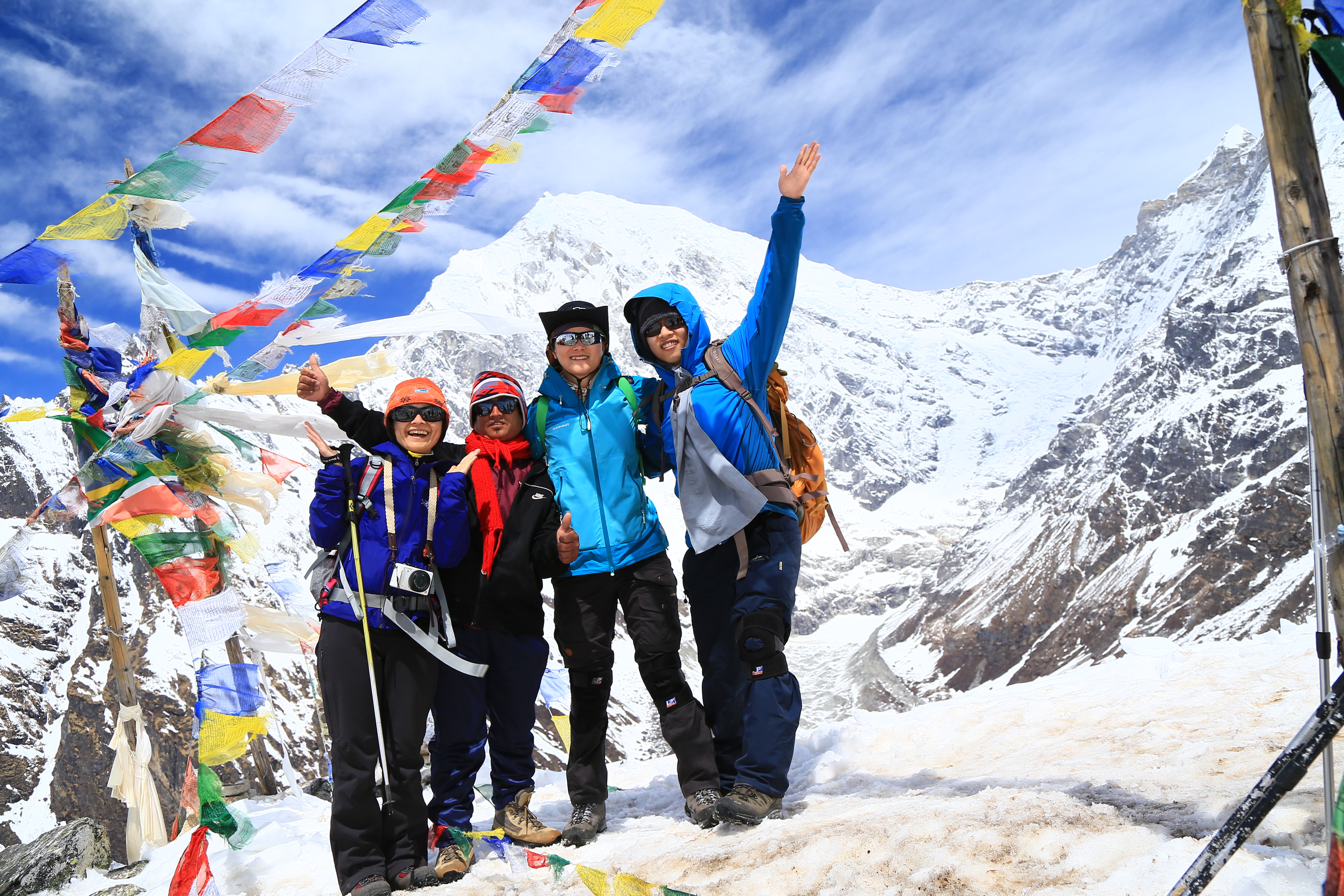
The Langtang valley trek, from Shyaphrubesi to Kyanjin Gumba and back, is known to be the third most popular trek in Nepal, after theAnnapurna circuit
The Annapurna Circuit is a trek within the mountain ranges of central Nepal. The total length of the route varies between 160–230 km (100-145 mi), depending on where motor transportation is used and where the trek is ended. This trek c ...
and Everest base camp
There are two base camps on Mount Everest, on opposite sides of the mountains: South Base Camp is in Nepal at an altitude of (), while North Base Camp is in Tibet, China at ().
The base camps are rudimentary campsites at the base of Mount Eve ...
treks. There are several treks that go through the Langtang valley and link it to nearby valleys. In most of these treks, one can stay at local 'tea-houses', which are run by locals in nearly every village in the valley, and where one gets basic lodging and food. There are several mountain-climbing options available too in the Langtang valley, ranging from relatively easy-to-climb peaks around 5,000m high, such as Kyanjin Ri and Cherko Ri, to technically challenging peaks, such as Dorje Lhakpa
Dorje Lhakpa is a mountain in the Jugal Himal, southeast of Langtang valley in Nepal.
Visible also from Kathmandu valley it has an elegant pyramid-shaped figure and is an ideal target for photographers and mountaineers. Considered by many of int ...
and Langtang Lirung
Langtang Lirung is the highest peak of the Langtang Himal Range, which is a subrange of the Nepalese Himalayas, southwest of the Eight-thousander Shishapangma. The List of the world's highest 100 mountains puts it at number 99.
Location
The Lang ...
.
2015 Nepal earthquake
The village of Langtang was almost completely destroyed (1 building survived) by a massiveavalanche
An avalanche is a rapid flow of snow down a slope, such as a hill or mountain.
Avalanches can be set off spontaneously, by such factors as increased precipitation or snowpack weakening, or by external means such as humans, animals, and eart ...
caused by the April 2015 Nepal earthquake
The April 2015 Nepal earthquake (also known as the Gorkha earthquake) killed 8,964 people and injured 21,952 more. It occurred at on Saturday, 25 April 2015, with a magnitude of 7.8 Mw or 8.1 Ms and a maximum Mercalli Intensity of X (''Extreme ...
. The village suffered an estimated 310 deaths, including 176 Langtang residents, 80 foreigners, and 10 army personnel. More than 100 bodies were never recovered. Several other villages in upper Langtang valley were also destroyed. The Langtangpas who survived the destruction of the earthquake were evacuated by helicopter to Kathmandu, where a displaced persons camp was temporarily set up at the Yellow Gumba near Swayanmbhu. Many Langtangpas returned to the valley in the following months, and a significant amount of reconstruction was completed within the first year after the earthquake. By early 2018, the centuries-old gompa
A Gompa or Gönpa ( "remote place", Sanskrit ''araṇya''), also known as ling (), is a Buddhist ecclesiastical fortification of learning, lineage and sādhanā that may be understood as a conflation of a fortification, a vihara and a universit ...
at Kyanjin Gompa, which had also been destroyed in the earthquake, had been rebuilt. The Swiss-cheese factory at Kyanjin Gompa village was destroyed too, but has been rebuilt and since then become operational again.
Climate change
Since the mid-2010s, Langtangpas have noticed that most natural springs in the valley have gone dry. Scientists have attributed the reduction in the glacier area of the Langtang glacier directly to anthropogenic climate change since the 1970s. The intergovernmental organisation ICIMOD conducts periodic cryospheric research in the Langtang valley and Yala Glacier.Langtang Himal
Langtang Himal is a mountain range in the Himalayas which includes the following peaks:
See also
*Langtang National Park
Langtang National Park was established in 1976 as Nepal's first Himalayan national park and the country's fourth protected area. It exceeds an elevation range of and covers an area of in the Nuwakot, Rasuwa and Sindhulpalchok Districts of the ...
* The earthquake of April 25, 2015 in Nepal
* Path of the Mani
References
{{coord, 28.250, N, 85.500, E, display=title, source:dewiki Bagmati Province Mountain ranges of Nepal