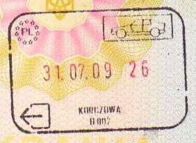
Korczowa on:
[Wikipedia]
[Google]
[Amazon]
Korczowa ( uk, Корчова, ''Korchova'') is a  The village lies approximately east of
Korczowa {{Jarosław-geo-stub
village
A village is a clustered human settlement or community, larger than a hamlet but smaller than a town (although the word is often used to describe both hamlets and smaller towns), with a population typically ranging from a few hundred ...
in the administrative district of Gmina Radymno, within Jarosław County
__NOTOC__
Jarosław County ( pl, powiat jarosławski) is a unit of territorial administration and local government (powiat) in Subcarpathian Voivodeship, south-eastern Poland, on the border with Ukraine. It came into being on January 1, 1999, as a ...
, Subcarpathian Voivodeship
Subcarpathian Voivodeship or Subcarpathia Province (in pl, Województwo podkarpackie ) is a voivodeship, or province, in the southeastern corner of Poland. Its administrative capital and largest city is Rzeszów. Along with the Marshall, it i ...
, in south-eastern Poland
Poland, officially the Republic of Poland, is a country in Central Europe. It is divided into 16 administrative provinces called voivodeships, covering an area of . Poland has a population of over 38 million and is the fifth-most populou ...
, close to the border with Ukraine
Ukraine ( uk, Україна, Ukraïna, ) is a country in Eastern Europe. It is the second-largest European country after Russia, which it borders to the east and northeast. Ukraine covers approximately . Prior to the ongoing Russian inv ...
.
 The village lies approximately east of
 Radymno
Radymno ( uk, Ради́мно ''Radymno'', yi, רעדעם ''Redem'') is a town in south-eastern Poland with 5,543 inhabitants (02.06.2009). It has been part of the Podkarpackie Voivodeship since its creation in 1999. Radymno was previously in t ...
, east of Jarosław
Jarosław (; uk, Ярослав, Yaroslav, ; yi, יאַרעסלאָוו, Yareslov; german: Jaroslau) is a town in south-eastern Poland, with 38,970 inhabitants, as of 30 June 2014. Situated in the Subcarpathian Voivodeship (since 1999), previ ...
, and east of the regional capital Rzeszów
Rzeszów ( , ; la, Resovia; yi, ריישא ''Raisha'')) is the largest city in southeastern Poland. It is located on both sides of the Wisłok River in the heartland of the Sandomierz Basin. Rzeszów has been the capital of the Subcarpathian ...
.
Before World War II
World War II or the Second World War, often abbreviated as WWII or WW2, was a world war that lasted from 1939 to 1945. It involved the vast majority of the world's countries—including all of the great powers—forming two opposing ...
the settlement was a farmstead in Gnojnice which were a suburb of nearby Krakowiec.
In 2006 the village had a population of 660.
The Korczowa-Krakovets road border crossing with Ukraine is located nearby. As Poland became part of the Schengen Area on 21 December 2007, this border crossing is a Schengen external border. The European route E40
European route E40 is the longest European route, more than long, connecting Calais in France via Belgium, Germany, Poland, Ukraine, Russia, Kazakhstan, Uzbekistan, Turkmenistan, and Kyrgyzstan, with Ridder in Kazakhstan near the border with R ...
crosses the border here. The eastern terminus of Poland's A4 motorway and National Road 94 are located at Korczowa.
References
Korczowa {{Jarosław-geo-stub