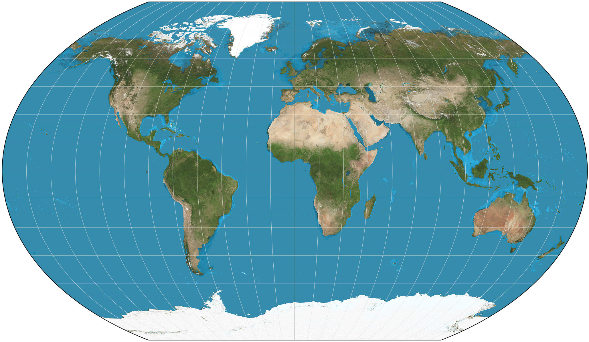
Kavrayskiy VII projection on:
[Wikipedia]
[Google]
[Amazon]

 The Kavrayskiy VII projection is a
Curvature in Map Projections
quantification of overall distortion in projections.
Mapthematics Kavrayskiy VII
bivariate distortion map.
description of the properties of the Kavrayskiy VII projection. {{Map Projections Map projections Soviet inventions Geography of the Soviet Union

map projection
In cartography, map projection is the term used to describe a broad set of transformations employed to represent the two-dimensional curved surface of a globe on a plane. In a map projection, coordinates, often expressed as latitude and longit ...
invented by Soviet cartographer Vladimir V. Kavrayskiy in 1939 for use as a general-purpose pseudocylindrical projection. Like the Robinson projection, it is a compromise intended to produce good-quality maps with low distortion overall. It scores well in that respect compared to other popular projections, such as the Winkel tripel, despite straight, evenly spaced parallels and a simple formulation. Regardless, it has not been widely used outside the former Soviet Union
The Soviet Union,. officially the Union of Soviet Socialist Republics. (USSR),. was a List of former transcontinental countries#Since 1700, transcontinental country that spanned much of Eurasia from 1922 to 1991. A flagship communist state, ...
.
The projection is defined as
where is the longitude
Longitude (, ) is a geographic coordinate that specifies the east– west position of a point on the surface of the Earth, or another celestial body. It is an angular measurement, usually expressed in degrees and denoted by the Greek lette ...
, and is the latitude
In geography, latitude is a coordinate that specifies the north– south position of a point on the surface of the Earth or another celestial body. Latitude is given as an angle that ranges from –90° at the south pole to 90° at the north pol ...
in radians.
See also
* List of map projections *Cartography
Cartography (; from grc, χάρτης , "papyrus, sheet of paper, map"; and , "write") is the study and practice of making and using maps. Combining science, aesthetics and technique, cartography builds on the premise that reality (or an i ...
* Wagner VI projection
Wagner VI is a pseudocylindrical whole Earth map projection. Like the Robinson projection, it is a compromise projection, not having any special attributes other than a pleasing, low distortion appearance. Wagner VI is equivalent to the Kavrayskiy ...
* Robinson projection
References
External links
Curvature in Map Projections
quantification of overall distortion in projections.
Mapthematics Kavrayskiy VII
bivariate distortion map.
description of the properties of the Kavrayskiy VII projection. {{Map Projections Map projections Soviet inventions Geography of the Soviet Union