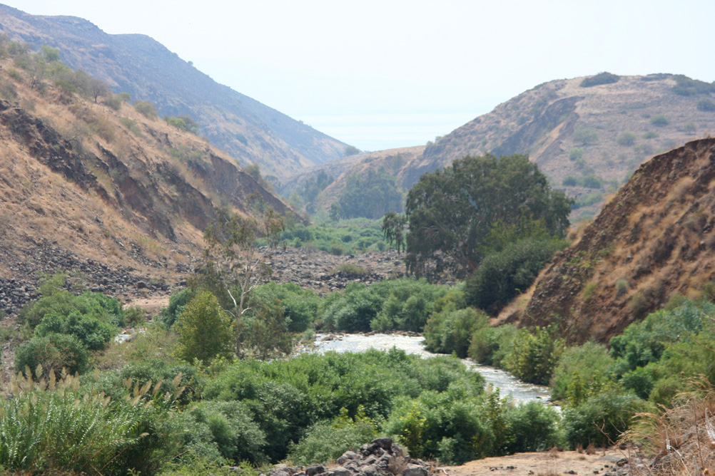
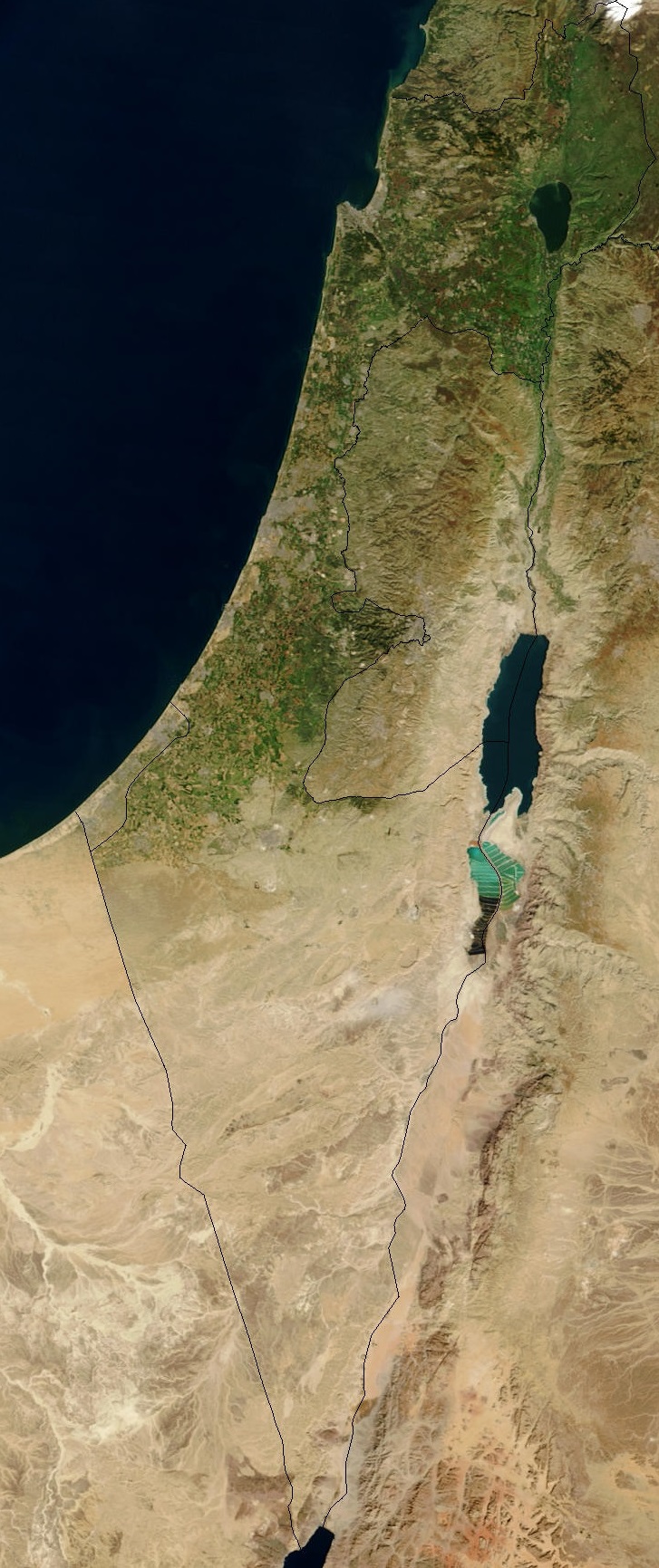
Jordan Rift Valley on:
[Wikipedia]
[Google]
[Amazon]

 The Jordan Rift Valley, also Jordan Valley ''Bīrʿāt haYardēn'', ar, الغور Al-Ghor or Al-Ghawr),, date=November 2022 also called the Syro-African Depression, is an elongated depression located in modern-day
 The Jordan Rift Valley was formed many millions of years ago in the
 The Jordan Rift Valley, also Jordan Valley ''Bīrʿāt haYardēn'', ar, الغور Al-Ghor or Al-Ghawr),, date=November 2022 also called the Syro-African Depression, is an elongated depression located in modern-day
 Israel
Israel (; he, יִשְׂרָאֵל, ; ar, إِسْرَائِيل, ), officially the State of Israel ( he, מְדִינַת יִשְׂרָאֵל, label=none, translit=Medīnat Yīsrāʾēl; ), is a country in Western Asia. It is situated ...
, and Jordan
Jordan ( ar, الأردن; tr. ' ), officially the Hashemite Kingdom of Jordan,; tr. ' is a country in Western Asia. It is situated at the crossroads of Asia, Africa, and Europe, within the Levant region, on the East Bank of the Jordan Rive ...
. This geographic region includes the entire length of the Jordan River
The Jordan River or River Jordan ( ar, نَهْر الْأُرْدُنّ, ''Nahr al-ʾUrdunn'', he, נְהַר הַיַּרְדֵּן, ''Nəhar hayYardēn''; syc, ܢܗܪܐ ܕܝܘܪܕܢܢ ''Nahrāʾ Yurdnan''), also known as ''Nahr Al-Shariea ...
– from its sources, through the Hula Valley
The Hula Valley ( he, עמק החולה, translit. ''Emek Ha-Ḥula''; also transliterated as Huleh Valley, ar, سهل الحولة) is an agricultural region in northern Israel with abundant fresh water, which used to be Lake Hula, prior to ...
, the Korazim block, the Sea of Galilee
The Sea of Galilee ( he, יָם כִּנֶּרֶת, Judeo-Aramaic: יַמּא דטבריא, גִּנֵּיסַר, ar, بحيرة طبريا), also called Lake Tiberias, Kinneret or Kinnereth, is a freshwater lake in Israel. It is the lowest ...
, the (Lower) Jordan Valley, all the way to the Dead Sea
The Dead Sea ( he, יַם הַמֶּלַח, ''Yam hamMelaḥ''; ar, اَلْبَحْرُ الْمَيْتُ, ''Āl-Baḥrū l-Maytū''), also known by other names, is a salt lake bordered by Jordan to the east and Israel and the West Ban ...
, the lowest land elevation on Earth – and then continues through the Arabah
The Arabah, Araba or Aravah ( he, הָעֲרָבָה, ''hāʿĂrāḇā''; ar, وادي عربة, ''Wādī ʿAraba''; lit. "desolate and dry area") is a loosely defined geographic area south of the Dead Sea basin, which forms part of the bord ...
depression, the Gulf of Aqaba
The Gulf of Aqaba ( ar, خَلِيجُ ٱلْعَقَبَةِ, Khalīj al-ʿAqabah) or Gulf of Eilat ( he, מפרץ אילת, Mifrátz Eilát) is a large gulf at the northern tip of the Red Sea, east of the Sinai Peninsula and west of the Arabian ...
whose shorelines it incorporates, until finally reaching the Red Sea
The Red Sea ( ar, البحر الأحمر - بحر القلزم, translit=Modern: al-Baḥr al-ʾAḥmar, Medieval: Baḥr al-Qulzum; or ; Coptic: ⲫⲓⲟⲙ ⲛ̀ϩⲁϩ ''Phiom Enhah'' or ⲫⲓⲟⲙ ⲛ̀ϣⲁⲣⲓ ''Phiom ǹšari''; ...
proper at the Straits of Tiran
The straits of Tiran ( ar, مضيق تيران ') are the narrow sea passages between the Sinai and Arabian peninsulas that connect the Gulf of Aqaba and the Red Sea. The distance between the two peninsulas is about . The Multinational Force ...
.
History and physical features
 The Jordan Rift Valley was formed many millions of years ago in the
 Miocene
The Miocene ( ) is the first geological epoch of the Neogene Period and extends from about (Ma). The Miocene was named by Scottish geologist Charles Lyell; the name comes from the Greek words (', "less") and (', "new") and means "less recen ...
epoch (23.8 – 5.3 Myr ago) when the Arabian Plate
The Arabian Plate is a minor tectonic plate in the Northern and Eastern Hemispheres.
It is one of the three continental plates (along with the African and the Indian Plates) that have been moving northward in geological history and colliding ...
moved northward and then eastward away from Africa. One million years later, the land between the Mediterranean
The Mediterranean Sea is a sea connected to the Atlantic Ocean, surrounded by the Mediterranean Basin and almost completely enclosed by land: on the north by Western and Southern Europe and Anatolia, on the south by North Africa, and on ...
and the Jordan Rift Valley rose so that the sea water stopped flooding the area.
The geological and environmental evolution of the valley since its inception in the Oligocene
The Oligocene ( ) is a geologic epoch of the Paleogene Period and extends from about 33.9 million to 23 million years before the present ( to ). As with other older geologic periods, the rock beds that define the epoch are well identified but t ...
can be seen in a variety of sedimentary and magmatic rock units, preserved as continuous sequences in the deeper basins. The outcropping formations around the basins represent alternating deposition and erosion phases.
The lowest point in the Jordan Rift Valley is in the Dead Sea, the lowest spot of which is below sea level. The shore of the Dead Sea is the lowest land on earth, at below sea level. Rising sharply to almost in the west, and similarly in the east, the rift is a significant topographic feature over which a few narrow paved roads and difficult mountain tracks lead. The valley north of the Dead Sea has long been a site of agriculture because of water available from the Jordan River and numerous springs located on the valley's flanks.
Dead Sea Transform
The plate boundary which extends through the valley is variously called the Dead Sea Transform (DST) or Dead Sea Rift. The boundary separates the Arabian Plate from theAfrican Plate
The African Plate is a major tectonic plate that includes much of the continent of Africa (except for its easternmost part) and the adjacent oceanic crust to the west and south. It is bounded by the North American Plate and South American Plate ...
, connecting the divergent plate boundary in the Red Sea
The Red Sea ( ar, البحر الأحمر - بحر القلزم, translit=Modern: al-Baḥr al-ʾAḥmar, Medieval: Baḥr al-Qulzum; or ; Coptic: ⲫⲓⲟⲙ ⲛ̀ϩⲁϩ ''Phiom Enhah'' or ⲫⲓⲟⲙ ⲛ̀ϣⲁⲣⲓ ''Phiom ǹšari''; ...
(the Red Sea Rift
The Red Sea Rift is a spreading center between two tectonic plates, the African Plate and the Arabian Plate. It extends from the Dead Sea Transform fault system, and ends at an intersection with the Aden Ridge and the East African Rift, forming ...
) to the East Anatolian Fault in Turkey
Turkey ( tr, Türkiye ), officially the Republic of Türkiye ( tr, Türkiye Cumhuriyeti, links=no ), is a transcontinental country located mainly on the Anatolian Peninsula in Western Asia, with a small portion on the Balkan Peninsula ...
.
The DST fault system is generally considered to be a transform fault that has accommodated a northwards displacement of the Arabian Plate. This interpretation is based on observation of offset markers, such as river terraces, gullies and archaeological features, giving horizontal slip rates of several mm per year over the last few million years. GPS data give similar rates of present-day movement of the Arabian Plate relative to the Africa Plate. It has also been proposed that the fault zone is a rift system that is an incipient oceanic spreading center, the northern extension of the Red Sea Rift.
In 1033, the rift valley was struck by a magnitude 7.3 earthquake, believed to have been produced along the DST fault system. It caused widespread destruction, a tsunami, and killed 70,000 people.
Climate
See also
* Geography of Israel * Geography of Jordan *Great Rift Valley
The Great Rift Valley is a series of contiguous geographic trenches, approximately in total length, that runs from Lebanon in Asia to Mozambique in Southeast Africa. While the name continues in some usages, it is rarely used in geology as it ...
References
External links
{{Authority control Valleys of Asia . Landforms of the Middle East Cenozoic geology of Asia Cenozoic rifts and grabens Dead Sea . Geography of Palestine (region) Landforms of Jordan Valleys of the West Bank Landforms of Western Asia Levant Regions of Israel Rifts and grabens Valleys of Israel Depressions of Israel Depressions of Jordan