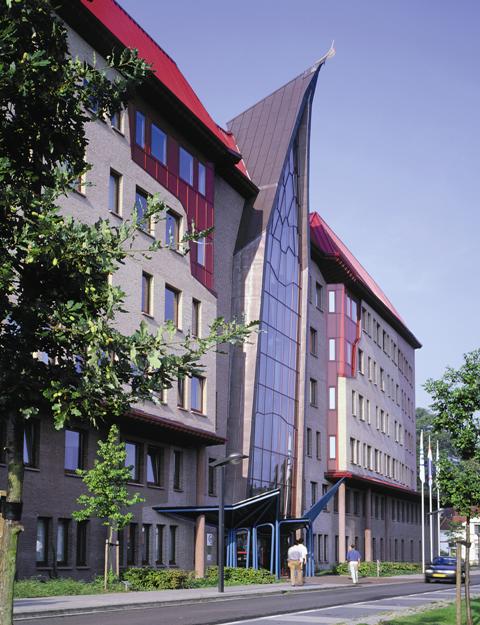
ITC Enschede on:
[Wikipedia]
[Google]
[Amazon]
The International Institute for Geo-Information Science and Earth Observation (ITC) was an institute of higher (tertiary) education located in Enschede, 


ITC Home Page
{{DEFAULTSORT:Itc Enschede Buildings and structures in Enschede 1950 establishments in the Netherlands Educational institutions established in 1950 Organisations based in Overijssel Remote sensing research institutes Universities in the Netherlands University of Twente Photogrammetry organizations
Netherlands
)
, anthem = ( en, "William of Nassau")
, image_map =
, map_caption =
, subdivision_type = Sovereign state
, subdivision_name = Kingdom of the Netherlands
, established_title = Before independence
, established_date = Spanish Netherl ...
. As of 1 January 2010 it has been incorporated into the University of Twente as the sixth faculty, while preserving its unique international character as a faculty '' sui generis'', and is now formally known as University of Twente, Faculty of Geo-Information Science and Earth Observation (ITC).


History and mission
ITC was founded in 1950 with the name "International Training Centre forAerial Survey
Aerial survey is a method of collecting geomatics or other imagery by using airplanes, helicopters, UAVs, balloons or other aerial methods. Typical types of data collected include aerial photography, Lidar, remote sensing (using various visible ...
" by the former Prime Minister of the Netherlands, Prof. Dr. Willem Schermerhorn to provide training in map making as an aid to developing countries. Over the years its mission has been adjusted to changing technological and development realities, so that today it offers MSc, Master's
A master's degree (from Latin ) is an academic degree awarded by universities or colleges upon completion of a course of study demonstrating mastery or a high-order overview of a specific field of study or area of professional practice.
, Diploma and Certificate courses in Geo-information Science (GIS) and Earth Observation (EO) with emphasis on applications in developing countries. ITC promotes PhD Research in collaboration with universities in the Netherlands. In addition, ITC undertakes applied and technological consultancy projects worldwide and contributes to fundamental research in the fields of its expertise.
Education at ITC
More than 19,000 students from over 170 countries have followed ITC courses since 1950. The institute's degrees are accredited by the Dutch system of higher education. ITC offers degree, diploma and certificate courses in geo-information science and earth observation applied to eight domains: Disaster management; Earth sciences; Geoinformatics; Governance; Land administration; Natural resources; Urban planning; and Water resources. ITC has several joint educational programmes with partner institutes in the developing world, for example joint MSc programmes in geoinformatics with the Indian Institute of Remote Sensing in Dehradun,India
India, officially the Republic of India (Hindi: ), is a country in South Asia. It is the seventh-largest country by area, the second-most populous country, and the most populous democracy in the world. Bounded by the Indian Ocean on the so ...
and Gadjah Mada University in Yogyakarta
Yogyakarta (; jv, ꦔꦪꦺꦴꦒꦾꦏꦂꦠ ; pey, Jogjakarta) is the capital city of Special Region of Yogyakarta in Indonesia, in the south-central part of the island of Java. As the only Indonesian royal city still ruled by a monarchy, ...
, Indonesia
Indonesia, officially the Republic of Indonesia, is a country in Southeast Asia and Oceania between the Indian and Pacific oceans. It consists of over 17,000 islands, including Sumatra, Java, Sulawesi, and parts of Borneo and New Guine ...
. It also offers much of its curriculum as distance education modules, and offers custom training courses to meet specific capacity building requirements, both in Enschede and abroad.
External links
ITC Home Page
{{DEFAULTSORT:Itc Enschede Buildings and structures in Enschede 1950 establishments in the Netherlands Educational institutions established in 1950 Organisations based in Overijssel Remote sensing research institutes Universities in the Netherlands University of Twente Photogrammetry organizations