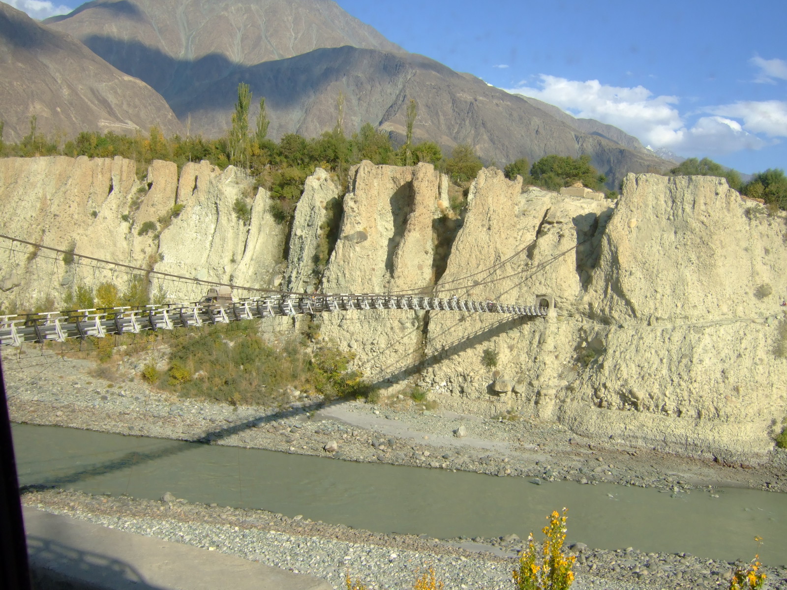
Hunza River on:
[Wikipedia]
[Google]
[Amazon]
 Hunza River ( ur, ) is the principal river of Hunza in
Gilgit River basin
marked on the OpenStreetMap, including the Hunza River basin. Tributaries of the Indus River Rivers of Gilgit-Baltistan Karakoram Hunza District Rivers of India {{India-river-stub
 Hunza River ( ur, ) is the principal river of Hunza in
 Gilgit–Baltistan
Gilgit-Baltistan (; ), formerly known as the Northern Areas, is a region administered by Pakistan as an administrative territory, and constituting the northern portion of the larger Kashmir region which has been the subject of a dispute bet ...
, Pakistan It is formed by the confluence of the Chapursan and Khunjerab ''nalas'' (gorges) which are fed by glacier
A glacier (; ) is a persistent body of dense ice that is constantly moving under its own weight. A glacier forms where the accumulation of snow exceeds its ablation over many years, often centuries. It acquires distinguishing features, such a ...
s. It is joined by the Gilgit River
The Gilgit River () is a tributary of the Indus River, and flows through the Gupis-Yasin, Ghizer and Gilgit districts of Gilgit-Baltistan. The Gilgit River starts from Shandur Lake, and joins the Indus River at near towns of Juglot and Bunji ...
and the Naltar River, before it flows into the Indus River
The Indus ( ) is a transboundary river of Asia and a trans-Himalayan river of South and Central Asia. The river rises in mountain springs northeast of Mount Kailash in Western Tibet, flows northwest through the disputed region of Kashmi ...
.
The river cuts through the Karakoram
The Karakoram is a mountain range in Kashmir region spanning the borders of Pakistan, China, and India, with the northwest extremity of the range extending to Afghanistan and Tajikistan. Most of the Karakoram mountain range falls under the ...
range, flowing from north to south. The Karakoram Highway
The Karakoram Highway ( ur, , translit=śāhirāh qarāquram; known by its initials KKH, also known as N-35 or National Highway 35 ( ur, ) or the China-Pakistan Friendship Highway) is a national highway which extends from Hasan Abdal in ...
(N-35) runs along the Hunza River valley, switching to the Khunjerab River valley at the point of confluence, eventually reaching the Khunjerab Pass
Khunjerab Pass (; ; ug, قونجىراپ ئېغىزى) is a mountain pass in the Karakoram Mountains, in a strategic position on the northern border of Pakistan (Gilgit–Baltistan's Hunza and Nagar Districts) and on the southwest border of Ch ...
at the border with China Xinjiang
Xinjiang, SASM/GNC: ''Xinjang''; zh, c=, p=Xīnjiāng; formerly romanized as Sinkiang (, ), officially the Xinjiang Uygur Autonomous Region (XUAR), is an autonomous region of the People's Republic of China (PRC), located in the northwes ...
.
The river is dammed for part of its route.
The Attabad landslide disaster in January 2010 completely blocked the Hunza Valley
The Hunza Valley ( bsk, , Wakhi: '; ur, ) is a mountainous valley in the northern part of the Gilgit-Baltistan region of Pakistan, formed by the Hunza River, bordering Ishkoman to the northwest, Shigar to the southeast, Afghanistan's Wa ...
. A new lake — now called the Attabad Lake
Attabad Lake ( ur, ) is a lake located in the Gojal region of Hunza Valley in Gilgit−Baltistan, Pakistan. It was created in January 2010 as the result of a major landslide in Attabad. The lake has become one of the biggest tourist attra ...
or Gojal Lake — which extends 30 kilometers and rose to a depth of 400 feet, was formed as the Hunza River backed-up. Karakorum Area Development Organization (KADO), Aliabad The landslide completely covered sections of the Karakoram Highway.
The Hunza river is being changed by climate change.
See also
*Hunza Valley
The Hunza Valley ( bsk, , Wakhi: '; ur, ) is a mountainous valley in the northern part of the Gilgit-Baltistan region of Pakistan, formed by the Hunza River, bordering Ishkoman to the northwest, Shigar to the southeast, Afghanistan's Wa ...
* Nagar Valley
References
External links
Gilgit River basin
marked on the OpenStreetMap, including the Hunza River basin. Tributaries of the Indus River Rivers of Gilgit-Baltistan Karakoram Hunza District Rivers of India {{India-river-stub