Haslingfield on:
[Wikipedia]
[Google]
[Amazon]
Haslingfield is a village and
here
 ''Haslingefeld'' appears in the
 'Parishes: Haslingfield', A History of the County of Cambridge and the Isle of Ely: Volume 5
(1973), pp. 227-240. Date accessed: 22 October 2009 used to make fertilizer in the late 19th century. The
civil parish
In England, a civil parish is a type of administrative parish used for local government. It is a territorial designation which is the lowest tier of local government below districts and counties, or their combined form, the unitary authorit ...
in South Cambridgeshire
Cambridgeshire (abbreviated Cambs.) is a county in the East of England, bordering Lincolnshire to the north, Norfolk to the north-east, Suffolk to the east, Essex and Hertfordshire to the south, and Bedfordshire and Northamptonshire to the ...
, England. The village is about six miles south-west of Cambridge
Cambridge ( ) is a College town, university city and the county town in Cambridgeshire, England. It is located on the River Cam approximately north of London. As of the 2021 United Kingdom census, the population of Cambridge was 145,700. Cam ...
, between Harston
Harston is a village and civil parish in South Cambridgeshire, England, located around 5 miles (8 km) south of Cambridge. In 2011, it had a population of 1,740.
Village Sign
The village sign was erected in the Queen's Silver Jubilee ye ...
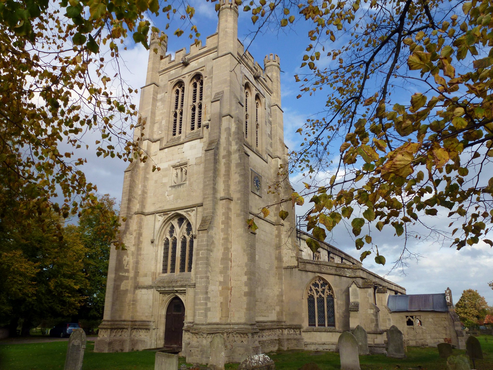
, Barton and Barrington. The population in the 2001 census was 1,550 people living in 621 households, reducing at the 2011 Census to a population of 1,507 living in 626 households. The main streets in the village are called High Street and New Road which together form an approximate circle around the Manor House. The village contains Haslingfield Primary School and All Saints Church. To find out more about what is going on in Haslingfield today sehere
History
 ''Haslingefeld'' appears in the
 Domesday book
Domesday Book () – the Middle English spelling of "Doomsday Book" – is a manuscript record of the "Great Survey" of much of England and parts of Wales completed in 1086 by order of King William I, known as William the Conqueror. The manus ...
with a population of 400, but there is archaeological evidence of people living in the vicinity 3,000 years ago . An Anglo-Saxon cemetery was discovered in the 1870s on Cantelupe Road, but unfortunately not carefully excavated.
The name Haslingfield is thought to be derived as follows: -field is an Anglo-Saxon suffix meaning cleared land in site of woods, while Hasling probably derives from the Haeslingas, a local band of people that lived here.
The Church of All Saints was consecrated in 1352, and while much of the building dates from the 14th Century, the chancel walls date from the 12th century. On White Hill behind the village there used to be a small chapel but all trace has since disappeared. The Tudor manor house was built by Sir Thomas Wendy, lord of the manor at the time, and used to be Haslingfield Hall, a large mansion. Only one wing of the house remains, as the Manor, renovated and extended.
The village sign
In many parts of England, an ornamental village sign is erected to announce the village name to those entering the village. They are typically placed on the principal road entrance or in a prominent location such as a village green. The design ...
shows Queen Elizabeth I
Elizabeth I (7 September 153324 March 1603) was Queen of England and Ireland from 17 November 1558 until her death in 1603. Elizabeth was the last of the five House of Tudor monarchs and is sometimes referred to as the "Virgin Queen".
El ...
who stayed one night at the Manor in the year 1564. During her stay she is supposed to have lost a ring and a number of ring hunts have been held in recent times.
The economy of the community has been based on farming for most of its existence. There was a short period of mining for coprolite
A coprolite (also known as a coprolith) is fossilized feces. Coprolites are classified as trace fossils as opposed to body fossils, as they give evidence for the animal's behaviour (in this case, diet) rather than morphology. The name is de ...
,(1973), pp. 227-240. Date accessed: 22 October 2009 used to make fertilizer in the late 19th century. The
Earl De La Warr
Earl De La Warr ( ) is a title in the Peerage of Great Britain. It was created in 1761 for John West, 7th Baron De La Warr.
The Earl holds the subsidiary titles of Viscount Cantelupe (1761) in the Peerage of Great Britain, Baron De La Warr ( ...
sold his estates in Haslingfield to John Chivers who planted fruit for his jam-making factory in Histon
Histon is a village and civil parish in the South Cambridgeshire district, in the county of Cambridgeshire, England. It is immediately north of Cambridge – and is separated from the city – by the A14 road which runs east–west. In ...
.
Notable people
* Richard Swann-Mason (1871–1942), cricketer and Anglican clergymanReferences
External links
{{authority control Villages in Cambridgeshire Civil parishes in Cambridgeshire South Cambridgeshire District