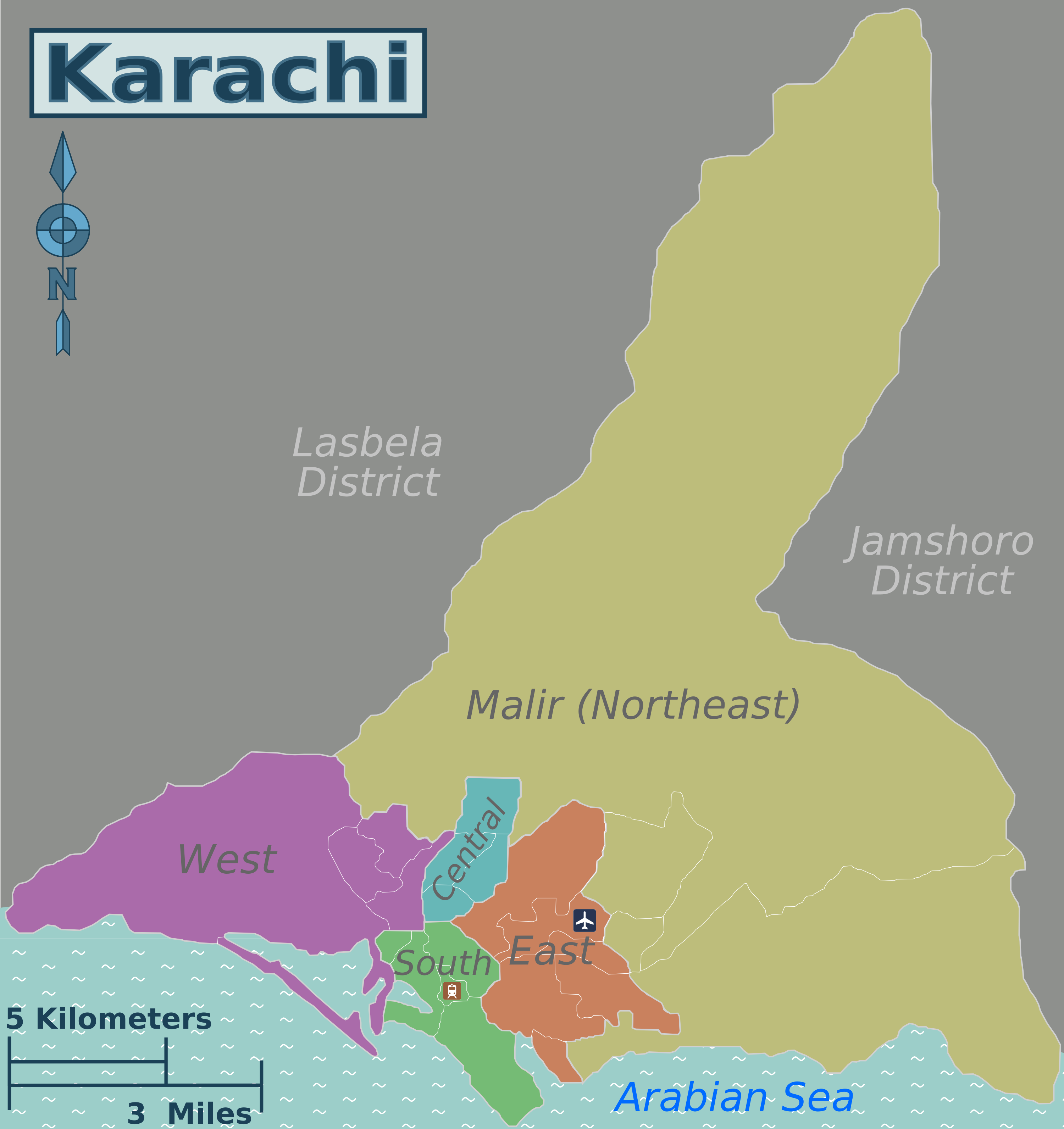
Geography of Karachi on:
[Wikipedia]
[Google]
[Amazon]

The case of Karachi, Pakistan
/ref> Karachi is located on the coastline of Sindh province in southern Pakistan, along a natural harbour on the

Karachi
Karachi (; ur, ; ; ) is the most populous city in Pakistan and 12th most populous city in the world, with a population of over 20 million. It is situated at the southern tip of the country along the Arabian Sea coast. It is the former c ...
is Pakistan
Pakistan ( ur, ), officially the Islamic Republic of Pakistan ( ur, , label=none), is a country in South Asia. It is the world's fifth-most populous country, with a population of almost 243 million people, and has the world's second-lar ...
's largest city and is the capital of Sindh; it lies on Pakistan's southern coast, on the Arabian Sea
The Arabian Sea ( ar, اَلْبَحرْ ٱلْعَرَبِيُّ, Al-Bahr al-ˁArabī) is a region of the northern Indian Ocean bounded on the north by Pakistan, Iran and the Gulf of Oman, on the west by the Gulf of Aden, Guardafui Channel ...
just northwest of the Indus River Delta .
Originally a tiny fishing village, Karachi became a trading center in the 18th century. The British, after gaining control of the region in the 19th century, developed the city into an important port. Rapid growth came after Pakistan became independent in 1947, largely, because of the city having been historically the largest urban centre during British rule in regions forming modern Pakistan. Karachi was the national capital from 1947 until 1959. Over the next several decades it became one of the fastest-growing cities in the world, doubling its population from 1981 to 1999.
The hills in Karachi are the off-shoots of the Kirthar Range
The Kirthar Mountains ( ur, كوه کھیرتھر; sd, کير ٿر جبل) are a mountain range that mark the boundary between the Pakistani provinces of Balochistan and Sindh, and which comprise much of the Kirthar National Park. The mountain ...
. The highest point of these hills in Karachi is about 528m in the extreme north. All these hills are devoid of vegetation and have wide intervening plains, dry river beds and water channels./ref> Karachi is located on the coastline of Sindh province in southern Pakistan, along a natural harbour on the
Arabian Sea
The Arabian Sea ( ar, اَلْبَحرْ ٱلْعَرَبِيُّ, Al-Bahr al-ˁArabī) is a region of the northern Indian Ocean bounded on the north by Pakistan, Iran and the Gulf of Oman, on the west by the Gulf of Aden, Guardafui Channel ...
. Karachi is built on coastal plains with scattered rocky outcroppings, hills and coastal marshlands. Coastal mangrove forests grow in the brackish waters around the Karachi Harbour, and further southeast towards the expansive Indus River Delta. West of Karachi city is the Cape Monze, locally known as Ras Muari, which is an area characterized by sea cliffs, rocky sandstone promontories and undeveloped beaches. As Karachi is situated on the Arabian Sea, so it serves as a transport hub and is home to two of Pakistan's largest seaports, namely, the Port of Karachi
The Port of Karachi ( ur, , ''Bandar gāh Karāchī'') is one of South Asia's largest and busiest deep-water seaports, handling about 60% of the nation's cargo (25 million tons per annum) located in Karachi, Pakistan. It is located on the Kar ...
and Port Bin Qasim.

See also
*Climate of Karachi
Karachi has an arid climate/semi-arid climate , albeit a moderate version of this climate. Karachi has a tropical climate, despite being located slightly above the Tropic of Cancer. It is situated in the monsoon region of Pakistan. It is locate ...
References
{{Karachi-stub