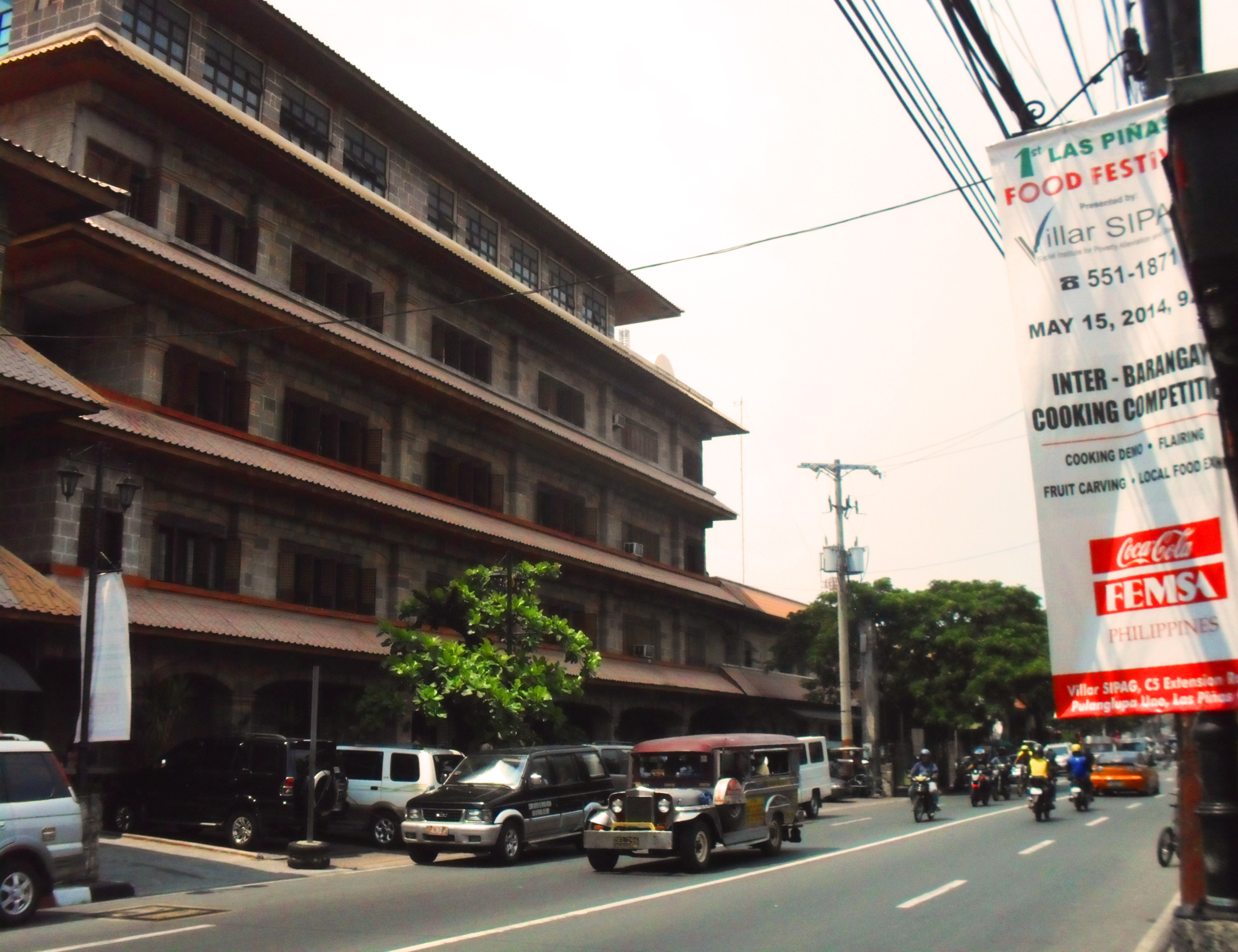
Diego Cera Avenue on:
[Wikipedia]
[Google]
[Amazon]
Padre Diego Cera Avenue, or simply Diego Cera Avenue, is a major north-south collector road in

 Diego Cera Avenue begins in
Las Piñas
Las Piñas, officially the City of Las Piñas ( fil, Lungsod ng Las Piñas), is a 1st class highly urbanized city in the National Capital Region of the Philippines. According to the 2020 census, it has a population of 606,293 people.
Las Piñas ...
, Metro Manila
Metropolitan Manila (often shortened as Metro Manila; fil, Kalakhang Maynila), officially the National Capital Region (NCR; fil, link=no, Pambansang Punong Rehiyon), is the seat of government and one of three defined metropolitan areas in ...
, Philippines
The Philippines (; fil, Pilipinas, links=no), officially the Republic of the Philippines ( fil, Republika ng Pilipinas, links=no),
* bik, Republika kan Filipinas
* ceb, Republika sa Pilipinas
* cbk, República de Filipinas
* hil, Republ ...
. It is a four-lane undivided arterial running parallel to the Manila–Cavite Expressway
The Manila–Cavite Expressway (more popularly known as CAVITEX), signed as E3 of the Philippine expressway network and R-1 of Metro Manila's arterial road network, is a controlled-access toll expressway linking Manila to the southern pro ...
to the west from Manuyo Uno at Las Piñas' border with Parañaque in the north to Zapote near the border with Bacoor in the south. It is a continuation of Elpidio Quirino Avenue from Parañaque and was originally a segment of ''Calle Real'' in Las Piñas. The road is a component of the National Route 62 (N62) of the Philippine highway network
The Philippine highway network is a network of national roads owned and maintained by the Department of Public Works and Highways (DPWH) and organized into three classifications according to their function or purpose: national primary, seconda ...
and Radial Road 2 (R-2) of Manila's arterial road network.
The avenue marks the original shoreline of Manila Bay
Manila Bay ( fil, Look ng Maynila) is a natural harbor that serves the Port of Manila (on Luzon), in the Philippines. Strategically located around the capital city of the Philippines, Manila Bay facilitated commerce and trade between the Phi ...
in Las Piñas as it existed during the Spanish colonial period. Prior to the construction of the Coastal Road in 1985, the road served as the highway linking Manila
Manila ( , ; fil, Maynila, ), officially the City of Manila ( fil, Lungsod ng Maynila, ), is the capital of the Philippines, and its second-most populous city. It is highly urbanized and, as of 2019, was the world's most densely populate ...
with Cavite and other southern provinces. The Manila Bay shoreline is currently about to the west.
The road is situated in the Las Piñas historical corridor being home to the city's oldest structures such as the Las Piñas Church, the Las Piñas Gabaldon Hall, and the old Las Piñas District Hospital. It was named for Fray Diego Cera de la Virgen del Carmen (1762–1832), the Spanish missionary from Huesca
Huesca (; an, Uesca) is a city in north-eastern Spain, within the autonomous community of Aragon. It is also the capital of the Spanish province of the same name and of the comarca of Hoya de Huesca. In 2009 it had a population of 52,059, almo ...
who designed and built the Bamboo Organ in 1824.
Route description

 Diego Cera Avenue begins in
 barangay
A barangay (; abbreviated as Brgy. or Bgy.), historically referred to as barrio (abbreviated as Bo.), is the smallest administrative division in the Philippines and is the native Filipino term for a village, district, or ward. In metropolita ...
Manuyo Uno as a continuation of Elpidio Quirino Avenue south of Villareal Street running parallel to the Manila–Cavite Expressway
The Manila–Cavite Expressway (more popularly known as CAVITEX), signed as E3 of the Philippine expressway network and R-1 of Metro Manila's arterial road network, is a controlled-access toll expressway linking Manila to the southern pro ...
to the west and Tramo Street to the east. It proceeds due south entering the old downtown barangays of Daniel Fajardo, Ilaya, and Elias Aldana where the old Las Piñas Municipal Hall and Las Piñas Church are located. Upon crossing the Las Piñas River via the Diego Cera Bridge, the avenue enters barangay Pulang Lupa Uno where the old Sarao Motors factory and the Las Piñas General Hospital are located. It intersects with Carlos Garcia Avenue Extension (C-5) and Naga Road before arriving in barangay Zapote. The avenue terminates at Alabang–Zapote Road
Alabang–Zapote Road is a four-lane national road which travels east–west through the southern limits of Metro Manila, Philippines. It runs parallel to Dr. Santos Avenue in the north and is named for the two barangays that it links: Alabang i ...
near the city's boundary with Cavite where it continues as Aguinaldo Highway
A thirteenth salary, or end-of-year bonus, is an extra payment given to employees at the end of December. Although the amount of the payment depends on a number of factors, it usually matches an employee's monthly salary and can be paid in o ...
.
Other landmarks along the avenue include the Saint Joseph's Academy, Plaza Quezon, Las Piñas Catholic Cemetery, Maricielo Villas, and Zapote Public Market.
See also
*Del Pilar Street
Marcelo H. del Pilar Street, also known as M.H. del Pilar Street or simply Del Pilar Street, is a north–south road running for connecting Ermita and Malate districts in Manila, Philippines. It is a two-lane street which carries traffic one-way ...
* Harrison Avenue
Francis Burton Harrison Avenue, more commonly known as F.B. Harrison Avenue or simply Harrison Avenue (formerly F.B. Harrison Street or Harrison Street), is a major north-south collector road in Pasay, western Metro Manila, Philippines. It is a fo ...
References
{{Road infrastructure in Manila Streets in Metro Manila