Bardaskan on:
[Wikipedia]
[Google]
[Amazon]
Bardaskan ( fa, بردسكن; also


File:Havayi.jpg, Aerial view of the city
File:Dahan Ghal'e reservoir.JPG, Dahan Ghaleh Dam
File:Seasonly floode in bardaskan playa.jpg, Bardaskan Playa
File:غروب آفتاب در کفه نمکی بردسکن.jpg, Bardaskan Playa
File:ورودی رباط.jpg, Ribat-i Kabudan
File:Sir cave in Bardaskan.jpg, Sir Cave
File:Nomads in Bardaskan county.JPG, Nomads of Bardaskan
File:Pistachio farm in Bardeskan (1).JPG, Farms
Photos of Bardaskan
Populated places in Bardaskan County Cities in Razavi Khorasan Province Cities in Bardaskan County {{Bardaskan-geo-stub
Romanize
Romanization or romanisation, in linguistics, is the conversion of text from a different writing system to the Roman (Latin) script, or a system for doing so. Methods of romanization include transliteration, for representing written text, an ...
d as ''Badar Askān'', ''Badr Eshkand'', ''Bardāskan'', ''Bardāskand'', ''Bardeshkand'' and ''Bardeskan'') is a city and capital of Bardaskan County
Bardaskan County ( fa, شهرستان بردسکن) is in Razavi Khorasan province, Iran. Bardaskan has also been called Baradaskan (باردسکن) or Berdaskan (برداسکن). The capital of the county is the city of Bardaskan. At the 200 ...
, in Razavi Khorasan Province, Iran
Iran, officially the Islamic Republic of Iran, and also called Persia, is a country located in Western Asia. It is bordered by Iraq and Turkey to the west, by Azerbaijan and Armenia to the northwest, by the Caspian Sea and Turkmeni ...
.
Bardaskan used to be part of Kashmar city
Geographical position, weather, jobs, products and roads
Bardaskan is located in the Khorasan Razavi province at the margin of the north part of Namak Desert ( salt desert). Its area is 8535 km2. Altitude of Bardaskan is 985 meter. The weather in the north part of Bardaskan is cold and in the south and central parts changes from semi dry to hot and dry. Annual raining average is 150 mm. Bardaskan's temperature in the hottest summer day is nearly 45 °C And in the coldest winter night is -5 °C. There in not any permanent river in the Bardaskan but there are several seasonal rivers. Main jobs in Bardaskan are farming and animal husbandry. Staple crops in Bardaskan arewheat
Wheat is a grass widely cultivated for its seed, a cereal grain that is a worldwide staple food. The many species of wheat together make up the genus ''Triticum'' ; the most widely grown is common wheat (''T. aestivum''). The archaeologi ...
, barley
Barley (''Hordeum vulgare''), a member of the grass family, is a major cereal grain grown in temperate climates globally. It was one of the first cultivated grains, particularly in Eurasia as early as 10,000 years ago. Globally 70% of barley p ...
, ccotton umin seed, and pistachio, Saffron
Saffron () is a spice derived from the flower of ''Crocus sativus'', commonly known as the "saffron crocus". The vivid crimson stigma and styles, called threads, are collected and dried for use mainly as a seasoning and colouring agent in ...
, pomegranate
The pomegranate (''Punica granatum'') is a fruit-bearing deciduous shrub in the family Lythraceae, subfamily Punicoideae, that grows between tall.
The pomegranate was originally described throughout the Mediterranean Basin, Mediterranean re ...
, fig
The fig is the edible fruit of ''Ficus carica'', a species of small tree in the flowering plant family Moraceae. Native to the Mediterranean and western Asia, it has been cultivated since ancient times and is now widely grown throughout the world ...
and grape products. Neighboring cities by Bardaskan are sabzevar
Sabzevar ( fa, سبزوار ), previously known as Beyhagh (also spelled "Beihagh"; fa, بيهق), is a city and capital of Sabzevar County, in Razavi Khorasan Province, approximately west of the provincial capital Mashhad, in northeastern ...
and neishabuor (in the North) kashmar
Kashmar () ( fa, کاشمر, also Romanized as ''Kāshmar''; formerly ''Keshmar'', '' Torshīz'' or ''Soltanabad'') is a city and the capital of Kashmar County, in Razavi Khorasan Province, Iran. Kashmar is located near the river Shesh Tara ...
(in the east) Tabas
Tabas ( fa, طبس, also Romanized as Ṭabas), formerly known as Golshan, is the capital city of Tabas County in South Khorasan Province of Iran. At the 2011 census, its population was 35,150, in 9,903 families.
Tabas is located in central Iran ...
(in the south) and Semnan (in the west).
Location
Bardeskan city is located between 56 degrees and 14 minutes to 58 degrees and 15 minutes of longitude and 34 degrees and 42 minutes of latitude. the city of Bardeskan is located in the west of Mashhad. The height of this city is 985 meters above sea level.Historical sites, ancient artifacts and tourism
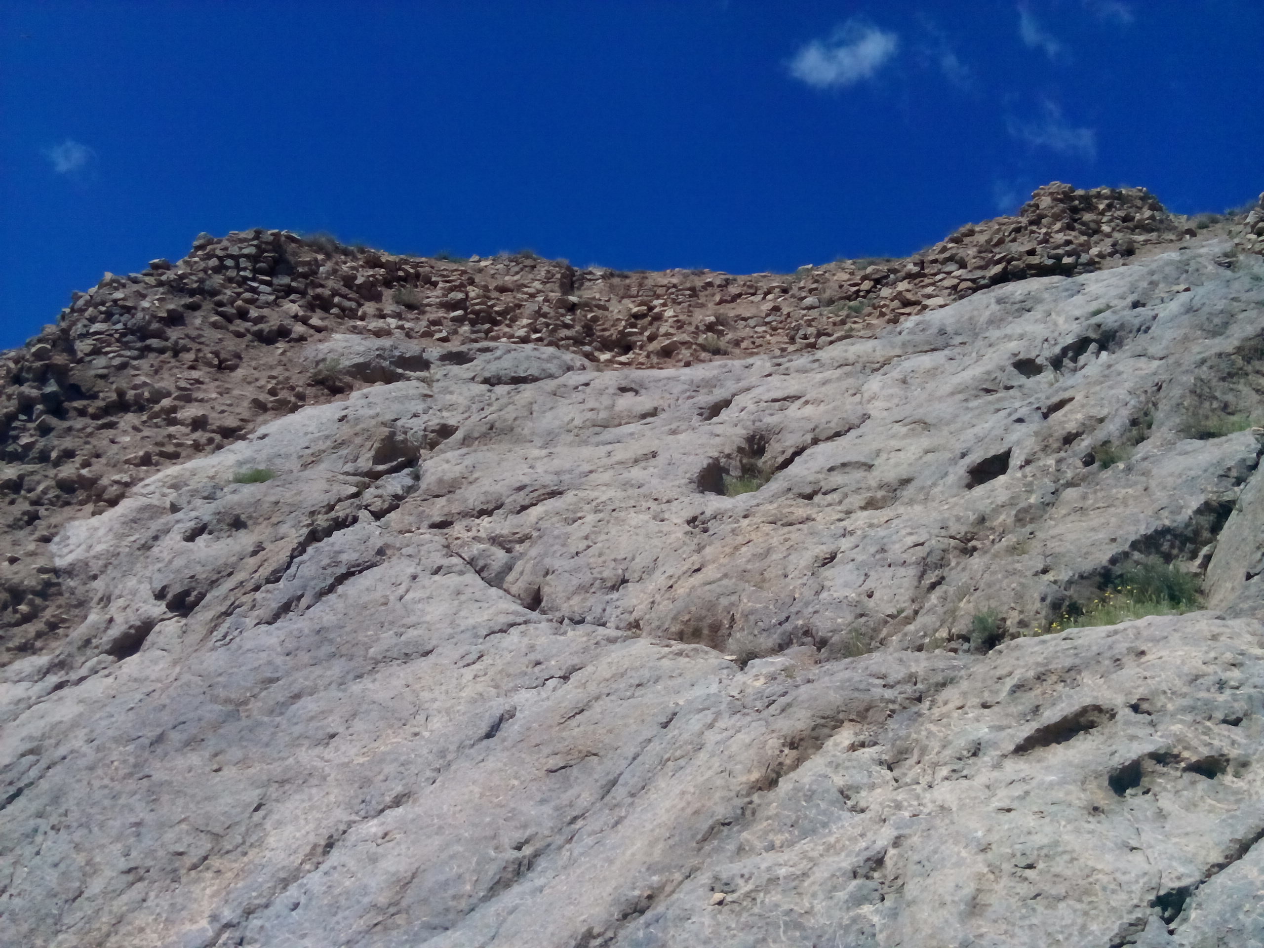
Sir Cave
Sir Cave is a cave inSir
''Sir'' is a formal honorific address in English for men, derived from Sire in the High Middle Ages. Both are derived from the old French "Sieur" (Lord), brought to England by the French-speaking Normans, and which now exist in French only as ...
village of the Central District of Bardaskan County
Bardaskan County ( fa, شهرستان بردسکن) is in Razavi Khorasan province, Iran. Bardaskan has also been called Baradaskan (باردسکن) or Berdaskan (برداسکن). The capital of the county is the city of Bardaskan. At the 200 ...
in Razavi Khorasan Province. The cave was inhabited in the past and was used as a shelter. Sir Cave is located on a rocky mountain with a height of about 80 meters and about 1608 meters above sea level. It is difficult to reach.

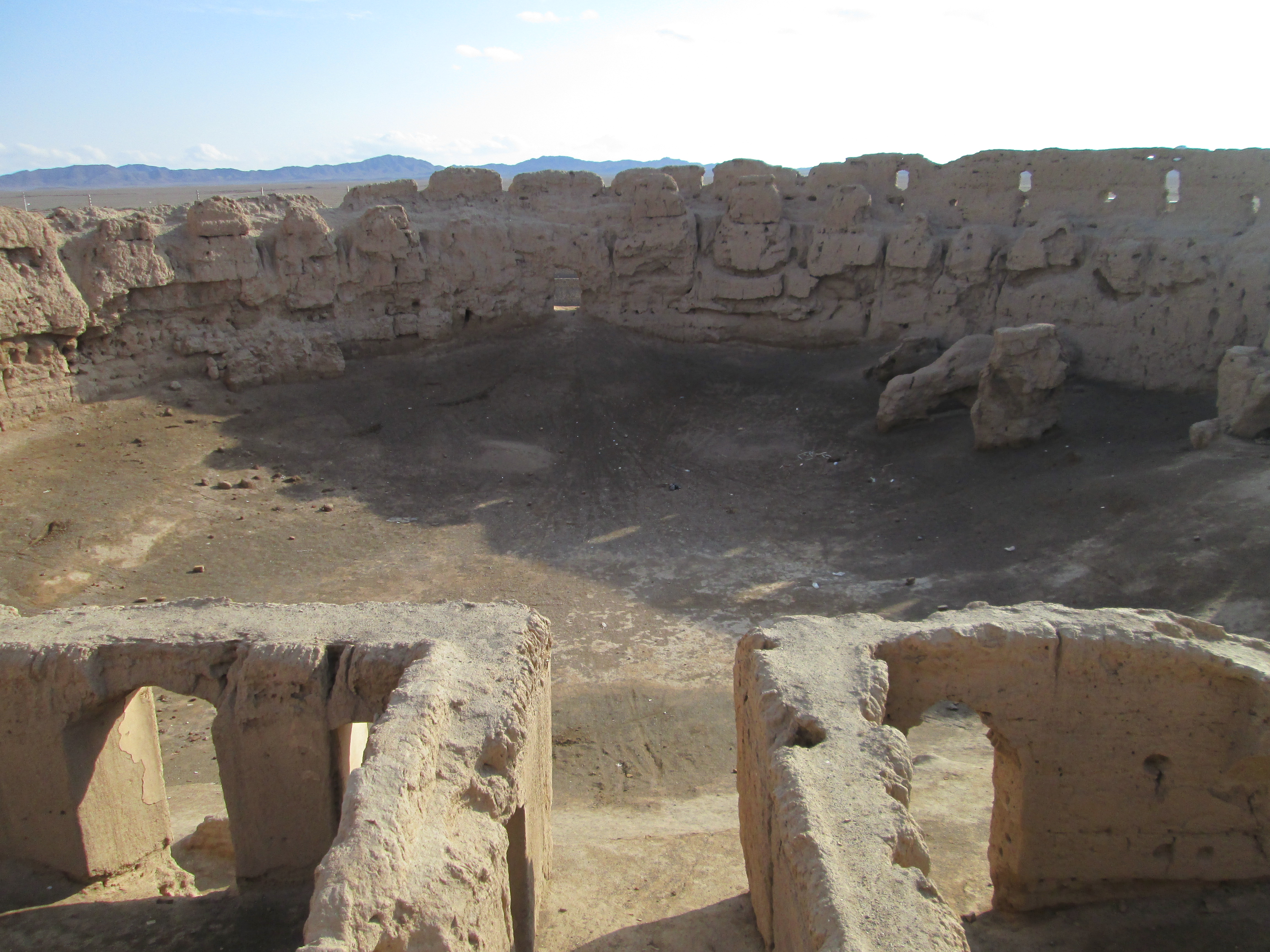
Rahmanniyeh Castle
Rahmanniyeh Castle is a historical castle located inBardaskan County
Bardaskan County ( fa, شهرستان بردسکن) is in Razavi Khorasan province, Iran. Bardaskan has also been called Baradaskan (باردسکن) or Berdaskan (برداسکن). The capital of the county is the city of Bardaskan. At the 200 ...
in Razavi Khorasan Province, The longevity of this fortress dates back to the 8th to 12th centuries AH.

Qal'eh Dokhtar, Khooshab
Qaleh Dokhtar is a historical castle located inBardaskan County
Bardaskan County ( fa, شهرستان بردسکن) is in Razavi Khorasan province, Iran. Bardaskan has also been called Baradaskan (باردسکن) or Berdaskan (برداسکن). The capital of the county is the city of Bardaskan. At the 200 ...
in Razavi Khorasan Province, The longevity of this fortress dates back to the 6th to 8th centuries AH.
Qal'eh Dokhtar, Doruneh
Qal'eh Dokhtar is a historical castle located inBardaskan County
Bardaskan County ( fa, شهرستان بردسکن) is in Razavi Khorasan province, Iran. Bardaskan has also been called Baradaskan (باردسکن) or Berdaskan (برداسکن). The capital of the county is the city of Bardaskan. At the 200 ...
in Razavi Khorasan Province, The longevity of this fortress dates back to the 6th to 9th centuries AH.
Aliabad Tower
This tower is located inAliabad-e Keshmar
Aliabad-e Keshmar ( fa, علیآباد کشمر) is a village in Kenarshahr Rural District, in the Central District of Bardaskan County, Razavi Khorasan Province, Iran
Iran, officially the Islamic Republic of Iran, and als ...
, 42 km from Kashmar city. This tower is built on the castle and its minaret is similar to the tower and its facade is made of decorative brick inlay. This dome is 18 meters. Tall with an octagonal interior. This tower is in the historical records.
Firuzabad Tower
This minaret is made of brick and there are inscriptions on it called "Kufic
Kufic script () is a style of Arabic script that gained prominence early on as a preferred script for Quran transcription and architectural decoration, and it has since become a reference and an archetype for a number of other Arabic scripts. It ...
" which dates back to the late 7th century AH. Although the minaret is made of simple brick - the bricks are laid in a zigzag pattern to enhance its beauty. Inside the minaret, the remains of a staircase can be seen and holes are inscribed on the minaret. Currently, this minaret is 18 meters high.
Seyyed Bagher Ab anbar
The Seyed Bagher Ab anbar is a historicalAb anbar
An ''ab anbar'' ( fa, آبانبار, literally "Cistern") is a traditional reservoir or cistern of drinking water in Greater Iran in antiquity.
Structure
To withstand the pressure the water exerts on the containers of the storage tank, ...
of Qajar dynasty that is located in city center of Bardaskan, in Ghaem Avenue. This Ab anbar was added to the list of National Monuments of Iran
Iran, officially the Islamic Republic of Iran, and also called Persia, is a country located in Western Asia. It is bordered by Iraq and Turkey to the west, by Azerbaijan and Armenia to the northwest, by the Caspian Sea and Turkmeni ...
As the 11034st monument.
Firuzabad area
The Firuzabad area is a historicalarea
Area is the quantity that expresses the extent of a region on the plane or on a curved surface. The area of a plane region or ''plane area'' refers to the area of a shape or planar lamina, while '' surface area'' refers to the area of an ope ...
related to the Pre-Islamic period and is located in Bardaskan County
Bardaskan County ( fa, شهرستان بردسکن) is in Razavi Khorasan province, Iran. Bardaskan has also been called Baradaskan (باردسکن) or Berdaskan (برداسکن). The capital of the county is the city of Bardaskan. At the 200 ...
, Central District, Firuzabad village.
Darone Cave
Darone Cave is a cave in Bardaskan County, Iran. It is located in Cave Doruneh, Bardaskan.
Ribat of Kabudan
Ribat of Kabudan is a historicalRibat
A ribāṭ ( ar, رِبَـاط; hospice, hostel, base or retreat) is an Arabic term for a small fortification built along a frontier during the first years of the Muslim conquest of the Maghreb to house military volunteers, called ''murabitun'' ...
related to the Qajar dynasty and is located in Kabudan, Razavi Khorasan Province.
Tomb of Abdolabad
The Tomb of Abdolabad is a historicaltomb
A tomb ( grc-gre, τύμβος ''tumbos'') is a repository for the remains of the dead. It is generally any structurally enclosed interment space or burial chamber, of varying sizes. Placing a corpse into a tomb can be called ''immureme ...
and chahartaqi of Ilkhanate
The Ilkhanate, also spelled Il-khanate ( fa, ایل خانان, ''Ilxānān''), known to the Mongols as ''Hülegü Ulus'' (, ''Qulug-un Ulus''), was a khanate established from the southwestern sector of the Mongol Empire. The Ilkhanid realm ...
era in Abdolabad village at Bardaskan County
Bardaskan County ( fa, شهرستان بردسکن) is in Razavi Khorasan province, Iran. Bardaskan has also been called Baradaskan (باردسکن) or Berdaskan (برداسکن). The capital of the county is the city of Bardaskan. At the 200 ...
.The tomb was added to the list of National Monuments of Iran
Iran, officially the Islamic Republic of Iran, and also called Persia, is a country located in Western Asia. It is bordered by Iraq and Turkey to the west, by Azerbaijan and Armenia to the northwest, by the Caspian Sea and Turkmeni ...
as the 10,908th monument.
Gallery
See also
*List of cities, towns and villages in Razavi Khorasan Province
A list of cities, towns and villages in Razavi Khorasan Province of north-eastern Iran:
Alphabetical
Cities are in bold text; all others are villages.
A
Ab Barg , Ab Barik , Ab Barik-e Bala , Ab Barik-e Olya , Ab Barik-e Sofla , Ab G ...
References
External links
*Photos of Bardaskan
Populated places in Bardaskan County Cities in Razavi Khorasan Province Cities in Bardaskan County {{Bardaskan-geo-stub