|
Munneru
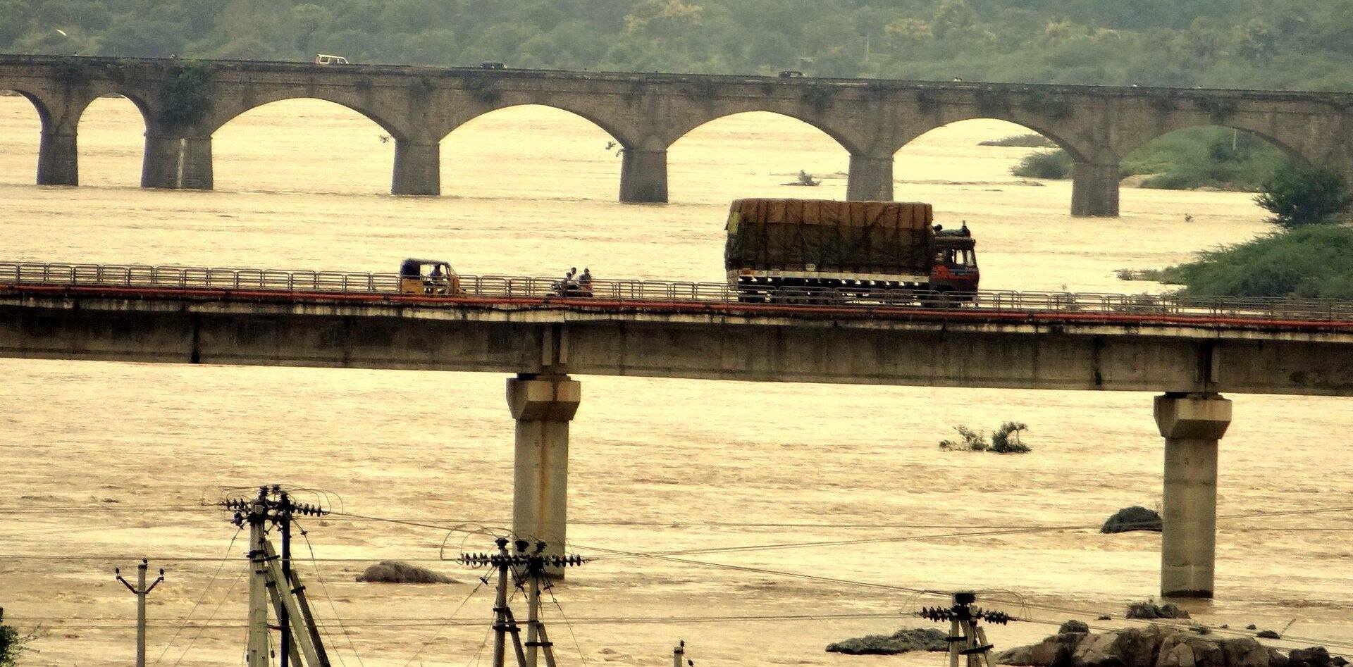
Munneru is a left tributary of the Krishna River. It originates in Warangal District of Telangana, India and flows in the districts of Khammam District and Krishna District. The river is named after Rishi Maudgalya, who is said to have created this river with his spiritual power and performed a penance ritual in Khammam. Origins It originates near Mahabubabad town of Warangal District, Telangana. Flow It flows through Dornakal Eru and comes via Kamanchkal to Danavaigudam suburb of Khammam city where it has a small Dam in order to facilitate water collection. Munneru acts as a water source to Khammam city. It goes through ManchiKanti Nagar, Kalavoddu, Moti Nagar, Prakash Nagar and Dhamsalampuram suburbs of Khammam city. It reaches Chinna Mandava and Lingala villages of Krishna District. It flows into Penuganchiprolu town, Keesara village and finally discharges into the Krishna river at Eturu village near Nandigama downstream of Pulichintala dam. Muniyeru barrage was c ... [...More Info...] [...Related Items...] OR: [Wikipedia] [Google] [Baidu] |
Pulichinthala Project
The Pulichintala Project is a multi-purpose water management project for irrigation, hydropower generation, and flood control in the state of Andhra Pradesh, India. It is a crucial irrigation facility for farmers in four coastal districts: West Godavari, Krishna, Guntur, and Prakasam, covering over 13 lakh acres. It has 24 gates and a balancing reservoir with a capacity of 46 Tmcft at MSL full reservoir level (FRL). History In 1911, British engineer Col. Ellis proposed an irrigation project upstream of the Prakasam Barrage. At the time, the British government showed little interest in the proposition. Later, the Raja of Muktyala led the push for the Pulichintala Project with the help of Moturi Satyanarayana and K.L Rao. It was the first project to start under the ambitious Jalayagnam program in the year 2004. https://irrigationap.cgg.gov.in/wrd/static/approjects/KLRaoProject.html Financial tie-up happened in 2009 and commenced in 2009. On 7 December 2013, the pr ... [...More Info...] [...Related Items...] OR: [Wikipedia] [Google] [Baidu] |
Rivers Of Andhra Pradesh
A river is a natural flowing watercourse, usually freshwater, flowing towards an ocean, sea, lake or another river. In some cases, a river flows into the ground and becomes dry at the end of its course without reaching another body of water. Small rivers can be referred to using names such as creek, brook, rivulet, and rill. There are no official definitions for the generic term river as applied to geographic features, although in some countries or communities a stream is defined by its size. Many names for small rivers are specific to geographic location; examples are "run" in some parts of the United States, "burn" in Scotland and northeast England, and "beck" in northern England. Sometimes a river is defined as being larger than a creek, but not always: the language is vague. Rivers are part of the water cycle. Water generally collects in a river from precipitation through a drainage basin from surface runoff and other sources such as groundwater recharge, springs, ... [...More Info...] [...Related Items...] OR: [Wikipedia] [Google] [Baidu] |
Geography Of Krishna District
Geography (from Greek: , ''geographia''. Combination of Greek words ‘Geo’ (The Earth) and ‘Graphien’ (to describe), literally "earth description") is a field of science devoted to the study of the lands, features, inhabitants, and phenomena of Earth. The first recorded use of the word γεωγραφία was as a title of a book by Greek scholar Eratosthenes (276–194 BC). Geography is an all-encompassing discipline that seeks an understanding of Earth and its human and natural complexities—not merely where objects are, but also how they have changed and come to be. While geography is specific to Earth, many concepts can be applied more broadly to other celestial bodies in the field of planetary science. One such concept, the first law of geography, proposed by Waldo Tobler, is "everything is related to everything else, but near things are more related than distant things." Geography has been called "the world discipline" and "the bridge between the human and t ... [...More Info...] [...Related Items...] OR: [Wikipedia] [Google] [Baidu] |
Hanamkonda District
Hanumakonda district, (formerly Warangal Urban district) is a district located in the northern region of the Indian state of Telangana. The district headquarters are located at Hanumakonda. The district borders the districts of Jangaon, Karimnagar, Warangal, Bhupalpally and Siddipet. The district was formed in 2016 by carving out Warangal Urban district from the erstwhile Warangal district. In August 2021, the Warangal Urban district was renamed as Hanumakonda district. History Formation of District During the rule of Nizam of Hyderabad, State of Hyderabad was divided into many small Circars. Warangal became a Circar in the early 1800s. In 1866 Circars was Abolished and merged to create districts, Warangal district was created by merging Warangal, Khummettu and part of Bhonagheer circars. Jangaon area from Bhongir Circar was transferred to warangal and Kamalapur area of warangal transferred to Karimnagar district. In 1905 when Princely state of Hyderabad sub divid ... [...More Info...] [...Related Items...] OR: [Wikipedia] [Google] [Baidu] |
Tributaries Of The Krishna River
A tributary, or affluent, is a stream or river that flows into a larger stream or main stem (or parent) river or a lake. A tributary does not flow directly into a sea or ocean. Tributaries and the main stem river drain the surrounding drainage basin of its surface water and groundwater, leading the water out into an ocean. The Irtysh is a chief tributary of the Ob river and is also the longest tributary river in the world with a length of . The Madeira River is the largest tributary river by volume in the world with an average discharge of . A confluence, where two or more bodies of water meet, usually refers to the joining of tributaries. The opposite to a tributary is a distributary, a river or stream that branches off from and flows away from the main stream. PhysicalGeography.net, Michael Pidwirny & Scott ... [...More Info...] [...Related Items...] OR: [Wikipedia] [Google] [Baidu] |
National Highway 9 (India)
National Highway 9 (NH 9) is a National Highway in India in east-west direction. It starts at Malout in Punjab and ends at Pithoragarh in Pithoragarh district in Uttarakhand. It passes through the states of Punjab, Haryana, Delhi, Uttar Pradesh and Uttarakhand. After renumbering of all national highways by National Highway Authority of India in 2010, the current NH 9 was formed by merging segments of five separate national highways in 2010; these were Old NH 10 (Fazilka-Delhi section), Old NH 24 (Delhi- Rampur section), Old NH 87 ( Rampur- Rudrapur section), Old NH 74 ( Rudrapur-Sitarganj-Khatima section) and Old NH 125 (Tanakpur- Pithoragarh section). Route Starting at Malout in Punjab and ending at Askot in the State of Uttarakhand, it passes connects several important cities in five states in North India (from west towards east): * Punjab ** Malout * Haryana ** Sirsa- Fatehabad- Hisar-Hansi-Maham-Rohtak-Bahadurgarh * Delhi * Uttar Pradesh ** Ghaziabad-Hapur-Moradaba ... [...More Info...] [...Related Items...] OR: [Wikipedia] [Google] [Baidu] |
Kodad
Kodad is a town in Suryapet district of the Indian state of Telangana. It is a municipality and the mandal headquarters of Kodad mandal in Kodad revenue division. It lies on the National Highway 65 between Hyderabad and Vijayawada. It is 44 km away from the district headquarters Suryapet Climate Kodad summer highest day temperature is in between 35 °C to 48 °C . Average temperatures of January is 24 °C, February is 26 °C, March is 29 °C, April is 33 °C, May is 36 °C . Transport TSRTC operates several buses from Kodad to various destinations in Andhra Pradesh and Telangana. Demographics According to Census of India, 2011, population of Kodad town is 65,234 of which 32,010 are male and 33,224 are female. The literacy rate of the town is 96.7%. Sex ratio is 1060 females to 1000 males. Child sex ratio is 1100 girls to 1000 boys. Kodad Mandal has a population of 134,130, of which 66,604 are male and 67,526 are female. The lite ... [...More Info...] [...Related Items...] OR: [Wikipedia] [Google] [Baidu] |
Nelakondapalli
Nelakondapally, also referred to as Nelakondapalli or Nela Kondapalli, is a town and headquarters of a mandal in Khammam district, Telangana, India. It is also an archaeological site important to early Buddhism and Hinduism, where excavations have discovered a major stupa site near an ancient manmade lake, another site where Buddhist and Hindu artwork were carved in pre-3rd century India, both sites also yielding hundreds of ancient rare coins with Shaiva and Vaishnava inscriptions from the dynasties of Andhra Ikshvakus and Vishnukundinas. Nelakondapally is also the birthplace of Bhakta Ramadasu.V.V. Krishna Sastry (1990), Recent Trends in Archaeology of Andhra Pradesh, Proceedings of the Indian History Congress, Vol. 51, pp. 771-772, Location Nelakondapalli is located 21 kilometers southwest of Khammam, 58 km east-southeast of Suryapet and close to the Telangana–Andhra Pradesh border. It is connected to the Indian national highway grid with NH365A, the link between Khammam ... [...More Info...] [...Related Items...] OR: [Wikipedia] [Google] [Baidu] |
Khammam District
Khammam district is a district in the eastern region of the Indian state of Telangana. The city of Khammam is the district headquarters. The district shares boundaries with Suryapet, Mahabubabad, Bhadradri districts and with Eluru and NTR districts in Andhra pradesh state. History Paleolithic man probably roamed around the areas of lower Godavari valley and the surroundings of Bhadrachalam, Kothagudem, Wyra, Sathupally and Paloncha Taluks in the district. Prehistoric rock paintings were found near Neeladri konda near Lankapalli of Sathupally Taluk. Megalithic Dolmens were found at Janampet of Pinapaka Taluk. Megalithic site on the campus of Government Degree college in Khammam has yielded pottery and skeletal remains. Kistapuram and Padugonigudem villages in Gundala Taluk of the district were rich in Megalithic cultural remnants explored and discovered recently. The southern parts of Khammam district flourished as famous Buddhist centers along with Amaravathi and Vi ... [...More Info...] [...Related Items...] OR: [Wikipedia] [Google] [Baidu] |
Water Bridge
Navigable aqueducts (sometimes called water bridges) are bridge structures that carry navigable waterway canals over other rivers, valleys, railways or roads. They are primarily distinguished by their size, carrying a larger cross-section of water than most water-supply aqueducts. Roman aqueducts were used to transport water and were created in Ancient Rome. The long steel Briare aqueduct carrying the Canal latéral à la Loire over the River Loire was built in 1896. It was ranked as the longest navigable aqueduct in the world for more than a century, until the Magdeburg Water Bridge in Germany took the title in the early 21st century. Early aqueducts such as the three on the Canal du Midi had stone or brick arches, the longest span being on the Cesse Aqueduct, built in 1690. But, the weight of the construction to support the trough with the clay or other lining to make it waterproof made these structures clumsy. In 1796 Longdon-on-Tern Aqueduct, the first large cast iron aq ... [...More Info...] [...Related Items...] OR: [Wikipedia] [Google] [Baidu] |


_Revenue_division.png)


