|
Wychavon
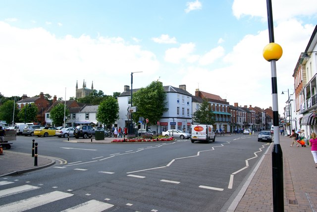
Wychavon is a local government district in Worcestershire, England, with a population size of 132,500 according to the 2021 census. Its council is based in the town of Pershore, and the other towns in the district are Droitwich Spa and Evesham. The district extends from the southeast corner of Worcestershire north and west. It borders all the other districts of Worcestershire, as well as the counties of Gloucestershire and Warwickshire. The district was created under the Local Government Act 1972, on 1 April 1974. It was a merger of the boroughs of Droitwich and Evesham along with Evesham Rural District and most of Droitwich Rural District and most of Pershore Rural District. The district's name, which was invented in 1973, contains two elements. "Wych" recalls the Saxon Kingdom of Hwicca, and "Avon" is for the River Avon. Wychavon District Council was a joint 'Council of the Year 2007', along with High Peak Borough Council. It was also featured as the 'Best Council to work ... [...More Info...] [...Related Items...] OR: [Wikipedia] [Google] [Baidu] |
Evesham
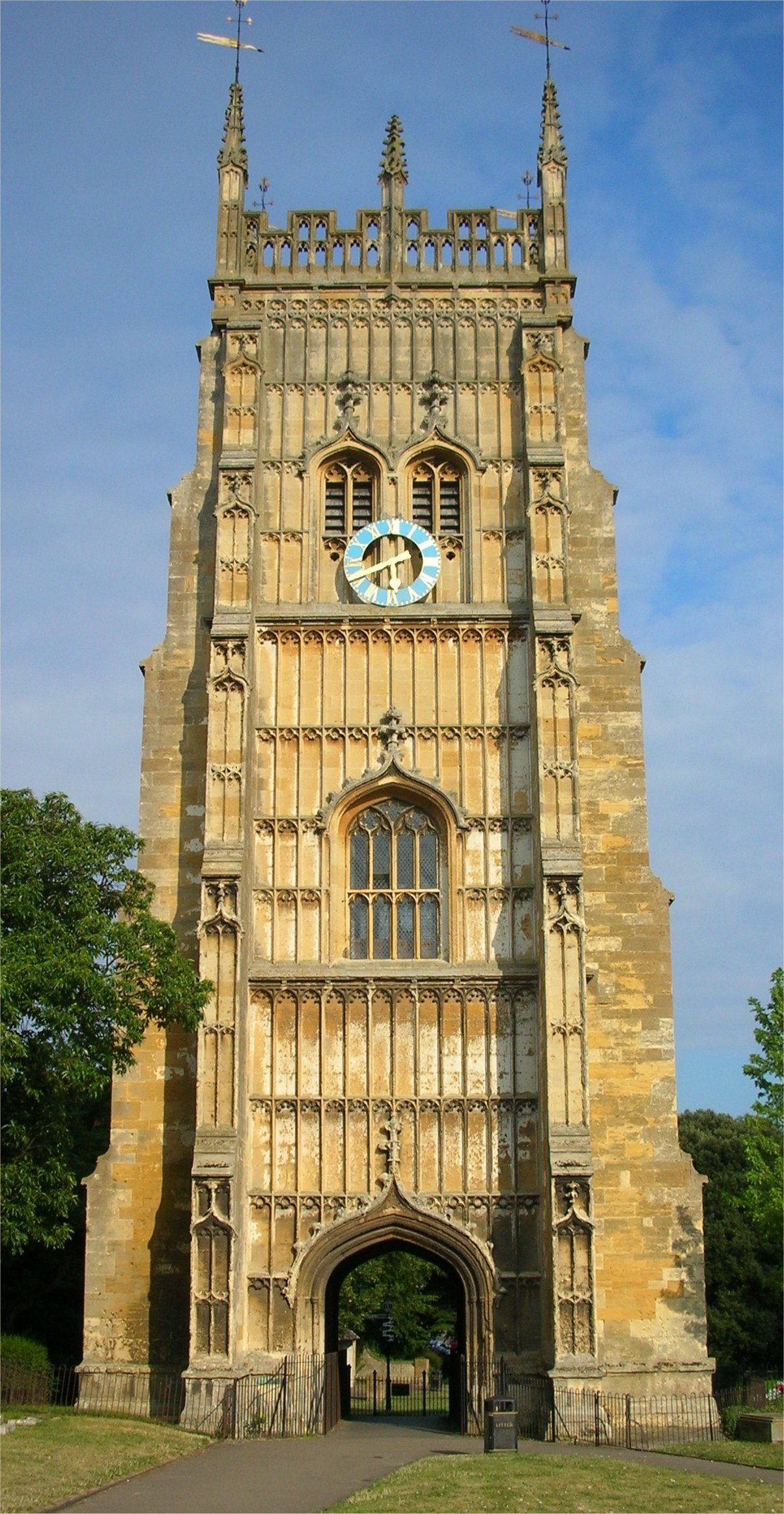
Evesham () is a market town and parish in the Wychavon district of Worcestershire, in the West Midlands region of England. It is located roughly equidistant between Worcester, Cheltenham and Stratford-upon-Avon. It lies within the Vale of Evesham, an area comprising the flood plain of the River Avon, which has been renowned for market gardening. The town centre, situated within a meander of the river, is subjected regularly to flooding. The 2007 floods were the most severe in recorded history. The town was founded around an 8th-century abbey, one of the largest in Europe, which was destroyed during the Dissolution of the Monasteries, with only Abbot Lichfield's Bell Tower remaining. During the 13th century, one of the two main battles of England's Second Barons' War took place near the town, marking the victory of Prince Edward, who later became King Edward I; this was the Battle of Evesham. History Evesham is derived from the Old English ''homme'' or ''ham'', and ''Eo ... [...More Info...] [...Related Items...] OR: [Wikipedia] [Google] [Baidu] |
Evesham, Worcestershire (48611649322)
Evesham () is a market town and parish in the Wychavon district of Worcestershire, in the West Midlands region of England. It is located roughly equidistant between Worcester, Cheltenham and Stratford-upon-Avon. It lies within the Vale of Evesham, an area comprising the flood plain of the River Avon, which has been renowned for market gardening. The town centre, situated within a meander of the river, is subjected regularly to flooding. The 2007 floods were the most severe in recorded history. The town was founded around an 8th-century abbey, one of the largest in Europe, which was destroyed during the Dissolution of the Monasteries, with only Abbot Lichfield's Bell Tower remaining. During the 13th century, one of the two main battles of England's Second Barons' War took place near the town, marking the victory of Prince Edward, who later became King Edward I; this was the Battle of Evesham. History Evesham is derived from the Old English ''homme'' or ''ham'', and ''E ... [...More Info...] [...Related Items...] OR: [Wikipedia] [Google] [Baidu] |
Wychavon District Council
Wychavon is a local government district in Worcestershire, England, with a population size of 132,500 according to the 2021 census. Its council is based in the town of Pershore, and the other towns in the district are Droitwich Spa and Evesham. The district extends from the southeast corner of Worcestershire north and west. It borders all the other districts of Worcestershire, as well as the counties of Gloucestershire and Warwickshire. The district was created under the Local Government Act 1972, on 1 April 1974. It was a merger of the boroughs of Droitwich and Evesham along with Evesham Rural District and most of Droitwich Rural District and most of Pershore Rural District. The district's name, which was invented in 1973, contains two elements. "Wych" recalls the Saxon Kingdom of Hwicca, and "Avon" is for the River Avon. Wychavon District Council was a joint 'Council of the Year 2007', along with High Peak Borough Council. It was also featured as the 'Best Council to work fo ... [...More Info...] [...Related Items...] OR: [Wikipedia] [Google] [Baidu] |
Pershore
Pershore is a market town in the Wychavon district in Worcestershire, England, on the banks of the River Avon. The town is part of the West Worcestershire parliamentary constituency. At the 2011 census, the population was 7,125. The town is best known for Pershore Abbey, Pershore College (now a campus of Warwickshire College) and plums grown locally. Pershore is situated on the River Avon, west of Evesham and east of Upton-upon-Severn in the Vale of Evesham, a district rich in fruit and vegetable production. History The town contains much elegant Georgian architecture. In 1964 the Council for British Archaeology included Pershore in its list of 51 British "Gem Towns" worthy of special consideration for historic preservation, and it has been listed as an outstanding conservation area. Parts of the abbey, which stand in an expanse of public grassland close to the centre of the town, date from the 11th century. The current structure is far smaller than the original bui ... [...More Info...] [...Related Items...] OR: [Wikipedia] [Google] [Baidu] |
Droitwich Spa
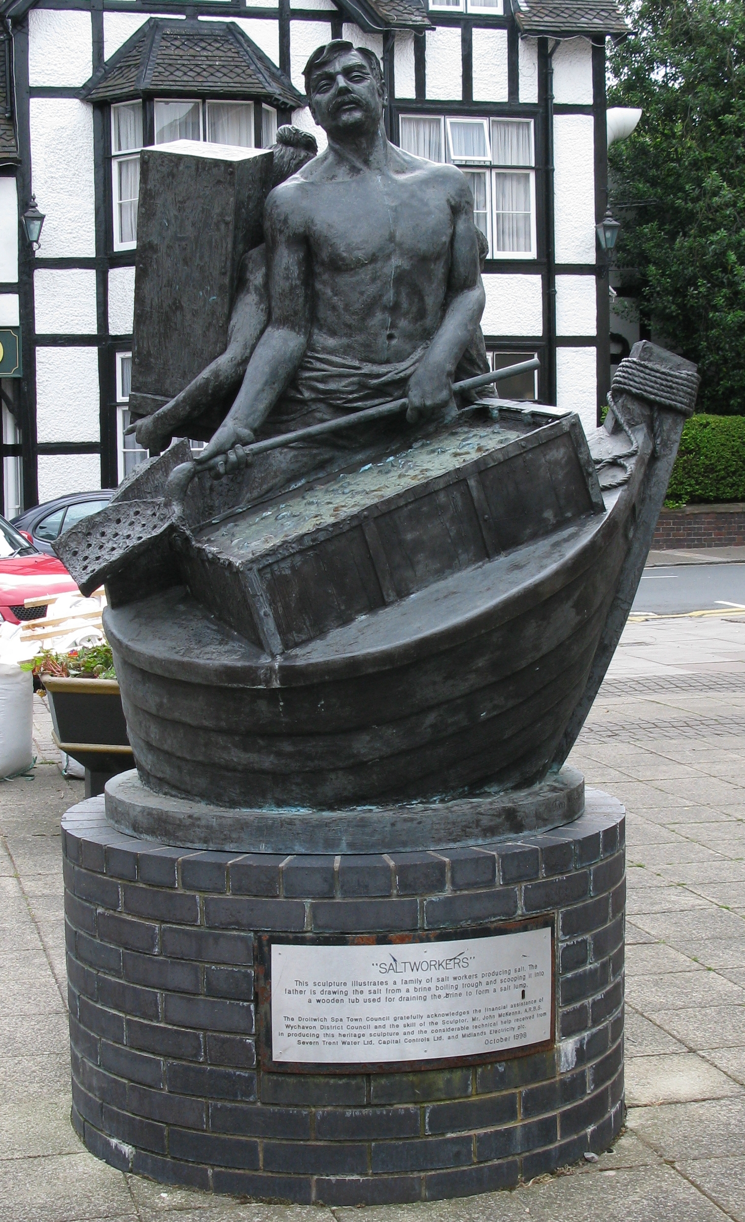
Droitwich Spa (often abbreviated to Droitwich ) is an historic spa town in the Wychavon district in northern Worcestershire, England, on the River Salwarpe. It is located approximately south-west of Birmingham and north-east of Worcester. The town was called Salinae in Roman times, then later called Wyche, derived from the Anglo-Saxon Hwicce kingdom, referred to as "Saltwich" according to Anglo-Saxon charters, with the Droit (meaning "right" in French) added when the town was given its charter on 1 August 1215 by King John. The "Spa" was added in the 19th century when John Corbett developed the town's spa facilities. The River Salwarpe running through Droitwich is likely derived from ''sal'' meaning "salt" and ''weorp'' which means "to throw up" - i.e. "the river which throws up salt" - which overflows from the salt brines. The town is situated on massive deposits of salt, and salt has been extracted there since ancient times. The natural Droitwich brine contains of salt; t ... [...More Info...] [...Related Items...] OR: [Wikipedia] [Google] [Baidu] |
Droitwich
Droitwich Spa (often abbreviated to Droitwich ) is an historic spa town in the Wychavon district in northern Worcestershire, England, on the River Salwarpe. It is located approximately south-west of Birmingham and north-east of Worcester. The town was called Salinae in Roman times, then later called Wyche, derived from the Anglo-Saxon Hwicce kingdom, referred to as "Saltwich" according to Anglo-Saxon charters, with the Droit (meaning "right" in French) added when the town was given its charter on 1 August 1215 by King John. The "Spa" was added in the 19th century when John Corbett developed the town's spa facilities. The River Salwarpe running through Droitwich is likely derived from ''sal'' meaning "salt" and ''weorp'' which means "to throw up" - i.e. "the river which throws up salt" - which overflows from the salt brines. The town is situated on massive deposits of salt, and salt has been extracted there since ancient times. The natural Droitwich brine contains of salt; te ... [...More Info...] [...Related Items...] OR: [Wikipedia] [Google] [Baidu] |
West Midlands (region)
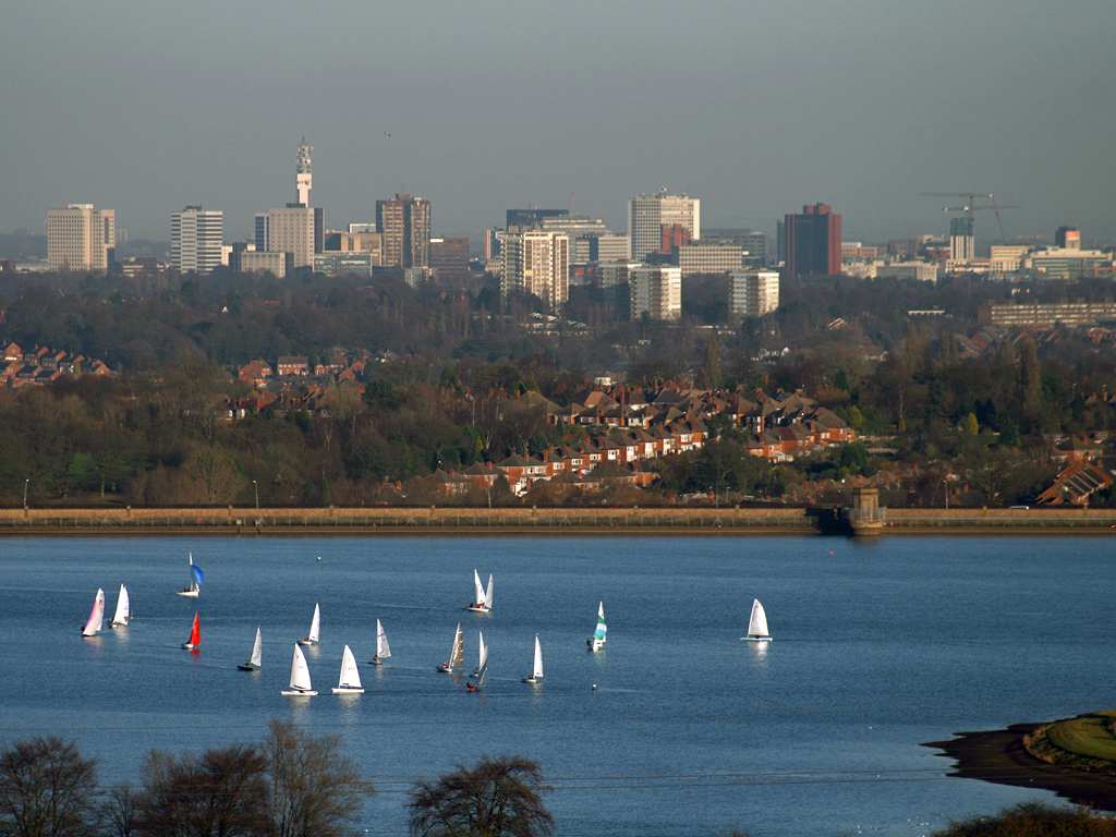
The West Midlands is one of nine official regions of England at the first level of International Territorial Level for statistical purposes. It covers the western half of the area traditionally known as the Midlands. The region consists of the counties of Herefordshire, Shropshire, Staffordshire, Warwickshire, West Midlands and Worcestershire. The region has seven cities; Birmingham, Coventry, Hereford, Lichfield, Stoke-on-Trent, Wolverhampton and Worcester. The West Midlands region is geographically diverse, from the urban central areas of the West Midlands conurbation to the rural counties of Herefordshire, Shropshire and Worcestershire which border Wales. The region is landlocked. However, the longest river in the UK, the River Severn, traverses the region southeastwards, flowing through the county towns of Shrewsbury and Worcester, and the Ironbridge Gorge, a UNESCO World Heritage Site. Staffordshire is home to the industrialised Potteries conurbation, including ... [...More Info...] [...Related Items...] OR: [Wikipedia] [Google] [Baidu] |
Worcestershire
Worcestershire ( , ; written abbreviation: Worcs) is a county in the West Midlands of England. The area that is now Worcestershire was absorbed into the unified Kingdom of England in 927, at which time it was constituted as a county (see History of Worcestershire). Over the centuries the county borders have been modified, but it was not until 1844 that substantial changes were made. Worcestershire was abolished as part of local government reforms in 1974, with its northern area becoming part of the West Midlands and the rest part of the county of Hereford and Worcester. In 1998 the county of Hereford and Worcester was abolished and Worcestershire was reconstituted, again without the West Midlands area. Location The county borders Herefordshire to the west, Shropshire to the north-west, Staffordshire only just to the north, West Midlands to the north and north-east, Warwickshire to the east and Gloucestershire to the south. The western border with Herefordshire includ ... [...More Info...] [...Related Items...] OR: [Wikipedia] [Google] [Baidu] |
Non-metropolitan District
Non-metropolitan districts, or colloquially "shire districts", are a type of Districts of England, local government district in England. As created, they are sub-divisions of non-metropolitan county, non-metropolitan counties (colloquially ''shire counties'') in a two-tier arrangement. Non-metropolitan districts with Borough status in the United Kingdom, borough status are known as boroughs, able to appoint a Mayors in England, mayor and refer to itself as a borough council. Non-metropolitan districts Non-metropolitan districts are subdivisions of English non-metropolitan county, non-metropolitan counties which have a two-tier structure of local government. Most non-metropolitan counties have a county council and several districts, each with a borough or district council. In these cases local government functions are divided between county and district councils, to the level where they can be practised most efficiently: *Borough/district councils are responsible for planning per ... [...More Info...] [...Related Items...] OR: [Wikipedia] [Google] [Baidu] |
List Of English Districts By Area
This is a list of districts of England ordered by area, according to Standard Area Measurements published by the Office for National Statistics The Office for National Statistics (ONS; cy, Swyddfa Ystadegau Gwladol) is the executive office of the UK Statistics Authority, a non-ministerial department which reports directly to the UK Parliament. Overview The ONS is responsible for .... More than 1,000 km2 100–1,000 km2 Less than 100 km2 References {{List of Settlements in the UK Districts by area Districts of England Demographics of England Local government in England ... [...More Info...] [...Related Items...] OR: [Wikipedia] [Google] [Baidu] |
List Of English Districts By Population
This is a list of the 314 districts of England ordered by population, according to estimated figures for from the Office for National Statistics. The list consists of 188 non-metropolitan districts, 32 London boroughs, 36 metropolitan boroughs, 56 unitary authorities, and two '' sui generis'' authorities (the City of London and the Isles of Scilly). North Northamptonshire and West Northamptonshire are new unitary authorities from 1 April 2021. See also *List of two-tier counties of England by population * List of ceremonial counties of England by population *List of English districts by area *List of English districts and their ethnic composition *List of English districts by population density This is a list of the districts of England ordered by population density, based on population estimates for from the Office for National Statistics. The densities are calculated by dividing the latest Population Estimate by the Standard Area Mea ... * List of districts in sout ... [...More Info...] [...Related Items...] OR: [Wikipedia] [Google] [Baidu] |
Non-metropolitan County
A non-metropolitan county, or colloquially, shire county, is a county-level entity in England that is not a metropolitan county. The counties typically have populations of 300,000 to 1.8 million. The term ''shire county'' is, however, an unofficial usage. Many of the non-metropolitan counties bear historic names and most, such as Wiltshire and Staffordshire, end in the suffix "-shire". Of the remainder, some counties had the "-shire" ending but have lost it over time, such as Devon and Somerset. Origins Prior to 1974 local government had been divided between single-tier county boroughs (the largest towns and cities) and two-tier administrative counties which were subdivided into municipal boroughs and urban and rural districts. The Local Government Act 1972, which came into effect on 1 April 1974, divided England outside Greater London and the six largest conurbations into thirty-nine non-metropolitan counties. Each county was divided into anywhere between two and fourteen non ... [...More Info...] [...Related Items...] OR: [Wikipedia] [Google] [Baidu] |
.jpg)


.jpg)
