|
West Midlands (region)
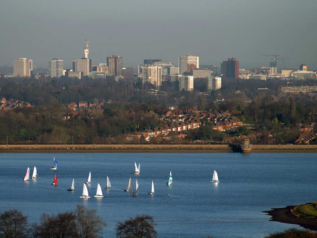
The West Midlands is one of nine official regions of England at the first level of International Territorial Level for statistical purposes. It covers the western half of the area traditionally known as the Midlands. The region consists of the counties of Herefordshire, Shropshire, Staffordshire, Warwickshire, West Midlands and Worcestershire. The region has seven cities; Birmingham, Coventry, Hereford, Lichfield, Stoke-on-Trent, Wolverhampton and Worcester. The West Midlands region is geographically diverse, from the urban central areas of the West Midlands conurbation to the rural counties of Herefordshire, Shropshire and Worcestershire which border Wales. The region is landlocked. However, the longest river in the UK, the River Severn, traverses the region southeastwards, flowing through the county towns of Shrewsbury and Worcester, and the Ironbridge Gorge, a UNESCO World Heritage Site. Staffordshire is home to the industrialised Potteries conurbation, including ... [...More Info...] [...Related Items...] OR: [Wikipedia] [Google] [Baidu] |
Regions Of England
The regions, formerly known as the government office regions, are the highest tier of sub-national division in England, established in 1994. Between 1994 and 2011, nine regions had officially devolved functions within government. While they no longer fulfil this role, they continue to be used for statistical and some administrative purposes. While the UK was a member of the European Union, they defined areas ( constituencies) for the purposes of elections to the European Parliament. Eurostat also used them to demarcate first level Nomenclature of Territorial Units for Statistics (NUTS) regions ("NUTS 1 regions") within the European Union, which in 2021 were superseded by International Territorial Level (ITL) regions ("ITL 1 regions"). The regions generally follow the boundaries of the former standard regions, established in the 1940s for statistical purposes. The London Region has a directly elected Mayor and Assembly. Six regions have local authority leaders' board ... [...More Info...] [...Related Items...] OR: [Wikipedia] [Google] [Baidu] |
International Territorial Level
International Territorial Level (ITL) is a geocode standard for referencing the subdivisions of the United Kingdom for statistical purposes, used by the Office for National Statistics (ONS). From 2003 and until 2020 it functioned as part of the European Union and European Statistical System's geocode standard Nomenclature of Territorial Units for Statistics or NUTS. Following Brexit, the ONS set to develop a domestic statistical classification framework separate from NUTS. Currently, the ITLs are a mirror to the pre-existing NUTS system, they retain the same three level hierarchy and boundaries used for NUTS in the United Kingdom since 2018, with the next review scheduled for 2024. ITLs are set to follow a similar review timetable to NUTS, being reviewed every three years. The ONS will develop new official GSS codes of ITL geography aligned with the existing NUTS codes. From 1 January 2021, the ONS encourages "ITL" be used as a replacement to the "NUTS" designation, with lookup ... [...More Info...] [...Related Items...] OR: [Wikipedia] [Google] [Baidu] |
Statistics
Statistics (from German: '' Statistik'', "description of a state, a country") is the discipline that concerns the collection, organization, analysis, interpretation, and presentation of data. In applying statistics to a scientific, industrial, or social problem, it is conventional to begin with a statistical population or a statistical model to be studied. Populations can be diverse groups of people or objects such as "all people living in a country" or "every atom composing a crystal". Statistics deals with every aspect of data, including the planning of data collection in terms of the design of surveys and experiments.Dodge, Y. (2006) ''The Oxford Dictionary of Statistical Terms'', Oxford University Press. When census data cannot be collected, statisticians collect data by developing specific experiment designs and survey samples. Representative sampling assures that inferences and conclusions can reasonably extend from the sample to the population as a whole. An ... [...More Info...] [...Related Items...] OR: [Wikipedia] [Google] [Baidu] |
ITL 1 Statistical Regions Of England
International Territorial Level (ITL) is a geocode standard for referencing the subdivisions of the United Kingdom for statistical purposes, used by the Office for National Statistics (ONS). Between 2003 and 2021, as part of the European Union and European Statistical System, the geocode standard used for the United Kingdom were ''Nomenclature of Territorial Units for Statistics'' or ''NUTS''. The NUTS code for the UK was ''UK'' and the NUTS standard had a hierarchy of three levels, with 12 first level regions, which are currently mirrored by the ITL classification, of which 9 regions are in England. The sub-structure corresponds to administrative divisions within the country. Formerly, the further NUTS divisions IV and V existed; these have now been replaced by Local Administrative Units (LAU-1 and LAU-2 respectively). Between 1994 and 2011, the nine regions had an administrative role in the implementation of UK Government policy, and as the areas covered by (mostly indirectly) ... [...More Info...] [...Related Items...] OR: [Wikipedia] [Google] [Baidu] |
Regions Of England
The regions, formerly known as the government office regions, are the highest tier of sub-national division in England, established in 1994. Between 1994 and 2011, nine regions had officially devolved functions within government. While they no longer fulfil this role, they continue to be used for statistical and some administrative purposes. While the UK was a member of the European Union, they defined areas ( constituencies) for the purposes of elections to the European Parliament. Eurostat also used them to demarcate first level Nomenclature of Territorial Units for Statistics (NUTS) regions ("NUTS 1 regions") within the European Union, which in 2021 were superseded by International Territorial Level (ITL) regions ("ITL 1 regions"). The regions generally follow the boundaries of the former standard regions, established in the 1940s for statistical purposes. The London Region has a directly elected Mayor and Assembly. Six regions have local authority leaders' board ... [...More Info...] [...Related Items...] OR: [Wikipedia] [Google] [Baidu] |
Stafford Castle05
Stafford () is a market town and the county town of Staffordshire, in the West Midlands region of England. It lies about north of Wolverhampton, south of Stoke-on-Trent and northwest of Birmingham. The town had a population of 70,145 in the 2021 census, It is the main settlement within the larger borough of Stafford which had a population of 136,837 (2021). History Stafford means " ford" by a staithe (landing place). The original settlement was on a dry sand and gravel peninsula that offered a strategic crossing point in the marshy valley of the River Sow, a tributary of the River Trent. There is still a large area of marshland north-west of the town, which is subject to flooding and did so in 1947, 2000, 2007 and 2019. Stafford is thought to have been founded about AD 700 by a Mercian prince called Bertelin, who, legend has it, founded a hermitage on a peninsula named Betheney. Until recently it was thought that the remains of a wooden preaching cross from the time had ... [...More Info...] [...Related Items...] OR: [Wikipedia] [Google] [Baidu] |
Shrewsbury Panorama
Shrewsbury ( , also ) is a market town, civil parish, and the county town of Shropshire, England, on the River Severn, north-west of London; at the 2021 United Kingdom census, 2021 census, it had a population of 76,782. The town's name can be pronounced as either 'Shrowsbury' or 'Shroosbury', the correct pronunciation being a matter of longstanding debate. The town centre has a largely unspoilt medieval street plan and over 660 listed buildings, including several examples of timber framing from the 15th and 16th centuries. Shrewsbury Castle, a red sandstone fortification, and Shrewsbury Abbey, a former Benedictine monastery, were founded in 1074 and 1083 respectively by the Normans, Norman Earl of Shrewsbury, Roger de Montgomery. The town is the birthplace of Charles Darwin and is where he spent 27 years of his life. east of the Wales, Welsh border, Shrewsbury serves as the commercial centre for Shropshire and mid-Wales, with a retail output of over £299 million per year ... [...More Info...] [...Related Items...] OR: [Wikipedia] [Google] [Baidu] |
Telford Townscape 2 - Geograph
Telford () is a town in the borough of Telford and Wrekin and ceremonial county of Shropshire, England, about east of Shrewsbury, south west of Stafford, north west of Wolverhampton and from Birmingham in the same direction. With an estimated population (for the borough) of 175,271 in 2017 and 142,723 in Telford itself, Telford is the largest town in Shropshire and one of the fastest-growing towns in the United Kingdom. It is named after the civil engineer Thomas Telford, who engineered many road, canal and rail projects in Shropshire. The town was put together in the 1960s and 1970s as a new town on previously industrial and agricultural land and towns. Like other planned towns of the era, Telford was created from the merger of other settlements and towns, most notably the towns of Wellington, Oakengates, Madeley and Dawley. Telford Shopping Centre, a modern shopping mall, was constructed at the new town's geographical centre, along with an extensive Town Park. T ... [...More Info...] [...Related Items...] OR: [Wikipedia] [Google] [Baidu] |
Lichfield Cathedral, Staffordshire - Aerial
Lichfield () is a city status in the United Kingdom, cathedral city and Civil parishes in England, civil parish in Staffordshire, England. Lichfield is situated roughly south-east of the county town of Stafford, south-east of Rugeley, north-east of Walsall, north-west of Tamworth, Staffordshire, Tamworth and south-west of Burton Upon Trent. At the time of the 2011 Census, the population was estimated at 32,219 and the wider Lichfield District at 100,700. Notable for its three-spired medieval Lichfield Cathedral, cathedral, Lichfield was the birthplace of Samuel Johnson, the writer of the first authoritative ''A Dictionary of the English Language, Dictionary of the English Language''. The city's recorded history began when Chad of Mercia arrived to establish his Diocese of Lichfield, Bishopric in 669 AD and the settlement grew as the ecclesiastical centre of Mercia. In 2009, the Staffordshire Hoard, the largest hoard of Anglo-Saxons, Anglo-Saxon gold and silver metalwor ... [...More Info...] [...Related Items...] OR: [Wikipedia] [Google] [Baidu] |


