|
Visayas
The Visayas ( ), or the Visayan Islands (Visayan: ''Kabisay-an'', ; tl, Kabisayaan ), are one of the three principal geographical divisions of the Philippines, along with Luzon and Mindanao. Located in the central part of the archipelago, it consists of several islands, primarily surrounding the Visayan Sea, although the Visayas are also considered the northeast extremity of the entire Sulu Sea. Its inhabitants are predominantly the Visayan peoples. The major islands of the Visayas are Panay, Negros, Cebu, Bohol, Leyte and Samar. The region may also include the provinces of Palawan, Romblon, and Masbate whose populations identify as Visayan and whose languages are more closely related to other Visayan languages than to the major languages of Luzon. There are three administrative regions in the Visayas: Western Visayas (pop. 7.9 million), Central Visayas (8 million) and Eastern Visayas (4.5 million). The Negros Island Region existed from 2015 to 2017, separating N ... [...More Info...] [...Related Items...] OR: [Wikipedia] [Google] [Baidu] |
Visayans
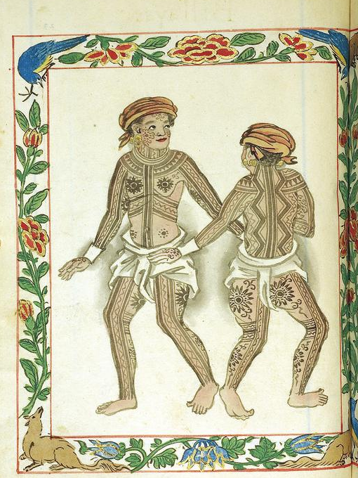
Visayans ( Visayan: ''mga Bisaya''; ) or Visayan people are a Philippine ethnolinguistic group or metaethnicity native to the Visayas, the southernmost islands of Luzon and a significant portion of Mindanao. When taken as a single ethnic group, they are both the most numerous in the entire country at around 33.5 million, as well as the most geographically widespread. The Visayans broadly share a maritime culture with strong Roman Catholic traditions integrated into a precolonial indigenous core through centuries of interaction and migration mainly across the Visayan, Sibuyan, Camotes, Bohol and Sulu seas. In more inland or otherwise secluded areas, ancient animistic-polytheistic beliefs and traditions either were reinterpreted within a Roman Catholic framework or syncretized with the new religion. Visayans are generally speakers of one or more of the Bisayan languages, the most widely spoken being Cebuano, followed by Hiligaynon (Ilonggo) and Waray-Waray. Terminology ' ... [...More Info...] [...Related Items...] OR: [Wikipedia] [Google] [Baidu] |
Eastern Visayas
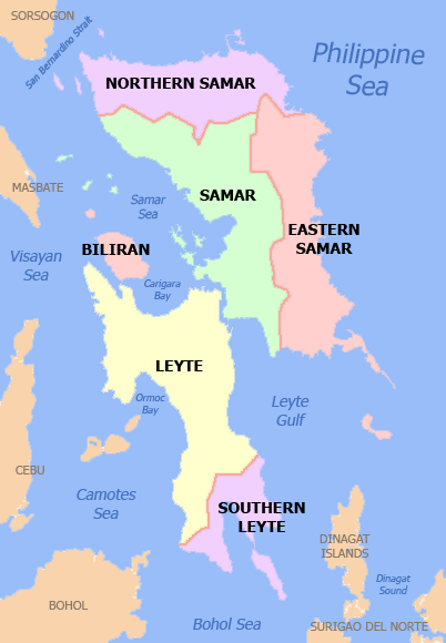
Eastern Visayas ( war, Sinirangan Kabisay-an; ceb, Sidlakang Kabisay-an; tl, Silangang Kabisayaan or ''Silangang Visayas'') is an administrative region in the Philippines, designated as Region VIII. It consists of three main islands, Samar, Leyte and Biliran. The region has six provinces, one independent city and one highly urbanized city namely, Biliran, Leyte (province), Leyte, Northern Samar, Samar (province), Samar, Eastern Samar, Southern Leyte, Ormoc and Tacloban. The highly urbanized city of Tacloban is the sole regional center. These provinces and cities occupy the easternmost islands of the Visayas group of islands. Eastern Visayas faces the Philippine Sea to the east. The region's most famous landmark is the San Juanico Bridge, which links the provinces of Samar and Leyte. As of 2020, the Eastern Visayas region has a population of 4,547,150 inhabitants, making it the third most populous region in the Visayas. Etymology The current name of the region was deriv ... [...More Info...] [...Related Items...] OR: [Wikipedia] [Google] [Baidu] |
Western Visayas
Western Visayas ( hil, Kabisay-an Nakatundan; tl, Kanlurang Kabisayaan or ''Kanlurang Visayas'') is an administrative region in the Philippines, numerically designated as Region VI. It consists of six provinces (Aklan, Antique, Capiz, Guimaras, Iloilo and Negros Occidental) and two highly urbanized cities (Bacolod and Iloilo City). The regional center is Iloilo City. The region is dominated by the native speakers of four Visayan languages: Hiligaynon, Kinaray-a, Aklanon and Capiznon. The land area of the region is , and with a population of 7,954,723 inhabitants, it is the second most populous region in the Visayas after Central Visayas. On May 29, 2015, the region was realigned, when Western Visayas (Region VI) lost both the province of Negros Occidental and the highly urbanized city of Bacolod to the newly formed Negros Island Region. However, the region was dissolved, resulting in the return of Negros Occidental and Bacolod to Western Visayas Region on August 9, 2017. ... [...More Info...] [...Related Items...] OR: [Wikipedia] [Google] [Baidu] |
Central Visayas
Central Visayas ( ceb, Tunga-tungang Kabisay-an; tl, Gitnang Kabisayaan) is an administrative region in the Philippines, numerically designated as Region VII. It consists of four provinces: (Cebu, Bohol, Negros Oriental, and Siquijor) and three highly urbanized cities: Cebu City, Lapu-Lapu, and Mandaue). Major islands are the eponymous Cebu, Bohol, and Siquijor, together with the eastern part of Negros. The regional center and largest city is Cebu City. The region is dominated by the native speakers of four Visayan languages: Cebuano, Bantayanon, Boholano, and Porohanon. The land area of the region is , and with a population of 8,081,988 inhabitants, it is the second most populous region in the Visayas. On May 29, 2015, the region was redefined, when Central Visayas (Region VII) lost the province of Negros Oriental to the newly formed Negros Island Region. However, the region was dissolved, with Negros Oriental returned to Central Visayas on August 9, 2017. Etymology T ... [...More Info...] [...Related Items...] OR: [Wikipedia] [Google] [Baidu] |
Cebu
Cebu (; ceb, Sugbo), officially the Province of Cebu ( ceb, Lalawigan sa Sugbo; tl, Lalawigan ng Cebu; hil, Kapuroan sang Sugbo), is a province of the Philippines located in the Central Visayas region, and consists of a main island and 167 surrounding islands and islets. Its capital and largest city is Cebu City, nicknamed "the Queen City of the South", the oldest city and first capital of the Philippines, which is politically independent from the provincial government. The Cebu Metropolitan Area or Metro Cebu is the second largest metropolitan area in the Philippines (after Metro Manila) with Cebu City as the main center of commerce, trade, education and industry in the Visayas. Being one of the most developed provinces in the Philippines, in a decade it has transformed into a global hub for business processing services, tourism, shipping, furniture-making, and heavy industry. Mactan–Cebu International Airport, located on Mactan Island, is the second busiest airpo ... [...More Info...] [...Related Items...] OR: [Wikipedia] [Google] [Baidu] |
Negros (Philippines)
Negros is the fourth largest and third most populous island in the Philippines, with a total land area of . Negros is one of the many islands of the Visayas, in the central part of the country. The predominant inhabitants of the island region are mainly called ''Negrenses'' (locally ''Negrosanons''). As of 2020 census, the total population of Negros is 4,656,945 people. From May 29, 2015 to August 9, 2017, the whole island was governed as an administrative region officially named the Negros Island Region, which comprised the highly urbanized city of Bacolod and the provinces of Negros Occidental and Negros Oriental, along with its corresponding outlying islands and islets within a total regional area of . It was created on May 29, 2015 by virtue of ''Executive Order No. 183'' issued by Benigno Aquino III, who was the president at that time. On August 9, 2017, President Rodrigo Duterte signed the Executive Order No. 38 dissolving the Negros Island Region. History Precoloni ... [...More Info...] [...Related Items...] OR: [Wikipedia] [Google] [Baidu] |
Cebu City
Cebu City, officially the City of Cebu ( ceb, Dakbayan sa Sugbo; fil, Lungsod ng Cebu; hil, Dakbanwa sang Sugbo), is a 1st class highly urbanized city in the Central Visayas region of the Philippines and capital of the Cebu Province. According to the 2020 census, it has a population of 964,169 people, making it the sixth-most populated city in the nation and the most populous in the Visayas. It is the regional center of Central Visayas and seat of government of the province of Cebu, but governed separate from the province. The city and its metropolitan area exert influence on commerce, trade, industry, education, culture, tourism, and healthcare beyond the region, over the entire Visayas and partly over Mindanao. It is the Philippines' main domestic shipping port and is home to about 80% of the country's domestic shipping companies. Cebu City is bounded on the north by the town of Balamban and the city of Danao City, on the west by the city of Toledo, on the east by ... [...More Info...] [...Related Items...] OR: [Wikipedia] [Google] [Baidu] |
Panay
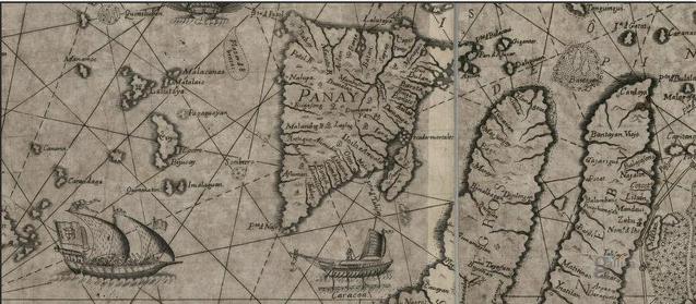
Panay is the sixth-largest and fourth-most populous island in the Philippines, with a total land area of and has a total population of 4,542,926 as of 2020 census. Panay comprises 4.4 percent of the entire population of the country. The City of Iloilo is its largest settlement with a total population of 457,626 inhabitants as of 2020 census. Panay is a triangular island, located in the western part of the Visayas. It is about across. It is divided into four provinces: Aklan, Antique, Capiz and Iloilo, all in the Western Visayas Region. Just closely off the mid-southeastern coast lies the island-province of Guimaras. It is located southeast of the island of Mindoro and northwest of Negros across the Guimaras Strait. To the north and northeast is the Sibuyan Sea, Jintotolo Channel and the island-provinces of Romblon and Masbate; to the west and southwest is the Sulu Sea and the Palawan archipelago and to the south is Panay Gulf. Panay is the only main island in the Vis ... [...More Info...] [...Related Items...] OR: [Wikipedia] [Google] [Baidu] |
Visayan Languages
The Bisayan languages or Visayan languages are a subgroup of the Austronesian languages spoken in the Philippines. They are most closely related to Tagalog and the Bikol languages, all of which are part of the Central Philippine languages. Most Bisayan languages are spoken in the whole Visayas section of the country, but they are also spoken in the southern part of the Bicol Region (particularly in Masbate and Sorsogon where several dialects of Waray are spoken), islands south of Luzon, such as those that make up Romblon, most of the areas of Mindanao and the province of Sulu located southwest of Mindanao. Some residents of Metro Manila also speak one of the Bisayan languages. Over 30 languages constitute the Bisayan language family. The Bisayan language with the most speakers is Cebuano, spoken by 20 million people as a native language in Central Visayas, parts of Eastern Visayas, and most of Mindanao. Two other well-known and widespread Bisayan languages are Hiligaynon ... [...More Info...] [...Related Items...] OR: [Wikipedia] [Google] [Baidu] |
Hiligaynon People
The Hiligaynon people (''mga Hiligaynon''), often referred to as Ilonggo people (''mga Ilonggo'') or Panayan people (''mga Panayanon''), are a Visayan ethnic group whose primary language is Hiligaynon, an Austronesian language of the Visayan branch native to Panay, Guimaras, and Negros. Over the years, inter-migrations and intra-migrations have contributed to the diaspora of the Hiligaynon to different parts of the Philippines. Today, the Hiligaynon form the majority in the provinces of Iloilo, Negros Occidental, Guimaras, Capiz, South Cotabato, Sultan Kudarat, and North Cotabato. Etymology of ''Hiligaynon'' and ''Ilonggo'' The demonym "Hiligaynon" is from Spanish ''Hiligueinos'' (also spelled ''Yliguenes'', ''Yligueynes'', or ''Hiligueynos''), which is derived from the older demonym "Iligan" or "Iliganon", meaning "people of the coast", from the root word ''ilig'' ("to go downstream"), referring to a river in Iloilo, Panay. During the early Spanish colonial period, th ... [...More Info...] [...Related Items...] OR: [Wikipedia] [Google] [Baidu] |
Mount Kanlaon
Kanlaon, also known as Mount Kanlaon and Kanlaon Volcano ( hil, Bolkang Kanglaon; ceb, Bolkang Kanglaon; fil, Bulkang Kanlaon), is an active stratovolcano and the highest mountain on the island of Negros in the Philippines, as well as the highest point in the Visayas, with an elevation of above sea level. Mount Kanlaon ranks as the 42nd-highest peak of an island in the world. The volcano straddles the provinces of Negros Occidental and Negros Oriental, approximately southeast of Bacolod, the capital and most populous city of Negros Occidental and whole island. It is one of the active volcanoes in the Philippines and part of the Pacific Ring of Fire. Physical features Kanlaon has a peak elevation of at its highest point, although it is in some sources, with a base diameter of and is dotted with pyroclastic cones and extinct craters lining to the north-northwest. Just below and north of the summit is the active Lugud crater. North of Lugud is a caldera known as Margaj ... [...More Info...] [...Related Items...] OR: [Wikipedia] [Google] [Baidu] |
Bohol
Bohol (), officially the Province of Bohol ( ceb, Lalawigan sa Bohol; tl, Lalawigan ng Bohol), is an island province of the Philippines located in the Central Visayas region, consisting of the island itself and 75 minor surrounding islands. Its capital is Tagbilaran. With a land area of and a coastline long, Bohol is the tenth largest island of the Philippines.The Island-Province of Bohol Retrieved November 15, 2006. The province of Bohol is a first-class province divided into 3 congressional districts, comprising 1 |


.jpg)


