|
Tamchy
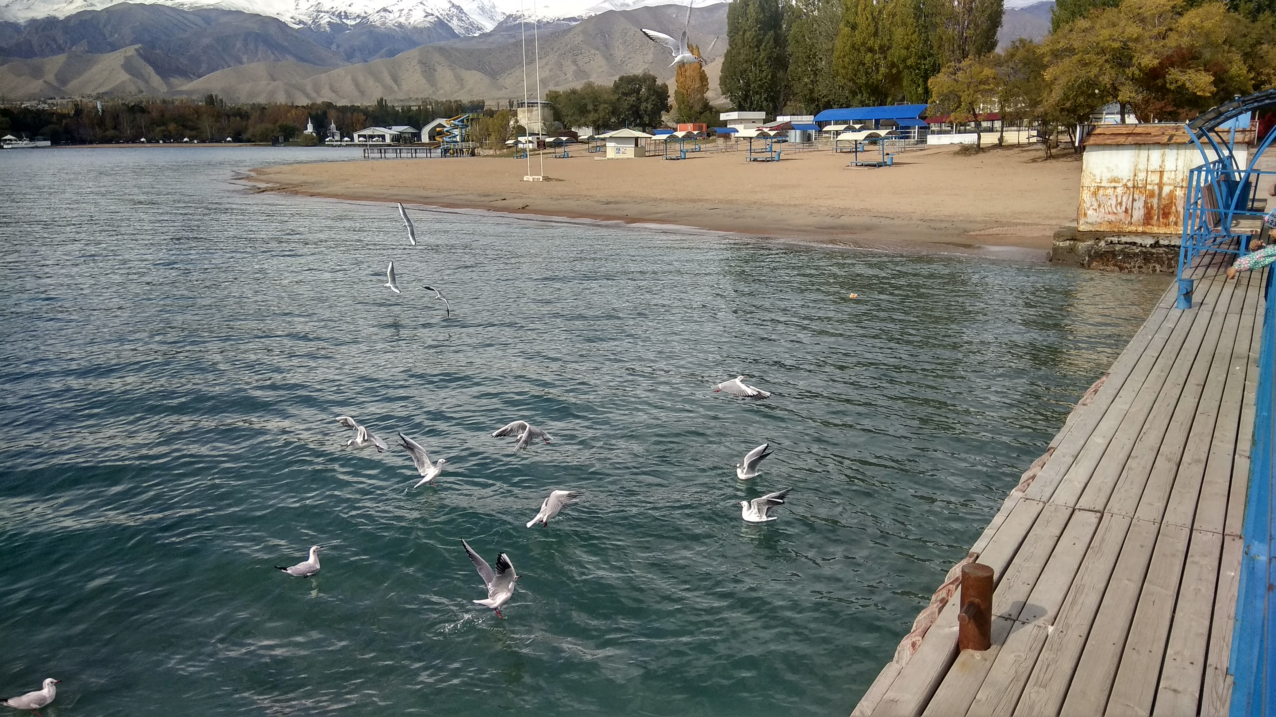
Tamchy ( ky, Тамчы, ''Tamçı'', تامچى; russian: Тамчы, ''Tamčy'', previously Тамчи, ''Tamči'') is a village in the Issyk-Kul District of the Issyk-Kul Region of Kyrgyzstan. Its population was 2,412 in 2021. The name used to be transcribed into English as ''Tamchi'', and some local road signs have it, surprisingly, as ''Tamczy'', which seems to be based on the Polish orthography. Geography Tamchy is located on the north shore of Lake Issyk Kul, between Balykchy and Cholpon Ata on highway A363. To the west is Kosh Kol. Natural environment The village stretches for a couple kilometers along the shore of a bay formed by promontories at Kosh Kol (to the west) and Choktal (to the east). A gently raising desert plain stretches for more than ten kilometers north of the village, towards the foothills of the mountain range that separates Issyk Kul basin from the Kemin Valley farther north. Remote snow-covered mountain tops can be seen from the village, and, ... [...More Info...] [...Related Items...] OR: [Wikipedia] [Google] [Baidu] |
Issyk-Kul District
Issyk-Kul District ( ky, Ысык-Көл району, ''Isıq-Köl rayonu'', ىسىق-كۅل رايونۇ; russian: Иссык-кульский район, ''Issyk-kuljskij rajon'') is a district of Issyk-Kul Region in north-eastern Kyrgyzstan. The seat lies at Cholpon-Ata. Its area is , and its resident population was 84,876 in 2021. Geography The district is located on the northern shore of Issyk-Kul and on the southern slopes of the Küngöy Ala-Too Range, which dominate much of the landscape. The topography varies from multiple-folded medium-altitude mountains featuring in erosional dissection to alluvial - proluvial planes with river fans, river valleys, intermittent water streams, and lakeside planes of Issyk-Kul lake area. Approximately 78% of the district is occupied by mountains, and 22% - by valleys. The hydrological conditions are dominated by rivers Toru-Aygyr with peak flood of 30 m/s, Orto Taldy-Bulak - 6.5 m/s, Chong Taldy-Bulak - 7 m/s, Cholpon-Ata - 20 m/s, Dyur ... [...More Info...] [...Related Items...] OR: [Wikipedia] [Google] [Baidu] |
Tamchy Airport
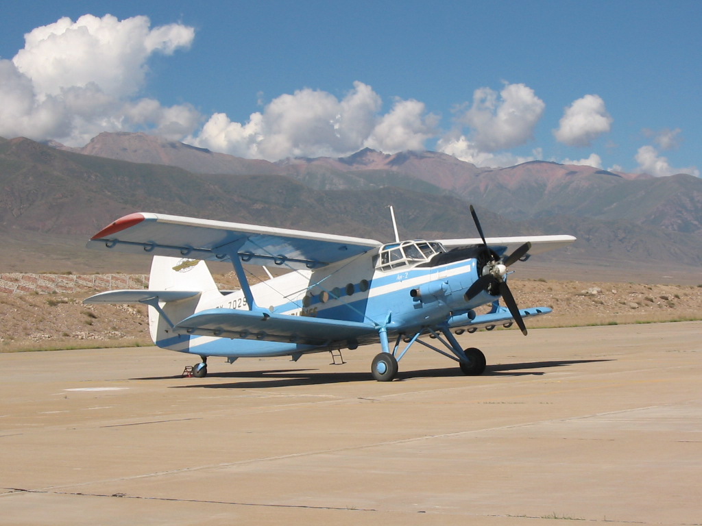
Issyk-Kul International Airport ( Kyrgyz: Ысык-Көл эл аралык аэропорту, ''Isıq-Köl el aralıq aeroportu'', ىسىق-كۅل ەل ارالىق اەروپورتۇ; Russian: Международный аэропорт «Иссык-Куль», ''Meždunarodnyj aeroport «Issyk-Kulj»'') is an international airport near Tamchy, a village in Issyk Kul District of Issyk Kul Region (''oblast'') of Kyrgyzstan. The Russian IATA code for Issyk-Kul International Airport is ИКУ. Formerly known as Tamchy Airport, Issyk-Kul International Airport started its operations in 1975 as a reserve airport for the nearby Cholpon-Ata Airport Cholpon-Ata Airport (Kyrgyz: Чолпон-Ата аэропорту, Russian: Чолпон-Атинский аэропорт) is an airport serving a resort town of Cholpon-Ata in the Issyk Kul Province (''oblast'') of Kyrgyzstan. The Russian IA .... The current runway and terminal were built in 2003. In the same year, the Kyrgyz Govern ... [...More Info...] [...Related Items...] OR: [Wikipedia] [Google] [Baidu] |
Issyk-Kul Region
Issyk-Kul Region ( ky, Ысык-Көл облусу, Ysyk-Köl oblusu; russian: Иссык-Кульская область, Issyk-Kulskaya oblast) is one of the regions of Kyrgyzstan. Its capital is Karakol. It is surrounded by Almaty Region, Kazakhstan (north), Chüy Region (west), Naryn Region (southwest) and Xinjiang, China (southeast). It takes its name from Lake Issyk-Kul ("warm lake"), the world's second-largest high altitude lake. Its total area is . The resident population of the region was 501,933 as of January 2021. The region has a sizeable Russian (8.0% in 2009) minority. Geography The north is dominated by the eye-shaped Issyk-Kul lake, surrounded by the ridges of the Tian Shan mountain system: the Kyungey Ala-Too mountains to the north and the Terskey Alatau to the south (the 'sunny' and 'shady' Alatau, respectively). To the south are mountains and 'jailoos' (mountain meadows used for summer grazing). The highest peaks of the Tian Shan mountains, including Khan Te ... [...More Info...] [...Related Items...] OR: [Wikipedia] [Google] [Baidu] |
Choktal
Chok-Tal ( ky, Чок-Тал) is a village in the Issyk-Kul District of the Issyk-Kul Region of Kyrgyzstan. Its population was 1,910 in 2021. It is located on the northern shore of Lake Issyk Kul between Tamchy Tamchy ( ky, Тамчы, ''Tamçı'', تامچى; russian: Тамчы, ''Tamčy'', previously Тамчи, ''Tamči'') is a village in the Issyk-Kul District of the Issyk-Kul Region of Kyrgyzstan. Its population was 2,412 in 2021. The name used t ... and Cholpon Ata. References Populated places in Issyk-Kul Region {{IssykKul-geo-stub ... [...More Info...] [...Related Items...] OR: [Wikipedia] [Google] [Baidu] |
Aryk
In Central Asia Central Asia, also known as Middle Asia, is a region of Asia that stretches from the Caspian Sea in the west to western China and Mongolia in the east, and from Afghanistan and Iran in the south to Russia in the north. It includes the fo ..., an aryk ( Turkic: arıq; ) is a relatively small aqueduct supporting agriculture and providing water to inhabitants of the area. Various aryks still exist and are frequently used, such as that of Tabarja, which has been continuously upgraded and expanded since the 16th century. References * * * * Irrigation {{CAsia-stub ... [...More Info...] [...Related Items...] OR: [Wikipedia] [Google] [Baidu] |
Issyk Kul
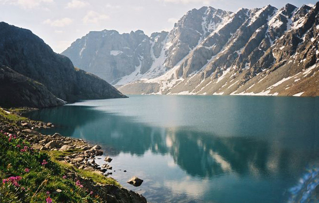
Issyk-Kul (also Ysyk-Köl, ky, Ысык-Көл, lit=warm lake, translit=Ysyk-Köl, , zh, 伊塞克湖) is an endorheic lake (i.e., without outflow) in the Northern Tian Shan mountains in Eastern Kyrgyzstan. It is the seventh-deepest lake in the world, the tenth-largest lake in the world by volume (though not in surface area) and the second-largest saline lake after the Caspian Sea. Issyk-Kul means "warm lake" in the Kyrgyz language; although it is located at a lofty elevation of and subject to severe cold during winter, it never freezes. The lake is a Ramsar site of globally significant biodiversity and forms part of the Issyk-Kul Biosphere Reserve. Geography Issyk-Kul Lake is long, up to wide and its area is . It is the second-largest mountain lake in the world behind Lake Titicaca in South America. It is at an altitude of and reaches in depth. About 118 rivers and streams flow into the lake; the largest are the Jyrgalang and Tüp. It is fed by springs, including man ... [...More Info...] [...Related Items...] OR: [Wikipedia] [Google] [Baidu] |
Cholpon Ata
Cholpon-Ata ( ky, Чолпон-Ата, ''Çolpon-Ata'', چولپون-اتا, pronounced , literally "Venus-father", the name of a mythological protecting spirit) is a resort town on the northern shore of Lake Issyk-Kul in Kyrgyzstan with a population of 14,237 (2021). It is the administrative center of the Issyk-Kul District of Issyk-Kul Region; this district occupies most of the lake's north shore. To the west along highway A363 is Tamchy and to the east, Bosteri. The town contains numerous large and small sanatoria, hotels and guesthouses to accommodate the many visitors who descend upon the lake in summer. During the Soviet era it was much frequented by vacationers brought here in organized mass tours from other parts of the USSR. Holidaymakers now usually visit on their own or in small groups and originate mainly from Kyrgyzstan, Kazakhstan and Uzbekistan. Attracting more demanding foreign tourists will require substantial upgrading of the existing facilities, but the locati ... [...More Info...] [...Related Items...] OR: [Wikipedia] [Google] [Baidu] |
Tian Shan
The Tian Shan,, , otk, 𐰴𐰣 𐱅𐰭𐰼𐰃, , tr, Tanrı Dağı, mn, Тэнгэр уул, , ug, تەڭرىتاغ, , , kk, Тәңіртауы / Алатау, , , ky, Теңир-Тоо / Ала-Тоо, , , uz, Tyan-Shan / Tangritog‘, , also known as the Tengri Tagh or Tengir-Too, meaning the ''Mountains of Heaven'' or the ''Heavenly Mountain'', is a large system of mountain ranges located in Central Asia. The highest peak in the Tian Shan is Jengish Chokusu, at high. Its lowest point is the Turpan Depression, which is below sea level. One of the earliest historical references to these mountains may be related to the Xiongnu word ''Qilian'' ( zh, s=祁连, t=祁連, first=t, p=Qílián) – according to Tang commentator Yan Shigu, ''Qilian'' is the Xiongnu word for sky or heaven. Sima Qian in the ''Records of the Grand Historian'' mentioned ''Qilian'' in relation to the homeland of the Yuezhi and the term is believed to refer to the Tian Shan rather than the ... [...More Info...] [...Related Items...] OR: [Wikipedia] [Google] [Baidu] |
Karakol
Karakol ( ky, Каракол, Karakol, قاراقول, ; zh, 卡拉科尔), formerly Przhevalsk (russian: Пржевальск), is the fourth-largest city in Kyrgyzstan, near the eastern tip of Lake Issyk-Kul, about from the Kyrgyzstan–China border and from the capital Bishkek. It is the administrative capital of Issyk-Kul Region. Its area is , and its resident population was 84,351 in 2021 (both including Pristan'-Przheval'sk). To the north, on highway A363, is Tüp, and to the southwest Jeti-Ögüz resort. History A Russian military outpost founded on 1 July 1869, Karakol grew in the 19th century after explorers came to map the peaks and valleys separating Kyrgyzstan from China. In the 1880s Karakol's population surged with an influx of Dungans, Chinese Muslims fleeing warfare in China. In 1888, the Russian explorer Nicholay Przhevalsky died in Karakol of typhoid, while preparing for an expedition to Tibet; the city was renamed Przhevalsk in his honor. After loca ... [...More Info...] [...Related Items...] OR: [Wikipedia] [Google] [Baidu] |
Marshrutka
''Marshrutka''Urban transportation systems: choices for communities (p. 254). Sigurd Grava. McGraw-Hill Professional, 2003. 840 pp. 0071384170, 9780071384179. or ''marshrutnoe taksi''THE COMPARATIVE ANALYSIS OF ENGLISH AND LITHUANIAN: TRANSPORT TERMS AND SOME METHODS OF DEVELOPING EFFECTIVE SCIENCE WRITING STRATEGIES BY NON ... [...More Info...] [...Related Items...] OR: [Wikipedia] [Google] [Baidu] |
Bishkek
Bishkek ( ky, Бишкек), ), formerly Pishpek and Frunze, is the capital and largest city of Kyrgyzstan. Bishkek is also the administrative centre of the Chüy Region. The region surrounds the city, although the city itself is not part of the region but rather a region-level unit of Kyrgyzstan. Bishkek is situated near the Kazakhstan–Kyrgyzstan border. Its population was 1,074,075 in 2021. In 1825, the Khanate of Kokand established the fortress of Pishpek to control local caravan routes and to collect tribute from Kyrgyz tribes. On 4 September 1860, with the approval of the Kyrgyz, Russian forces led by Colonel Apollon Zimmermann destroyed the fortress. In the present day, the fortress ruins can be found just north of Jibek jolu street, near the new main mosque. In 1868, a Russian settlement was established on the site of the fortress under its original name, Pishpek. It lay within the General Governorship of Russian Turkestan and its Semirechye Oblast. In 1925, the Kar ... [...More Info...] [...Related Items...] OR: [Wikipedia] [Google] [Baidu] |
Kyrgyzstan
Kyrgyzstan,, pronounced or the Kyrgyz Republic, is a landlocked country in Central Asia. Kyrgyzstan is bordered by Kazakhstan to the north, Uzbekistan to the west, Tajikistan to the south, and the People's Republic of China to the east. Its capital and largest city is Bishkek. Ethnic Kyrgyz make up the majority of the country's seven million people, followed by significant minorities of Uzbeks and Russians. The Kyrgyz language is closely related to other Turkic languages. Kyrgyzstan's history spans a variety of cultures and empires. Although geographically isolated by its highly mountainous terrain, Kyrgyzstan has been at the crossroads of several great civilizations as part of the Silk Road along with other commercial routes. Inhabited by a succession of tribes and clans, Kyrgyzstan has periodically fallen under larger domination. Turkic nomads, who trace their ancestry to many Turkic states. It was first established as the Yenisei Kyrgyz Khaganate later in ... [...More Info...] [...Related Items...] OR: [Wikipedia] [Google] [Baidu] |


