|
Subotica
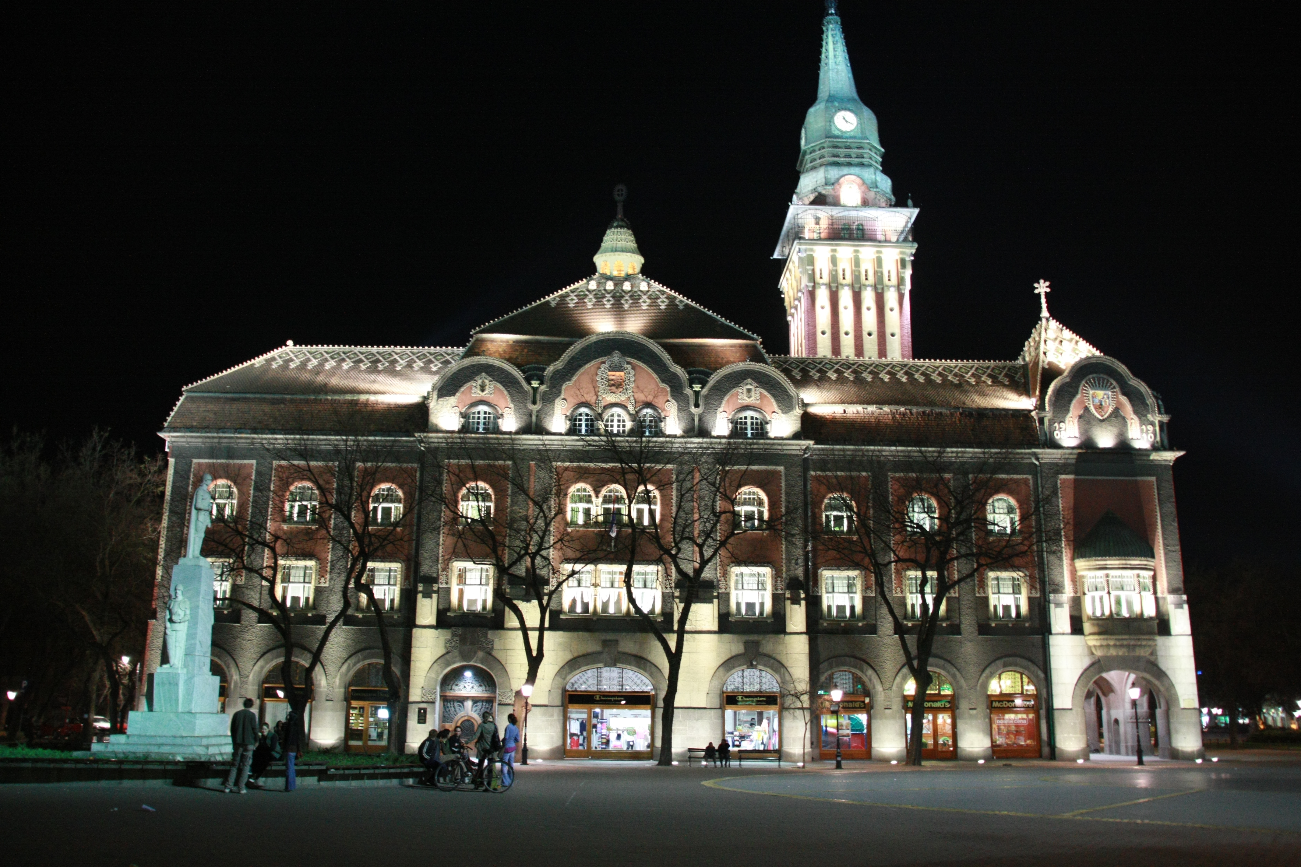
Subotica ( sr-cyrl, Суботица, ; hu, Szabadka) is a city and the administrative center of the North Bačka District in the autonomous province of Vojvodina, Serbia. Formerly the largest city of Vojvodina region, contemporary Subotica is now the second largest city in the province, following the city of Novi Sad. According to the 2011 census, the city itself has a population of 97,910, while the urban area of Subotica (with adjacent urban settlement of Palić included) has 105,681 inhabitants, and the population of metro area (the administrative area of the city) stands at 141,554 people. Name The name of the city has changed frequently over time.History of Subotica Retrieved 8 September 2022. The earliest known written name of the city was ''Zabotka'' or ''Zabatka'', which dates fro ... [...More Info...] [...Related Items...] OR: [Wikipedia] [Google] [Baidu] |
Subotica Synagogue
hu, Jakab és Komor téri zsinagóga, Szabadka , image = Synagogue in Subotica.jpg , alt = , caption = Subotica Synagogue in 2020, after renovation , map_type =Serbia , map_size = , location = Subotica-Szabadka, Jakab and Komor Square , coordinates = , religious_affiliation = Neolog Judaism , rite = , region = , state = , province = , territory = , prefecture = , sector = , district = , cercle = , municipality = , consecration_year = 1901 , status = , functional_status = , heritage_designation = , leadership = , website = , architecture = , architect = , architecture_type = , architecture_style = Hungarian Art Nouveau , general_contractor = ... [...More Info...] [...Related Items...] OR: [Wikipedia] [Google] [Baidu] |
North Bačka District
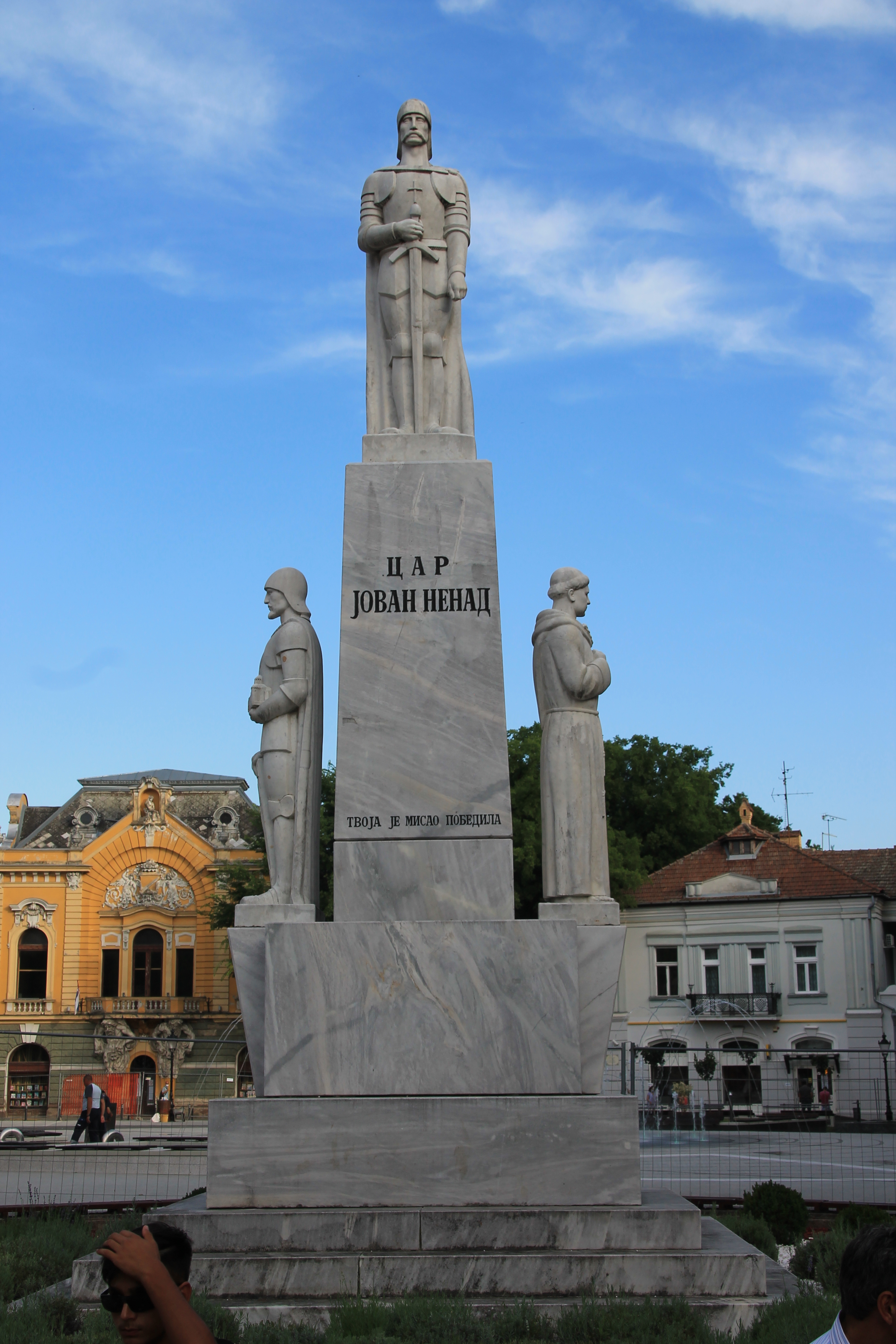
The North Bačka District ( sr, Севернобачки округ, Severnobački okrug, ; hu, Észak-bácskai körzet) is one of seven administrative districts of the autonomous province of Vojvodina, Serbia. It lies in the Bačka geographical region. According to the 2011 census results, it has a population of 186,906 inhabitants. The administrative center of the district is the city of Subotica. Administrative history In the 9th century, the area was ruled by the Bulgarian- Slavic duke Salan. From 11th to 16th century, during the administration of the medieval Kingdom of Hungary (medieval), Kingdom of Hungary, the area was divided between the Bodrogiensis County, Bacsensis County, Csongradiensis County, and Cumania region. In 1526-1527, the area was ruled by the independent Serb ruler, emperor Jovan Nenad, while during Ottoman administration (16th-17th century), it was part of the Sanjak of Segedin. During Habsburg administration (18th century), the area was divi ... [...More Info...] [...Related Items...] OR: [Wikipedia] [Google] [Baidu] |
List Of Mayors Of Subotica
This is a list of mayors of Subotica since 1796. The Mayor of Subotica is the head of the City of Subotica (the fifth largest city in Serbia and second largest city in the Autonomous Province of Vojvodina). He acts on behalf of the city, and performs an executive function in the City of Subotica. The current Mayor of Subotica is Stevan Bakić ( SNS). Habsburg monarchy / Austrian Empire / Austria-Hungary * Janoš Sučić (János Szucsics) (1796 – 1798) * Antal Milodanović (Antal Milodánovics) (1798 – 1800) * Janoš Sučić (János Szucsics) (1800 – 1802) * Jakov Sarić (1802 – 1804) * Đerđ Kopunović (György Kopunovics) (1804 – 1809) * Ferenc Czorda (1809 – 1813) * Antal Milodanović (Antal Milodánovics) (1813 – 1816) * Toma Kulunčić (1816 – 1820) * Ferenc Czorda (1820 – 1828) * Šimun Mukić (1828 – 1834) * Jožef Sarić (József Szárics) (1834 – 1847) * Ištvan Kulunčić (István Kuluncsics) (1847) * Đerđ Vilov (György Vilov) (1847 – 1 ... [...More Info...] [...Related Items...] OR: [Wikipedia] [Google] [Baidu] |
List Of Cities, Towns And Villages In Serbia
This is the list of populated places in Serbia (excluding Kosovo), as recorded by the 2002 census, sorted alphabetically by municipalities. Settlements denoted as "urban" (towns and cities) are marked bold. Population for every settlement is given in brackets. The same list in alphabetic order is in List of populated places in Serbia (alphabetic). A Ada Aleksandrovac Aleksinac Alibunar Apatin Aranđelovac Arilje B Babušnica Bač Bačka Palanka Bačka Topola Bački Petrovac Bajina Bašta Barajevo Batočina Bečej Bela Crkva Bela Palanka Beočin Blace Bogatić Bojnik Boljevac Bor Bosilegrad Brus Bujanovac C Crna Trava Č Čačak Čajetina Čoka Čukarica Ć Ćićevac Ćuprija D Despotovac Dimitrovgrad Doljevac G Gadžin Han Golubac Gornji Milanovac Grocka I Inđija Irig Ivanjica J Jagodina K Kanjiža Kikinda Kladovo Knić Knjaževac Koceljeva Kosjerić Kov ... [...More Info...] [...Related Items...] OR: [Wikipedia] [Google] [Baidu] |
List Of Cities In Serbia
, plural: ) is elected through popular vote, elected by their citizens in local elections. Also, the presidents of the municipalities are often referred to as "mayors" in everyday usage. There are 29 cities (, singular: ), each having an assembly and budget of its own. As with a municipality, the territory of a city is composed of a city proper and surrounding villages (e.g. the territory of the City of Subotica is composed of the Subotica town and surrounding villages). The capital Belgrade is the only city on the level of a district. All other cities are on the municipality level and are part of a district. ;City municipalities The city may or may not be divided into ''city municipalities''. Five cities (Belgrade, Niš, Požarevac, Vranje and Užice) comprise several city municipalities. Competences of cities and city municipalities are divided. The city municipalities of these six cities also have their assemblies and other prerogatives. The largest city municipality by numbe ... [...More Info...] [...Related Items...] OR: [Wikipedia] [Google] [Baidu] |
Serbia
Serbia (, ; Serbian: , , ), officially the Republic of Serbia (Serbian: , , ), is a landlocked country in Southeastern and Central Europe, situated at the crossroads of the Pannonian Basin and the Balkans. It shares land borders with Hungary to the north, Romania to the northeast, Bulgaria to the southeast, North Macedonia to the south, Croatia and Bosnia and Herzegovina to the west, and Montenegro to the southwest, and claims a border with Albania through the disputed territory of Kosovo. Serbia without Kosovo has about 6.7 million inhabitants, about 8.4 million if Kosvo is included. Its capital Belgrade is also the largest city. Continuously inhabited since the Paleolithic Age, the territory of modern-day Serbia faced Slavic migrations in the 6th century, establishing several regional states in the early Middle Ages at times recognised as tributaries to the Byzantine, Frankish and Hungarian kingdoms. The Serbian Kingdom obtained recognition by the Holy See and Consta ... [...More Info...] [...Related Items...] OR: [Wikipedia] [Google] [Baidu] |
Vojvodina
Vojvodina ( sr-Cyrl, Војводина}), officially the Autonomous Province of Vojvodina, is an autonomous province that occupies the northernmost part of Serbia. It lies within the Pannonian Basin, bordered to the south by the national capital Belgrade and the Sava and Danube Rivers. The administrative center, Novi Sad, is the second-largest city in Serbia. The historic regions of Banat, Bačka, and Syrmia overlap the province. Modern Vojvodina is multi-ethnic and multi-cultural, with some 26 ethnic groups and six official languages. About two million people, nearly 27% of Serbia's population, live in the province. Naming ''Vojvodina'' is also the Serbian word for voivodeship, a type of duchy overseen by a voivode. The Serbian Voivodeship, a precursor to modern Vojvodina, was an Austrian province from 1849 to 1860. Its official name is the Autonomous Province of Vojvodina. Its name in the province's six official languages is: * Croatian: ''Autonomna Pokrajina Vojvodina'' * ... [...More Info...] [...Related Items...] OR: [Wikipedia] [Google] [Baidu] |
Palić
Palić ( sr-Cyrl, Палић; hu, Palics; german: Palitsch) is a town located in the city of Subotica, North Bačka District, autonomous province of Vojvodina, Serbia. It is also located from the border between Serbia and Hungary. The town has a Hungarian ethnic majority and its population numbering 7,771 inhabitants (as of 2011 census). Many tourists come to Palić every year because of the Palić lake and spa. There are over 450 guest houses, and even a five-star hotel. It is known for its Palić European Film Festival which takes place every summer. In 2008 the life achievement award was presented to the British film director Ken Loach. Demographics Historical population *1961: 6,135 *1971: 7,253 *1981: 6,974 *1991: 7,375 *2002: 7,745 *2011: 7,771 Ethnic groups *Hungarians = 4,178 (53.95%) *Serbs = 1,930 (24.92%) *Croats = 399 (5.15%) *Yugoslavs = 351 (4.53%) *Bunjevci = 335 (4.33%) Cityscape Unique in Serbia, Palić and adjacent Subotica have the most buildings built i ... [...More Info...] [...Related Items...] OR: [Wikipedia] [Google] [Baidu] |
Lake Palić
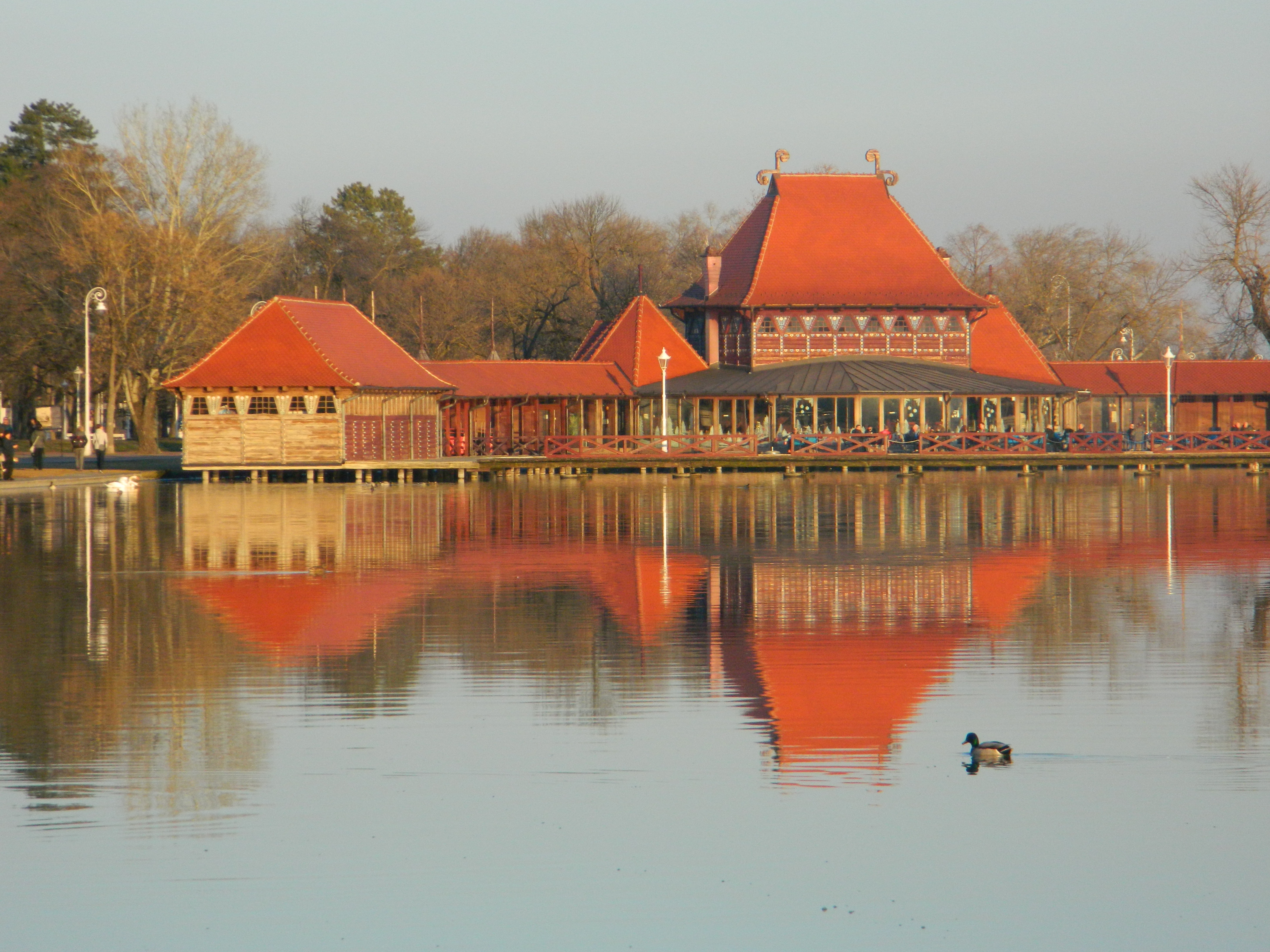
Lake Palić ( sr, Палићко језеро, Palićko jezero; hu, Palicsi-tó) is a lake from Subotica, near the town of Palić, in Serbia. It covers an area of . The average depth of the lake is . With the surrounding area it forms the protected Nature Park Palić, which covers . Geology Despite popular belief, Lake Palić is not a remnant of the vast Pannonian Sea which covered this area and completely drained out some 600,000 years ago. It is estimated that both the Palić and Ludoš lakes originated in the early Holocene, around 10,000 years ago, when the last major changes in the surrounding terrain occurred. Prior to that, since the draining of the sea, the European climate was much colder, with the exchange of the cold and dry and the warm and wet periods. Alternatively, being frozen and defrosted, the rocks crushed under the ice and crumbled into the dust, which formed sand and loess. The winds would then disperse the loess into the valleys of the Danube and Tisz ... [...More Info...] [...Related Items...] OR: [Wikipedia] [Google] [Baidu] |
Districts Of Serbia
An ''okrug'' is one of the first-level administrative divisions of Serbia, corresponding to a "district" in many other countries (Serbia also has two autonomous provinces at a higher level than districts). The term ''okrug'' (pl. ''okruzi)'' literally means "encircling" and corresponds to in German language. It can be translated as "county", though it is generally rendered by the Serbian government as "district". The Serbian local government reforms of 1992, going into effect the following year, created 29 districts, with the City of Belgrade holding similar authority. Following the 2008 Kosovo declaration of independence, the districts created by the UNMIK-Administration were adopted by Kosovo. The Serbian government does not recognize these districts. The districts of Serbia are generally named after historical and geographical regions, though some, such as the Pčinja District and the Nišava District, are named after local rivers. Their areas and populations vary, rangi ... [...More Info...] [...Related Items...] OR: [Wikipedia] [Google] [Baidu] |
Pannonian Basin
The Pannonian Basin, or Carpathian Basin, is a large basin situated in south-east Central Europe. The geomorphological term Pannonian Plain is more widely used for roughly the same region though with a somewhat different sense, with only the lowlands, the plain that remained when the Pliocene Epoch ''Pannonian Sea'' dried out. It is a geomorphological subsystem of the Alps-Himalaya system, specifically a sediment-filled back-arc basin which spread apart during the Miocene. The plain or basin is diagonally bisected by the Transdanubian Mountains, separating the larger Great Hungarian Plain (including the Eastern Slovak Lowland) from the Little Hungarian Plain. It forms a topographically discrete unit set in the European landscape, surrounded by imposing geographic boundaries—the Carpathian Mountains and the Alps. The Rivers Danube and Tisza divide the basin roughly in half. It extends roughly between Vienna in the northwest, Košice in the northeast, Zagreb in th ... [...More Info...] [...Related Items...] OR: [Wikipedia] [Google] [Baidu] |
Novi Sad
Novi Sad ( sr-Cyrl, Нови Сад, ; hu, Újvidék, ; german: Neusatz; see below for other names) is the second largest city in Serbia and the capital of the autonomous province of Vojvodina. It is located in the southern portion of the Pannonian Plain on the border of the Bačka and Syrmia geographical regions. Lying on the banks of the Danube river, the city faces the northern slopes of Fruška Gora. , Novi Sad proper has a population of 231,798 while its urban area (including the adjacent settlements of Petrovaradin and Sremska Kamenica) comprises 277,522 inhabitants. The population of the administrative area of the city totals 341,625 people. Novi Sad was founded in 1694 when Serb merchants formed a colony across the Danube from the Petrovaradin Fortress, a strategic Habsburg military post. In subsequent centuries, it became an important trading, manufacturing and cultural centre, and has historically been dubbed ''the Serbian Athens''. The city was heavily devastat ... [...More Info...] [...Related Items...] OR: [Wikipedia] [Google] [Baidu] |


.jpg)