|
Scottsdale, Arizona
, settlement_type = City , named_for = Winfield Scott , image_skyline = , image_seal = Seal of Scottsdale (Arizona).svg , image_blank_emblem = City of Scottsdale Script Logo.svg , nickname = "The West's Most Western Town" (official) , image_map = File:Maricopa County Arizona Incorporated and Unincorporated areas Scottsdale Highlighted 0465000.svg , mapsize = 200x200px , map_caption = Location in Maricopa County, Arizona , mapsize1 = , map_caption1 = , pushpin_map = USA Arizona Maricopa County#USA Arizona#USA , pushpin_label = Scottsdale , pushpin_map_caption = , coordinates = , subdivision_type = Country , subdivision_name = United States , subdivision_type1 = State , subdivision_name1 = Arizona , subdivision_type2 = County , subdivisio ... [...More Info...] [...Related Items...] OR: [Wikipedia] [Google] [Baidu] |
City
A city is a human settlement of notable size.Goodall, B. (1987) ''The Penguin Dictionary of Human Geography''. London: Penguin.Kuper, A. and Kuper, J., eds (1996) ''The Social Science Encyclopedia''. 2nd edition. London: Routledge. It can be defined as a permanent and densely settled place with administratively defined boundaries whose members work primarily on non-agricultural tasks. Cities generally have extensive systems for housing, transportation, sanitation, utilities, land use, production of goods, and communication. Their density facilitates interaction between people, government organisations and businesses, sometimes benefiting different parties in the process, such as improving efficiency of goods and service distribution. Historically, city-dwellers have been a small proportion of humanity overall, but following two centuries of unprecedented and rapid urbanization, more than half of the world population now lives in cities, which has had profound consequences for ... [...More Info...] [...Related Items...] OR: [Wikipedia] [Google] [Baidu] |
Phoenix Metropolitan Area
The Phoenix Metropolitan Area – also the Valley of the Sun, the Salt River Valley, or Metro Phoenix (known by most locals simply as “the Valley”) – is the largest metropolitan area in the Southwestern United States, centered on the city of Phoenix, that includes much of the central part of Arizona. The United States Office of Management and Budget designates the area as the Phoenix-Mesa-Chandler Metropolitan Statistical Area (MSA), defining it as Maricopa and Pinal counties. As of the 2020 census, Metro Phoenix had 4,845,832 residents, making it the 11th largest metropolitan area in the nation by population. It anchors the Arizona Sun Corridor megaregion along with the second most populous metropolitan area in the state, the Tucson metropolitan area. The gross domestic product of the Phoenix Metropolitan Area was $255 billion in 2018, 16th largest amongst metro areas in the United States. It is also one of the fastest-growing major metropolitan areas, gaining ... [...More Info...] [...Related Items...] OR: [Wikipedia] [Google] [Baidu] |
Winfield & Helen Scott, 1900
Winfield may refer to: Places Canada * Winfield, Alberta * Winfield, British Columbia United States * Winfield, Alabama * Winfield, Arkansas * Winfield, Georgia * Winfield, Illinois * Winfield, Indiana * Winfield, Iowa * Winfield, Kansas * Winfield, Maryland ( southern Carroll County) * Winfield, Missouri * Winfield (town), New York * Winfield, Pennsylvania * Winfield, Tennessee * Winfield, Texas * Winfield, West Virginia * Winfield, Wisconsin * Winfield Township, Michigan * Winfield Township, Renville County, Minnesota * Winfield Township, New Jersey * Winfield Township, Butler County, Pennsylvania * West Winfield, New York People Given name Military * Winfield Scott Edgerly (1846–1927), United States Army General * Winfield Scott Hancock (1824–1886), United States Army General * Winfield Scott Schley (1839-1911), United States Navy Admiral * Winfield Scott (1786–1866), United States Army general * Winfield Scott (chaplain) (1837–1910), United States Army chaplain ... [...More Info...] [...Related Items...] OR: [Wikipedia] [Google] [Baidu] |
Pima People
The Pima (or Akimel O'odham, also spelled Akimel Oʼotham, "River People," formerly known as ''Pima'') are a group of Native Americans living in an area consisting of what is now central and southern Arizona, as well as northwestern Mexico in the states of Sonora and Chihuahua. The majority population of the two current bands of the Akimel O'odham in the United States are based in two reservations: the Keli Akimel Oʼodham on the Gila River Indian Community (GRIC) and the On'k Akimel O'odham on the Salt River Pima-Maricopa Indian Community (SRPMIC). The Akimel O'odham are closely related to the Ak-Chin O'odham, now forming the Ak-Chin Indian Community. They are also related to the Sobaipuri, whose descendants reside on the San Xavier Indian Reservation or Wa꞉k (together with the Tohono O'odham), and in the Salt River Indian Community. Together with the related Tohono O'odham ("Desert People") and the Hia C-ed O'odham ("Sand Dune People"), the Akimel O'odham form the Uppe ... [...More Info...] [...Related Items...] OR: [Wikipedia] [Google] [Baidu] |
Irrigation Canal
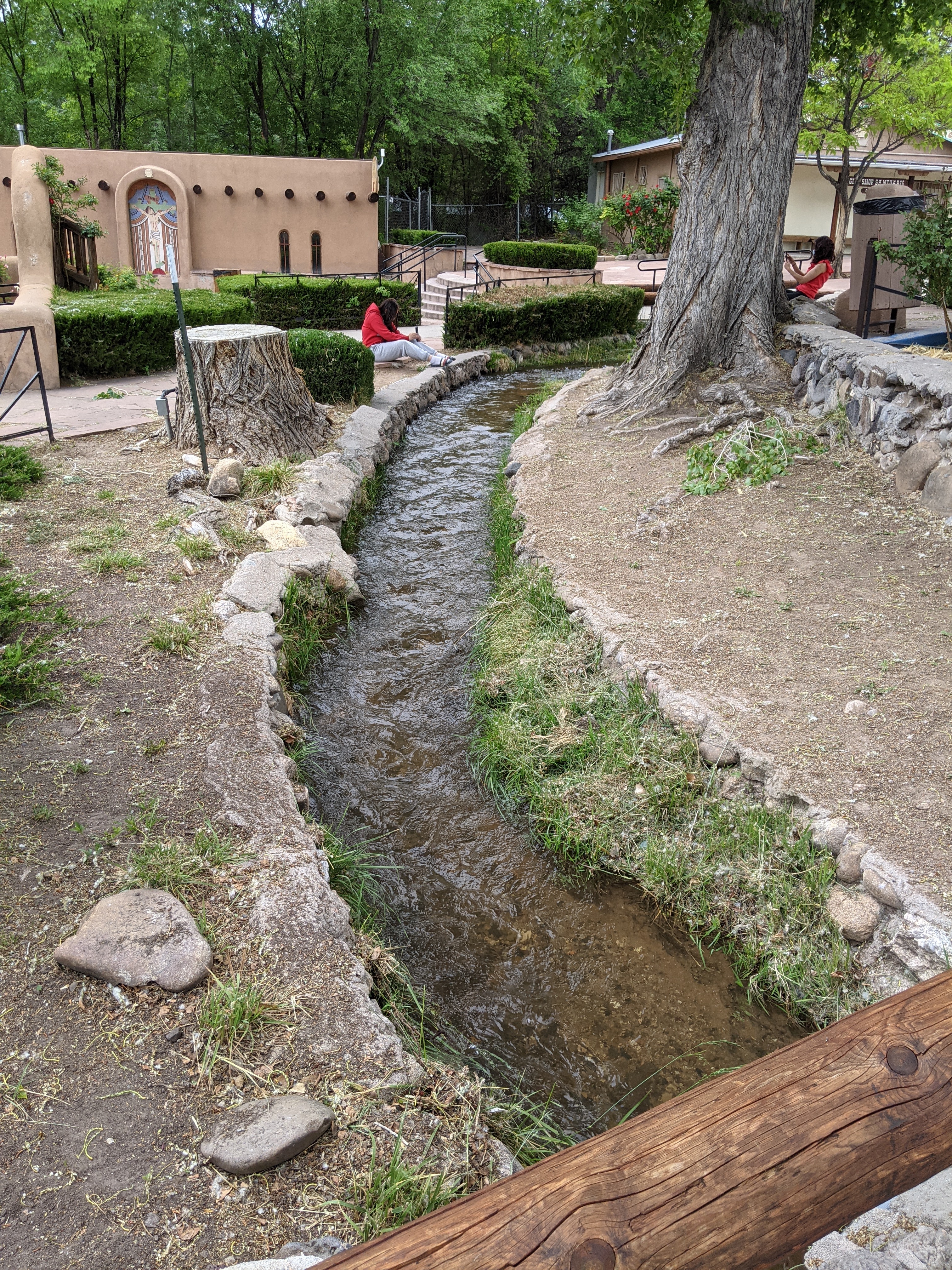
An acequia () or séquia () is a community-operated watercourse used in Spain and former Spanish colonization of America, Spanish colonies in the Americas for irrigation. Particularly in Spain, the Andes, northern Mexico, and the modern-day American Southwest particularly northern New Mexico and southern Colorado, acequias are usually historically engineered canals that carry surface runoff, snow runoff or river water to distant fields. Examples of acequias in New Mexico have lengthy historical roots to Puebloans, Pueblo and Hispanos of New Mexico, Hispano communities, and they are incorporated into traditions including the matachines, life in the Rio Grande Bosque of the Albuquerque metropolitan area, and pilgrimages to El Santuario de Chimayo. The term can also refer to the long central pool in a Moorish garden, such as the Generalife in the Alhambra in Southern Iberia. Overview The Spanish language, Spanish word (and Catalan language, Catalan ) comes from Classical Arabi ... [...More Info...] [...Related Items...] OR: [Wikipedia] [Google] [Baidu] |
Hohokam
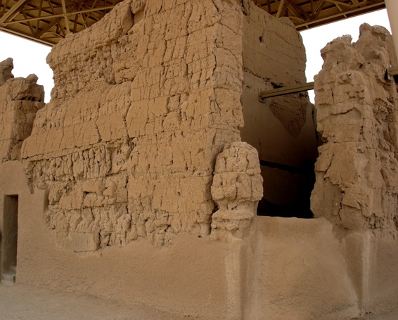
Hohokam () was a culture in the North American Southwest in what is now part of Arizona, United States, and Sonora, Mexico. It existed between 300 and 1500 AD, with cultural precursors possibly as early as 300 BC. Archaeologists disagree about whether communities that practiced the culture were related or politically united. According to local oral tradition, Hohokam societies may be the ancestors of the historic Pima and Tohono O'odham peoples in Southern Arizona. The origin of the culture is debated. Most archaeologists either argue it emerged locally or in Mesoamerica, but it was also influenced by the Northern Pueblo culture. Hohokam settlements were located on trade routes that extended past the Hohokam area, as far east as the Great Plains and west to the Pacific coast. Hohokam societies received a remarkable amount of immigration. Some communities established significant markets, such as that in Snaketown. The harshness of the Sonoran Desert may have been the most i ... [...More Info...] [...Related Items...] OR: [Wikipedia] [Google] [Baidu] |
Fountain Hills, Arizona
Fountain Hills is a town in Maricopa County, Arizona, United States. Known for its impressive fountain, once the tallest in the world, it borders the Fort McDowell Yavapai Nation, Salt River Pima-Maricopa Indian Community, and Scottsdale. The population was 23,820 as of the 2020 census. Between the 1990 and 2000 censuses it was the eighth-fastest-growing place among cities and towns in Arizona. The median value of an owner-occupied housing during the period 2016-2020 was estimated at $402,100. History Before the development of Fountain Hills, the area was home to the Yavapai people, and petroglyphs can be found near the Dixie Mine in the northwest corner of the town along the mountains. In the early 20th century, the area that became Fountain Hills and the McDowell Mountain Regional Park was part of the Pemberton Ranch, later renamed the P-Bar Ranch. Fountain Hills High School is built on the site of one of the P-Bar Ranch's buildings, and a plaque stands in the parkin ... [...More Info...] [...Related Items...] OR: [Wikipedia] [Google] [Baidu] |
Salt River Pima-Maricopa Indian Community
Salt is a mineral composed primarily of sodium chloride (NaCl), a chemical compound belonging to the larger class of salts; salt in the form of a natural crystalline mineral is known as rock salt or halite. Salt is present in vast quantities in seawater. The open ocean has about of solids per liter of sea water, a salinity of 3.5%. Salt is essential for life in general, and saltiness is one of the basic human tastes. Salt is one of the oldest and most ubiquitous food seasonings, and is known to uniformly improve the taste perception of food, including otherwise unpalatable food. Salting, brining, and pickling are also ancient and important methods of food preservation. Some of the earliest evidence of salt processing dates to around 6,000 BC, when people living in the area of present-day Romania boiled spring water to extract salts; a salt-works in China dates to approximately the same period. Salt was also prized by the ancient Hebrews, Greeks, Romans, Byzantines, ... [...More Info...] [...Related Items...] OR: [Wikipedia] [Google] [Baidu] |
Tempe, Arizona
, settlement_type = City , named_for = Vale of Tempe , image_skyline = Tempeskyline3.jpg , imagesize = 260px , image_caption = Tempe skyline as seen from Papago Park , image_flag = Tempe, Arizona official flag.png , seal_size = , image_map = File:Maricopa County Arizona Incorporated and Unincorporated areas Tempe Highlighted 0473000.svg , mapsize = 250px , map_caption = Location of Tempe in Maricopa County, Arizona , image_map1 = , mapsize1 = , map_caption1 = , pushpin_map = Arizona#USA , pushpin_map_caption = Location in Arizona##Location in the United States , pushpin_relief = 1 , coordinates = , subdivision_type = C ... [...More Info...] [...Related Items...] OR: [Wikipedia] [Google] [Baidu] |
Tonto National Forest
The Tonto National Forest, encompassing , is the largest of the six national forests in Arizona and is the ninth largest national forest in the United States. The forest has diverse scenery, with elevations ranging from 1,400 feet (427 m) in the Sonoran Desert to 7,400 feet (2,256 m) in the ponderosa pine forests of the Mogollon Rim (pronounced MOH-gee-on, or MUH-gee-own). The Tonto National Forest is also the most visited "urban" forest in the United States. The boundaries of the Tonto National Forest are the Phoenix metropolitan area to the south, the Mogollon Rim to the north and the San Carlos and Fort Apache Indian Reservation to the east. The Tonto (Spanish for "dumb") is managed by the USDA Forest Service and its headquarters are in Phoenix. There are local ranger district offices in Globe, Mesa, Payson, Roosevelt, Scottsdale, and Young. On June 13, 2020, a wildfire ignited in the Tonto Basin area. The Bush Fire, as it was named, burned 193,455 acres, b ... [...More Info...] [...Related Items...] OR: [Wikipedia] [Google] [Baidu] |
Carefree, Arizona
Carefree is a town in Maricopa County, Arizona, United States. As of the 2020 United States census, the population of the town was 3,690. History Characterized as an upscale residential area, Carefree was conceived in the mid-1950s by business partners K.T. Palmer and Tom Darlington as a master-planned community. Land sales commenced in 1955 and homebuilding started in 1958. Carefree was incorporated in 1984 to avoid annexation by neighboring Scottsdale. Geography and climate Carefree is in northeastern Maricopa County, bordered by the city of Scottsdale to the south and east and by the town of Cave Creek to the west. Carefree and Cave Creek are sometimes thought of as a single community. The two towns share the local landmark Black Mountain, which rises more than above them, to an elevation of . According to the United States Census Bureau, the town has a total area of , of which , or 0.05%, are listed as water. Carefree has a hot semi-arid climate ( Köppen ''BSh'') ... [...More Info...] [...Related Items...] OR: [Wikipedia] [Google] [Baidu] |


.jpg)


