|
Salt Lake Valley
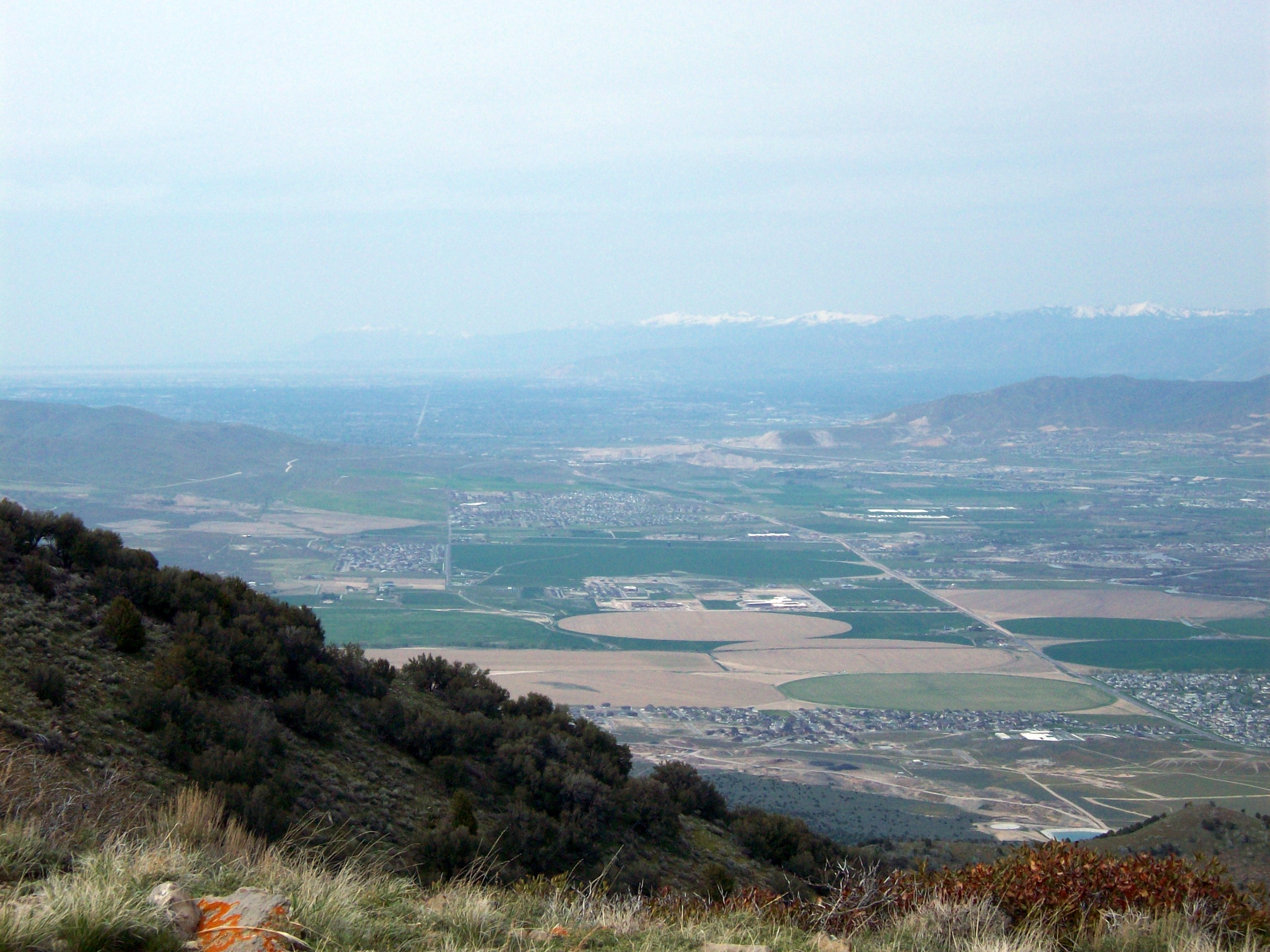
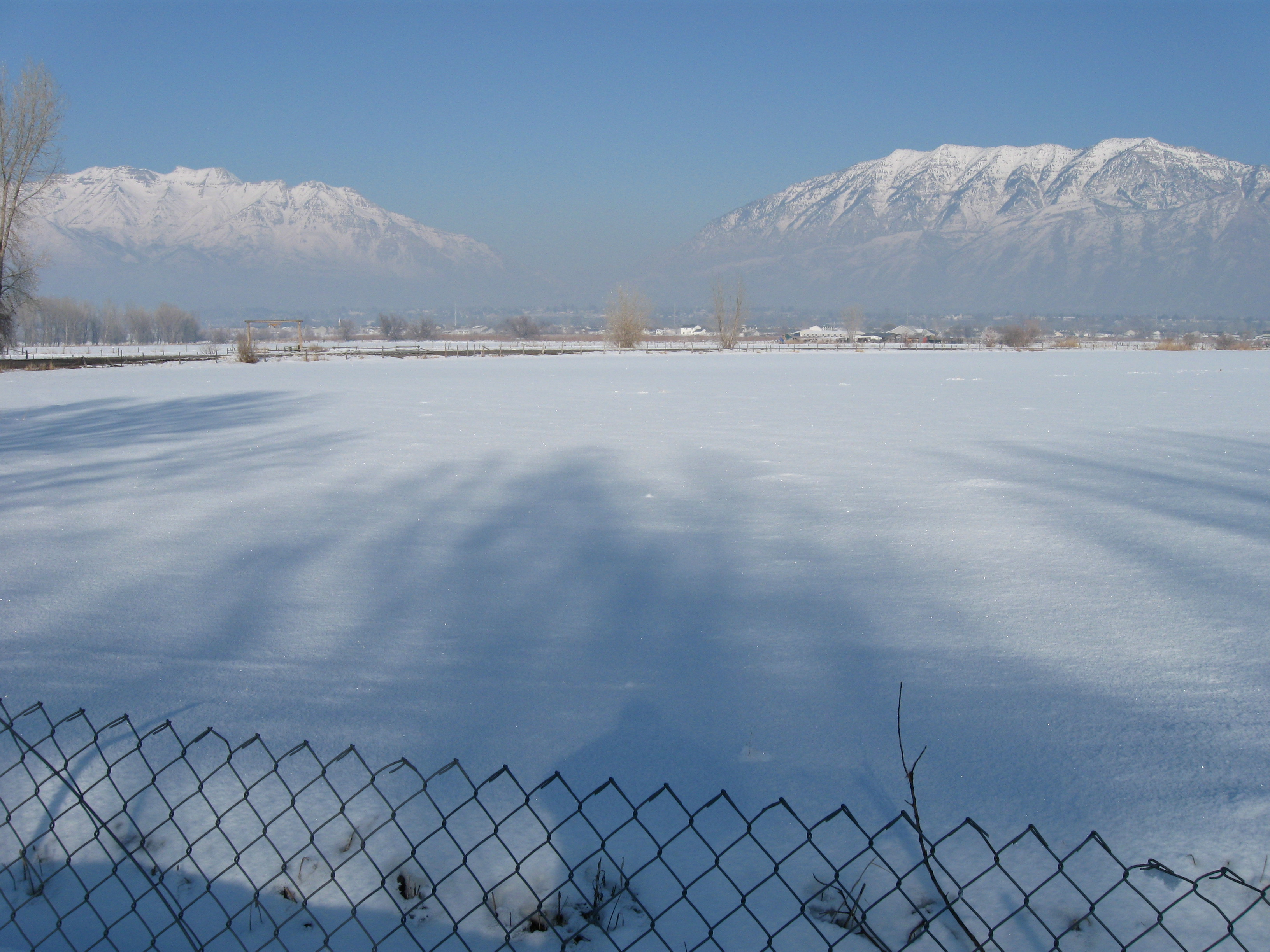
Salt Lake Valley is a valley in Salt Lake County in the north-central portion of the U.S. state of Utah. It contains Salt Lake City and many of its suburbs, notably Murray, Sandy, South Jordan, West Jordan, and West Valley City; its total population is 1,029,655 as of 2010. Brigham Young said, "this is the right place," when he and his fellow Mormon settlers moved into Utah after being driven out of several states.Utah Pioneers (Salt Lake City, 1880), p. 23, quoted in Leland H. Creer, The Founding of an Empire (Salt Lake City, 1947), p. 302, n. 913. Cited by Poll R. Dealing with Dissonance: Myths, Documents and Faith. Sunstone, 1988 p. 17, available online asunstonemagazine.com/ref> Geography The Valley is surrounded in every direction except the northwest by steep mountains that at some points rise from the valley floor's base elevation. It lies nearly encircled by the Wasatch Mountains on the east, the Oquirrh Mountains on the west, Traverse Ridge to the south and th ... [...More Info...] [...Related Items...] OR: [Wikipedia] [Google] [Baidu] |
Oquirrh
Oquirrh is a census-designated place (CDP) in Salt Lake County, Utah, located on the slopes of the Oquirrh Mountains that gave it its name. Oquirrh was once part of Kearns, UT. Through annexation, the city of West Jordan cut Oquirrh off from Kearns, making Oquirrh a CDP. As of the 2000 census, the CDP population was 10,390, a modest increase over the 1990 figure of 7,593. In 2000 parts Oquirrh were annexed by West Jordan. Geography Oquirrh is located at (40.630046, -112.015675). According to the United States Census Bureau, the CDP has a total area of 4.5 km2 (1.8 mi2), all land. Demographics As of the census of 2000, there were 10,390 people, 2,683 households, and 2,428 families residing in the CDP. The population density was 2,292.3/km2 (5,950.3/mi2). There were 2,728 housing units at an average density of 601.9/km2 (1,562.3/mi2). The racial makeup of the CDP was 87.60% White, 0.69% African American, 0.41% Native American, 1.36% Asian, 1.62% Pacific Islander, 6.18 ... [...More Info...] [...Related Items...] OR: [Wikipedia] [Google] [Baidu] |
Traverse Ridge
The Traverse Mountains, or sometimes Traverse Range, are an anomalous, geologically complex, east-trending range that separates Salt Lake Valley and Utah Valley in Salt Lake and Utah counties in the U.S. State of Utah. Point of the Mountain is colloquially used to refer to the part of this range that separates the Salt Lake City and Provo metropolitan areas, as well as the mountain pass at , used by the highways and rail arteries that connect the two areas. Description The Traverse Mountains mark the boundary between the Salt Lake and Provo segments of the Wasatch Fault, and they are much faulted and locally involved in landslides. Lake Bonneville once covered Salt Lake and Utah Valleys, and shorelines and deposits from the ice age lake are now etched into the flanks of the Traverse Mountains. The eastern section of the range (often called Traverse Mountain) is split up between the cities of Lehi and Draper. The Draper portion contains the Suncrest community, while the Lehi ... [...More Info...] [...Related Items...] OR: [Wikipedia] [Google] [Baidu] |
Mountain View Corridor
The Mountain View Corridor is a freeway under construction in northern Utah that will run along the western periphery of Salt Lake County and south into northwest Utah County. Except for the last several miles on its southern end the Mountain View Corridor is numerically designated as State Route 85 (SR-85) in the Utah state highway system. The entire Mountain View Corridor will be maintained by the Utah Department of Transportation (UDOT). Route description Mountain View Corridor is an arterial road with a distance of one to two miles parallel on the west to Bangerter Highway (SR-154), built to meet the demand of the growing cities in Salt Lake County. It starts at SR-73 in Saratoga Springs and runs north to a junction with a spur of the roadway that runs east to Interstate 15 in Lehi. The spur, designated as 2100 North, also carries the SR-85 designation. From the junction at 2100 North, the Mountain View Corridor will continue north through Camp Williams into Salt Lake Cou ... [...More Info...] [...Related Items...] OR: [Wikipedia] [Google] [Baidu] |
KUED
KUED (channel 7), branded on-air as PBS Utah, is a PBS member television station in Salt Lake City, Utah, United States. The station is owned by the University of Utah, and has studios at the Eccles Broadcast Center on Wasatch Drive in the northeastern section of Salt Lake City; its transmitter is located on Farnsworth Peak in the Oquirrh Mountains, southwest of Salt Lake City. KUED has a large network of broadcast translators that extend its over-the-air coverage throughout Utah. Prior to July 2018, KUED was one of two PBS member stations serving Utah, the other being Provo-licensed KBYU-TV (channel 11), owned by Brigham Young University. In October 2017, it was announced that KBYU would drop PBS programming on June 30, 2018 in favor of its own BYUtv service, leaving KUED as the sole PBS station for the state. History The station first signed on the air on January 20, 1958, with an episode of ''The Friendly Giant''. The station originally broadcast from improvised studios ... [...More Info...] [...Related Items...] OR: [Wikipedia] [Google] [Baidu] |
Air Quality In Utah
Air quality in Utah is often some of the worst in the United States. Poor air quality in Utah is due to the mountainous topography which can cause pollutants to build up near the surface (especially during inversions) combined with the prevalence of emissions from gasoline- and diesel-powered vehicles, especially older models. Burning wood fuel for home heating can also contribute significantly to poor air quality. Homes heated with wood contribute about 3000 times the amount of pollution as homes heated with natural gas. About 50% of air pollution in Salt Lake County is from vehicles. In 2017 the American Lung Association (ALA) ranked Salt Lake City-Provo-Orem area as the 14th worst city for ozone air quality in the U.S. and 8th for worst short-term particle pollution, just after Los Angeles. Logan was ranked the 11th worst city for short-term particle pollution. Of the 12 counties with ozone data from 2014 to 2016, 7 received an "F" grade by the ALA, and 6 of 9 counties monito ... [...More Info...] [...Related Items...] OR: [Wikipedia] [Google] [Baidu] |
Jordan River (Utah)
The Jordan River, in the state of Utah, United States, is a river about long. Regulated by pumps at its headwaters at Utah Lake, it flows northward through the Salt Lake Valley and empties into the Great Salt Lake. Four of Utah's six largest cities border the river: Salt Lake City, West Valley City, West Jordan, and Sandy. More than a million people live in the Jordan Subbasin, part of the Jordan River watershed that lies within Salt Lake and Utah counties. During the Pleistocene, the area was part of Lake Bonneville. Members of the Desert Archaic Culture were the earliest known inhabitants of the region; an archaeological site found along the river dates back 3,000 years. Mormon pioneers led by Brigham Young were the first European American settlers, arriving in July 1847 and establishing farms and settlements along the river and its tributaries. The growing population, needing water for drinking, irrigation, and industrial use in an arid climate, dug ditches and canals, built ... [...More Info...] [...Related Items...] OR: [Wikipedia] [Google] [Baidu] |
Utah Valley
Utah ( , ) is a state in the Mountain West subregion of the Western United States. Utah is a landlocked U.S. state bordered to its east by Colorado, to its northeast by Wyoming, to its north by Idaho, to its south by Arizona, and to its west by Nevada. Utah also touches a corner of New Mexico in the southeast. Of the fifty U.S. states, Utah is the 13th-largest by area; with a population over three million, it is the 30th-most-populous and 11th-least-densely populated. Urban development is mostly concentrated in two areas: the Wasatch Front in the north-central part of the state, which is home to roughly two-thirds of the population and includes the capital city, Salt Lake City; and Washington County in the southwest, with more than 180,000 residents. Most of the western half of Utah lies in the Great Basin. Utah has been inhabited for thousands of years by various indigenous groups such as the ancient Puebloans, Navajo and Ute. The Spanish were the first European ... [...More Info...] [...Related Items...] OR: [Wikipedia] [Google] [Baidu] |
Utah Lake
Utah Lake is a shallow freshwater lake in the center of Utah County, Utah, United States. It lies in Utah Valley, surrounded by the Provo- Orem metropolitan area. The lake's only river outlet, the Jordan River, is a tributary of the Great Salt Lake. Evaporation accounts for 42% of the lake's outflow, which leaves the lake slightly saline. The elevation of the lake is at above sea level. If the lake's water level rises above that, the pumps and gates on the Jordan River are left open. Recently the lake has been at a lower level because of a drought. The first European to see Utah Lake was Father Silvestre Vélez de Escalante in 1776. He stayed with the Timpanogots band of Ute Tribe for three days. The Timpanogots were later ethnically cleansed from the area by Mormon settlers between the 1850s and 1870s. The fish of the lake were overharvested by the settlers and subsequently restocked with non-native species. Although thirteen species of fish were native to the lake, onl ... [...More Info...] [...Related Items...] OR: [Wikipedia] [Google] [Baidu] |
Emigration Canyon, Utah
Emigration Canyon is a metro township and canyon in Salt Lake County, Utah, United States, located east of Salt Lake City in the Wasatch Range. Beginning at the southern end of the University of Utah, the canyon itself heads east and northeast between Salt Lake City and Morgan County. The boundaries of the metro township do not extend to the county line, nor do they encompass all of Emigration Canyon, as parts of it are within Salt Lake City. As of the 2010 census, the population was 1,568. A portion of Emigration Canyon, located in This Is the Place Heritage Park, was declared a National Historic Landmark in 1961 for the canyon's significance in the Mormon migration of the 19th century. Demographics History Emigration Canyon was significant in early Utah history as the original route used by pioneers entering the area. It was part of the Hastings Cutoff route used by the Donner Party in 1846 and where the Mormon Pioneers entered the Salt Lake Valley in 1847. As Brigham You ... [...More Info...] [...Related Items...] OR: [Wikipedia] [Google] [Baidu] |
Parley's Canyon
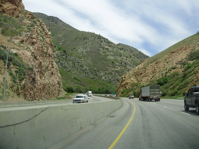
Parleys Canyon is a canyon located in the U.S. state of Utah. The canyon provides the route of Interstate 80 (I-80) (and previously the Lincoln Highway, U.S. Route 40, and a railroad) up the western slope of the Wasatch Mountains and is a relatively wide, straight canyon other than near its mouth. The mountain pass at the top of the canyon is known as Parleys Summit. With an elevation of , the pass is the highest point along I-80 in the state of Utah. Both features are named for Parley P. Pratt, an early settler of the Salt Lake Valley and leader of the Church of Jesus Christ of Latter-day Saints who surveyed the area to find a better transportation route through the Wasatch Mountains than the previous route which traversed Emigration Canyon. Description Parleys Canyon begins where I-215 merges into I-80 in Salt Lake City and ends at Parleys Summit. The lower part of the canyon is relatively twisty and narrow and had to be dynamited to make way for I-80. Despite this, the in ... [...More Info...] [...Related Items...] OR: [Wikipedia] [Google] [Baidu] |
Traverse Mountains
The Traverse Mountains, or sometimes Traverse Range, are an anomalous, geologically complex, east-trending range that separates Salt Lake Valley and Utah Valley in Salt Lake and Utah counties in the U.S. State of Utah. Point of the Mountain is colloquially used to refer to the part of this range that separates the Salt Lake City and Provo metropolitan areas, as well as the mountain pass at , used by the highways and rail arteries that connect the two areas. Description The Traverse Mountains mark the boundary between the Salt Lake and Provo segments of the Wasatch Fault, and they are much faulted and locally involved in landslides. Lake Bonneville once covered Salt Lake and Utah Valleys, and shorelines and deposits from the ice age lake are now etched into the flanks of the Traverse Mountains. The eastern section of the range (often called Traverse Mountain) is split up between the cities of Lehi and Draper. The Draper portion contains the Suncrest community, while the Le ... [...More Info...] [...Related Items...] OR: [Wikipedia] [Google] [Baidu] |
Jordan Narrows
Jordan ( ar, الأردن; tr. ' ), officially the Hashemite Kingdom of Jordan,; tr. ' is a country in Western Asia. It is situated at the crossroads of Asia, Africa, and Europe, within the Levant region, on the East Bank of the Jordan River. Jordan is bordered by Saudi Arabia to the south and east, Iraq to the northeast, Syria to the north, and the Palestinian West Bank, Israel, and the Dead Sea to the west. It has a coastline in its southwest on the Gulf of Aqaba's Red Sea, which separates Jordan from Egypt. Amman is Jordan's capital and largest city, as well as its economic, political, and cultural centre. Modern-day Jordan has been inhabited by humans since the Paleolithic period. Three stable kingdoms emerged there at the end of the Bronze Age: Ammon, Moab and Edom. In the third century BC, the Arab Nabataeans established their Kingdom with Petra as the capital. Later rulers of the Transjordan region include the Assyrian, Babylonian, Roman, Byzantine, Rashi ... [...More Info...] [...Related Items...] OR: [Wikipedia] [Google] [Baidu] |


