|
Roxheim
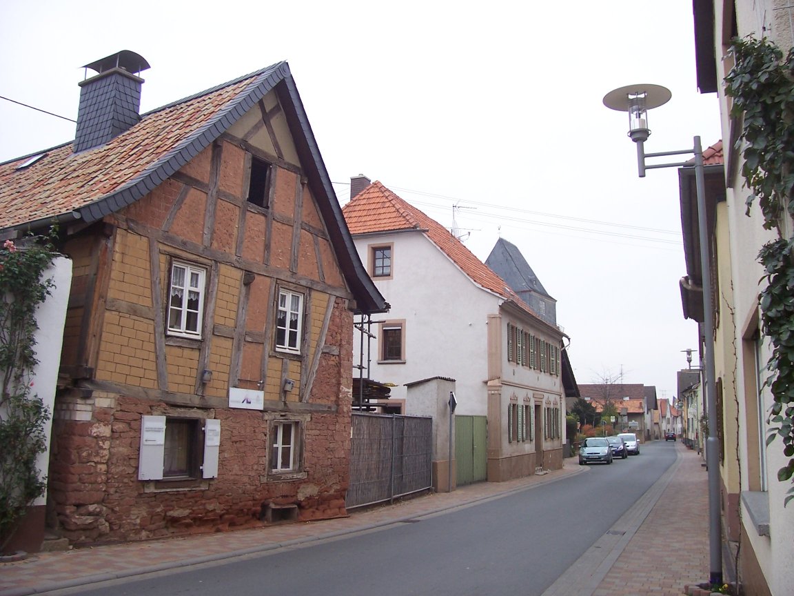
Roxheim is an '' Ortsgemeinde'' – a municipality belonging to a ''Verbandsgemeinde'', a kind of collective municipality – in the Bad Kreuznach district in Rhineland-Palatinate, Germany. It belongs to the ''Verbandsgemeinde'' of Rüdesheim, whose seat is in the municipality of Rüdesheim an der Nahe. Roxheim is a winegrowing village. Geography Location Roxheim lies on the Katzenbach north of the Nahe. Neighbouring municipalities Clockwise from the north, Roxheim's neighbours are the municipalities of Gutenberg and Hargesheim, the town of Bad Kreuznach and the municipalities of Rüdesheim an der Nahe, Mandel, Sankt Katharinen, Sommerloch and Wallhausen, all of which likewise lie within the Bad Kreuznach district. Constituent communities Also belonging to Roxheim are the outlying homesteads of Rollars Mühle and Schauß Mühle. History In old documents from the 8th century, the village's name appears as ''Hrocchesheim'' (773, 781, 785, 790), ''Roghesheim'' (813) and lat ... [...More Info...] [...Related Items...] OR: [Wikipedia] [Google] [Baidu] |
Rüdesheim An Der Nahe
Rüdesheim an der Nahe, or simply Rüdesheim, is an ''Ortsgemeinde'' – a municipality belonging to a ''Verbandsgemeinde'', a kind of collective municipality – in the Bad Kreuznach district in Rhineland-Palatinate, Germany. It belongs to the ''Verbandsgemeinde'' of Rüdesheim, and is also its seat. Rüdesheim customarily takes the tag “an der Nahe” to distinguish itself from nearby Rüdesheim am Rhein. Rüdesheim is laid out in state planning as a lower centre. Rüdesheim is a winegrowing village. Geography Location Rüdesheim lies in the transitional zone between Rhenish Hesse and the Hunsrück at the mouth of the Katzenbach, where it empties into the Ellerbach, itself a tributary to the Nahe. Although that river lies a short way outside Rüdesheim, the municipality still styles itself “an der Nahe” (“on the Nahe”) and claims that it lies ''im Herzen des wunderschönen Nahetals'' (“in the heart of the wonderfully lovely Nahe valley”). The village is found so ... [...More Info...] [...Related Items...] OR: [Wikipedia] [Google] [Baidu] |
Sankt Katharinen, Bad Kreuznach
Sankt Katharinen (official spelling until 25 November 1936: ''Sankt Catharinen'') is an '' Ortsgemeinde'' – a municipality belonging to a ''Verbandsgemeinde'', a kind of collective municipality – in the Bad Kreuznach district in Rhineland-Palatinate, Germany. It belongs to the ''Verbandsgemeinde'' of Rüdesheim, whose seat is in the municipality of Rüdesheim an der Nahe. Geography Location Sankt Katharinen lies in the Naheland at the southern edge of the Gauchswald (forest) and therefore the Hunsrück. Sankt Katharinen sits at an elevation of 217 m above sea level and its municipal area measures 1.70 km². Neighbouring municipalities Clockwise from the north, Sankt Katharinen’s neighbours are the municipalities of Sommerloch, Roxheim, Mandel and Braunweiler, all of which likewise lie within the Bad Kreuznach district. History The village of Sankt Katharinen goes back to the Cistercian monastery of the same name that stood here from the early 13th century unti ... [...More Info...] [...Related Items...] OR: [Wikipedia] [Google] [Baidu] |
Bad Kreuznach
Bad Kreuznach () is a town in the Bad Kreuznach district in Rhineland-Palatinate, Germany. It is a spa town, most well known for its medieval bridge dating from around 1300, the Alte Nahebrücke, which is one of the few remaining bridges in the world with buildings on it.Brückenhäuser, Alte Nahebrücke, Neustadt , Bad Kreuznach o www.romantic-germany.info (in English). Retrieved 14 June 2018 The town is located in the Nahe River wine region, renowned both nationally and internati ... [...More Info...] [...Related Items...] OR: [Wikipedia] [Google] [Baidu] |
Descriptio Wormatiensis Civitatis
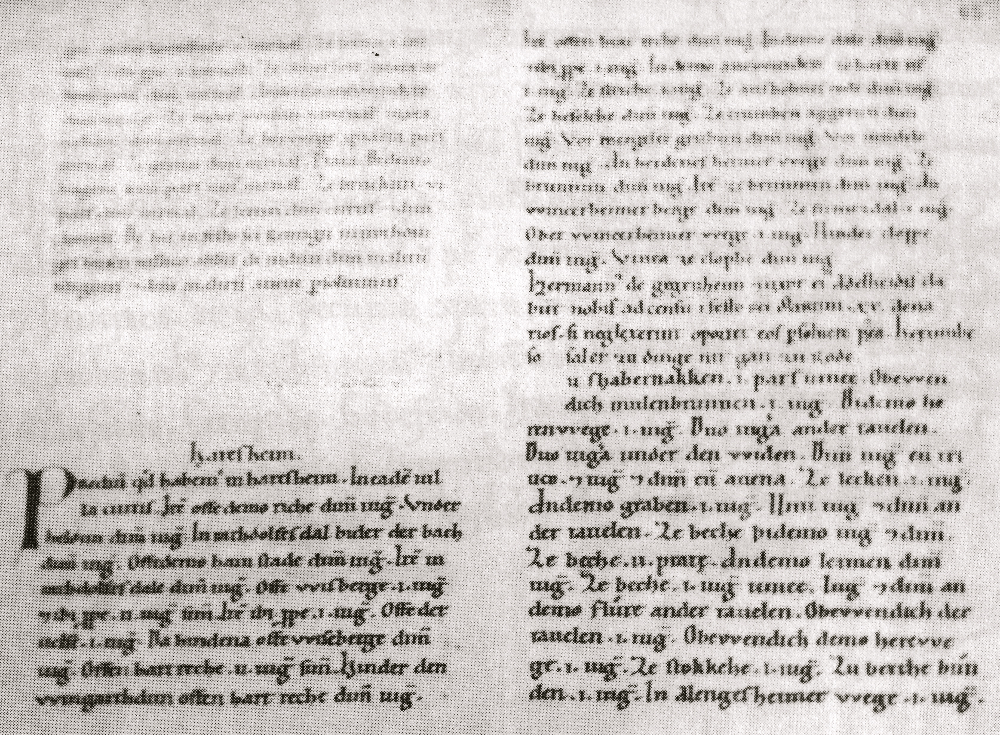
The ''Descriptio Wormatiensis civitatis'' ('description of the city of Worms'), also known as the ''Wormser Mauerbauordnung'' ('wall-building ordinance of Worms'), is an ordinance from about 900 concerning the maintenance of the city wall of Worms, Germany. Manuscript and editions The ''Descriptio'', which is written in Latin, is preserved in the ''Wormser Chronik'' of . Zorn's work, which dates to 1576, combines material from several sources, including the ''Annales Wormatienses'' and the ''Chronicon Wormatiense''. The combined ''Descriptio'', ''Annales'' and ''Chronicon'' were published under the title ''Annales Wormatienses'' by G. H. Pertz. The disentangling of the medieval texts combined in Zorn's was done by .David S. Bachrach, ed. (2014), ''The Histories of a Medieval German City, Worms c. 1000–c. 1300: Translation and Commentary'' (Farnham: Ashgate), pp. 25–26 and 40 n44. The ''Descriptio'' has been published three times: by Pertz,G. H. Pertz, ed. (1861), "Annales ... [...More Info...] [...Related Items...] OR: [Wikipedia] [Google] [Baidu] |
Mandel, Germany
Mandel is an ''Ortsgemeinde'' – a Municipalities of Germany, municipality belonging to a ''Verbandsgemeinde'', a kind of collective municipality – in the Bad Kreuznach (district), Bad Kreuznach Districts of Germany, district in Rhineland-Palatinate, Germany. It belongs to the Rüdesheim (Verbandsgemeinde), ''Verbandsgemeinde'' of Rüdesheim, whose seat is in the municipality of Rüdesheim an der Nahe. Mandel is a winegrowing village. Geography Location Mandel lies in the Naheland (the region either side of the River Nahe (Rhine), Nahe), south of the Hunsrück, some 5 km west of Bad Kreuznach amidst vineyards, meadows and woodland. Mandel sits at an elevation of 200 m above sea level and its municipal area measures 6.33 km2. Neighbouring municipalities Clockwise from the north, Mandel's neighbours are the municipalities of Sankt Katharinen, Bad Kreuznach, Sankt Katharinen, Roxheim, Rüdesheim an der Nahe, Weinsheim, Bad Kreuznach, Weinsheim, Sponheim and Braunwei ... [...More Info...] [...Related Items...] OR: [Wikipedia] [Google] [Baidu] |
Hargesheim
Hargesheim is an ''Ortsgemeinde'' – a municipality belonging to a ''Verbandsgemeinde'', a kind of collective municipality – in the Bad Kreuznach district in Rhineland-Palatinate, Germany. It belongs to the ''Verbandsgemeinde'' of Rüdesheim, whose seat is in the municipality of Rüdesheim an der Nahe. Hargesheim is a state-recognized tourism community. Geography Location Hargesheim lies on the Gräfenbach in a side valley of the Nahe. Lying 5 km away is the district seat of Bad Kreuznach. Hargesheim thus lies on the boundary between Rhenish Hesse and the Hunsrück. A great part of the municipality's area is built up (48 ha), whereas only a small part is used for forestry. The rest is used for either agriculture or winegrowing. Neighbouring municipalities Clockwise from the north, Hargesheim's neighbours are Guldental, Bad Kreuznach, Roxheim and Gutenberg, all of which likewise lie within the Bad Kreuznach district. Constituent communities Also belonging to Har ... [...More Info...] [...Related Items...] OR: [Wikipedia] [Google] [Baidu] |
Bad Kreuznach (district)
Bad Kreuznach is a district in Rhineland-Palatinate, Germany. It is bounded by (from the north and clockwise) the districts of Rhein-Hunsrück, Mainz-Bingen, Alzey-Worms, Donnersbergkreis, Kusel and Birkenfeld. History The region is full of medieval castles, especially along the Nahe River. Best known is the Kyrburg of Kirn, built in the 12th century and sitting in state above the river. In 1815, the district of Kreuznach was established by the Prussian government. In 1932, it was merged with the district of Meisenheim. The name of the district officially changed from Kreuznach to Bad Kreuznach in 1969. Geography The district is located in the hilly country between the mountain chains of the Hunsrück in the north and the North Palatine Uplands in the south. The main axis of the district is the Nahe River, which enters the territory in the west, runs through Kirn, Bad Sobernheim and Bad Kreuznach, and leaves to the northeast. The region formed by this district and the adjoi ... [...More Info...] [...Related Items...] OR: [Wikipedia] [Google] [Baidu] |
Braunweiler
Braunweiler is an '' Ortsgemeinde'' – a municipality belonging to a ''Verbandsgemeinde'', a kind of collective municipality – in the Bad Kreuznach district in Rhineland-Palatinate, Germany. It belongs to the ''Verbandsgemeinde'' of Rüdesheim, whose seat is in the municipality of Rüdesheim an der Nahe. Braunweiler is a winegrowing village. Geography Location Braunweiler lies in the Naheland – the land lining both sides of the Nahe – right at the edge of the Gauchswald (forest) and therefore also the Hunsrück. It sits on a spur overlooking its vineyards. Braunweiler's elevation is 275 m above sea level and the municipal area measures 4.68 km². Neighbouring municipalities Clockwise from the north, Braunweiler's neighbours are the municipality of Wallhausen, the municipality of Sommerloch, the municipality of Sankt Katharinen, the municipality of Mandel, the municipality of Sponheim and the municipality of Argenschwang. However, of these places, ... [...More Info...] [...Related Items...] OR: [Wikipedia] [Google] [Baidu] |
Rüdesheim (Verbandsgemeinde)
Rüdesheim is a ''Verbandsgemeinde'' ("collective municipality") in the district of Bad Kreuznach, Rhineland-Palatinate, Germany. The seat of the ''Verbandsgemeinde'' is in Rüdesheim an der Nahe. The ''Verbandsgemeinde'' Rüdesheim consists of the following ''Ortsgemeinden'' ("local municipalities"): # Allenfeld # Argenschwang # Bockenau # Boos # Braunweiler # Burgsponheim # Dalberg # Duchroth # Gebroth # Gutenberg # Hargesheim # Hergenfeld # Hüffelsheim # Mandel # Münchwald # Niederhausen # Norheim # Oberhausen an der Nahe # Oberstreit # Roxheim # Rüdesheim an der Nahe # Sankt Katharinen # Schloßböckelheim # Sommerloch # Spabrücken # Spall Spall are fragments of a material that are broken off a larger solid body. It can be produced by a variety of mechanisms, including as a result of projectile impact, corrosion, weathering, cavitation, or excessive rolling pressure (as in a ball ... # Sponheim # Traisen # Waldböckelheim # Wallhausen ... [...More Info...] [...Related Items...] OR: [Wikipedia] [Google] [Baidu] |
Gutenberg, Germany
Gutenberg is an ''Ortsgemeinde'' – a municipality belonging to a ''Verbandsgemeinde'', a kind of collective municipality – in the Bad Kreuznach district in Rhineland-Palatinate, Germany. It belongs to the ''Verbandsgemeinde'' of Rüdesheim, whose seat is in the municipality of Rüdesheim an der Nahe. Gutenberg is a winegrowing village. Geography Location Flowing through Gutenberg is the Gräfenbach. Gutenberg belongs to the Nahe wine region and lies at the foot of the Soonwald in the Hunsrück. Its elevation is roughly 145 m above sea level and it lies some 7 km from the district seat, Bad Kreuznach. Bad Sobernheim, Idar-Oberstein, Bad Münster am Stein-Ebernburg and Bingen am Rhein also lie relatively nearby. Gutenberg is distinguished by the consistency of its weather, low rainfall averaging only 480 mm yearly and a great many sunny days. This has led the municipality to adopt the slogan "''Gutenberg – auf der Sonnenseite der Welt''" ("Gutenberg&nb ... [...More Info...] [...Related Items...] OR: [Wikipedia] [Google] [Baidu] |
Ortsgemeinde
A Verbandsgemeinde (; plural Verbandsgemeinden) is a low-level administrative unit in the German federal states of Rhineland-Palatinate and Saxony-Anhalt. A Verbandsgemeinde is typically composed of a small group of villages or towns. Rhineland-Palatinate The state of Rhineland-Palatinate is divided into 163 Verbandsgemeinden, which are municipal associations grouped within the 24 districts of the state and subdivided into 2,257 Ortsgemeinden (singular Ortsgemeinde) which comprise single settlements. Most of the Verbandsgemeinden were established in 1969. Formerly the name for an administrative unit was '' Amt''. Most of the functions of municipal government for several municipalities are consolidated and administered centrally from a larger or more central town or municipality among the group, while the individual municipalities (Ortsgemeinden) still maintain a limited degree of local autonomy. Saxony-Anhalt The 11 districts of Saxony-Anhalt are divided into ''Verwaltungsgeme ... [...More Info...] [...Related Items...] OR: [Wikipedia] [Google] [Baidu] |
Worms, Germany
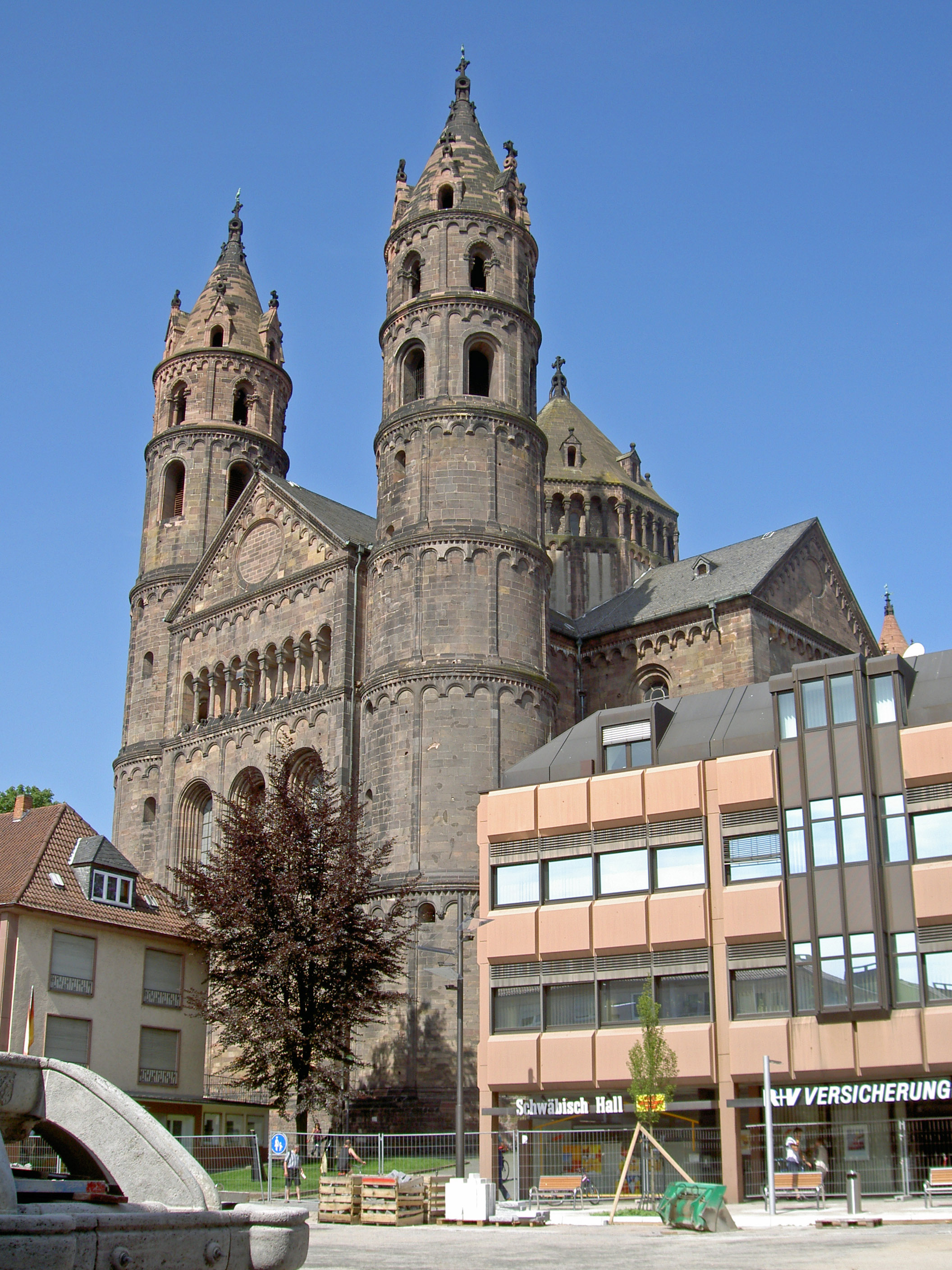
Worms () is a city in Rhineland-Palatinate, Germany, situated on the Upper Rhine about south-southwest of Frankfurt am Main. It had about 82,000 inhabitants . A pre-Roman foundation, Worms is one of the oldest cities in northern Europe. It was the capital of the Kingdom of the Burgundians in the early fifth century, hence is the scene of the medieval legends referring to this period, notably the first part of the '' Nibelungenlied''. Worms has been a Roman Catholic bishopric since at least 614, and was an important palatinate of Charlemagne. Worms Cathedral is one of the imperial cathedrals and among the finest examples of Romanesque architecture in Germany. Worms prospered in the High Middle Ages as an imperial free city. Among more than a hundred imperial diets held at Worms, the Diet of 1521 (commonly known as ''the'' Diet of Worms) ended with the Edict of Worms, in which Martin Luther was declared a heretic. Worms is also one of the historical ShUM-cities as a cu ... [...More Info...] [...Related Items...] OR: [Wikipedia] [Google] [Baidu] |


