|
Risle
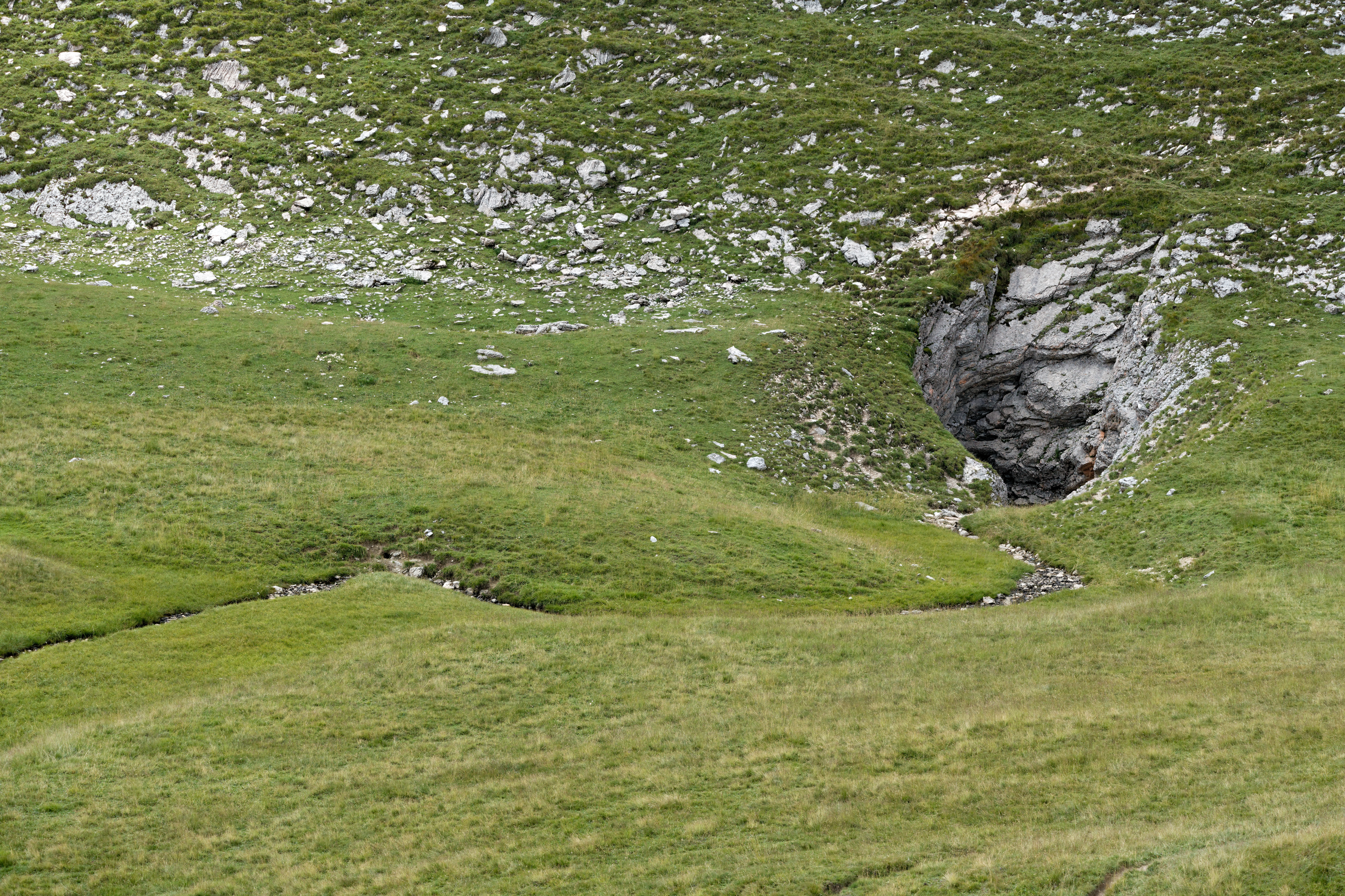
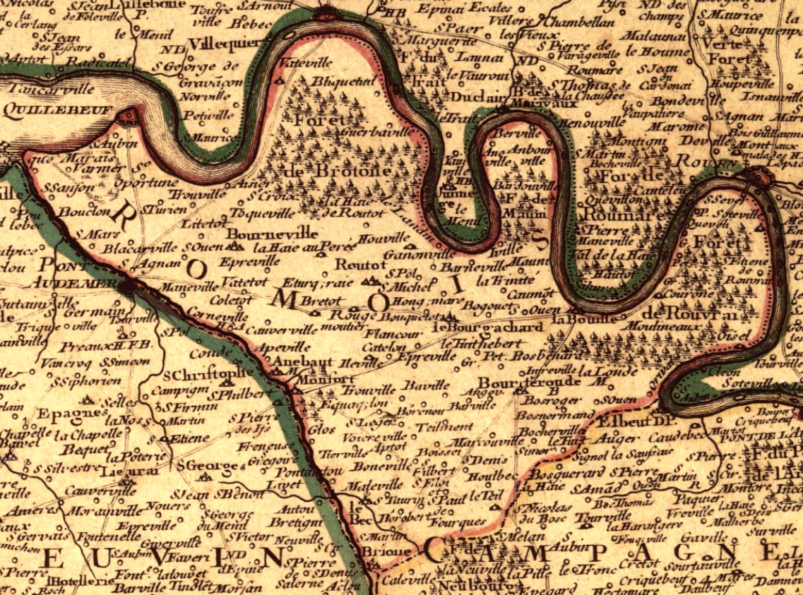
The Risle (; less common: ''Rille'') is a long river in Normandy, left tributary of the Seine. The river begins in the Orne department west of L'Aigle, crosses the western part of the department of Eure flowing from south to north and out into the estuary of the Seine on the left bank near Berville-sur-Mer. Its upper valley is part of the Pays d'Ouche, its lower valley separates the regions of the Lieuvin and Roumois. The Risle is regarded as a coastal river. Fishing is common downstream at Pont-Audemer. On July 30, 2012, the Risle vanished in a ponor between La Ferrière-sur-Risle and La Houssaye. It runs underground for . Its only major tributary is the Charentonne. The Risle flows through the following departments and communes: *Orne: Sainte-Gauburge-Sainte-Colombe, L'Aigle * Eure: Rugles, Beaumont-le-Roger, Brionne, Montfort-sur-Risle, Pont-Audemer Pont-Audemer () is a commune in the Eure department in the Normandy region in northern France. ... [...More Info...] [...Related Items...] OR: [Wikipedia] [Google] [Baidu] |
Montfort-sur-Risle
Montfort-sur-Risle (, literally ''Montfort on Risle'') is a commune in the Eure department in Normandy region in northern France. History In Gallic times the river Risle delimited the territories of the tribes of Veliocasses and the Lexovii. Between 980 and 1204, when it passed into the hands of the King of France with its castle, Montfort-sur-Risle was a lordship. The most famous Lord of Montfort was Hugues II de Montfort (died 1083), who joined in the Norman conquest of England, for which he received 114 English manors. Population See also *Communes of the Eure department The following is a list of the 585 communes of the Eure department of France. The communes cooperate in the following intercommunalities (as of 2020):C ... [...More Info...] [...Related Items...] OR: [Wikipedia] [Google] [Baidu] |
Charentonne
The Charentonne is a 63 km long river in Normandy, left tributary of the Risle. The river begins in pays d'Ouche (Orne), in the forest of Saint-Évroult, in the south of the Saint-Évroult-Notre-Dame-du-bois village and the ruins of the abbey where lived and died Orderic Vitalis (1075–1142). The river runs, in a north-northeast direction, towards the Risle with which it joins at Serquigny. The Charentonne valley, which separates the Lieuvin plateau and the Ouche plateau has stiff and wooded slopes. The bottom of the valley is covered with clay Clay is a type of fine-grained natural soil material containing clay minerals (hydrous aluminium phyllosilicates, e.g. kaolin, Al2 Si2 O5( OH)4). Clays develop plasticity when wet, due to a molecular film of water surrounding the clay pa ...ed alluvions ; it is flat and wet, flooded in winter, with beautiful natural meadows, characteristic of Normandy. The Charentonne flows through the following communes: Broglie, Be ... [...More Info...] [...Related Items...] OR: [Wikipedia] [Google] [Baidu] |
La Ferrière-sur-Risle
La Ferrière-sur-Risle (, literally ''La Ferrière on Risle'') is a commune in the Eure department in the Normandy region in northern France. Population See also *Communes of the Eure department The following is a list of the 585 communes of the Eure department of France. The communes cooperate in the following intercommunalities (as of 2020):Communes of Eure {{Eure-geo-stub ... [...More Info...] [...Related Items...] OR: [Wikipedia] [Google] [Baidu] |
Pont-Audemer
Pont-Audemer () is a commune in the Eure department in the Normandy region in northern France.Commune de Pont-Audemer (27467) INSEE On 1 January 2018, the former commune of Saint-Germain-Village was merged into Pont-Audemer. 6 December 2017 Geography The commune is situated on the river , 13 km upstream from its outflow into the |
Ponor
A ponor is a natural opening where surface water enters into underground passages; they may be found in karst landscapes where the geology and the geomorphology is typically dominated by porous limestone rock. Ponors can drain stream or lake water continuously or can at times work as springs, similar to estavelles. Morphologically, ponors come in forms of large pits and caves, large fissures and caverns, networks of smaller cracks, and sedimentary, alluvial drains. Etymology The name for the karst formation ponor comes from Croatian and Slovene. It derives from the proto-Slavic word ''nora'', meaning ''pit'', ''hole'', ''abyss''; the English word ''narrow'' probably has the same origin. Several places in southeast Europe (Bulgaria, Croatia, Czech Republic, Hungary, Romania, Montenegro, Slovenia) bear the name ''Ponor'' due to associated karst openings. Description Whereas a sinkhole (doline) is a depression of surface topography with a pit or cavity directly underneath, a po ... [...More Info...] [...Related Items...] OR: [Wikipedia] [Google] [Baidu] |
Seine
) , mouth_location = Le Havre/ Honfleur , mouth_coordinates = , mouth_elevation = , progression = , river_system = Seine basin , basin_size = , tributaries_left = Yonne, Loing, Eure, Risle , tributaries_right = Ource, Aube, Marne, Oise, Epte The Seine ( , ) is a river in northern France. Its drainage basin is in the Paris Basin (a geological relative lowland) covering most of northern France. It rises at Source-Seine, northwest of Dijon in northeastern France in the Langres plateau, flowing through Paris and into the English Channel at Le Havre (and Honfleur on the left bank). It is navigable by ocean-going vessels as far as Rouen, from the sea. Over 60 percent of its length, as far as Burgundy, is negotiable by large barges and most tour boats, and nearly its whole length is available for recreational boating; excursion boats offer sightseeing tours of the river banks in the capital city, Paris. There are 37 b ... [...More Info...] [...Related Items...] OR: [Wikipedia] [Google] [Baidu] |
Berville-sur-Mer
Berville-sur-Mer is a commune in the Norman department of Eure in northern France. The village is located on the banks of the Seine estuary, and was the crossing point of the river before the Pont de Normandie opened. It is the location of the longest barn in Normandy at 77 metres long. This has now been converted into holiday cottages which are mainly owned by Top Sun Ltd. Geography Berville-sur-Mer ( "Berville on the sea") is a French commune located in the north-west of the Eure department in Normandy on the right bank (south) of the Seine estuary and have a small and uninhabited strip on the left bank. Berville is part of natural region of Lieuvin and included in the Natural regional reserve of the Norman Seine loops (''Parc naturel régional des Boucles de la Seine normande''). The village is 8.5 km east of Honfleur, 18.5 km south east of Le Havre and 55 km west of Rouen (as the crow flies). The commune is crossed by the canal de Retour ("Return canal"), parallele t ... [...More Info...] [...Related Items...] OR: [Wikipedia] [Google] [Baidu] |
Pays D'Ouche
The Pays d'Ouche (, literally ''Land of Ouche'') is an historical and geographical region in Normandy. It extends from the southwest of Évreux up to Bernay and Beaumont-le-Roger as a northern limit, and down to L'Aigle and to Gacé in the south. Additional cities are Breteuil-sur-Iton, Conches and Rugles. Neighboring regions are the Pays d'Auge and to the south is Perche (''Perche'' (fr)). Since the French revolution, the main part is located in the department of Eure, and the lesser portion in the neighboring Orne department (both Normandy region), where its capital town L'Aigle is situated. The Risle River and other tributaries of the Seine flow through this area. Its chalky soil is not agriculturally productive. The principal towns of the area are L'Aigle, population 8,090 (2017), [...More Info...] [...Related Items...] OR: [Wikipedia] [Google] [Baidu] |
Roumois
The Roumois () is a region in the northwestern part of the Eure ''département'' in Normandy, France. It is a plateau situated southwest of Rouen. Its northern boundary is the Seine downstream of Elbeuf, its western boundary is the Risle valley. The plain of Le Neubourg lies to the south. The main towns of the Roumois are Bourg-Achard and Bourgtheroulde-Infreville. The landscape is similar to that of the Pays de Caux on the north side of the Seine. The economy is mainly based on agriculture, but it is also influenced by the nearby Rouen agglomeration. History Encyclopédie Méthodique The ''Encyclopédie méthodique par ordre des matières'' ("Methodical Encyclopedia by Order of Subject Matter") was published between 1782 and 1832 by the French publisher Charles Joseph Panckoucke, his son-in-law Henri Agasse, and the latter's ... References {{Coord, 49.36, 0.76, display=title Landforms of Eure Former provinces of France Plateaus of Metropolitan France Landforms ... [...More Info...] [...Related Items...] OR: [Wikipedia] [Google] [Baidu] |
Beaumont-le-Roger
Beaumont-le-Roger () is a commune in the department of Eure in Normandy region in northern France. Geography The commune is located in the valley of the Risle on the edge of the forest with which it shares its name. It is crossed by the Paris-Cherbourg railway line, on which it has a station. The Beaumont forest covers four communes; it is the largest private forest in Normandy. History Humphrey (or Honfroy, Onfroi or Umfrid) de Vieilles (died c. 1044) was the first holder of the "grand honneur" of Beaumont-le-Roger, one of the most important groups of domains in eastern Normandy and the founder of the House of Beaumont. He was married to Albreda or Alberée de la Haye Auberie. His son, Roger de Beaumont, a powerful 11th century lord and adviser to William the Conqueror, derived his family name from Beaumont, of which his family were lords. Population See also *Communes of the Eure department The following is a list of the 585 communes of the Eure department of Fran ... [...More Info...] [...Related Items...] OR: [Wikipedia] [Google] [Baidu] |
Normandy
Normandy (; french: link=no, Normandie ; nrf, Normaundie, Nouormandie ; from Old French , plural of ''Normant'', originally from the word for "northman" in several Scandinavian languages) is a geographical and cultural region in Northwestern Europe, roughly coextensive with the historical Duchy of Normandy. Normandy comprises mainland Normandy (a part of France) and the Channel Islands (mostly the British Crown Dependencies). It covers . Its population is 3,499,280. The inhabitants of Normandy are known as Normans, and the region is the historic homeland of the Norman language. Large settlements include Rouen, Caen, Le Havre and Cherbourg. The cultural region of Normandy is roughly similar to the historical Duchy of Normandy, which includes small areas now part of the departments of Mayenne and Sarthe. The Channel Islands (French: ''Îles Anglo-Normandes'') are also historically part of Normandy; they cover and comprise two bailiwicks: Guernsey and Jersey, which ... [...More Info...] [...Related Items...] OR: [Wikipedia] [Google] [Baidu] |
Lieuvin
The Lieuvin () is a plateau region in the western part of the Eure ''département'' in Normandy, France. The plateau consists of typical Norman ''bocage'' and is bounded by the Seine estuary to the north, the Risle valley to the east, the Charentonne valley to the south and, in the west, the Pays d'Auge which corresponds to the Touques basin. The economy is primarily agricultural. The largest towns are Beuzeville Beuzeville () is a commune in the north-western part of the department of Eure in the Normandy region in northern France. Located on the Lieuvin plateau, it is adjacent to the communes of Pont-l'Évêque, Honfleur and Deauville. Beuzeville i ..., Épaignes, Lieurey and Thiberville. External linksTourism office of Vièvre Lieuvin Geography of Eure Former provinces of France Normandy region articles needing translation from French Wikipedia {{Eure-geo-stub ... [...More Info...] [...Related Items...] OR: [Wikipedia] [Google] [Baidu] |


