|
Piccadilly
Piccadilly () is a road in the City of Westminster, London, to the south of Mayfair, between Hyde Park Corner in the west and Piccadilly Circus in the east. It is part of the A4 road that connects central London to Hammersmith, Earl's Court, Heathrow Airport and the M4 motorway westward. St James's is to the south of the eastern section, while the western section is built up only on the northern side. Piccadilly is just under in length, and it is one of the widest and straightest streets in central London. The street has been a main thoroughfare since at least medieval times, and in the Middle Ages was known as "the road to Reading" or "the way from Colnbrook". Around 1611 or 1612, a Robert Baker acquired land in the area, and prospered by making and selling piccadills. Shortly after purchasing the land, he enclosed it and erected several dwellings, including his home, Pikadilly Hall. What is now Piccadilly was named Portugal Street in 1663 after Catherine of Braganza ... [...More Info...] [...Related Items...] OR: [Wikipedia] [Google] [Baidu] |
St James's Church, Piccadilly
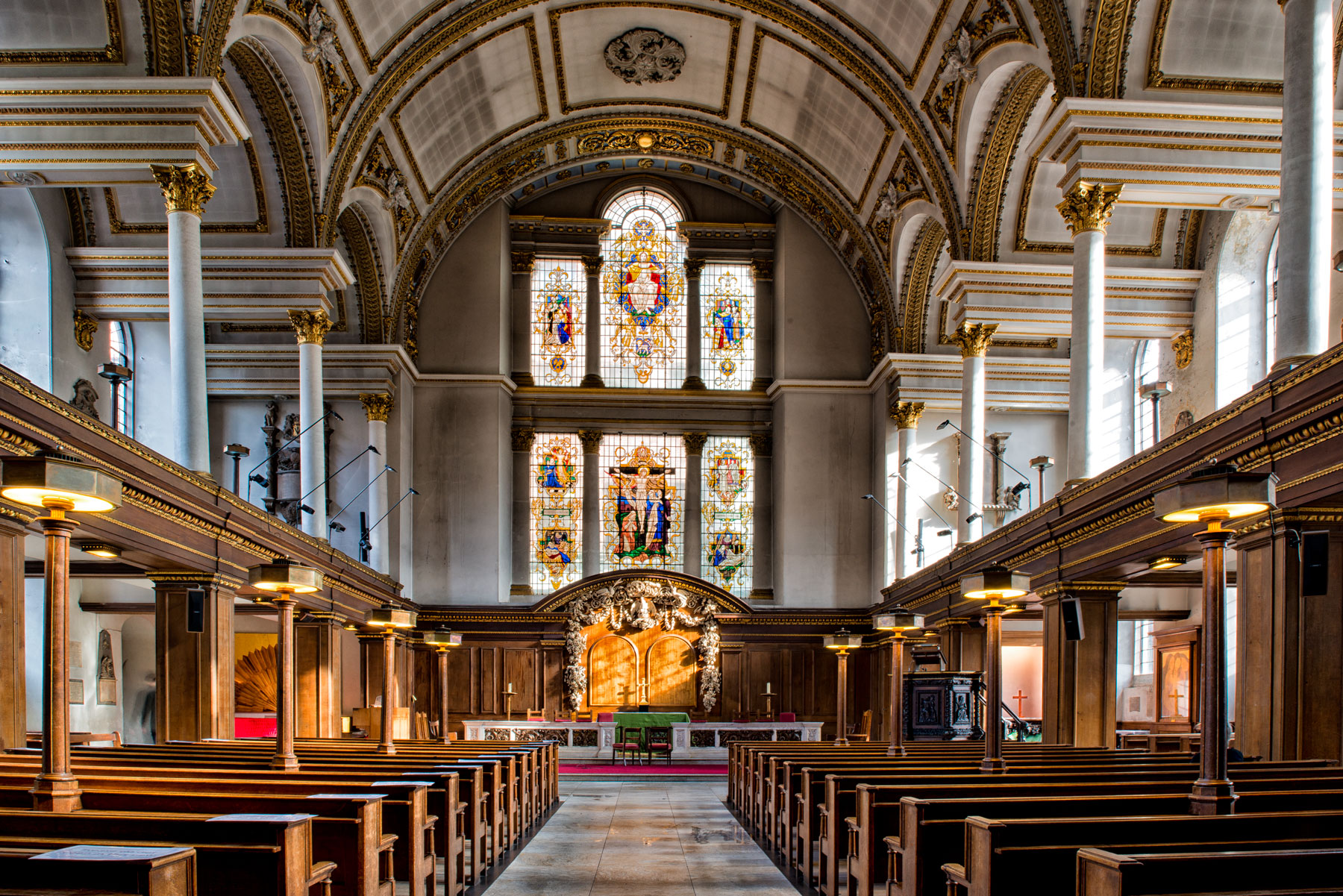
St James's Church, Piccadilly, also known as St James's Church, Westminster, and St James-in-the-Fields, is an Anglican church on Piccadilly in the centre of London, United Kingdom. The church was designed and built by Sir Christopher Wren. The church is built of red brick with Portland stone dressings. Its interior has galleries on three sides supported by square pillars and the nave has a barrel vault supported by Corinthian columns. The carved marble font and limewood reredos are both notable examples of the work of Grinling Gibbons. In 1902, an outside pulpit was erected on the north wall of the church. It was designed by Temple Moore and carved by Laurence Arthur Turner. It was damaged in 1940, but restored at the same time as the rest of the fabric. History In 1662, Henry Jermyn, 1st Earl of St Albans, was granted land for residential development on what was then the outskirts of London. He set aside land for the building of a parish church and churchyard on the so ... [...More Info...] [...Related Items...] OR: [Wikipedia] [Google] [Baidu] |
Burlington House
Burlington House is a building on Piccadilly in Mayfair, London. It was originally a private Neo-Palladian mansion owned by the Earls of Burlington and was expanded in the mid-19th century after being purchased by the British government. Today, the Royal Academy and five learned societies occupy much of the building. History The house was one of the earliest of a number of very large private residences built on the north side of Piccadilly, previously a country lane, from the 1660s onwards. The first version was begun by Sir John Denham in about 1664. It was a red-brick double-pile hip-roofed mansion with a recessed centre, typical of the style of the time, or perhaps even a little old fashioned. Denham may have acted as his own architect, or he may have employed Hugh May, who certainly became involved in the construction after the house was sold in an incomplete state in 1667 to Richard Boyle, 1st Earl of Burlington, from whom it derives its name. Burlington had the hou ... [...More Info...] [...Related Items...] OR: [Wikipedia] [Google] [Baidu] |
Mayfair
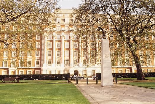
Mayfair is an affluent area in the West End of London towards the eastern edge of Hyde Park, in the City of Westminster, between Oxford Street, Regent Street, Piccadilly and Park Lane. It is one of the most expensive districts in the world. The area was originally part of the manor of Eia and remained largely rural until the early 18th century. It became well known for the annual "May Fair" that took place from 1686 to 1764 in what is now Shepherd Market. Over the years, the fair grew increasingly downmarket and unpleasant, and it became a public nuisance. The Grosvenor family (who became Dukes of Westminster) acquired the land through marriage and began to develop it under the direction of Thomas Barlow. The work included Hanover Square, Berkeley Square and Grosvenor Square, which were surrounded by high-quality houses, and St George's Hanover Square Church. By the end of the 18th century, most of Mayfair was built on with upper-class housing; unlike some nearby areas ... [...More Info...] [...Related Items...] OR: [Wikipedia] [Google] [Baidu] |
St James's
St James's is a central district in the City of Westminster, London, forming part of the West End. In the 17th century the area developed as a residential location for the British aristocracy, and around the 19th century was the focus of the development of gentlemen's clubs. Once part of the parish of St Martin in the Fields, much of it formed the parish of St James from 1685 to 1922. Since the Second World War the area has transitioned from residential to commercial use. St James's is bounded to the north by Piccadilly and Mayfair, to the west by Green Park, to the south by The Mall bounding St. James's Park, and to the east by Haymarket. History Toponymy The area's name is derived from the dedication of a 12th-century leper hospital to Saint James the Less. The hospital site is now occupied by St James's Palace. The area became known as "Clubland" because of the historic presence of gentlemen's clubs. The section of Regent Street (colloquially known as 'Lower Regent S ... [...More Info...] [...Related Items...] OR: [Wikipedia] [Google] [Baidu] |
Devonshire House
Devonshire House in Piccadilly, was the London townhouse of the Dukes of Devonshire during the 18th and 19th centuries. Following a fire in 1733 it was rebuilt by William Cavendish, 3rd Duke of Devonshire, in the Palladian style, to designs by William Kent. Completed circa 1740, it stood empty after the First World War and was demolished in 1924. Many of Britain's great noblemen maintained large London houses that bore their names. As a ducal house (only in mainland Europe were such houses referred to as palaces), Devonshire House was one of the largest and grandest, ranking alongside Burlington House, Montague House, Lansdowne House, Londonderry House, Northumberland House, and Norfolk House. All of these have long been demolished, except Burlington and Lansdowne, both of which have been substantially altered. Today the site is occupied by a namesake modern office building. The site Devonshire House occupied the site of Berkeley House, which was built between 1665 and 16 ... [...More Info...] [...Related Items...] OR: [Wikipedia] [Google] [Baidu] |
Berkeley House, London
Devonshire House in Piccadilly, was the London townhouse of the Dukes of Devonshire during the 18th and 19th centuries. Following a fire in 1733 it was rebuilt by William Cavendish, 3rd Duke of Devonshire, in the Palladian style, to designs by William Kent. Completed circa 1740, it stood empty after the First World War and was demolished in 1924. Many of Britain's great noblemen maintained large London houses that bore their names. As a ducal house (only in mainland Europe were such houses referred to as palaces), Devonshire House was one of the largest and grandest, ranking alongside Burlington House, Montague House, Lansdowne House, Londonderry House, Northumberland House, and Norfolk House. All of these have long been demolished, except Burlington and Lansdowne, both of which have been substantially altered. Today the site is occupied by a namesake modern office building. The site Devonshire House occupied the site of Berkeley House, which was built between 1665 and 1 ... [...More Info...] [...Related Items...] OR: [Wikipedia] [Google] [Baidu] |
Westminster St James
Westminster St James (or St James Piccadilly) was a civil parish in the metropolitan area of London, England. The creation of the parish followed the building of the Church of St James, Piccadilly, in 1684. After several failed attempts, the parish was formed in 1685 from part of the ancient parish of St Martin in the Fields in the Liberty of Westminster and county of Middlesex. It included part of the West End of London, taking in sections of Soho, Mayfair and St James's. Civil parish administration was in the hands of a select vestry until the parish adopted the Vestries Act 1831. The vestry was reformed again in 1855 by the Metropolis Management Act. In 1889 the parish became part of the County of London and the vestry was abolished in 1900, replaced by Westminster City Council. The parish continued to have nominal existence until 1922. Creation There were attempts in 1664, 1668 and 1670 to create a new parish, with its own church, from the area of the bailiwick of St Jam ... [...More Info...] [...Related Items...] OR: [Wikipedia] [Google] [Baidu] |
Hyde Park Corner
Hyde Park Corner is between Knightsbridge, Belgravia and Mayfair in London, England. It primarily refers to its major road junction at the southeastern corner of Hyde Park, that was designed by Decimus Burton. Six streets converge at the junction: Park Lane (from the north), Piccadilly (northeast), Constitution Hill (southeast), Grosvenor Place (south), Grosvenor Crescent (southwest) and Knightsbridge (west). Hyde Park Corner tube station served by the Piccadilly line has many accessways around the junction as do its notable monuments. Immediately to the north of the junction is Apsley House, the home of the first Duke of Wellington; several monuments to the Duke stand in the vicinity, some installed during his lifetime, and others subsequently. Creation by Decimus Burton Central London parks During the second half of the 1820s, the Commissioners of Woods and Forests and the King resolved that Hyde Park, and the area around it, must be renovated to the extent of th ... [...More Info...] [...Related Items...] OR: [Wikipedia] [Google] [Baidu] |
A4 Road (England)
The A4 is a major road in England from Central London to Avonmouth via Heathrow Airport, Reading, Bath and Bristol. It is historically known as the Bath Road with newer sections including the Great West Road and Portway. The road was once the main route from London to Bath, Bristol and the west of England and formed, after the A40, the second main western artery from London. Although most traffic is carried by the M4 motorway today, the A4 still acts as the main route from Bristol to London for non-motorway traffic. History Turnpikes The A4 has gone through many transformations through the ages from pre-Roman routes, Roman roads (such as the one passing Silbury Hill), and basic wagon tracks. During the Middle Ages, most byways and tracks served to connect villages with their nearest market town. A survey of Savernake Forest near Hungerford in 1228 mentions "The King's Street" running between the town and Marlborough. This street corresponded roughly with the route of ... [...More Info...] [...Related Items...] OR: [Wikipedia] [Google] [Baidu] |
Earl's Court
Earl's Court is a district of Kensington in the Royal Borough of Kensington and Chelsea in West London, bordering the rail tracks of the West London line and District line that separate it from the ancient borough of Fulham to the west, the sub-districts of South Kensington to the east, Chelsea to the south and Kensington to the northeast. It lent its name to the now defunct eponymous pleasure grounds opened in 1887 followed by the pre–World War II Earls Court Exhibition Centre, as one of the country's largest indoor arenas and a popular concert venue, until its closure in 2014. In practice, the notion of Earl's Court, which is geographically confined to the SW5 postal district, tends to apply beyond its boundary to parts of the neighbouring Fulham area with its SW6 and W14 postcodes to the west, and to adjacent streets in postcodes SW7, SW10 and W8 in Kensington and Chelsea. Earl's Court is also an electoral ward of the local authority, Kensington and Chelsea London ... [...More Info...] [...Related Items...] OR: [Wikipedia] [Google] [Baidu] |
Royal Academy Of Arts
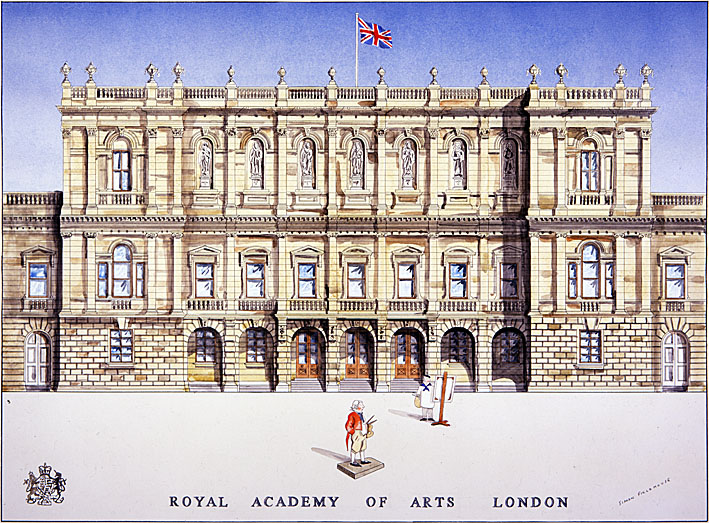
The Royal Academy of Arts (RA) is an art institution based in Burlington House on Piccadilly in London. Founded in 1768, it has a unique position as an independent, privately funded institution led by eminent artists and architects. Its purpose is to promote the creation, enjoyment and appreciation of the visual arts through exhibitions, education and debate. History The origin of the Royal Academy of Arts lies in an attempt in 1755 by members of the Society for the Encouragement of Arts, Manufactures and Commerce, principally the sculptor Henry Cheere, to found an autonomous academy of arts. Prior to this a number of artists were members of the Society for the Encouragement of Arts, Manufactures and Commerce, including Cheere and William Hogarth, or were involved in small-scale private art academies, such as the St Martin's Lane Academy. Although Cheere's attempt failed, the eventual charter, called an 'Instrument', used to establish the Royal Academy of Arts over a d ... [...More Info...] [...Related Items...] OR: [Wikipedia] [Google] [Baidu] |
Green Park
Green Park, officially The Green Park, is one of the Royal Parks of London. It is in the southern part – the core part – of the City of Westminster, Central London, but before that zone was extended to the north, to take in Marylebone and Paddington it lay in its north-centre. It is north of the gardens and the semi-circular forecourt of Buckingham Palace. First enclosed in the 16th century, it was landscaped in 1820 and is notable among central London parks for having no lakes or buildings, and only minimal flower planting in the form of naturalised narcissus. Description and surroundings Green Park covers just over between Hyde Park and St. James's Park. Together with Kensington Gardens and the gardens of Buckingham Palace, these parks form an almost unbroken stretch of tended green land. This combined parkland is mostly bounded on the four cardinal compass points by Horse Guards Parade or adjoining Downing Street (east); the Victoria/Belgravia district (south) ... [...More Info...] [...Related Items...] OR: [Wikipedia] [Google] [Baidu] |


