|
Mount Orient
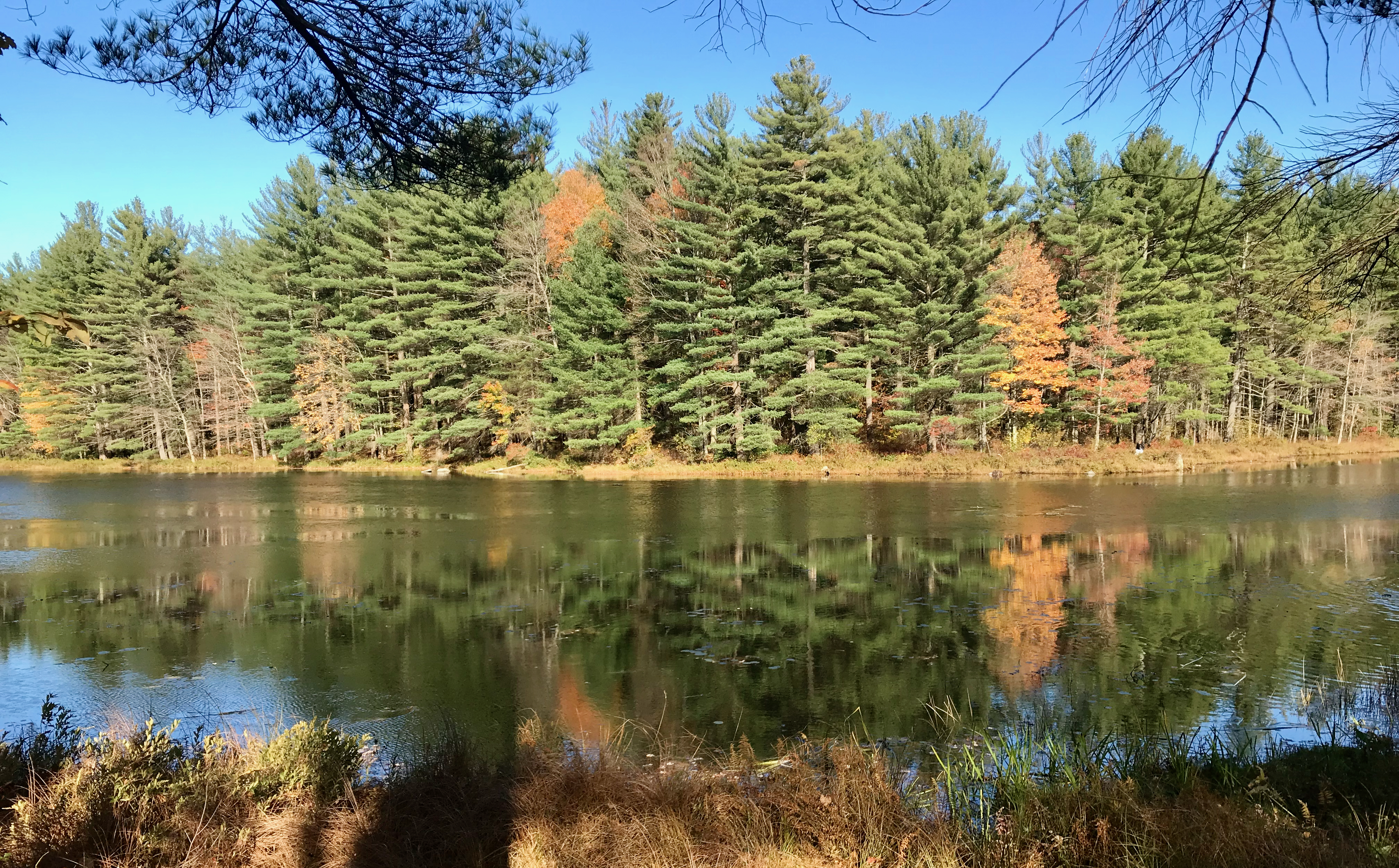
Mount Orient, , is a south-facing high point on an upland plateau overlooking the Connecticut River Valley in Pelham, Massachusetts (near Amherst, Massachusetts). Although the summit is wooded, a lower, south-facing ledge of exfoliating metamorphic rock provides views of the Holyoke Range and the east-central Pioneer Valley. Both the Metacomet-Monadnock Trail The Metacomet-Monadnock Trail (M&M Trail) is a hiking trail that traverses the Metacomet Ridge of the Pioneer Valley region of Massachusetts and the central uplands of Massachusetts and southern New Hampshire. Although less than from Boston and ... and the Robert Frost Trail (Massachusetts) traverse Mount Orient. The ledge is a popular hiking destination among college students and residents of nearby Amherst. Easiest access is via the Amethyst Brook Conservation Area parking lot on Pelham Road in east Amherst. Mount Orient drains into Heatherstone Brook and Amethyst Brook, thence into Fort River, the Connecticut River, ... [...More Info...] [...Related Items...] OR: [Wikipedia] [Google] [Baidu] |
Hampshire County, Massachusetts
Hampshire County is a historical and judicial county located in the U.S. state of Massachusetts. Following the dissolution of the county government in 1999, county affairs were managed by the Hampshire Council of Governments, which itself ceased operations in 2019, due to a "fundamentally flawed, unsustainable operational model". As of the 2020 census, the population was 162,308. Its most populous municipality is Amherst, its largest town in terms of landmass is Belchertown, and its traditional county seat is Northampton. The county is named after the county Hampshire, in England. Hampshire County is part of the Springfield, MA Metropolitan Statistical Area. Together with Hampden County, Hampshire County municipalities belong to the Pioneer Valley Planning Commission. History Hampshire County was constituted in 1662 from previously unorganized territory comprising the entire western part of Massachusetts Bay Colony. It included the original towns of Springfield, Northampto ... [...More Info...] [...Related Items...] OR: [Wikipedia] [Google] [Baidu] |
Metacomet-Monadnock Trail
The Metacomet-Monadnock Trail (M&M Trail) is a hiking trail that traverses the Metacomet Ridge of the Pioneer Valley region of Massachusetts and the central uplands of Massachusetts and southern New Hampshire. Although less than from Boston and other large population centers, the trail is considered remarkably rural and scenic and includes many areas of unique ecologic, historic, and geologic interest. Notable features include waterfalls, dramatic cliff faces, exposed mountain summits, woodlands, swamps, lakes, river floodplain, farmland, significant historic sites, and the summits of Mount Monadnock, Mount Tom and Mount Holyoke.''The Metacomet-Monadnock Trail Guide,'' 10th edition. (2005). Amherst, Massachusetts: Appalachian Mountain Club. The Metacomet-Monadnock Trail is maintained largely through the efforts of the Berkshire Chapter of the Appalachian Mountain Club (AMC). Much of the trail (but not all) is a portion of the New England National Scenic Trail. Trail descriptio ... [...More Info...] [...Related Items...] OR: [Wikipedia] [Google] [Baidu] |
Mountains Of Hampshire County, Massachusetts
A mountain is an elevated portion of the Earth's crust, generally with steep sides that show significant exposed bedrock. Although definitions vary, a mountain may differ from a plateau in having a limited summit area, and is usually higher than a hill, typically rising at least 300 metres (1,000 feet) above the surrounding land. A few mountains are isolated summits, but most occur in mountain ranges. Mountains are formed through tectonic forces, erosion, or volcanism, which act on time scales of up to tens of millions of years. Once mountain building ceases, mountains are slowly leveled through the action of weathering, through slumping and other forms of mass wasting, as well as through erosion by rivers and glaciers. High elevations on mountains produce colder climates than at sea level at similar latitude. These colder climates strongly affect the ecosystems of mountains: different elevations have different plants and animals. Because of the less hospitable terrain ... [...More Info...] [...Related Items...] OR: [Wikipedia] [Google] [Baidu] |
Millicent Todd Bingham
Millicent Todd Bingham (1880–1968), was an American geographer and the first woman to receive a doctorate in geology and geography from Harvard. She was also a leading expert on the poet Emily Dickinson. Biography Born Millicent Todd on February 5, 1880, in Washington, D.C., she was the only child of highly accomplished parents, astronomer David Peck Todd and writer and editor Mabel Loomis Todd. Millicent attended Mrs. Stearns' School in Amherst, Massachusetts, and Miss Hersey's School for Girls in Boston, founded by Heloise Hersey, before beginning her university studies at Vassar College, Poughkeepsie, New York, where she was awarded a B.A. in liberal arts in 1902. For a short time, she became an instructor of French, first at Vassar (1902-1904) and then at Wellesley College (1906-1907). During her years of travels with her family, she studied at the Sorbonne, University of Paris (1905-1906), and at the University of Berlin (1909-1910). After returning to Massachusetts ... [...More Info...] [...Related Items...] OR: [Wikipedia] [Google] [Baidu] |
Mabel Loomis Todd
Mabel Loomis Todd or Mabel Loomis (November 10, 1856 – October 14, 1932) was an American editor and writer. She is remembered as the editor of posthumously published editions of Emily Dickinson and also wrote several novels and logs of her travel with her husband, astronomer David Peck Todd. Todd's relationship to the Dickinson family was complicated. She had a lengthy affair with Emily's married older brother William Austin Dickinson. In preparing Emily's poetry for publication, which was also marred by family controversies, she freely edited and adapted the writing to suit her own style. Biography She was born Mabel Loomis on November 10, 1856, the daughter of Mary Alden Wilder and Eben Jenks Loomis. Though her family traced its lineage to such New England luminaries as Priscilla Alden, they led financially difficult lives and Mabel spent much of her childhood in boardinghouses in Cambridge, Massachusetts, Concord, Massachusetts, and Washington, D.C. She graduated from ... [...More Info...] [...Related Items...] OR: [Wikipedia] [Google] [Baidu] |
Long Island Sound
Long Island Sound is a marine sound and tidal estuary of the Atlantic Ocean. It lies predominantly between the U.S. state of Connecticut to the north and Long Island in New York to the south. From west to east, the sound stretches from the East River in New York City, along the North Shore of Long Island, to Block Island Sound. A mix of freshwater from tributaries and saltwater from the ocean, Long Island Sound is at its widest point and varies in depth from . Shoreline Major Connecticut cities on the Sound include Stamford, Norwalk, Bridgeport, New Haven, and New London. Cities on the New York side of the Sound include Rye, Glen Cove, New Rochelle, Larchmont and portions of Queens and the Bronx in New York City. Climate and geography The climate of Long Island Sound is warm temperate or Cfa in the Köppen climate classification. Summers are hot and humid often with convective showers and strong sunshine, while the cooler months feature cold temperatures and a mix ... [...More Info...] [...Related Items...] OR: [Wikipedia] [Google] [Baidu] |
Connecticut River
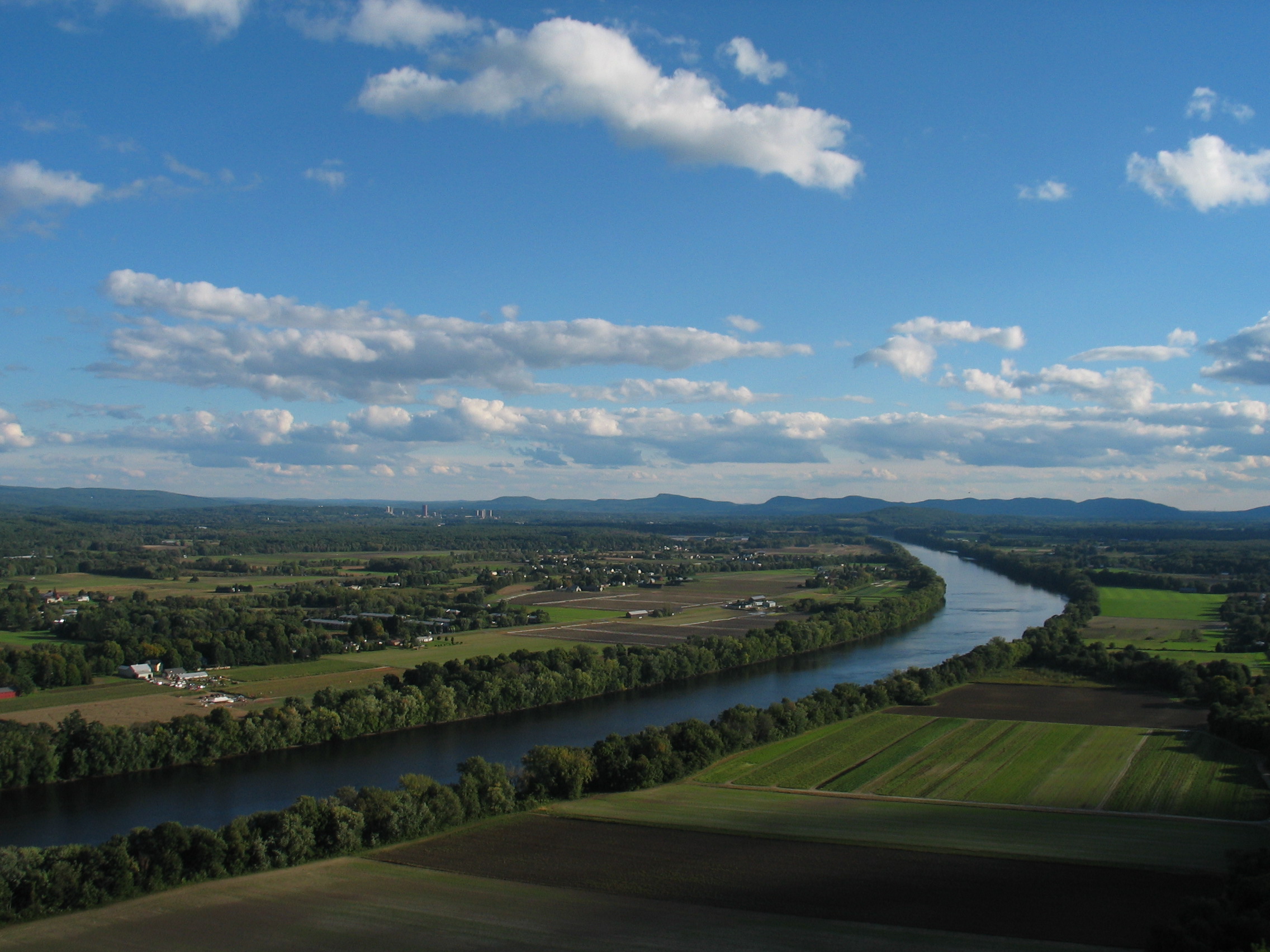
The Connecticut River is the longest river in the New England region of the United States, flowing roughly southward for through four states. It rises 300 yards (270 m) south of the U.S. border with Quebec, Canada, and discharges at Long Island Sound. Its watershed encompasses , covering parts of five U.S. states and one Canadian province, via 148 tributaries, 38 of which are major rivers. It produces 70% of Long Island Sound's fresh water, discharging at per second. The Connecticut River Valley is home to some of the northeastern United States' most productive farmland, as well as the Hartford–Springfield Knowledge Corridor, a metropolitan region of approximately two million people surrounding Springfield, Massachusetts, and Hartford, Connecticut. History The word "Connecticut" is a corruption of the Mohegan word ''quinetucket'', which means "beside the long, tidal river". The word came into English during the early 1600s to name the river, which was also called simply " ... [...More Info...] [...Related Items...] OR: [Wikipedia] [Google] [Baidu] |
Robert Frost Trail (Massachusetts)
The Robert Frost Trail is a long footpath that passes through the eastern Connecticut River Valley of Massachusetts. The trail runs from the Connecticut River in South Hadley, Massachusetts to Ruggles Pond in Wendell State Forest, through both Hampshire and Franklin County and includes a number of scenic features such as the Holyoke Range, Mount Orient, Puffer's Pond, and Mount Toby.''A Guide to the Robert Frost Trail'' (2004). Amherst, Massachusetts: Amherst Conservation Department. The trail is named after the poet Robert Frost, who lived and taught in the area from 1916 to 1938. Trail description Although only 47 miles long, the Robert Frost Trail takes in a diverse patchwork of habitats, terrain, and scenery. The trail traverses trap rock Metacomet Ridge with its microclimate ecosystems; wetland habitat; ponds; farmland; deep ravines; wooded ledges; river banks; reservoirs; historic mill ponds; and dense forests. One segment of the trail follows a narrow greenway that s ... [...More Info...] [...Related Items...] OR: [Wikipedia] [Google] [Baidu] |
Pioneer Valley
The Pioneer Valley is the colloquial and promotional name for the portion of the Connecticut River Valley that is in Massachusetts in the United States. It is generally taken to comprise the three counties of Hampden, Hampshire, and Franklin. The lower Pioneer Valley corresponds to the Springfield, Massachusetts metropolitan area, the region's urban center, and the seat of Hampden County. The upper Pioneer Valley region includes the smaller cities of Northampton and Greenfield, the county seats of Hampshire and Franklin counties, respectively. Historically the northern part of the Valley was an agricultural region, known for growing Connecticut shade tobacco and other specialty crops like Hadley asparagus; however, since the late 19th century its economy has become increasingly a knowledge economy, due to the prominence of the Five Colleges in Hampshire County. Similarly the Springfield- Chicopee-Holyoke economies transformed from volume producers of goods such as pa ... [...More Info...] [...Related Items...] OR: [Wikipedia] [Google] [Baidu] |
Metamorphic Rock
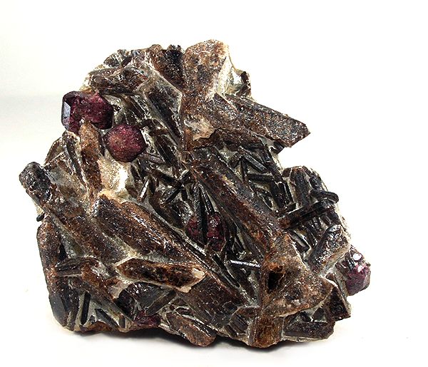
Metamorphic rocks arise from the transformation of existing rock to new types of rock in a process called metamorphism. The original rock ( protolith) is subjected to temperatures greater than and, often, elevated pressure of or more, causing profound physical or chemical changes. During this process, the rock remains mostly in the solid state, but gradually recrystallizes to a new texture or mineral composition. The protolith may be an igneous, sedimentary, or existing metamorphic rock. Metamorphic rocks make up a large part of the Earth's crust and form 12% of the Earth's land surface. They are classified by their protolith, their chemical and mineral makeup, and their texture. They may be formed simply by being deeply buried beneath the Earth's surface, where they are subject to high temperatures and the great pressure of the rock layers above. They can also form from tectonic processes such as continental collisions, which cause horizontal pressure, friction, and dis ... [...More Info...] [...Related Items...] OR: [Wikipedia] [Google] [Baidu] |
Holyoke Range
The Holyoke Range or Mount Holyoke Range is a traprock mountain range located in the Connecticut River Valley of Massachusetts. It is a sub-range of the narrow, linear Metacomet Ridge that extends from Long Island Sound near New Haven, Connecticut north through the Connecticut River Valley of Massachusetts to the Vermont border. A popular hiking destination, the range is known for its anomalous east–west orientation, high ledges and its scenic character. It is also notable for its unique microclimate ecosystems and rare plant communities, as well as significant historic sites, such as the Mount Holyoke Summit House and the Horse Caves.Farnsworth, Elizabeth J"Metacomet-Mattabesett Trail Natural Resource Assessment." (2004). PDF file. Retrieved November 20, 2007. Retrieved December 10, 2007 Holyoke Range vs. Mount Holyoke Range Both ...[...More Info...] [...Related Items...] OR: [Wikipedia] [Google] [Baidu] |
Metamorphic Rock
Metamorphic rocks arise from the transformation of existing rock to new types of rock in a process called metamorphism. The original rock ( protolith) is subjected to temperatures greater than and, often, elevated pressure of or more, causing profound physical or chemical changes. During this process, the rock remains mostly in the solid state, but gradually recrystallizes to a new texture or mineral composition. The protolith may be an igneous, sedimentary, or existing metamorphic rock. Metamorphic rocks make up a large part of the Earth's crust and form 12% of the Earth's land surface. They are classified by their protolith, their chemical and mineral makeup, and their texture. They may be formed simply by being deeply buried beneath the Earth's surface, where they are subject to high temperatures and the great pressure of the rock layers above. They can also form from tectonic processes such as continental collisions, which cause horizontal pressure, friction, and dis ... [...More Info...] [...Related Items...] OR: [Wikipedia] [Google] [Baidu] |


