|
Manavgat
Manavgat is a city in the district of the Antalya Province in Turkey, from the city of Antalya. The Manavgat River has a waterfall near the city. The population of the district is 242,490 (2020 census). Geography Between the Taurus Mountains to the north, and the sandy beaches of the Mediterranean coast, much of the district is surrounded by a flat plain. This is mostly fertile farmland and agriculture is well-developed in Manavgat, keeping livestock and growing crops including grains, sesame and many fruits and vegetables; in recent years olives have also been planted. There is no industry except for food-processing, so apart from agriculture the local economy depends on tourism. The mountains are covered with forests and typical Mediterranean shrubs, there are small plains higher in the mountains too, traditionally used for summer grazing by the yörük nomads. Manavgat has a Mediterranean climate of hot, dry summers and warm, wet winters; the temperature rarely drops to ... [...More Info...] [...Related Items...] OR: [Wikipedia] [Google] [Baidu] |
Manavgat 560DSC 0225 (48104165062)
Manavgat is a city in the district of the Antalya Province in Turkey, from the city of Antalya. The Manavgat River has a waterfall near the city. The population of the district is 242,490 (2020 census). Geography Between the Taurus Mountains to the north, and the sandy beaches of the Mediterranean coast, much of the district is surrounded by a flat plain. This is mostly fertile farmland and agriculture is well-developed in Manavgat, keeping livestock and growing crops including grains, sesame and many fruits and vegetables; in recent years olives have also been planted. There is no industry except for food-processing, so apart from agriculture the local economy depends on tourism. The mountains are covered with forests and typical Mediterranean shrubs, there are small plains higher in the mountains too, traditionally used for summer grazing by the yörük nomads. Manavgat has a Mediterranean climate of hot, dry summers and warm, wet winters; the temperature rarely drops to fre ... [...More Info...] [...Related Items...] OR: [Wikipedia] [Google] [Baidu] |
Manavgat River
Manavgat River originates on the eastern slopes of Western Taurus Mountains in Turkey. In ancient times it was called Melas ( grc, Μέλας). At an elevation of 1,350 m, the outflow of several small springs joins together to become the headwaters of the Manavgat. The largest of these springs is called Dumanli, whose name means "place where there is fog", because of the dense mist that forms above the spring. In addition to the springs from the Taurus Mountains, the Manavgat is also fed underground from large lakes to the north of the mountains, on the Anatolian Plateau. Pliny the Elder considered that the river was the boundary between ancient Pamphylia and Cilicia. From there, the river flows south over conglomerated strata for about 90 km, descending through a series of canyons. Finally, it washes over the Manavgat Waterfall and through the coastal plain and into the Mediterranean Sea. There are many caves in the river watershed area, the most interesting being the Altın ... [...More Info...] [...Related Items...] OR: [Wikipedia] [Google] [Baidu] |
Manavgat Waterfall (1) Red
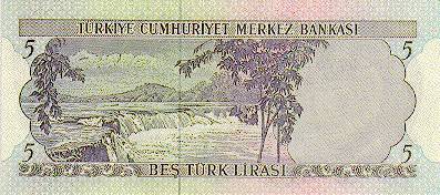
Manavgat Waterfall on the Manavgat River is near the city of Side, north of Manavgat, Turkey. Its high flow over a wide area as it falls from a low height is best viewed from a high altitude. The white, foaming water of the Manavgat Waterfalls flows powerfully over the rocks. Near the waterfalls are shady tea gardens providing a pleasant resting place. The Oymapinar Dam is located to the north of the river. During floods, the Manavgat Falls may disappear under high water. The waterfall was depicted on the reverse of the Turkish 5 lira Lira is the name of several currency units. It is the current currency of Turkey and also the local name of the currencies of Lebanon and of Syria. It is also the name of several former currencies, including those of Italy, Malta and Israe ... banknotes of 1968-1983. [...More Info...] [...Related Items...] OR: [Wikipedia] [Google] [Baidu] |
Manavgat Waterfall
Manavgat Waterfall on the Manavgat River is near the city of Side, north of Manavgat, Turkey. Its high flow over a wide area as it falls from a low height is best viewed from a high altitude. The white, foaming water of the Manavgat Waterfalls flows powerfully over the rocks. Near the waterfalls are shady tea gardens providing a pleasant resting place. The Oymapinar Dam is located to the north of the river. During floods, the Manavgat Falls may disappear under high water. The waterfall was depicted on the reverse of the Turkish 5 lira Lira is the name of several currency units. It is the current currency of Turkey and also the local name of the currencies of Lebanon and of Syria. It is also the name of several former currencies, including those of Italy, Malta and Israe ... banknotes of 1968-1983. [...More Info...] [...Related Items...] OR: [Wikipedia] [Google] [Baidu] |
Antalya Province
Antalya Province ( tr, ) is located on the Mediterranean coast of south-west Turkey, between the Taurus Mountains and the Mediterranean Sea. Antalya Province is the centre of Turkey's tourism industry, attracting 30% of foreign tourists visiting Turkey. Its capital city of the same name was the world's third most visited city by number of international arrivals in 2011, displacing New York. Antalya is Turkey's biggest international sea resort. The province of Antalya corresponds to the lands of ancient Pamphylia to the east and Lycia to the west. It features a shoreline of with beaches, ports, and ancient cities scattered throughout, including the World Heritage Site Xanthos. The provincial capital is Antalya city with a population of 1,344,000. Antalya is the fastest-growing province in Turkey; with a 4.17% yearly population growth rate between years 1990–2000, compared with the national rate of 1.83%. This growth is due to a fast rate of urbanization, particularly ... [...More Info...] [...Related Items...] OR: [Wikipedia] [Google] [Baidu] |
Ilıca, Manavgat
Ilıca is a small town 3 km inland from the beach resort of Kumköy, near Side, on the "Turkish Riviera". The centre of Ilıca has a rural village character with old stone houses built around a central square. There are a handful of small shops, a small park, a teahouse, a weekly open market, primary school and the inevitable football ground. To be here Arslan Zeki Demirci Sports Complex Arslan Zeki Demirci Sports Complex ( tr, Arslan Zeki Demirci Spor Kompleksi), also known as Emirhan Sport Center or Emirhan Sport Complex, is a sports venue in Manavgat district of Antalya Province, southern Turkey. The sports complex is part of Em .... Populated places in Antalya Province Manavgat District Towns in Turkey {{Antalya-geo-stub ... [...More Info...] [...Related Items...] OR: [Wikipedia] [Google] [Baidu] |
Side, Turkey
Side is a city on the southern Mediterranean coast of Turkey. It includes the modern resort town and the ruins of the ancient city of Side, one of the best-known classical sites in the country. It lies near Manavgat and the village of Selimiye, 78 km from Antalya in the province of Antalya. It is located on the eastern part of the Pamphylian coast, which lies about 20 km east of the mouth of the Eurymedon River. Today, as in antiquity, the ancient city is situated on a small north-south peninsula about 1 km long and 400 m across. History Pseudo-Scylax, Strabo and Arrian record that Side was founded by Greek settlers from Cyme in Aeolis, a region of western Anatolia. This most likely occurred in the 7th century BC. A basalt column base from the 7th century BC found in the excavations and attributable to the Neo-Hittites is evidence of the site's early history. Possessing a good harbour for small craft, Side's natural geography made it one of the most imp ... [...More Info...] [...Related Items...] OR: [Wikipedia] [Google] [Baidu] |
Cities In Turkey
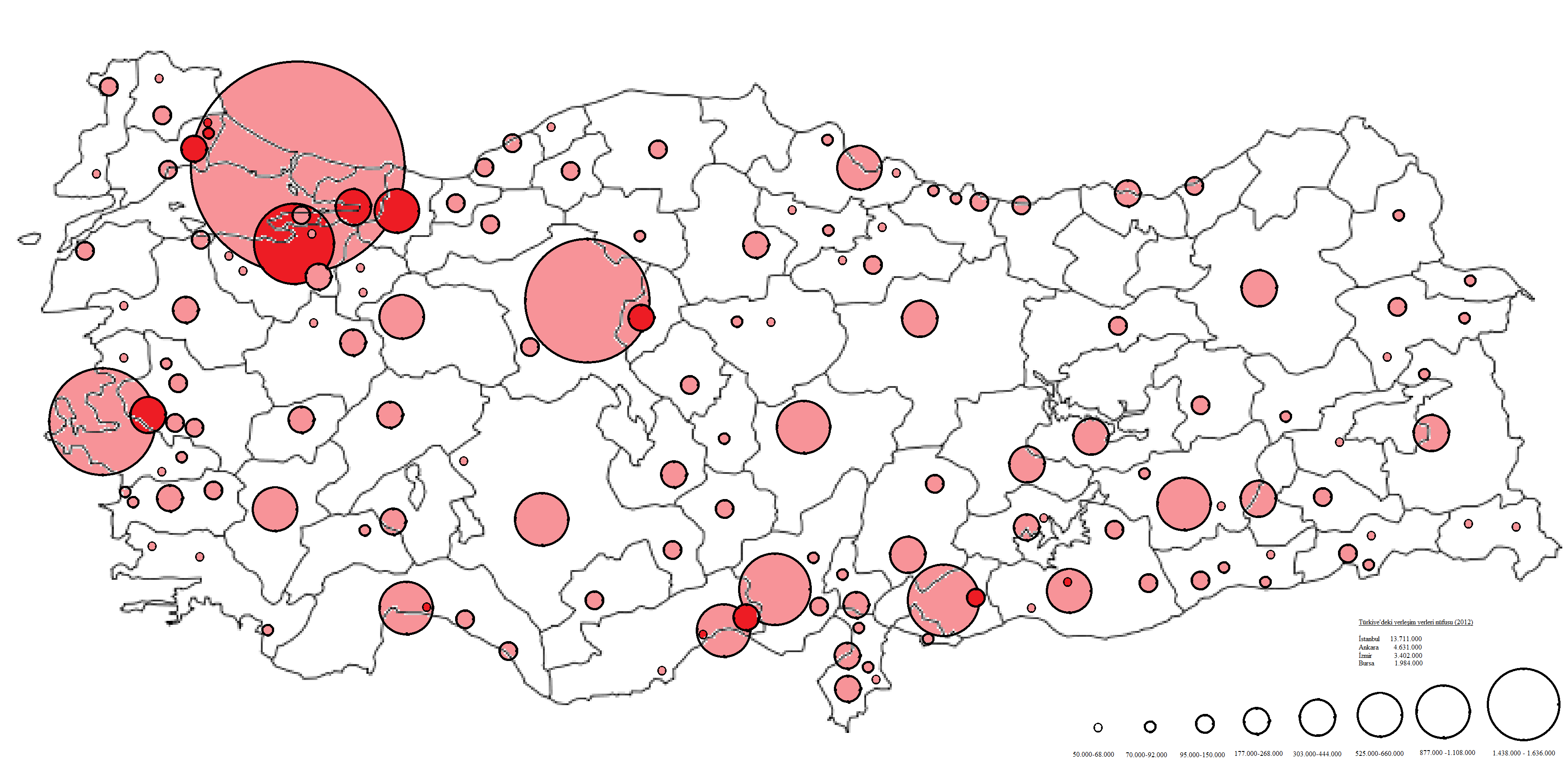
This is a list of cities and towns in Turkey by population, which includes cities and towns that are provincial capitals or have a population of at least 7,000. The total population of Turkey is 84,680,273 according to the 2020 estimate, making it the 17th most populated country in the world. *Istanbul, Turkey's economic and cultural capital is the largest city with a population of 15.84 million in its metropolitan area as of 2021. *Ankara, the capital of Turkey and Turkey's second largest city has a population of 5.7 million in its metropolitan area as of 2021. * Izmir, Turkey's third largest city has a population of over 4.3 million in its metropolitan area as of 2019. *Bursa, Turkey's fourth largest city has a population of over 3.1 million in its metropolitan area as of 2021. *Antalya, Turkey's fifth-largest city has a population of 2.6 million in its metropolitan area as of 2019. Cities and towns with more than 7,000 inhabitants Cities and Towns with a population of over ... [...More Info...] [...Related Items...] OR: [Wikipedia] [Google] [Baidu] |
Taurus Mountains
The Taurus Mountains ( Turkish: ''Toros Dağları'' or ''Toroslar'') are a mountain complex in southern Turkey, separating the Mediterranean coastal region from the central Anatolian Plateau. The system extends along a curve from Lake Eğirdir in the west to the upper reaches of the Euphrates and Tigris rivers in the east. It is a part of the Alpide belt in Eurasia. Etymology The mountain range under the current name was mentioned in ''The Histories'' by Polybius as Ταῦρος (''Taûros''). Heinrich Kiepert writes in ''Lehrbuch der alten Geographie'' that the name was borrowed into Ancient Greek from the Semitic ( Old Aramaic) root טורא ''ṭūrā'', meaning "mountain". Geography The Taurus mountains are divided into three chains from west to east as follows; * Western Taurus (Batı Toroslar) *Central Taurus (Orta Toroslar) *Southeastern Taurus (Güneydoğu Toroslar) Western Taurus The Western Taurus Mountains form an arc around the Gulf of Antalya. It inclu ... [...More Info...] [...Related Items...] OR: [Wikipedia] [Google] [Baidu] |
Seleucia (Pamphylia)
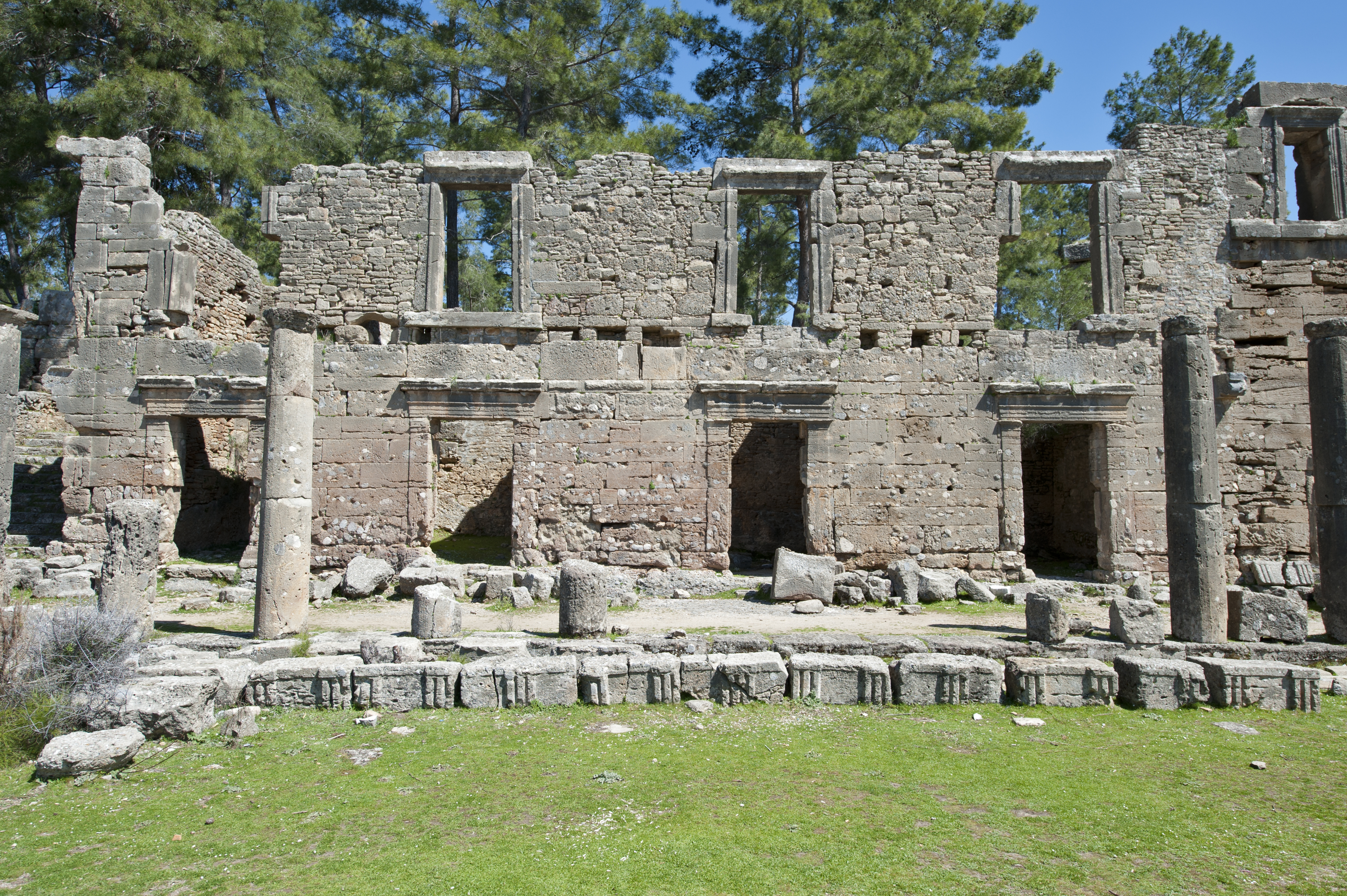
Seleucia ( el, Σελεύκεια – also transliterated as Seleukeia) was originally an ancient Greek city on the Mediterranean coast of Pamphylia, in Anatolia, approximately 15 km northeast of Side; the site is about 1 km north of the village of Bucakşeyhler (also Bucakşıhler), approximately 12 km northeast of Manavgat, Antalya Province, Turkey. Modern scholars, however, place Pamphylian Seleucia near Şıhlar, north of the mouth of the Peri Su, west of Side. and the remains at this location are rather considered those of Lyrba. Another name for the city in the Middle Ages was Scandalor, which was documented on portolan maps. It is situated on a hilltop with steep escarpments on several sides making a strong defensive position. The Site There are remains of an agora containing a row of two-storey and three-storey building façades, a gate, a mausoleum, a Roman bath, a necropolis A necropolis (plural necropolises, necropoles, necropoleis, nec ... [...More Info...] [...Related Items...] OR: [Wikipedia] [Google] [Baidu] |
Antalya
la, Attalensis grc, Ἀτταλειώτης , postal_code_type = Postal code , postal_code = 07xxx , area_code = (+90) 242 , registration_plate = 07 , blank_name = Licence plate , timezone = TRT , utc_offset = +3 , website = , name = , population_density_metro_km2 = 122 , blank_name_sec1 = Patron deity , blank_info_sec1 = Athena Antalya () is the fifth-most populous city in Turkey as well as the capital of Antalya Province. Located on Anatolia's southwest coast bordered by the Taurus Mountains, Antalya is the largest Turkish city on the Mediterranean coast outside the Aegean region with over one million people in its metropolitan area. [...More Info...] [...Related Items...] OR: [Wikipedia] [Google] [Baidu] |
Köprülü Canyon
Köprülü Canyon ( tr, Köprülü Kanyon) is a canyon and a National Park in the Province of Antalya, Turkey. Covering an area of , it was established as a national park by the Ministry of Forest on December 12, 1973. The canyon is deep in some places and stretches for along the Köprü River. There are fish restaurants at the rest area; fresh trout is a specialty. The Roman Oluklu Bridge (Olukluköprü) over a tributary gorge and the Bugrum Bridge over the Kocadere stream were engineering feats of their time. Getting there The park, rich in flora and fauna and noted for its wild beauty, is from Antalya. Northeast of Antalya on the Side Side or Sides may refer to: Geometry * Edge (geometry) of a polygon (two-dimensional shape) * Face (geometry) of a polyhedron (three-dimensional shape) Places * Side (Ainis), a town of Ainis, ancient Thessaly, Greece * Side (Caria), a town of an ... road, take the turnoff for Taşağıl and Beşkonak to reach Köprülü Canyon Nation ... [...More Info...] [...Related Items...] OR: [Wikipedia] [Google] [Baidu] |
.jpg)


