|
Lonmay
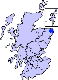
Lonmay (Scottish Gaelic: ''Lòn Magh'') is a village and parish in the Buchan area of Aberdeenshire, Scotland. It lies along the A90 road, between Peterhead and Fraserburgh, near to the junction with the A952 road at Cortes. The parish, formerly known as St Colms, encompasses the villages of St Combs (to which it lent its name) and Crimond, as well as the village of Lonmay. It had a station on the Formartine and Buchan Railway, but this closed in 1965. The present Lonmay Kirk dates from 1786. Lonmay is largely agricultural and has several historic properties, notably Cairness House. Lonmay is said to be the home of the ancestors of Elvis Presley Elvis Aaron Presley (January 8, 1935 – August 16, 1977), or simply Elvis, was an American singer and actor. Dubbed the " King of Rock and Roll", he is regarded as one of the most significant cultural figures of the 20th century. His ener .... References Villages in Aberdeenshire {{Aberdeenshire-geo-stub ... [...More Info...] [...Related Items...] OR: [Wikipedia] [Google] [Baidu] |
Cortes, Aberdeenshire
Cortes is a rural settlement in the Banff and Buchan area of Aberdeenshire, Scotland, situated in the parish of Rathen, south of Fraserburgh. The area stretches from the grounds of Cortes House in the west to Cortes Village in the east on the border with the adjacent parish of Lonmay. Schools Primary education is provided at Rathen School, whilst secondary pupils travel to Fraserburgh Academy. Transport Cortes lies at the northern end of the A952 road at its junction with the A90 road. Regular bus services connect the area to Fraserburgh, Peterhead and Aberdeen, and an on-demand Dial-a-bus service is also available. The nearby Lonmay railway station closed in 1979, and now offers an access point to the Formartine and Buchan Way, the long-distance path that follows the route of the former railway. Landmarks To the south lies Mormond Hill, on the slopes of which a hill figure known as the White Stag of Mormond, marked with quartz stones, was first laid out by Mr F. ... [...More Info...] [...Related Items...] OR: [Wikipedia] [Google] [Baidu] |
St Combs
St Combs is a small fishing village in Aberdeenshire, Scotland, immediately southwest of Inverallochy. It has existed since at least the 17th century, and takes its name from a church to St Colm (or Columba) that used to exist in the area and was abandoned in 1607. Only a fragment of it remains. The remains of Lonmay Castle are also in the area. The village sits across Loch Strathbeg from Rattray. History There is considerable evidence of local habitation by early man in and around St Combs. Somewhat to the southwest lies the Catto Long Barrow and a number of tumuli.C. M, Hogan, 2008 The "new toon" of St Combs was laid out in 1784 by Charles Gordon of Cairness. Houses were laid out in large garden plots, gable to the street, running downhill to the shore. Lonmay Parish Church was established in 1787, and Cairness House (the work of James Playfair) followed in the 1790s. Charlestown, just across the Mill Water and closer to the shore, was founded by the Inverallochy Eastate ... [...More Info...] [...Related Items...] OR: [Wikipedia] [Google] [Baidu] |
Peterhead
Peterhead (; gd, Ceann Phàdraig, sco, Peterheid ) is a town in Aberdeenshire, Scotland. It is Aberdeenshire's biggest settlement (the city of Aberdeen itself not being a part of the district), with a population of 18,537 at the 2011 Census. It is the biggest fishing port in the United Kingdom for total landings by UK vessels, according to a 2019 survey."Brexit trade deal: What does it mean for fishing?" - BBC News, December 2020 Peterhead sits at the easternmost point in mainland Scotland. It is often referred to as ''The Blue Toun'' (locally spelled "The Bloo Toon") and its natives are known as ''Bloo Touners''. They are also referred to as ''blue mogganers'' (locally spelled "bloomogganners"), supposedly from the blue |
Formartine And Buchan Railway
The Formartine and Buchan Railway was a railway company operating in the north-east of Scotland. It was built to link the important fishing ports of Fraserburgh and Peterhead with Aberdeen. It had a junction with the main line of the Great North of Scotland Railway (GNoS) at . Due to shortage of finance, the line was opened in stages as money became available. The section from Dyce to Mintlaw opened in 1861, and from there to Peterhead in 1862. The Fraserburgh line opened in 1865. The Company was never profitable, and it was heavily supported financially by the GNoSR; it was formally absorbed by that company in 1866. The area served was a good agricultural district, and farm produce supplemented the buoyant fish traffic, which included fishing boats' crews travelling home; there was some leisure business, especially connected with a golf course and hotel sponsored by the GNoSR at Cruden Bay. Ordinary use of the line declined after 1950, although the line fared better than some ... [...More Info...] [...Related Items...] OR: [Wikipedia] [Google] [Baidu] |
Cairness House
Cairness House, south-east of Fraserburgh in Buchan in the county of Aberdeenshire, is a country house built in the Neoclassical style between 1791 and 1797 to designs by architect James Playfair. It replaced an earlier house of 1781 by Robert Burn, which was in part incorporated into the Playfair scheme. Sir John Soane assisted in the final stages of the construction after Playfair's death in 1794. The park was laid out by Thomas White, a follower of Lancelot 'Capability' Brown. The Pevsner Architectural Guide for Aberdeenshire North and Moray states that "Cairness House, by James Playfair 1791-97, is of international importance as the only house in Britain, the design and construction of which reflected and evolved with the rapid advances in French Neoclassicism towards the end of the C18" and that "its survival is the more precious as so many of Playfair's other designs were either not built or have been lost or altered". History Cairness House was commissioned by Charle ... [...More Info...] [...Related Items...] OR: [Wikipedia] [Google] [Baidu] |
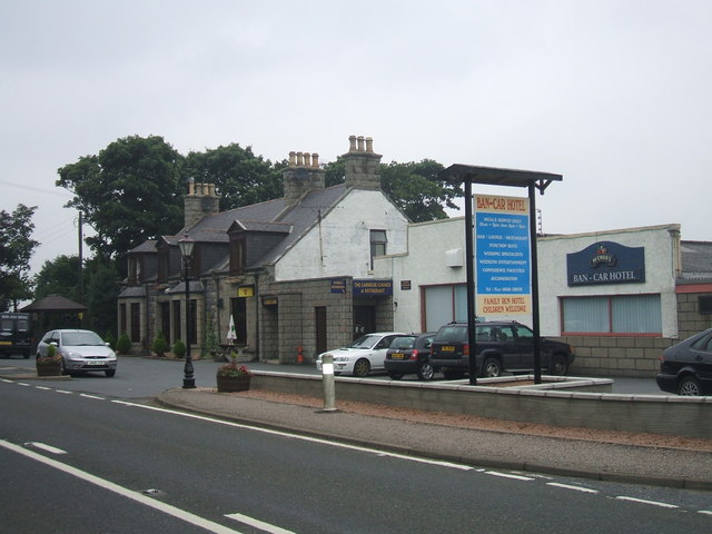
Ban Car Hotel, Lonmay - Geograph
Ban, or BAN, may refer to: Law * Ban (law), a decree that prohibits something, sometimes a form of censorship, being denied from entering or using the place/item ** Imperial ban (''Reichsacht''), a form of outlawry in the medieval Holy Roman Empire * Ban (medieval), the sovereign's power to command ** King's ban (''Königsbann''), a royal command or prohibition in the medieval Holy Roman Empire * Herem (other), a Hebrew word usually translated as "the ban" * A ban could be served on people in apartheid-era South Africa People * Ban (surname), a Chinese surname * Ban (Korean name), a Korean surname and element in given names ** Ban Ki-moon, United Nations Secretary-General * King Ban, a king from the Matter of Britain * Ban (title), a noble title used in Central and Southeastern Europe (Romania, Croatia, Bosnia and Hungary) ** Banate of Bosnia ** Ban of Croatia * Matija Ban, a Croatian poet * Oana Ban, a Romanian artistic gymnast * Shigeru Ban, a Japanese archi ... [...More Info...] [...Related Items...] OR: [Wikipedia] [Google] [Baidu] |
Scottish Gaelic
Scottish Gaelic ( gd, Gàidhlig ), also known as Scots Gaelic and Gaelic, is a Goidelic language (in the Celtic branch of the Indo-European language family) native to the Gaels of Scotland. As a Goidelic language, Scottish Gaelic, as well as both Irish and Manx, developed out of Old Irish. It became a distinct spoken language sometime in the 13th century in the Middle Irish period, although a common literary language was shared by the Gaels of both Ireland and Scotland until well into the 17th century. Most of modern Scotland was once Gaelic-speaking, as evidenced especially by Gaelic-language place names. In the 2011 census of Scotland, 57,375 people (1.1% of the Scottish population aged over 3 years old) reported being able to speak Gaelic, 1,275 fewer than in 2001. The highest percentages of Gaelic speakers were in the Outer Hebrides. Nevertheless, there is a language revival, and the number of speakers of the language under age 20 did not decrease between the 200 ... [...More Info...] [...Related Items...] OR: [Wikipedia] [Google] [Baidu] |
Buchan
Buchan is an area of north-east Scotland, historically one of the original provinces of the Kingdom of Alba. It is now one of the six committee areas and administrative areas of Aberdeenshire Council, Scotland. These areas were created by the council in 1996, when the Aberdeenshire council area was created under the Local Government etc (Scotland) Act 1994. The council area was formed by merging three districts of the Grampian Region: Banff and Buchan, Gordon and Kincardine and Deeside. The committee area of Buchan was formed from part of the former district of Banff and Buchan. Etymology The genesis of the name ''Buchan'' is shrouded in uncertainty, but may be of Pictish origin. The name may involve an equivalent of Welsh ''buwch'' meaning "a cow". American academic Thomas Clancy has noted cautiously the similarity between the territory names ''Buchan'' and '' Marr'' to those of the Welsh commotes '' Cantref Bychan'' and ''Cantref Mawr'', meaning "small-" and "larg ... [...More Info...] [...Related Items...] OR: [Wikipedia] [Google] [Baidu] |
Aberdeenshire
Aberdeenshire ( sco, Aiberdeenshire; gd, Siorrachd Obar Dheathain) is one of the 32 council areas of Scotland. It takes its name from the County of Aberdeen which has substantially different boundaries. The Aberdeenshire Council area includes all of the area of the historic counties of Aberdeenshire and Kincardineshire (except the area making up the City of Aberdeen), as well as part of Banffshire. The county boundaries are officially used for a few purposes, namely land registration and lieutenancy. Aberdeenshire Council is headquartered at Woodhill House, in Aberdeen, making it the only Scottish council whose headquarters are located outside its jurisdiction. Aberdeen itself forms a different council area (Aberdeen City). Aberdeenshire borders onto Angus and Perth and Kinross to the south, Highland and Moray to the west and Aberdeen City to the east. Traditionally, it has been economically dependent upon the primary sector (agriculture, fishing, and forestry) and rel ... [...More Info...] [...Related Items...] OR: [Wikipedia] [Google] [Baidu] |
A90 Road
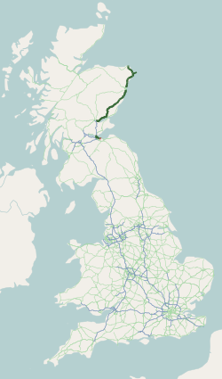
The A90 road is a major north to south road in eastern Scotland, running from Edinburgh to Fraserburgh, through Dundee and Aberdeen. Along with the A9 and the A82 it is one of the three major north–south trunk roads connecting the Central Belt to the North. Background The creation and development of the A90 road has to be understood in terms of the development of the economy of the North-East of Scotland which had resulted in an increase in traffic along the route between Perth and Aberdeen. In recognition of this, in 1979, the British government announced that it was giving priority to the upgrading of the route to dual carriageway standard. It had already been decided that the trunk route between Dundee and Stonehaven which, previously, had followed the same route as the railway line between the two towns, would now follow an inland route through Forfar and Laurencekirk. The new route would incorporate the A85 from Perth to Dundee the A929 between Dundee and Forfar, the ... [...More Info...] [...Related Items...] OR: [Wikipedia] [Google] [Baidu] |
Fraserburgh
Fraserburgh (; sco, The Broch or ; gd, A' Bhruaich) is a town in Aberdeenshire, Scotland with a population recorded in the 2011 Census at 13,100. It lies at the far northeast corner of Aberdeenshire, about north of Aberdeen, and north of Peterhead. It is the biggest shellfish port in Scotland and one of the largest in Europe, landing over in 2016. Fraserburgh is also a major port for white and pelagic fish. History 16th and 17th century: Origins The name of the town means, literally, 'burgh of Fraser', after the Fraser family that bought the lands of Philorth in 1504 and thereafter brought about major improvement due to investment over the next century. By 1570, the Fraser family had built Fraserburgh Castle at Kinnaird Head and within a year a church was built for the area. Sir Alexander Fraser built a port in the town in 1579, obtained a charter establishing it as a burgh of barony in 1588 and secured the right to change the name from Faithlie to Fraserburgh in ... [...More Info...] [...Related Items...] OR: [Wikipedia] [Google] [Baidu] |
A952 Road
A95 or A-95 may refer to: * A95 road (Great Britain), a major road in the United Kingdom * A 95 motorway (Germany) * Canon PowerShot A95, a digital camera * Dutch Defence The Dutch Defence is a chess opening characterised by the moves: :1. d4 f5 Black's 1...f5 stakes a claim to the e4-square and envisions an attack in the middlegame on White's ; however, it also weakens Black's kingside to an extent (especia ..., in the Encyclopaedia of Chess Openings * MAN ND323F, a double decker bus model also known as the MAN A95 {{Letter-NumberCombDisambig ... [...More Info...] [...Related Items...] OR: [Wikipedia] [Google] [Baidu] |


