|
Kulusuk
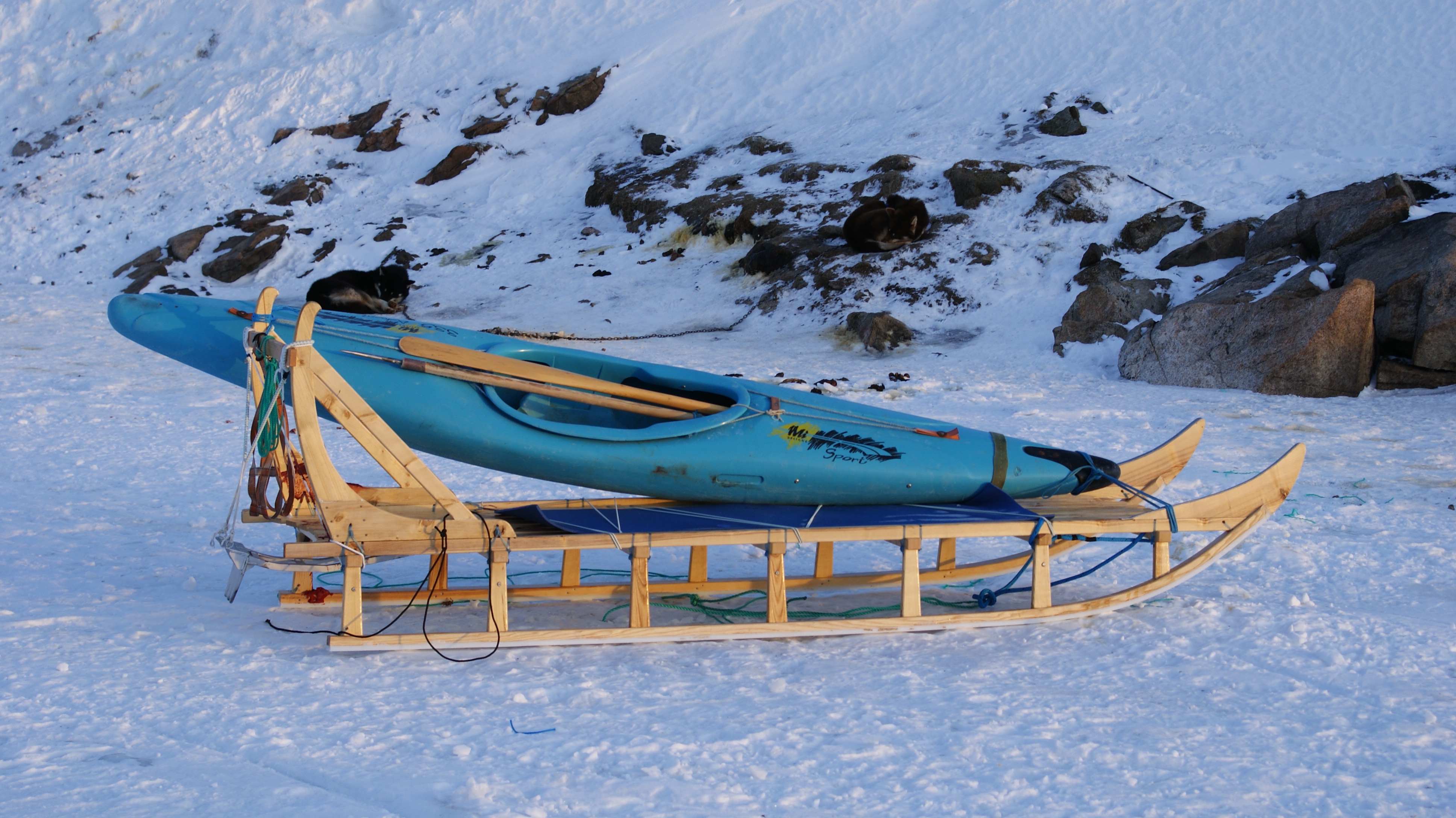
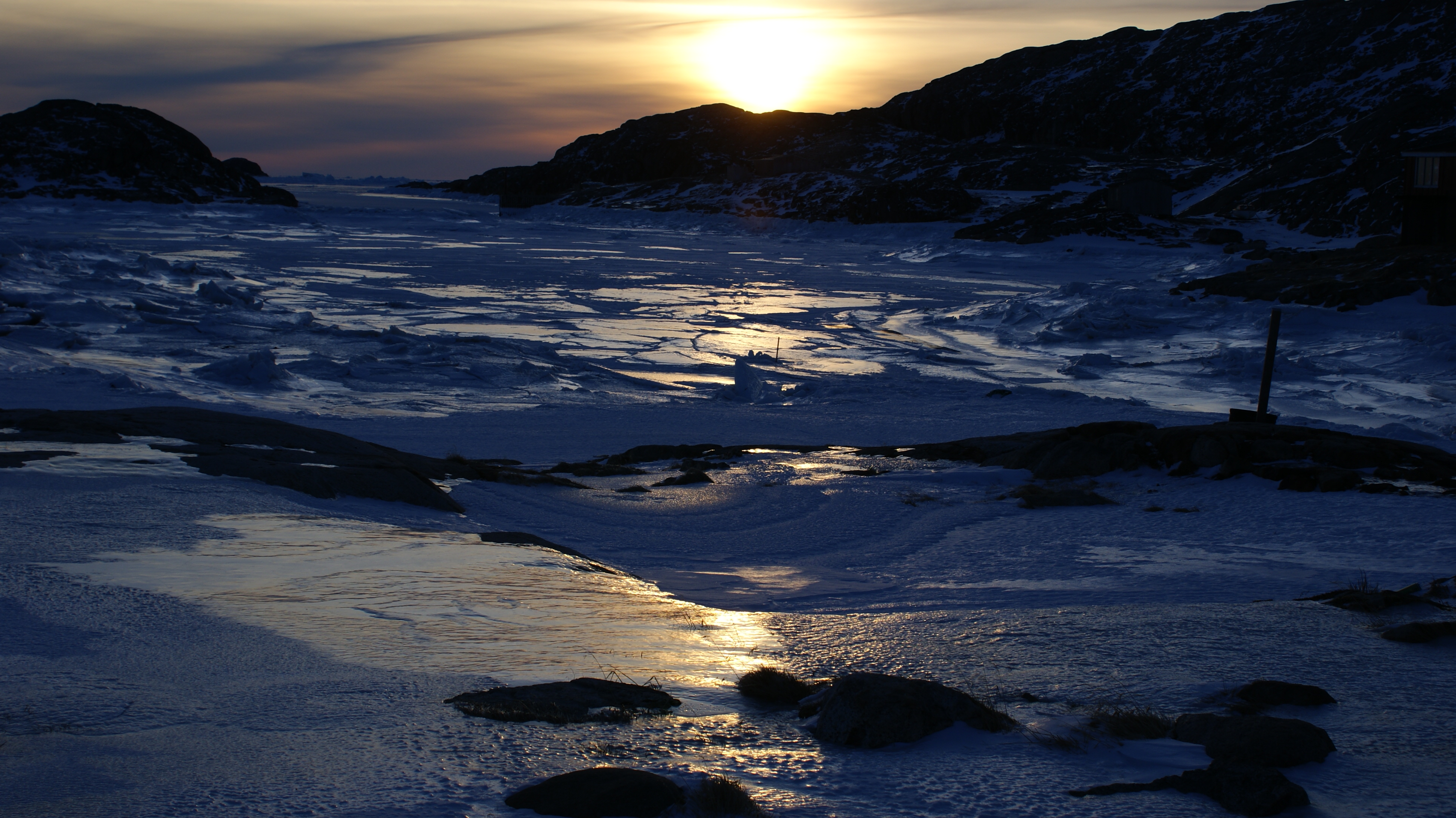
Kulusuk (old spelling: ''Qulusuk''Eastgreenland.com.Kulusuk".), formerly Kap Dan, is a settlement in the Sermersooq municipality in southeastern Greenland, located on an island of the same name. The settlement population of 241 includes many Danes choosing to live there due to the airport. In the Kalaallisut language, the name of the village means "Chest of a Black Guillemot". Geography The urbanized area of the settlement is centered around the harbour in the northwestern part of the island, on the shores of the Torsuut Tunoq sound. Industrial utility buildings are also scattered in the vicinity of the airport, to the northwest of the runway. Kulusuk Island The island measures from north to south and from west to east. It is hilly throughout, with several distinct mountains dominating the eastern and southern coast. The southernmost point is Cape Naujaangivit, formerly Cape Dan ( da, Kap Dan, a name previously extended to the settlement and island) under the Isikajia mou ... [...More Info...] [...Related Items...] OR: [Wikipedia] [Google] [Baidu] |
Kulusuk2018
Kulusuk (old spelling: ''Qulusuk''Eastgreenland.com.Kulusuk".), formerly Kap Dan, is a settlement in the Sermersooq municipality in southeastern Greenland, located on an island of the same name. The settlement population of 241 includes many Danes choosing to live there due to the airport. In the Kalaallisut language, the name of the village means "Chest of a Black Guillemot". Geography The urbanized area of the settlement is centered around the harbour in the northwestern part of the island, on the shores of the Torsuut Tunoq sound. Industrial utility buildings are also scattered in the vicinity of the airport, to the northwest of the runway. Kulusuk Island The island measures from north to south and from west to east. It is hilly throughout, with several distinct mountains dominating the eastern and southern coast. The southernmost point is Cape Naujaangivit, formerly Cape Dan ( da, Kap Dan, a name previously extended to the settlement and island) under the Isikajia mou ... [...More Info...] [...Related Items...] OR: [Wikipedia] [Google] [Baidu] |
Kulusuk Island
Kulusuk Island ( kl, Kulusup qeqertaa) is an island in the Sermersooq municipality on the southeastern shore of Greenland.Tasiilaq, Saga Map, Tage Schjøtt, 1992 It is an outlying island in the Ammassalik archipelago of islands on the coast of the North Atlantic. The island is home to Kulusuk, the fourth-largest settlement on the entire eastern coast of Greenland. The island has an area of 41.98 km2, and measures from north to south and from west to east. The Kulusuk Airport on the island is one of the two airports on the entire eastern Greenland coast. History Among the archaeological ruins on Kulusuk the ancient settlement of Ikaasap Ittiva (Ikâsap Igtiva) is located near the shore at the northern end of the isla ...[...More Info...] [...Related Items...] OR: [Wikipedia] [Google] [Baidu] |
Torsuut Tunoq
Torsuut Tunoq (old spelling: ''Torssuut Tunoq'') is a sound on the southeastern coast of Greenland. It is an inner waterway of the North Atlantic. Geography The sound separates Kulusuk Island in the south from Apusiaajik Island in the northeast, and from the small ''Akinaaq'' island and smaller skerries in the northwest. The strait waterway connects Ammassalik Fjord in the northwest with the North Atlantic in the southeast, through the Ikaasaartik Strait.Tasiilaq, Saga Map, Tage Schjøtt, 1992 During winter pack ice and small icebergs pushed forth by the East Greenland Current ram against the northeastern coast, blocking the narrow Ikaasaartik Strait and facilitating the freeze of the much wider Torsuut Tunoq sound. The tidewater Apusiaajik Glacier drains into the sound in its northernmost part. Settlement Kulusuk is the only settlement in the area, located on an island of the same name on the southern coast of the sound. Transport The inhabitants of Kulusuk use snow ... [...More Info...] [...Related Items...] OR: [Wikipedia] [Google] [Baidu] |
Qalorujoorneq
Qalorngoorneq is a small mountain range in the eastern part of Kulusuk Island in Sermersooq Municipality, southeastern Greenland. At its highest point is the highest mountain on the island. Geography Qalorngoorneq is located in the eastern part of , to the southeast of the .Walls To the northeast and to the east, Qalorngoorneq walls fall directly into the[...More Info...] [...Related Items...] OR: [Wikipedia] [Google] [Baidu] |
Sermersooq
Sermersooq (, da, sted med meget is, lit=place of much ice) is a municipality in Greenland, formed on 1 January 2009 from five earlier, smaller municipalities. Its administrative seat is the city of Nuuk (formerly called Godthåb), the capital of Greenland, and it is the most populous municipality in the country, with 23,123 inhabitants as of January 2020. Creation The municipality consists of former municipalities of eastern and southwestern Greenland, each named after the largest settlement at the time of formation: * Ammassalik Municipality * Ittoqqortoormiit Municipality * Ivittuut Municipality * Nuuk Municipality * Paamiut Municipality Administrative divisions Ammassalik area * Tasiilaq (Ammassalik) * Kuummiit * Kulusuk (Kap Dan) * Tiniteqilaaq * Sermiligaaq * Isortoq Ittoqqortoormiit area * Ittoqqortoormiit (Scoresbysund) * Itterajivit Ivittuut area * Kangilinnguit (Grønnedal) Nuuk area * Nuuk (Godthåb) * Kapisillit * Qeqertarsuatsiaat (Fiskenæsset) Paami ... [...More Info...] [...Related Items...] OR: [Wikipedia] [Google] [Baidu] |
Greenland
Greenland ( kl, Kalaallit Nunaat, ; da, Grønland, ) is an island country in North America that is part of the Kingdom of Denmark. It is located between the Arctic and Atlantic oceans, east of the Canadian Arctic Archipelago. Greenland is the world's largest island. It is one of three constituent countries that form the Kingdom of Denmark, along with Denmark and the Faroe Islands; the citizens of these countries are all citizens of Denmark and the European Union. Greenland's capital is Nuuk. Though a part of the continent of North America, Greenland has been politically and culturally associated with Europe (specifically Norway and Denmark, the colonial powers) for more than a millennium, beginning in 986.The Fate of Greenland's Vikings , by Dale Mackenzie Brown, ''Archaeological Institute of Americ ... [...More Info...] [...Related Items...] OR: [Wikipedia] [Google] [Baidu] |
Kuummiit
Kuummiit ( Kalaallisut: ''Kuummiut'') is a settlement in the Sermersooq municipality in southeastern Greenland. Founded in 1915, it had 248 inhabitants in 2020. Geography The settlement is located on the eastern shore of the Ammassalik Fjord, approximately to the northeast of Tasiilaq and to the north of Kulusuk Kulusuk (old spelling: ''Qulusuk''Eastgreenland.com.Kulusuk".), formerly Kap Dan, is a settlement in the Sermersooq municipality in southeastern Greenland, located on an island of the same name. The settlement population of 241 includes many Dane .... Population The population of Kuummiit has decreased by more than 27% relative to its 1990 level and almost 15% relative to its 2000 level. Transports The settlement is served by the Kuummiit Heliport . References External links eastgreenland.comSettlement map and other information. {{Authority control Populated places in Greenland Populated places established in 1915 ... [...More Info...] [...Related Items...] OR: [Wikipedia] [Google] [Baidu] |
Tasiilaq
Tasiilaq, formerly Ammassalik and Angmagssalik, is a town in the Sermersooq municipality in southeastern Greenland. With 1,985 inhabitants as of 2020, it is the most populous community on the eastern coast, and the seventh-largest town in Greenland. The Sermilik Station, dedicated to the research of the nearby Mittivakkat Glacier, is located near the town. History Prehistory to the fifteenth century The people of Saqqaq culture were the first to reach eastern Greenland, arriving from the north,eastgreenland.com ''History of East Greenland'' through what is now known as Peary Land and Independence Fjord, to be surpassed by the [...More Info...] [...Related Items...] OR: [Wikipedia] [Google] [Baidu] |
Sermitsiaq (newspaper)
''Sermitsiaq'' is one of two national newspapers in Greenland. It is named after the mountain Sermitsiaq. The newspaper was published for the first time May 21, 1958, as a Kalaallisut-language alternative to the Danish-language newspaper ''Mikken''. The two magazines were printed separately, with Mikken on Saturdays and Sermitsiaq on Mondays for about six months, until Mikken was published for the last time on 22 November the same year. ''Sermitsiaq'' was first printed in both Danish and Kalaallisut the week before ''Mikken'' closed down. ''Sermitsiaq'' was a local newspaper distributed only in Nuuk city until around 1980 when the newspaper became national. The newspaper became increasingly political in the period around 1980, since Greenland was granted home rule in 1979. The newspaper is published every Friday, while the online version is updated several times daily. In 2010 ''Sermitsiaq'' merged with ''Atuagagdliutit/Grønlandsposten ''Atuagagdliutit/Grønlandsposten'', us ... [...More Info...] [...Related Items...] OR: [Wikipedia] [Google] [Baidu] |
Lumber
Lumber is wood that has been processed into dimensional lumber, including beams and planks or boards, a stage in the process of wood production. Lumber is mainly used for construction framing, as well as finishing (floors, wall panels, window frames). Lumber has many uses beyond home building. Lumber is sometimes referred to as timber as an archaic term and still in England, while in most parts of the world (especially the United States and Canada) the term timber refers specifically to unprocessed wood fiber, such as cut logs or standing trees that have yet to be cut. Lumber may be supplied either rough- sawn, or surfaced on one or more of its faces. Beside pulpwood, ''rough lumber'' is the raw material for furniture-making, and manufacture of other items requiring cutting and shaping. It is available in many species, including hardwoods and softwoods, such as white pine and red pine, because of their low cost. ''Finished lumber'' is supplied in standard sizes, mostl ... [...More Info...] [...Related Items...] OR: [Wikipedia] [Google] [Baidu] |
Organ (music)
Carol Williams performing at the United States Military Academy West Point Cadet Chapel.">West_Point_Cadet_Chapel.html" ;"title="United States Military Academy West Point Cadet Chapel">United States Military Academy West Point Cadet Chapel. In music, the organ is a keyboard instrument of one or more Pipe organ, pipe divisions or other means for producing tones, each played from its own Manual (music), manual, with the hands, or pedalboard, with the feet. Overview Overview includes: * Pipe organs, which use air moving through pipes to produce sounds. Since the 16th century, pipe organs have used various materials for pipes, which can vary widely in timbre and volume. Increasingly hybrid organs are appearing in which pipes are augmented with electric additions. Great economies of space and cost are possible especially when the lowest (and largest) of the pipes can be replaced; * Non-piped organs, which include: ** pump organs, also known as reed organs or harmoniums, which ... [...More Info...] [...Related Items...] OR: [Wikipedia] [Google] [Baidu] |


