|
King Frederick VI Coast
King Frederick VI Coast ( da, Kong Frederik VI Kyst) is a major geographic division of Greenland. It comprises the coastal area of Southeastern Greenland in Sermersooq and Kujalleq municipalities fronting the Irminger Sea of the North Atlantic Ocean. It is bordered by King Christian IX Land on the north and the Greenland Ice Sheet to the west. Named after King Frederick VI of Denmark-Norway, the coast stretches for about south of the Arctic Circle. It is characterized by a succession of short fjords, steep mountains and small coastal islands. There is a narrow belt of ice-free land between the shore and the Inland ice cap, interrupted by active glaciers reaching the shore with the ice limit varying seasonally from year to year. Owing to the movement of pack ice carried by the East Greenland Current and frequent gale-force winds that sweep down from the Greenland ice cap, it is mostly very difficult to approach or navigate along the coast by ship. History This area was in ... [...More Info...] [...Related Items...] OR: [Wikipedia] [Google] [Baidu] |
Region
In geography, regions, otherwise referred to as zones, lands or territories, are areas that are broadly divided by physical characteristics ( physical geography), human impact characteristics ( human geography), and the interaction of humanity and the environment (environmental geography). Geographic regions and sub-regions are mostly described by their imprecisely defined, and sometimes transitory boundaries, except in human geography, where jurisdiction areas such as national borders are defined in law. Apart from the global continental regions, there are also hydrospheric and atmospheric regions that cover the oceans, and discrete climates above the land and water masses of the planet. The land and water global regions are divided into subregions geographically bounded by large geological features that influence large-scale ecologies, such as plains and features. As a way of describing spatial areas, the concept of regions is important and widely used among the many branch ... [...More Info...] [...Related Items...] OR: [Wikipedia] [Google] [Baidu] |
Qulleq
Qulleq, Qutdleq or Kutdlek is an uninhabited island in the King Frederick VI Coast, Sermersooq municipality in southern Greenland. Geography Qulleq is an irregularly-shaped island that lies off the southeastern coast of Greenland. It is located 5.5 km from the shore off the mouth of the Anorituup Kangerlua fjord, to the north-northeast of Cape Tordenskjold, northeast of Nuuk Point. Qulleq is the largest and southernmost island of a small offshore archipelago of four main islands, including Qipinnguak close by to the west, Takisoq to the northwest and Qeqertarsuaq to the north. The island's length is and its maximum width . History Qutsigsormiut is an important Paleo-Eskimo archaeological site on Qulleq's southern coast. It is located by a south-facing bay known as Qulleq Sound that forms a sheltered natural harbour A harbor (American English), harbour (British English; see spelling differences), or haven is a sheltered body of water where ships, boats, and barges c ... [...More Info...] [...Related Items...] OR: [Wikipedia] [Google] [Baidu] |
Eastern Norse Settlement
The Eastern Settlement ( non, Eystribygð ) was the first and by far the larger of the two main areas of Norse Greenland, settled by Norsemen from Iceland. At its peak, it contained approximately 4,000 inhabitants. The last written record from the Eastern Settlement is of a wedding in Hvalsey in 1408, placing it about 50–100 years later than the end of the more northerly Western Settlement. Despite its name, the Eastern Settlement was more south than east of its companion and, like the Western Settlement, was located on the southwestern tip of Greenland at the head of long fjords such as Tunulliarfik Fjord or Eiriksfjord, Igaliku or Einarsfjord, and Sermilik Fjord. Approximately 500 groups of ruins of Norse farms are found in the area, with 16 church ruins, including Brattahlíð, Dyrnæs, Garðar, Hvalsey and Herjolfsnes. The Vatnahverfi district to the southeast of Einarsfjord had some of the best pastoral land in the colony, and boasted 10% of all the known farm sites ... [...More Info...] [...Related Items...] OR: [Wikipedia] [Google] [Baidu] |
Wilhelm August Graah
Wilhelm August Graah (1793–1863) was a Danish naval officer and Arctic explorer. Graah had mapped areas of West Greenland when he, in 1828–30, was sent by King Frederick VI of Denmark on an expedition to the unmapped eastern coast with the purpose to search for the lost Eastern Norse Settlement. Expedition The expedition set out from Copenhagen in the brig ''Hvalfisken'', but - once arrived in Greenland - used umiaks able to navigate in the waters between the coast and the sea ice of southeastern Greenland. In 1829, the expedition reached Dannebrog Island (65° 18' N), where it was stopped by ice. They wintered at Nugarlik (63° 22' N) and returned to the settlements on the west coast of Greenland in 1830. Two naturalists participated - the geologist Christian Pingel and the botanist Jens Vahl. Graah published an account of the exploration. Graah named the southeastern coast of Greenland King Frederick VI Coast and mapped about 550 km of formerly uncharted territory. ... [...More Info...] [...Related Items...] OR: [Wikipedia] [Google] [Baidu] |
Umiak
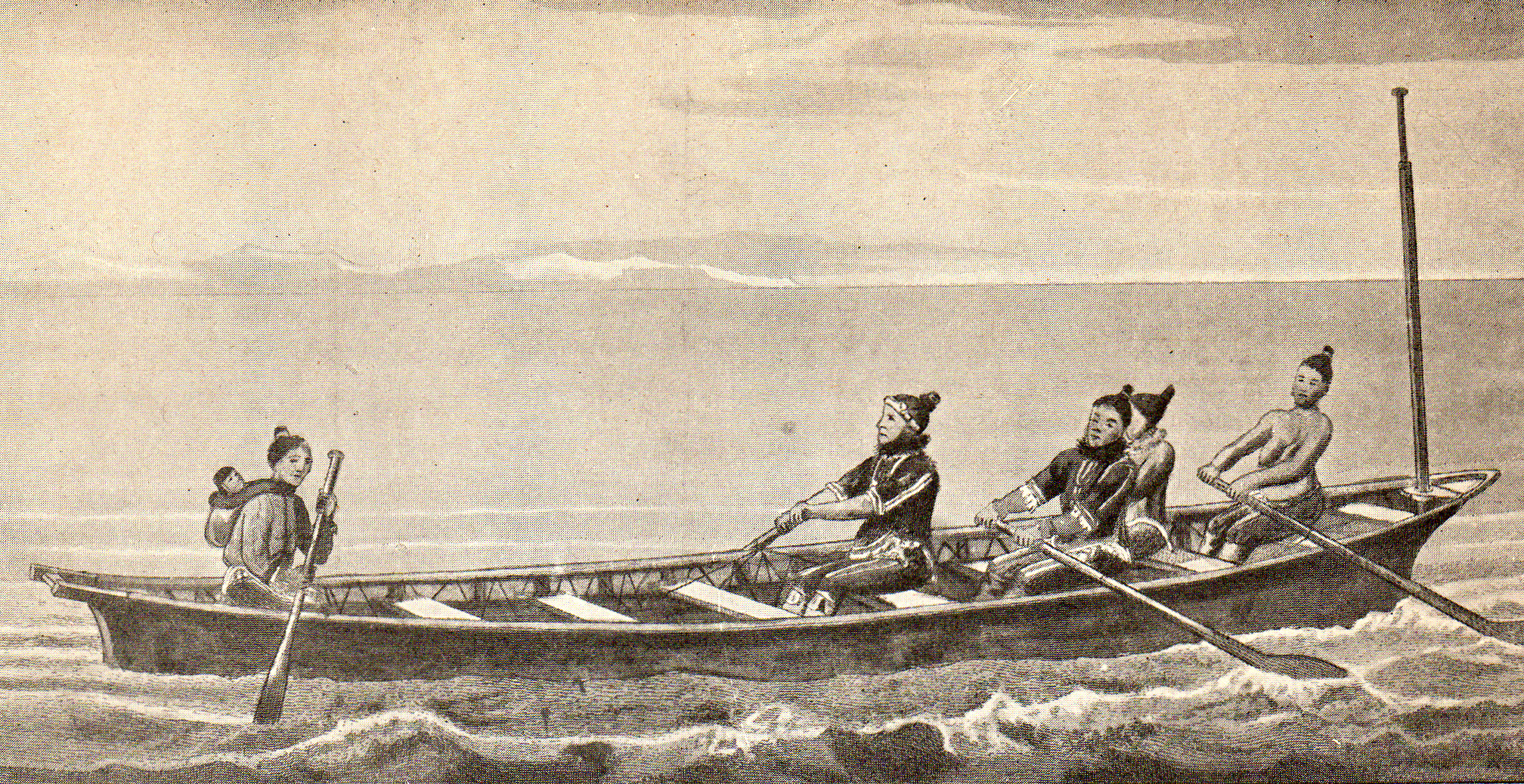
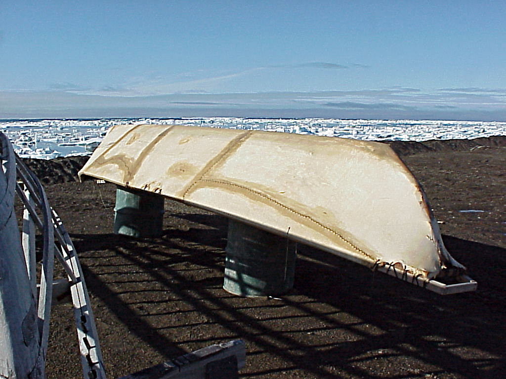
The umiak, umialak, umiaq, umiac, oomiac, oomiak, ongiuk, or anyak is a type of open skin boat, used by both Yupik and Inuit, and was originally found in all coastal areas from Siberia to Greenland. First arising in Thule times, it has traditionally been used in summer to move people and possessions to seasonal hunting grounds and for hunting whales and walrus.Umiaks at the Canadian Museum of Civilization Although the umiak was usually propelled by oars (women) or paddles (men), sails—sometimes made from seal s—were also used, and in the 20th century, [...More Info...] [...Related Items...] OR: [Wikipedia] [Google] [Baidu] |
Peder Olsen Walløe
Peder Olsen Walløe (1716 – 27 April 1793) was a Dano-Norwegian Arctic explorer most noted for his historic exploration of the former Norse settlements on Greenland. Biography Peder Olsen Walloe was born on the Baltic Sea island of Bornholm. In 1739, he came to Greenland as one of five colonists called by Lutheran missionary Hans Egede. He learned to speak the Kalaallisut language and settled as a trader with permission to operate outside the Godthåb colony. During 1751–53, Walløe explored the southern coasts of Greenland on behalf of the Danish mission. The aim was to locate the lost Eastern Norse Settlement which was commonly believed to be located on the east coast of Greenland. In August 1751, Walloe left Godthaab in a native boat accompanied by two Danish sailors and two Eskimo rowers. The expedition used umiaks able to navigate in the shallow waters between the coast and the sea ice. The first year he reached what became Julianehåb District where he made certain ... [...More Info...] [...Related Items...] OR: [Wikipedia] [Google] [Baidu] |
Torgils Orrabeinfostre
Torgils Orrabeinfostre (''Þorgils Orrabeinsfóstri'', Þorgils the step-son of Scarleg) is the Viking hero of Flóamanna saga. A Norwegian weather station built in Nanuuseq Fjord in 1932 was named Torgilsbu, after this legendary hero. In 1940 this station was abandoned and the name "Torgilsbu" was transferred to one of the Bluie WWII weather stations, Bluie East One, a little further south on Prince Christian Sound. Summary The chapters 1-9 and 18 of the Flóamanna saga detail Torgils' ancestry according to Sturla Þórðarson's version of Landnámabók.Fornrit 2011 . Then the saga narrates Torgils' adventures in and the |
Western Settlement
The Western Settlement ( non, Vestribygð ) was a group of farms and communities established by Norsemen from Iceland around 985 in medieval Greenland. Despite its name, the Western Settlement was more north than west of its companion Eastern Settlement and was located at the bottom of the deep Nuup Kangerlua fjord (inland from Nuuk, the modern-day Greenlandic capital). Much less is known about the Western Settlement than the Eastern Settlement, as there is very little mention and no direct description of it in any of the medieval sources on Greenland. At its peak, the Western Settlement probably had about 1,000 inhabitants, about a quarter of the size of the Eastern Settlement, owing to its shorter growing season. The largest of the Western Settlement farms was Sandnæs. Ruins of almost 95 farms have been found in the area. The Western Settlement was last mentioned by Ivar Bardarson (''Ivar Bårdsson''), a Norwegian cleric who was sent to Greenland in 1341 to serve as superinte ... [...More Info...] [...Related Items...] OR: [Wikipedia] [Google] [Baidu] |
Gunnbjörn Ulfsson
Gunnbjörn Ulfsson (fl. c. 10th century), also Gunnbjörn Ulf-Krakuson, was a Norwegian settler of Iceland. He was reportedly the first European to sight Greenland. A number of modern place names in Greenland commemorate Gunnbjörn, most notably Gunnbjørn Fjeld. Sources The only reference to Gunnbjörn is from the ''Book of Settlement of Iceland'' (''Landnámabók''). It is stated that his sons lived in Iceland's Westfjords and a note is made that Gunnbjörnssker are named after him. Gunnbjörn was blown off course while sailing from Norway to Iceland. He and his crew sighted islands ( Gunnbjörn's skerries) lying close off the coast of Greenland, and reported this find but did not land. Since Greenland is physically part of North America, separated from Ellesmere Island by only a narrow strait, this sighting could also have been the first European connection with North America. The exact date of this event is not recorded in the sagas. Various sources cite dates ranging from 8 ... [...More Info...] [...Related Items...] OR: [Wikipedia] [Google] [Baidu] |
Iceland
Iceland ( is, Ísland; ) is a Nordic island country in the North Atlantic Ocean and in the Arctic Ocean. Iceland is the most sparsely populated country in Europe. Iceland's capital and largest city is Reykjavík, which (along with its surrounding areas) is home to over 65% of the population. Iceland is the biggest part of the Mid-Atlantic Ridge that rises above sea level, and its central volcanic plateau is erupting almost constantly. The interior consists of a plateau characterised by sand and lava fields, mountains, and glaciers, and many glacial rivers flow to the sea through the lowlands. Iceland is warmed by the Gulf Stream and has a temperate climate, despite a high latitude just outside the Arctic Circle. Its high latitude and marine influence keep summers chilly, and most of its islands have a polar climate. According to the ancient manuscript , the settlement of Iceland began in 874 AD when the Norwegian chieftain Ingólfr Arnarson became the first p ... [...More Info...] [...Related Items...] OR: [Wikipedia] [Google] [Baidu] |
Thule Culture
The Thule (, , ) or proto-Inuit were the ancestors of all modern Inuit. They developed in coastal Alaska by the year 1000 and expanded eastward across northern Canada, reaching Greenland by the 13th century. In the process, they replaced people of the earlier Dorset culture that had previously inhabited the region. The appellation "Thule" originates from the location of Thule (relocated and renamed Qaanaaq in 1953) in northwest Greenland, facing Canada, where the archaeological remains of the people were first found at Comer's Midden. The links between the Thule and the Inuit are biological, cultural, and linguistic. Evidence supports the idea that the Thule (and also the Dorset, but to a lesser degree) were in contact with the Vikings, who had reached the shores of Canada in the 11th century as part of Norse colonization of North America. In Viking sources, these peoples are called the ''Skrælingjar''. Some Thule migrated southward, in the "Second Expansion" or "Second Phase". ... [...More Info...] [...Related Items...] OR: [Wikipedia] [Google] [Baidu] |
Paleo-Eskimo
The Paleo-Eskimo (also pre-Thule or pre-Inuit) were the peoples who inhabited the Arctic region from Chukotka (e.g., Chertov Ovrag) in present-day Russia across North America to Greenland prior to the arrival of the modern Inuit (Eskimo) and related cultures. The first known Paleo-Eskimo cultures developed by 2500 BCE, but were gradually displaced in most of the region, with the last one, the Dorset culture, disappearing around 1500 CE. Paleo-Eskimo groups included the Pre-Dorset; the Saqqaq culture of Greenland (2500 – 800 BCE); the Independence I and Independence II cultures of northeastern Canada and Greenland (c. 2400 – 1800 BCE and c. 800 – 1 BCE); the Groswater of Labrador, Nunavik, and Newfoundland and the Dorset culture (500 BCE to 1400 CE), which spread across Arctic North America. The Dorset were the last major "Paleo-Eskimo" culture in the Arctic before the migration east from present-day Alaska of the Thule, the ancestors of the modern Inuit. Terminology T ... [...More Info...] [...Related Items...] OR: [Wikipedia] [Google] [Baidu] |


