|
Kammanadu
Kammanadu (or Kamma-nadu, also Kamma-rashtra) is a historical region in the Indian state of Andhra Pradesh. It consisted of parts of the present day Guntur and Prakasam districts. According to historian and geographer K. Iswara Dutt, Kammanadu consisted of the Narasaraopet, Sattenapalle, Bapatla and Ongole taluks, including the villages of the Addanki area. It was bounded by Srisailam in the west, Palnadu and Velanadu in the north, the Gundlakamma river in the south and the Bay of Bengal in the east. The erstwhile Vinukonda taluk and the Chirala taluk are also often included, which are anyway indicated by the boundary at the Gundlakamma river. Etymology According to one theory, Kammanadu derived its name from the Gundlakamma river, which is a prominent river between the Krishna and Penna rivers in coastal Andhra. "Kamma" in this context means a stream or river. According to another theory, Kammanadu was the region between Gundlakamma and ''Pērakamma'' (the "big river", perha ... [...More Info...] [...Related Items...] OR: [Wikipedia] [Google] [Baidu] |
Ongole Mandal
Ongole mandal is one of the 56 mandals in Prakasam district of the state of Andhra Pradesh, India. It is administered under Ongole revenue division and its headquarters are located at Ongole. The mandal is bounded by Naguluppalapadu, Maddipadu, Santhanuthlapadu, and Kothapatnam Tangutur mandals. The mandals lies on the shore of Bay of Bengal. History Ongole was once part of great historical regions of the world Kamma Rashtra. Demographics census, the mandal had a population of 253,122. The total population constitute, 126,983 males and 126,139 females —a sex ratio of 993 females per 1000 males. 24,500 children are in the age group of 0–6 years, of which 12,635 are boys and 11,865 are girls —a ratio of 939 per 1000. The average literacy rate stands at 79.91% with 182,682 literates. Towns and villages census A census is the procedure of systematically acquiring, recording and calculating information about the members of a given population. This term is ... [...More Info...] [...Related Items...] OR: [Wikipedia] [Google] [Baidu] |
Sattenapalle
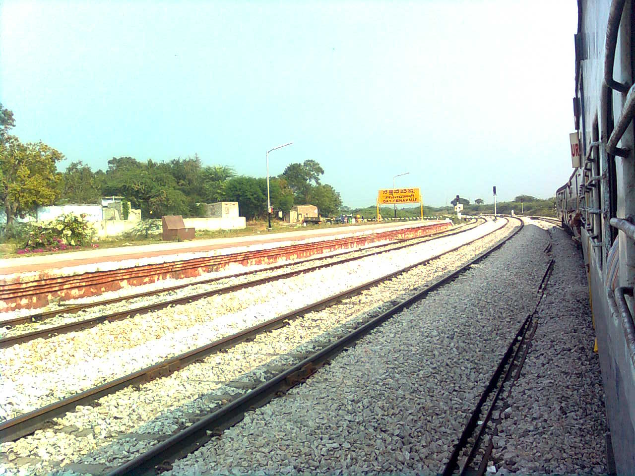
Sattenapalle is a town in Palnadu district of the Indian state of Andhra Pradesh. It is a municipality and the headquarters of Sattenapalle mandal under Sattenapalle revenue division. History The region is an important region of the ancient Kammanadu. This region is also part of the Palnadu region. Demographics Census of India, Sattenapalle had a population of 56,721. The total population constitute, 28,350 males and 28,371 females —a sex ratio of 1001 females per 1000 males. 5,827 children are in the age group of 0–6 years, of which 3,046 are boys and 2,781 are girls —a ratio of 913 per 1000. The average literacy rate stands at 73.58% with 37,449 literates, significantly higher than the state average of 67.41%. Civic administration On 1 April 1984, the municipality was formed as 3rd grade which is now a second grade municipality. The municipality constitutes 30 election and 11 revenue wards. The civic services and infrastructure of the municipality include, suppl ... [...More Info...] [...Related Items...] OR: [Wikipedia] [Google] [Baidu] |
Chalukya Dynasty
The Chalukya dynasty () was a Classical Indian dynasty that ruled large parts of southern and central India between the 6th and the 12th centuries. During this period, they ruled as three related yet individual dynasties. The earliest dynasty, known as the "Badami Chalukyas", ruled from Vatapi (modern Badami) from the middle of the 6th century. The Badami Chalukyas began to assert their independence at the decline of the Kadamba kingdom of Banavasi and rapidly rose to prominence during the reign of Pulakeshin II. After the death of Pulakeshin II, the Eastern Chalukyas became an independent kingdom in the eastern Deccan. They ruled from Vengi until about the 11th century. In the western Deccan, the rise of the Rashtrakutas in the middle of the 8th century eclipsed the Chalukyas of Badami before being revived by their descendants, the Western Chalukyas, in the late 10th century. These Western Chalukyas ruled from Kalyani (modern Basavakalyan) until the end of the 12t ... [...More Info...] [...Related Items...] OR: [Wikipedia] [Google] [Baidu] |
Telugu Cholas
The Telugu Cholas or Telugu Chodas ruled parts of present-day Andhra Pradesh between the sixth and the thirteenth century. Velanati Chodas Telugu Chodas of Velanadu (Velanati Chola) were one of the Telugu Choda families. Velanadu is located in the modern Guntur district. The chieftains who ruled over Velanadu came to be known as the Velanati Chodas. One of them, Rajendra Choda II had even assumed the title Durjayakulaprakara since Velanati Cholas belong to Durjaya clans. These Velanati chiefs were the subordinate allies of the Later Cholas of the south. They were entrusted with the responsibility of the governance of the Andhra region, which formed a part of the Chola kingdom in the between the tenth and early decades of the thirteenth century. Their capital was Dhanadapura (Dhannada) or Sanaduprolu, the modern Chandolu in the Guntur district initially then later they ruled from Vengi in West Godavari and Pithpuram in East Godavari Districts. Dhannada is also the site of the ... [...More Info...] [...Related Items...] OR: [Wikipedia] [Google] [Baidu] |
Guntur
Guntur () is a city and the administrative headquarters of Guntur district in the Indian state of Andhra Pradesh. Guntur is spread across 168.49 km square and is the third-largest city in the state. It is situated to the west of the Bay of Bengal, on the Eastern Coastal Plains. The city is the heartland of the state, located in the centre of Andhra Pradesh and making it a central part connecting different regions. It serves as a major hub for exports chilli, cotton and tobacco and has the largest chili market yard in Asia. It is a major transportation, education and commercial hub for the state. Guntur city is a municipal corporation and also the headquarters of Guntur East and Guntur West mandals in Guntur revenue division. The city region is a major part of Amaravati Metropolitan Region. census of India the city is the third most populous in the state with a population of 743,354. It is classified as a ''Y-grade'' city as per the Seventh Central Pay Commission. ... [...More Info...] [...Related Items...] OR: [Wikipedia] [Google] [Baidu] |
Repalle Mandal
Repalle mandal is one of the 25 mandals in Bapatla district of the state of Andhra Pradesh, India. It is under the administration of Bapatla revenue division and the mandal headquarters are located at Repalle. The mandal is situated on the banks of Krishna River of Velanadu region and is bounded by Bhattiprolu, Nagaram and Nizampatnam mandals. History On 1 October 1904, Guntur district was formed with eight mandals. In 1909, Repalle mandal was formed by carving out from Tenali mandal. In 1933, eleven of its villages were merged in Bapatla mandal and in 1981-82, Repalle mandal was further divided into Repalle and Pallpatla. Demographics census, the mandal had a population of 111,989. The total population constitute, 54,956 males and 57,936 females —a sex ratio of 1056 females per 1000 males. 9,461 children are in the age group of 0–6 years, of which 4,824 are boys and 4,637 are girls. The average literacy rate stands at 72.99% with 74,830 literates. Politics A ... [...More Info...] [...Related Items...] OR: [Wikipedia] [Google] [Baidu] |
Tenali Mandal
Tenali mandal is one of the 57 mandals in Guntur district of the Indian state of Andhra Pradesh. It is under the administration of Tenali revenue division, headquartered at Tenali. The mandal is located in Velanadu region, bounded by Pedakakani, Duggirala, Kollipara, Vemuru, Amruthalur, Tsundur and Chebrole mandals. History Guntur district was constituted in the year 1904 and Tenali was one of the eight taluks of the district. On 1 July 1909, Tenali taluk was split into Tenali and Repalle taluks. In 1981–82, Tenali taluk was again split into Tenali and Emani taluks. Tenali city taluk was split into Vemuru and Tenali Mandals. Later it was split it into Tenali and Bapatla mandals. On 25 May 1985, mandals were recognised, replacing taluks and firkas. Demographics census, the mandal had a population of 240,031. The total population constituted 118,616 males and 121,415 females, for a sex ratio of 1024 females per 1000 males. 21,333 children were in the age group of 0–6 ... [...More Info...] [...Related Items...] OR: [Wikipedia] [Google] [Baidu] |
Chirala Mandal
Chirala mandal is one of the 25 mandals in Bapatla district of the Indian state of Andhra Pradesh. It is administered under Ongole revenue division and its headquarters are located at Chirala. The mandal is situated at the shore of Bay of Bengal and is bounded by Parchur, Karamchedu and Vetapalem mandals. Towns and villages census, the mandal has 5 settlements. It includes 2 towns and 3 villages. Chirala is the municipality and its adjoining area was classified as a census town with the same name. ''Note'': M: Municipality A municipality is usually a single administrative division having corporate status and powers of self-government or jurisdiction as granted by national and regional laws to which it is subordinate. The term ''municipality'' may also mean the go ..., CT: Census town, OG: Out Growth See also * Prakasam district References {{Prakasam district Mandals in Prakasam district ... [...More Info...] [...Related Items...] OR: [Wikipedia] [Google] [Baidu] |
Vinukonda
Vinukonda is a town in Palnadu district of the Indian state of Andhra Pradesh. It is a municipality and the headquarters of Vinukonda mandal and administered under Narasaraopet revenue division. Etymology The town was formerly known as ''Vishnukundinapuram''. The hill is in the shape of tortoise. Many temples are also found on the top of hill. Srigangasametha Ramalingeswara Swamy temple (according to available sources the deity present in temple was sanctified by Lord Rama). Down the hill Sri Lakshmi Narasimha Swamy temple was found which was constructed in Gupta's rule. History Dolmens and other megalithic structures have been found in the town's neighbourhood. Inscriptions from about 1000–1400 CE are also to be found in many old temples. The Vishnukundinas, a local dynasty, ruled the adjoining areas from here during the turn of the millennium. During the medieval era, the hill nearby was the site of a fortress. A four-hundred-year-old Jamia Masjid, built in 1640, i ... [...More Info...] [...Related Items...] OR: [Wikipedia] [Google] [Baidu] |
Bay Of Bengal
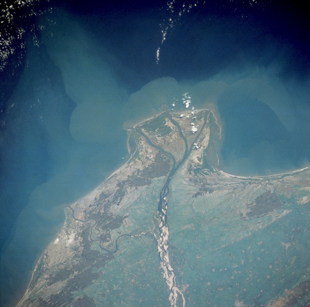
The Bay of Bengal is the northeastern part of the Indian Ocean, bounded on the west and northwest by India, on the north by Bangladesh, and on the east by Myanmar and the Andaman and Nicobar Islands of India. Its southern limit is a line between Sangaman Kanda, Sri Lanka, and the north westernmost point of Sumatra, Indonesia. It is the largest water region called a bay in the world. There are countries dependent on the Bay of Bengal in South Asia and Southeast Asia. During the existence of British India, it was named as the Bay of Bengal after the historic Bengal region. At the time, the Port of Kolkata served as the gateway to the Crown rule in India. Cox's Bazar, the longest sea beach in the world and Sundarbans, the largest mangrove forest and the natural habitat of the Bengal tiger, are located along the bay. The Bay of Bengal occupies an area of . A number of large rivers flow into the Bay of Bengal: the Ganges– Hooghly, the Padma, the Brahmaputra–Yamuna, the Barak� ... [...More Info...] [...Related Items...] OR: [Wikipedia] [Google] [Baidu] |


