|
Itanhaém
Itanhaém is a municipality in the state of São Paulo in Brazil. It is part of the Metropolitan Region of Baixada Santista. The population is 103,102 (2020 est.) in an area of 601.85 km². The elevation is 4 m. Location The name Itanhaém comes from the Tupi word '' itá''-'' nha'ẽ'', meaning the ''plate of rock''. Some other Tupinologists (people who study the ancient language Tupi, spoken by the natives back in the 16th century) believe itanhaém means, ita = rock - and nhaém = that cries; due to the rocky coast and the waves that constantly hit it. Itanhaém was among the greatest tour destinations in the State of São Paulo, in the late-1970s. Located in the Southeastern Brazil, the region is surrounded by the tropical Atlantic Forest that shelters many tropical animals such as colorful birds named Saíra (many subspecies) and animals such as Onças (Brazilian Jaguars), Quatis and Saruês. Itanhaém has many beaches: Downtown beach (Centro or Boca da Barra), Fi ... [...More Info...] [...Related Items...] OR: [Wikipedia] [Google] [Baidu] |
Itanhaém Airport
Antônio Ribeiro Nogueira Jr. State Airport is the airport serving Itanhaém, Brazil. It is operated by Rede Voa. History On March 15, 2017 Voa São Paulo was granted by the government of the State of São Paulo the concession to operate this facility, previously operated by DAESP. Airlines and destinations No scheduled flights operate at this airport. Access The airport is located from downtown Itanhaém. See also *List of airports in Brazil This is a list of airports in Brazil, sorted by location. The National Civil Aviation Agency of Brazil lists on March 10, 2022, 491 public and 2,677 private aerodromes in Brazil. __TOC__ Airports Airport names shown in bold indicate that t ... References External links * * * {{DEFAULTSORT:Itanhaém Airport Airports in São Paulo (state) ... [...More Info...] [...Related Items...] OR: [Wikipedia] [Google] [Baidu] |
Mongaguá
Mongaguá is a municipality in the state of São Paulo in Brazil. It is part of the Metropolitan Region of Baixada Santista. The population is 57,648 (2020 est.) in an area of 141.87 km2. The name comes from the Tupi language. Its seal carries the national motto of the United States of America, E pluribus unum. The municipality's street plan is on a planned grid running from SSE to NNW and many of the houses are within sight of the Atlantic Ocean. The populated area of Mongaguá is near the bottom of steep-sloping and densely forested mountains. The BR-101 superhighway linking Santos (São Paulo), Santos and the southern part of the state runs through Mongaguá. The freeway to the city of São Paulo is also easily accessible. Housing developments near the beaches were built in the 1970s and the 1990s. Prior to the construction of the housing developments, the population was mainly rural. Housing development continues to this day. There are two aboriginal villages ... [...More Info...] [...Related Items...] OR: [Wikipedia] [Google] [Baidu] |
SP-57
The SP-57 is a highway in the eastern and the southeastern parts of the state of São Paulo in Brazil Brazil ( pt, Brasil; ), officially the Federative Republic of Brazil (Portuguese: ), is the largest country in both South America and Latin America. At and with over 217 million people, Brazil is the world's fifth-largest country by area .... The highway is unnamed on its entire length. The highway runs from BR-116 up to Siderúrgica (Ponte de Ferro). See also * Parelheiros * Itanhaém References Highways in São Paulo (state) {{Brazil-road-stub ... [...More Info...] [...Related Items...] OR: [Wikipedia] [Google] [Baidu] |
Tupiniquins Ecological Station
Tupiniquins Ecological Station ( pt, Estação Ecológica dos Tupiniquins) is a coastal marine ecological station on the coast of São Paulo State, Brazil. Location The Tupiniquins Ecological Station is a coastal marine area of that was created on 21 July 1986. It is administered by the Chico Mendes Institute for Biodiversity Conservation. It is in the municipalities of Cananéia, Itanhaém and Peruíbe in São Paulo State. The unit includes the following islands and islets: Conservation and environment The Ecological Station is a "strict nature reserve" under IUCN protected area category Ia. The purpose is to conserve nature and support research. Average rainfall is and average temperature . Vegetation is from the Atlantic Forest biome with plants typical of salt marshes, sandy ridges, plains and continental beaches. Migratory bird species included royal tern (thalasseus maximus), Sandwich tern (Thalasseus sandvicensis), South American tern (sterna hirundinacea) and pe ... [...More Info...] [...Related Items...] OR: [Wikipedia] [Google] [Baidu] |
Baixada Santista
The Baixada Santista is a metropolitan area located on the coast of São Paulo state in Brazil, with a population of 1.7 million. Its most populous city is Santos. As an administrative division (''Região Metropolitana da Baixada Santista''), it was created in 1996. It consists of 9 municipalities. The Baixada Santista is a major tourism region, especially for its numerous beaches. It also features the Port of Santos, the busiest container port in Latin America, and Cubatão Cubatão is a city in the state of São Paulo, Brazil, 12 kilometers away from Santos seaport, the largest in Latin America. It is part of the Metropolitan Region of Baixada Santista. The population is 131,626 (2020 est.) in an area of 142.88 k ..., an industrial hub. List of municipalities References External links Agência Metropolitana da Baixada Santista {{SaoPauloState-geo-stub ... [...More Info...] [...Related Items...] OR: [Wikipedia] [Google] [Baidu] |
List Of Dialling Codes In Brazil
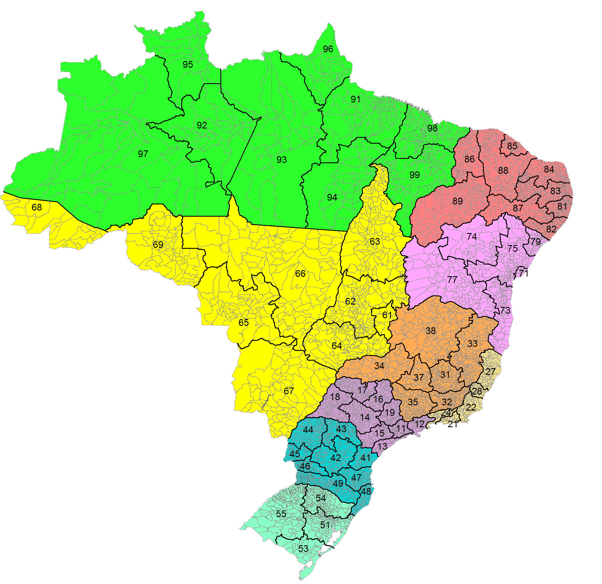
Country Code: +55 International Call Prefix: 00 then Carrier Code Trunk Prefix: 0 then Carrier Code This article contains a list of area codes in Brazil for telephone dialing. The area codes are distributed geographically, citing the main cities in each area. Local phone numbers in Brazil observe an eight-digit pattern (''nnnn-nnnn'') for landlines and nine digits (''nnnnn-nnnn'') for mobile phones. Mobile numbers share the same geographic area codes as landlines, but the first digit differentiates them. Landline numbers start with digits ''2'' through ''5''. Initial digits ''6'' through ''9'' are reserved for mobile numbers, but as of 2017 all mobile numbers in Brazil start with the digit ''9''. (There is an exception for some iDEN mobile lines operated by Nextel, which are eight digits long and start with ''7'' and disestablished in 2018.) Area codes have two digits, and are often notated between parentheses: ''(aa) nnnn-nnnn''. For long-distance calls within Brazil, a zero ... [...More Info...] [...Related Items...] OR: [Wikipedia] [Google] [Baidu] |
Pedro De Toledo, Brazil
Pedro is a masculine given name. Pedro is the Spanish, Portuguese, and Galician name for ''Peter''. Its French equivalent is Pierre while its English and Germanic form is Peter. The counterpart patronymic surname of the name Pedro, meaning "son of Peter" (compare with the English surname Peterson) is Pérez in Spanish, and Peres in Galician and Portuguese, Pires also in Portuguese, and Peiris in coastal area of Sri Lanka (where it originated from the Portuguese version), with all ultimately meaning "son of Pêro". The name Pedro is derived via the Latin word "petra", from the Greek word "η πέτρα" meaning "stone, rock". The name Peter itself is a translation of the Aramaic ''Kephas'' or '' Cephas'' meaning "stone". An alternate archaic spelling is ''Pêro''. Pedro may refer to: Notable people Monarchs, mononymously *Pedro I of Portugal * Pedro II of Portugal * Pedro III of Portugal * Pedro IV of Portugal, also Pedro I of Brazil * Pedro V of Portugal * Pedro II ... [...More Info...] [...Related Items...] OR: [Wikipedia] [Google] [Baidu] |
Juquitiba
Juquitiba is a suburban municipality in the southeastern part of the state of São Paulo in Brazil. It is part of the Metropolitan Region of São Paulo. The population is 31,646 (2020 est.) in an area of 522.17 km². This name comes from the Tupi language. The southern part of the municipality is heavily forested with the Serra do Mar mountain range, the central and the northern parts are predominantly hilly. The municipality contains part of the Serra do Mar Environmental Protection Area The Serra do Mar Environmental Protection Area ( pt, Área de Proteção Ambiental Serra do Mar) is an environmental protection area in the state of São Paulo, Brazil. It controls land use in an extensive area of Atlantic Forest in the Serra do ..., created in 1984. Population history Tourism Tourism is a strong point of Juquitiba. Just 70 km from the state capital, offers contact with the animals and plants of the Atlantic forest. It offers various adventure sports like river rafting ... [...More Info...] [...Related Items...] OR: [Wikipedia] [Google] [Baidu] |
Roman Catholic Diocese Of Santos
The Roman Catholic Diocese of Santos ( la, Dioecesis Santosensis) is a diocese located in the city of Santos in the Ecclesiastical province of São Paulo São Paulo (, ; Portuguese for ' Saint Paul') is the most populous city in Brazil, and is the capital of the state of São Paulo, the most populous and wealthiest Brazilian state, located in the country's Southeast Region. Listed by the Ga ... in Brazil. History * 4 July 1924: Established as Diocese of Santos from the Metropolitan Archdiocese of São Paulo Special churches *Minor Basilicas: **Basílica Santo Antônio do Embaré Bishops * Bishops of Santos (Roman rite), in reverse chronological order ** Bishop Tarcísio Scaramussa, S.D.B. (2015.05.06 – present); formerly, Coadjutor Bishop of the Diocese under Bishop Braido ** Bishop Jacyr Francisco Braido, C.S. (2000.07.26 – 2015.05.06) ** Bishop David Picão (1966.11.21 – 2000.07.26) ** Bishop Idílio José Soares (1943.06.12 – 1966.11.21) ** Bishop Pau ... [...More Info...] [...Related Items...] OR: [Wikipedia] [Google] [Baidu] |
Serra Do Mar
The Serra do Mar (, Portuguese for ''Sea's Ridge'' or ''Sea Ridge'') is a 1,500 km long system of mountain ranges and escarpments in Southeastern Brazil. Geography The Serra do Mar runs parallel to the Atlantic Ocean coast from the state of Espírito Santo to southern Santa Catarina,Angulo, R. J., G. C. Lessa, M. C. de Souza (2009). ''The Holocene Barrier Systems of Paranaguá and Northern Santa Catarina Coasts, Southern Brazil.'' Lecture Notes in Earth Sciences 107: 135-176. although some literature includes the Serra Geral in the Serra do Mar, in which case the range would extend to northeastern Rio Grande do Sul. The main escarpment forms the boundary between the sea-level littoral and the inland plateau (''planalto''), which has a mean altitude of . This escarpment is part of the Great Escarpment that runs along much of the eastern coast of Brazil south from the city of Salvador, Bahia. Mountain ranges The mountain ranges are discontinuous in several places and ar ... [...More Info...] [...Related Items...] OR: [Wikipedia] [Google] [Baidu] |
Red-tailed Amazon
The red-tailed amazon (''Amazona brasiliensis''), also known as the red-tailed parrot, is a species of parrot in the family Psittacidae. It is endemic to coastal regions in the south-east Brazilian states of São Paulo and Paraná. The bird has been threatened by habitat loss and capture for the wild bird trade, and is a symbol of the efforts to conserve one of the Earth's most biologically diverse ecosystems. Consequently, it is considered Near Threatened by BirdLife International and the IUCN. In 1991–92, the population had fallen below 2000 individuals. Following on-going conservation efforts, a count and estimate from 2015 suggests a population of 9,000–10,000, indicating that this species is recovering from earlier persecution. A recent study shows that the population of this species is stable at Paraná state, Southern Brazil, revealing population trend fluctuation during the last 12 years. Taxonomy In 1751 the English naturalist George Edwards included an illustr ... [...More Info...] [...Related Items...] OR: [Wikipedia] [Google] [Baidu] |


