|
Interstate 69
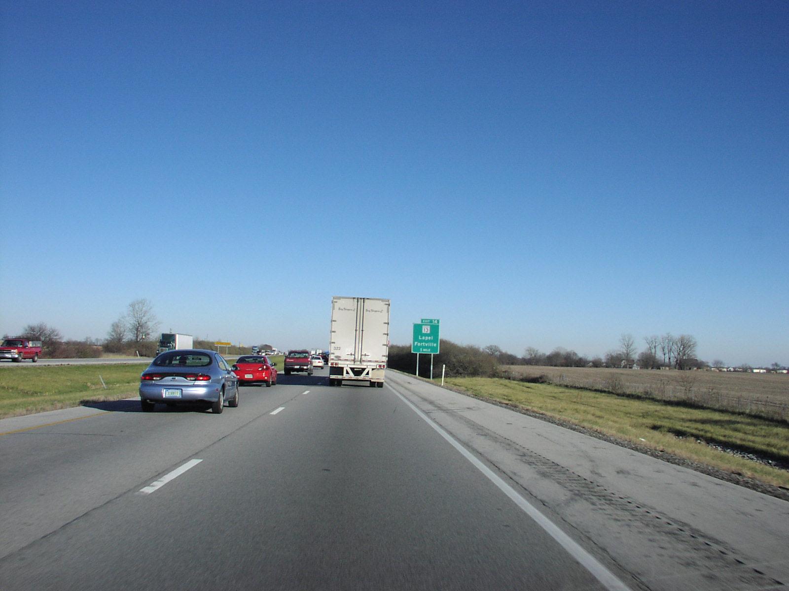
Interstate 69 (I-69) is an Interstate Highway in the United States currently consisting of 10 unconnected segments with an original continuous segment from Indianapolis, Indiana, northeast to the Canadian border in Port Huron, Michigan, at . The remaining separated segments are variously completed and posted or not posted sections of an extension southwest to the Mexican border in Texas. Of this extension—nicknamed the NAFTA Superhighway because it would help trade with Canada and Mexico spurred by the North American Free Trade Agreement (NAFTA)—five pieces near Corpus Christi, Texas; Houston, Texas; northwestern Mississippi; Memphis, Tennessee; and Evansville, Indiana, have been built or upgraded and signposted as I-69. A sixth segment of I-69 through Kentucky utilizing that state's existing parkway system and a section of I-24 was established by federal legislation in 2008, but only a portion is signposted. This brings the total length to about . The proposed exte ... [...More Info...] [...Related Items...] OR: [Wikipedia] [Google] [Baidu] |
Federal Highway Administration
The Federal Highway Administration (FHWA) is a division of the United States Department of Transportation that specializes in highway transportation. The agency's major activities are grouped into two programs, the Federal-aid Highway Program and the Federal Lands Highway Program. Its role had previously been performed by the Office of Road Inquiry, Office of Public Roads and the Bureau of Public Roads. History Background The organization has several predecessor organizations and complicated history. The Office of Road Inquiry (ORI) was founded in 1893. In 1905, that organization's name was changed to the Office of Public Roads (OPR) which became a division of the United States Department of Agriculture. The name was changed again to the Bureau of Public Roads in 1915 and to the Public Roads Administration (PRA) in 1939. It was then shifted to the Federal Works Agency which was abolished in 1949 when its name reverted to Bureau of Public Roads under the Department of Comme ... [...More Info...] [...Related Items...] OR: [Wikipedia] [Google] [Baidu] |
Calvert City, Kentucky
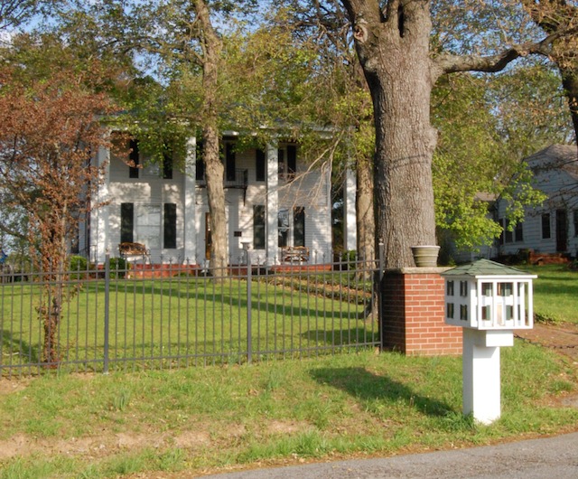
Calvert City is a home rule-class city in Marshall County, Kentucky, United States. The population was 2,566 at the 2010 census. History Calvert City was named for Potilla Willis Calvert. He built his home, Oak Hill, in 1860 and around a decade later gave a portion of his land to a new railroad, specifying that a station be built near his home.Rennick, Robert. ''Kentucky Place Names'', p. 46. University Press of Kentucky (Lexington), 1987. Accessed 24 July 2013. That station served as the starting point of the town, which was incorporated on March 18, 1871. The railroad station and post office long favored the shorter Calvert, but the Board on Geographic Names reversed its earlier decision in 1957 and switched to the longer form. By 1896, Calvert City was known as a sundown town, where African Americans were not allowed to reside. By 1908, the rest of Marshall County had also expelled its African American residents. During the Ohio River flood of 1937, Calvert City's busines ... [...More Info...] [...Related Items...] OR: [Wikipedia] [Google] [Baidu] |
Corpus Christi, Texas
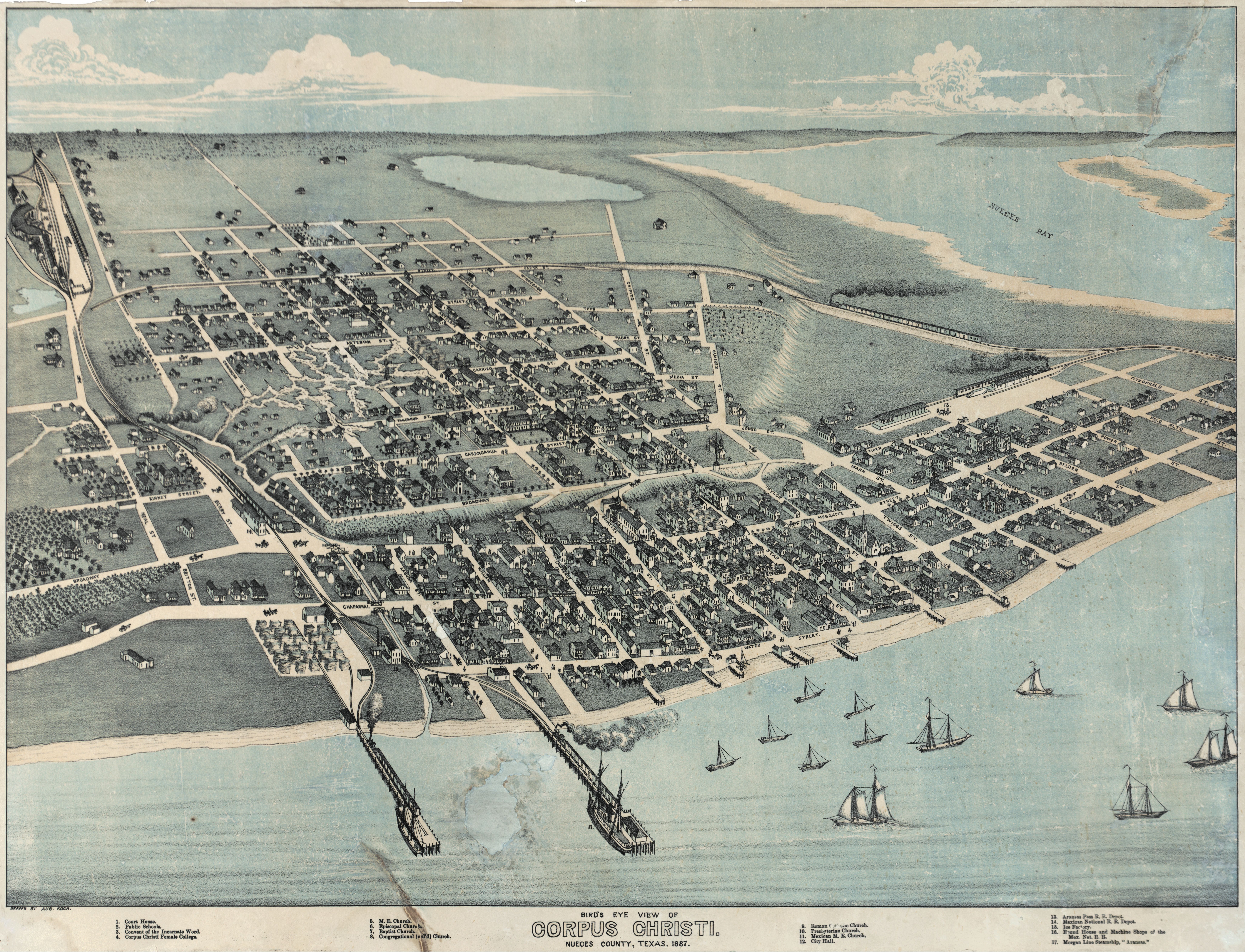
Corpus Christi (; Ecclesiastical Latin: "''Body of Christ"'') is a coastal city in the South Texas region of the U.S. state of Texas and the county seat and largest city of Nueces County, it also extends into Aransas, Kleberg, and San Patricio Counties. It is southeast of San Antonio. Its political boundaries encompass Nueces Bay and Corpus Christi Bay. Its zoned boundaries include small land parcels or water inlets of three neighboring counties. The city's population was 317,863 in 2020, making it the eighth-most populous city in Texas. The Corpus Christi metropolitan area had an estimated population of 442,600. It is also the hub of the six-county Corpus Christi-Kingsville Combined Statistical Area, with a 2013 estimated population of 516,793. The Port of Corpus Christi is the fifth-largest in the United States. The region is served by the Corpus Christi International Airport. The city's name means body of Christ in Ecclesiastical Latin, in reference to the Christian sac ... [...More Info...] [...Related Items...] OR: [Wikipedia] [Google] [Baidu] |
North American Free Trade Agreement
The North American Free Trade Agreement (NAFTA ; es, Tratado de Libre Comercio de América del Norte, TLCAN; french: Accord de libre-échange nord-américain, ALÉNA) was an agreement signed by Canada, Mexico, and the United States that created a trilateral trade bloc in North America. The agreement came into force on January 1, 1994, and superseded the 1988 Canada–United States Free Trade Agreement between the United States and Canada. The NAFTA trade bloc formed one of the largest trade blocs in the world by gross domestic product. The impetus for a North American free trade zone began with U.S. president Ronald Reagan, who made the idea part of his 1980 presidential campaign. After the signing of the Canada–United States Free Trade Agreement in 1988, the administrations of U.S. president George H. W. Bush, Mexican President Carlos Salinas de Gortari, and Canadian prime minister Brian Mulroney agreed to negotiate what became NAFTA. Each submitted the agreement for ... [...More Info...] [...Related Items...] OR: [Wikipedia] [Google] [Baidu] |
Mexico
Mexico (Spanish: México), officially the United Mexican States, is a country in the southern portion of North America. It is bordered to the north by the United States; to the south and west by the Pacific Ocean; to the southeast by Guatemala, Belize, and the Caribbean Sea; and to the east by the Gulf of Mexico. Mexico covers ,Mexico ''''. . making it the world's 13th-largest country by are ... [...More Info...] [...Related Items...] OR: [Wikipedia] [Google] [Baidu] |
Canada
Canada is a country in North America. Its ten provinces and three territories extend from the Atlantic Ocean to the Pacific Ocean and northward into the Arctic Ocean, covering over , making it the world's second-largest country by total area. Its southern and western border with the United States, stretching , is the world's longest binational land border. Canada's capital is Ottawa, and its three largest metropolitan areas are Toronto, Montreal, and Vancouver. Indigenous peoples have continuously inhabited what is now Canada for thousands of years. Beginning in the 16th century, British and French expeditions explored and later settled along the Atlantic coast. As a consequence of various armed conflicts, France ceded nearly all of its colonies in North America in 1763. In 1867, with the union of three British North American colonies through Confederation, Canada was formed as a federal dominion of four provinces. This began an accretion of provinces an ... [...More Info...] [...Related Items...] OR: [Wikipedia] [Google] [Baidu] |
Mexico–United States Border
The Mexico–United States border ( es, frontera Estados Unidos–México) is an international border separating Mexico and the United States, extending from the Pacific Ocean in the west to the Gulf of Mexico in the east. The border traverses a variety of terrains, ranging from urban areas to deserts. The Mexico–United States border is the most frequently crossed border in the world, with approximately 350 million documented crossings annually. It is the tenth-longest border between two countries in the world. The total length of the continental border is . From the Gulf of Mexico, it follows the course of the Rio Grande (Río Bravo del Norte) to the border crossing at Ciudad Juárez, Chihuahua, and El Paso, Texas. Westward from El Paso–Juárez, it crosses vast tracts of the Chihuahuan and Sonoran deserts to the Colorado River Delta and San Diego–Tijuana, before reaching the Pacific Ocean. Four American states border Mexico: California, Arizona, New Mexico, an ... [...More Info...] [...Related Items...] OR: [Wikipedia] [Google] [Baidu] |
Indianapolis
Indianapolis (), colloquially known as Indy, is the state capital and most populous city of the U.S. state of Indiana and the seat of Marion County. According to the U.S. Census Bureau, the consolidated population of Indianapolis and Marion County was 977,203 in 2020. The "balance" population, which excludes semi-autonomous municipalities in Marion County, was 887,642. It is the 15th most populous city in the U.S., the third-most populous city in the Midwest, after Chicago and Columbus, Ohio, and the fourth-most populous state capital after Phoenix, Arizona, Austin, Texas, and Columbus. The Indianapolis metropolitan area is the 33rd most populous metropolitan statistical area in the U.S., with 2,111,040 residents. Its combined statistical area ranks 28th, with a population of 2,431,361. Indianapolis covers , making it the 18th largest city by land area in the U.S. Indigenous peoples inhabited the area dating to as early as 10,000 BC. In 1818, the Lenape relinquished the ... [...More Info...] [...Related Items...] OR: [Wikipedia] [Google] [Baidu] |
United States
The United States of America (U.S.A. or USA), commonly known as the United States (U.S. or US) or America, is a country primarily located in North America. It consists of 50 states, a federal district, five major unincorporated territories, nine Minor Outlying Islands, and 326 Indian reservations. The United States is also in free association with three Pacific Island sovereign states: the Federated States of Micronesia, the Marshall Islands, and the Republic of Palau. It is the world's third-largest country by both land and total area. It shares land borders with Canada to its north and with Mexico to its south and has maritime borders with the Bahamas, Cuba, Russia, and other nations. With a population of over 333 million, it is the most populous country in the Americas and the third most populous in the world. The national capital of the United States is Washington, D.C. and its most populous city and principal financial center is New York City. Paleo-Americ ... [...More Info...] [...Related Items...] OR: [Wikipedia] [Google] [Baidu] |
Interstate Highway
The Dwight D. Eisenhower National System of Interstate and Defense Highways, commonly known as the Interstate Highway System, is a network of controlled-access highways that forms part of the National Highway System in the United States. The system extends throughout the contiguous United States and has routes in Hawaii, Alaska, and Puerto Rico. The U.S. federal government first funded roadways through the Federal Aid Road Act of 1916, and began an effort to construct a national road grid with the passage of the Federal Aid Highway Act of 1921. In 1926, the United States Numbered Highway System was established, creating the first national road numbering system for cross-country travel. The roads were still state-funded and maintained, however, and there was little in the way of national standards for road design. U.S. Highways could be anything from a two-lane country road to a major multi-lane freeway. After Dwight D. Eisenhower became president in 1953, his administr ... [...More Info...] [...Related Items...] OR: [Wikipedia] [Google] [Baidu] |
Flint, Michigan
Flint is the largest city and seat of Genesee County, Michigan, United States. Located along the Flint River, northwest of Detroit, it is a principal city within the region known as Mid Michigan. At the 2020 census, Flint had a population of 81,252, making it the twelfth largest city in Michigan. The Flint metropolitan area is located entirely within Genesee County. It is the fourth largest metropolitan area in Michigan with a population of 406,892 in 2020. The city was incorporated in 1855. Flint was founded as a village by fur trader Jacob Smith in 1819 and became a major lumbering area on the historic Saginaw Trail during the 19th century. From the late 19th century to the mid 20th century, the city was a leading manufacturer of carriages and later automobiles, earning it the nickname "Vehicle City". General Motors (GM) was founded in Flint in 1908, and the city grew into an automobile manufacturing powerhouse for GM's Buick and Chevrolet divisions, especially after Wo ... [...More Info...] [...Related Items...] OR: [Wikipedia] [Google] [Baidu] |
Lansing, Michigan
Lansing () is the capital of the U.S. state of Michigan. It is mostly in Ingham County, although portions of the city extend west into Eaton County and north into Clinton County. The 2020 census placed the city's population at 112,644, making it the sixth largest city in Michigan. The population of its metropolitan statistical area ( MSA) was 541,297 at the 2020 census, the third largest in the state after metropolitan Detroit and Grand Rapids. It was named the new state capital of Michigan in 1847, ten years after Michigan became a state. The Lansing metropolitan area, colloquially referred to as "Mid-Michigan", is an important center for educational, cultural, governmental, commercial, and industrial functions. Neighboring East Lansing is home to Michigan State University, a public research university with an enrollment of more than 50,000. The area features two medical schools, one veterinary school, two nursing schools, and two law schools. It is the site of the Michig ... [...More Info...] [...Related Items...] OR: [Wikipedia] [Google] [Baidu] |


