|
Heathcote Valley
Heathcote Valley is a suburb of Christchurch, New Zealand. It is named after Sir William Heathcote, who was secretary of the Canterbury Association. Location Nestled at the foot of the steep volcanic crags that form the northern edge of the hills, some southeast of the city centre the Heathcote Valley is dominated by the approaches to the Lyttelton road tunnel, a major arterial that passes through the Port Hills. The road is part of the State Highway 74 network. The Main South Railway line also passes through the suburb, before entering the Lyttelton rail tunnel that connects with the port of Lyttelton. Heathcote Valley is the lower terminus of the Christchurch Gondola, which goes up to Mount Cavendish on the Port Hills, and also for the Bridle Path walking track over the northern rim of the Lyttelton volcano to the port of Lyttelton. History In the past the Heathcote Valley was known for its orchards, brickworks and maltworks. The distinctive towers of the Canterbury Ma ... [...More Info...] [...Related Items...] OR: [Wikipedia] [Google] [Baidu] |
Christchurch
Christchurch ( ; mi, Ōtautahi) is the largest city in the South Island of New Zealand and the seat of the Canterbury Region. Christchurch lies on the South Island's east coast, just north of Banks Peninsula on Pegasus Bay. The Avon River / Ōtākaro flows through the centre of the city, with an urban park along its banks. The city's territorial authority population is people, and includes a number of smaller urban areas as well as rural areas. The population of the urban area is people. Christchurch is the second-largest city by urban area population in New Zealand, after Auckland. It is the major urban area of an emerging sub-region known informally as Greater Christchurch. Notable smaller urban areas within this sub-region include Rangiora and Kaiapoi in Waimakariri District, north of the Waimakariri River, and Rolleston and Lincoln in Selwyn District to the south. The first inhabitants migrated to the area sometime between 1000 and 1250 AD. They hunted moa, which led ... [...More Info...] [...Related Items...] OR: [Wikipedia] [Google] [Baidu] |
Lyttelton, New Zealand
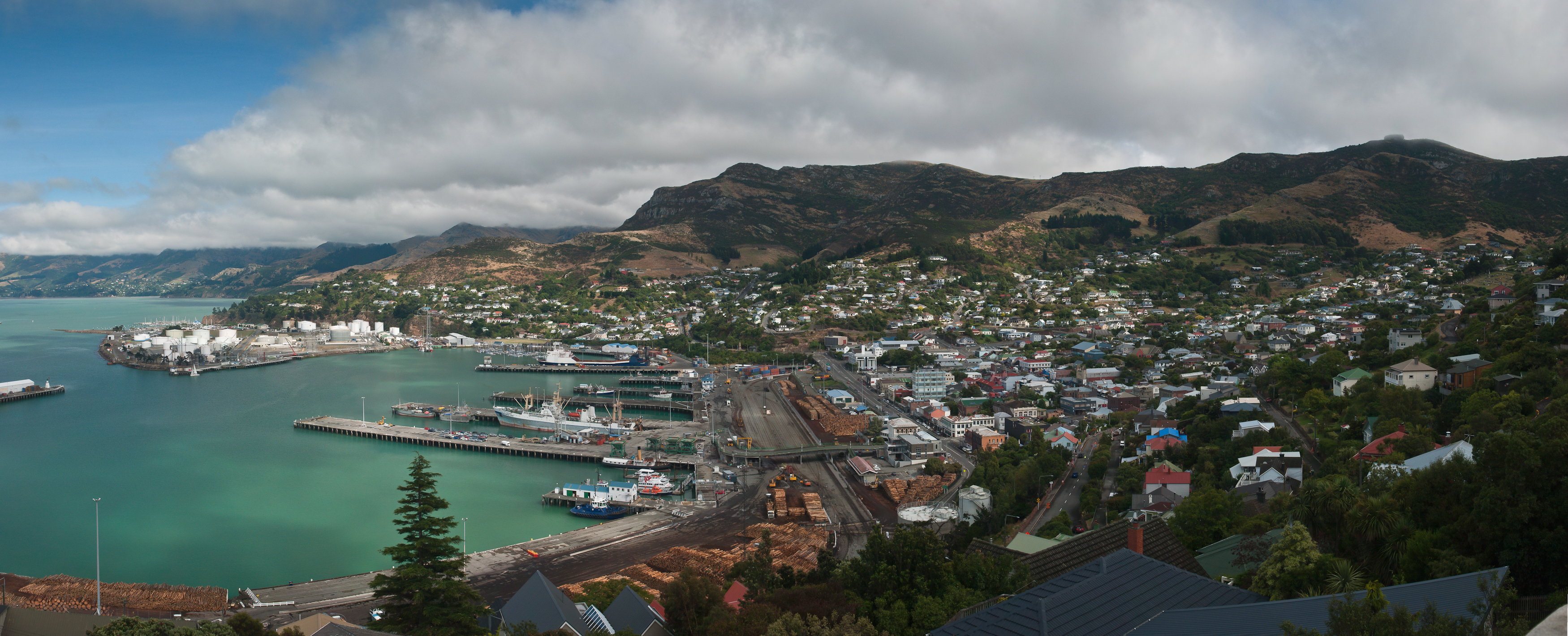
Lyttelton (Māori: ''Ōhinehou'') is a port town on the north shore of Lyttelton Harbour / Whakaraupō, at the northwestern end of Banks Peninsula and close to Christchurch, on the eastern coast of the South Island of New Zealand. As a landing point for Christchurch-bound seafarers, Lyttelton has historically been regarded as the "Gateway to Canterbury" for colonial settlers. Until the 2020 coronavirus pandemic, the port has been a regular destination for cruise ships. It is the South Island's principal goods-transport terminal, handling 34% of exports and 61% of imports by value. In 2009 Lyttelton was awarded Category I Historic Area status by the Historic Places Trust (NZHPT) defined as "an area of special or outstanding historical or cultural heritage significance or value", not long before much of the historic fabric was destroyed in the 2011 Christchurch earthquake. Location Lyttelton is the largest settlement on Lyttelton Harbour / Whakaraupō, an inlet on the northwe ... [...More Info...] [...Related Items...] OR: [Wikipedia] [Google] [Baidu] |
Wally Argus
Walter Garland Argus (29 May 1921 – 21 October 2016) was a New Zealand rugby union player who played 10 matches including four tests for the national team. From 16 November 2012 until his death he was the oldest living All Black. Early life and family Argus was born in Auckland on 29 May 1921, the son of Ernest Edward Argus, a railway worker, and his second wife, Margaret Elizabeth Argus (née Olsen). He was educated at Albury School and Pleasant Point District High School in South Canterbury. Early rugby career A wing three-quarter, Argus began playing senior club rugby for the Southern Football Club in 1938, and the same year made his representative debut for the Mackenzie sub-union. Following the outbreak of World War II, he moved to Christchurch, where he played for the Linwood club, and made the provincial team in 1941 and 1942. From 1942, Argus served with the 2nd New Zealand Expeditionary Force (2NZEF) in North Africa and Italy. Post-war rugby career After the end of ... [...More Info...] [...Related Items...] OR: [Wikipedia] [Google] [Baidu] |
2006 New Zealand Census
The New Zealand Census of Population and Dwellings ( mi, Te Tatauranga o ngā Tāngata Huri Noa i Aotearoa me ō rātou Whare Noho) is a national population and housing census conducted by government department Statistics New Zealand every five years. There have been 34 censuses since 1851. In addition to providing detailed information about national demographics, the results of the census play an important part in the calculation of resource allocation to local service providers. The 2018 census took place on Tuesday 6 March 2018. The next census is expected in March 2023. Census date Since 1926, the census has always been held on a Tuesday and since 1966, the census always occurs in March. These are statistically the month and weekday on which New Zealanders are least likely to be travelling. The census forms have to be returned by midnight on census day for them to be valid. Conducting the census Until 2018, census forms were hand-delivered by census workers during the lead ... [...More Info...] [...Related Items...] OR: [Wikipedia] [Google] [Baidu] |
2013 New Zealand Census
The 2013 New Zealand census was the thirty-third national census. "The National Census Day" used for the census was on Tuesday, 5 March 2013. The population of New Zealand was counted as 4,242,048, – an increase of 214,101 or 5.3% over the 2006 census. The 2013 census forms were the same as the forms developed for the 2011 census which was cancelled due to the February 2011 major earthquake in Christchurch. There were no new topics or questions. New Zealand's next census was conducted in March 2018. Collection methods The results from the post-enumeration survey showed that the 2013 census recorded 97.6 percent of the residents in New Zealand on census night. However, the overall response rate was 92.9 percent, with a non-response rate of 7.1 percent made up of the net undercount and people who were counted in the census but had not received a form. Results Population and dwellings Population counts for New Zealand regions. Note: All figures are for the census usually r ... [...More Info...] [...Related Items...] OR: [Wikipedia] [Google] [Baidu] |
2018 New Zealand Census
Eighteen or 18 may refer to: * 18 (number), the natural number following 17 and preceding 19 * one of the years 18 BC, AD 18, 1918, 2018 Film, television and entertainment * ''18'' (film), a 1993 Taiwanese experimental film based on the short story ''God's Dice'' * ''Eighteen'' (film), a 2005 Canadian dramatic feature film * 18 (British Board of Film Classification), a film rating in the United Kingdom, also used in Ireland by the Irish Film Classification Office * 18 (''Dragon Ball''), a character in the ''Dragon Ball'' franchise * "Eighteen", a 2006 episode of the animated television series ''12 oz. Mouse'' Music Albums * ''18'' (Moby album), 2002 * ''18'' (Nana Kitade album), 2005 * '' 18...'', 2009 debut album by G.E.M. Songs * "18" (5 Seconds of Summer song), from their 2014 eponymous debut album * "18" (One Direction song), from their 2014 studio album ''Four'' * "18", by Anarbor from their 2013 studio album '' Burnout'' * "I'm Eighteen", by Alice Cooper commo ... [...More Info...] [...Related Items...] OR: [Wikipedia] [Google] [Baidu] |
Heathcote River
Heathcote may refer to: Places in Australia *Heathcote, New South Wales, a suburb of Sydney **Electoral district of Heathcote, a seat in the New South Wales Legislative Assembly **Heathcote National Park ** Parish of Heathcote a parish of Cumberland County *Heathcote, Victoria **Heathcote-Graytown National Park ** Heathcote wine region * Heathcote Junction, Victoria * Heathcote South, Victoria * Point Heathcote, Western Australia in Canada * Heathcote Lake, Ontario in England * Heathcote, Ilkley, a villa in West Yorkshire * Heathcote, Derbyshire * Heathcote, Shropshire * Heathcote, Warwickshire, a suburb of Leamington Spa in New Zealand * Heathcote Valley, a suburb of Christchurch ** Heathcote River ** Heathcote (New Zealand electorate) in the United States * Heathcote Community, Maryland * Heathcote, New Jersey ** Heathcote Brook ** Withington Estate, also known as Heathcote Farm People as a forename * Heathcote Helmore (1894–1965), New Zealand architect *Heathcote ... [...More Info...] [...Related Items...] OR: [Wikipedia] [Google] [Baidu] |
The NEW Triangle Tavern - Panoramio
''The'' () is a grammatical article in English, denoting persons or things already mentioned, under discussion, implied or otherwise presumed familiar to listeners, readers, or speakers. It is the definite article in English. ''The'' is the most frequently used word in the English language; studies and analyses of texts have found it to account for seven percent of all printed English-language words. It is derived from gendered articles in Old English which combined in Middle English and now has a single form used with pronouns of any gender. The word can be used with both singular and plural nouns, and with a noun that starts with any letter. This is different from many other languages, which have different forms of the definite article for different genders or numbers. Pronunciation In most dialects, "the" is pronounced as (with the voiced dental fricative followed by a schwa) when followed by a consonant sound, and as (homophone of pronoun ''thee'') when followed by a v ... [...More Info...] [...Related Items...] OR: [Wikipedia] [Google] [Baidu] |
Christchurch Landmark, Heathcote Grain Silos Finally Falling To The Wreckers Ball - Panoramio
Christchurch ( ; mi, Ōtautahi) is the largest city in the South Island of New Zealand and the seat of the Canterbury Region. Christchurch lies on the South Island's east coast, just north of Banks Peninsula on Pegasus Bay. The Avon River / Ōtākaro flows through the centre of the city, with an urban park along its banks. The city's territorial authority population is people, and includes a number of smaller urban areas as well as rural areas. The population of the urban area is people. Christchurch is the second-largest city by urban area population in New Zealand, after Auckland. It is the major urban area of an emerging sub-region known informally as Greater Christchurch. Notable smaller urban areas within this sub-region include Rangiora and Kaiapoi in Waimakariri District, north of the Waimakariri River, and Rolleston and Lincoln in Selwyn District to the south. The first inhabitants migrated to the area sometime between 1000 and 1250 AD. They hunted moa, which led t ... [...More Info...] [...Related Items...] OR: [Wikipedia] [Google] [Baidu] |
Bridle Path (New Zealand)
The Bridle Path is a steep shared-use track that traverses the northern rim of the Lyttelton volcano connecting the port of Lyttelton with the city of Christchurch in the South Island of New Zealand. It is a popular walking and mountain biking route. The track ascends from the port itself to a height of before descending again via Heathcote Valley to Christchurch. At the summit, next to the Summit Road, is a stone shelter with covered seats that is a 1940 New Zealand centennial memorial to the Pioneer Women of Canterbury. There are also seven commemorative stone seats placed along the Bridle Path; most of these were built for the 1950 Canterbury centenary celebrations. Hastily constructed in late 1850, just in time for the first Canterbury Association settlers to use, it was the most direct way to travel from the port to the new settlements on the plains on the northern side of the Port Hills. Although very steep, it was the primary means of traversing the hills until the '' ... [...More Info...] [...Related Items...] OR: [Wikipedia] [Google] [Baidu] |
Mount Cavendish
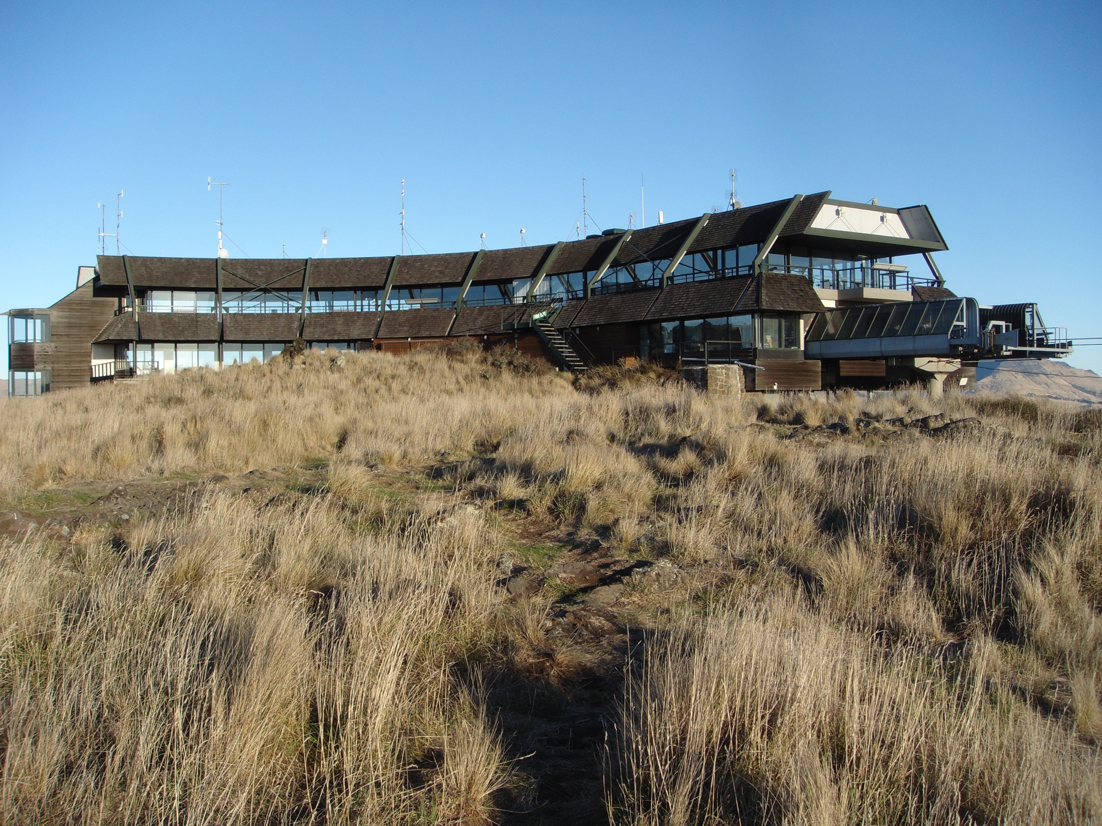
Mount Cavendish is located in the Port Hills, with views over Christchurch, New Zealand and Lyttelton. It is part of the crater wall of the extinct volcano that formed Lyttelton Harbour. The Mount Cavendish Reserve displays some of the best examples of lava flow to be seen on the Port Hills. History Mount Cavendish was first transferred to the Crown for a Scenic Reserve in 1910, by the Morten Brothers. The mountain was first named Hill Morten in 1912 by Harry Ell, in recognition of the Morten family's gifts of land for the Summit Road and scenic reserves. The name Mount Cavendish was first given to nearby Mount Pleasant (after which a suburb is now named) in 1848, but did not stick and the peak of Hill Morten was named Mount Cavendish after the Hon. Richard Cavendish of the Canterbury Association. Description It is 448 metres (1,470 feet) high and falls within the Mount Cavendish Scenic Reserve, which sits at the top of the Heathcote Valley, close to the northern entran ... [...More Info...] [...Related Items...] OR: [Wikipedia] [Google] [Baidu] |
Christchurch Gondola
The Christchurch Gondola is a tourist attraction service offered bChristchurch Attractionsin Christchurch, New Zealand. The gondola base is located in Heathcote Valley, and it traverses the slopes of Mount Cavendish in the Port Hills. Also known as a Aerial lift, cable car, the Christchurch Gondola's course is in length, and from the summit it is possible to see across the city of Christchurch and the Canterbury Plains to the Southern Alps in the north and west, and down into Lyttelton Harbour and Banks Peninsula in the south and east. Sometimes used as a transport method for visitors who use the walking tracks on Mt Cavendish, the gondola is ranked as one of the top tourist attractions in Christchurch by TripAdvisor. The summit is above sea level.Bulovic, AnneThe Christchurch Gondola opened 24th October 1992, ''peelingbackhistory.co.nz'', Retrieved 10 November 2016. The gondola opened as the Mount Cavendish Gondola in October 1992 after a long planning process at a costs of Ne ... [...More Info...] [...Related Items...] OR: [Wikipedia] [Google] [Baidu] |


.png)

