|
Hardangerfjorden
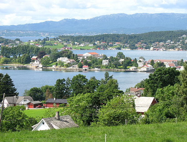
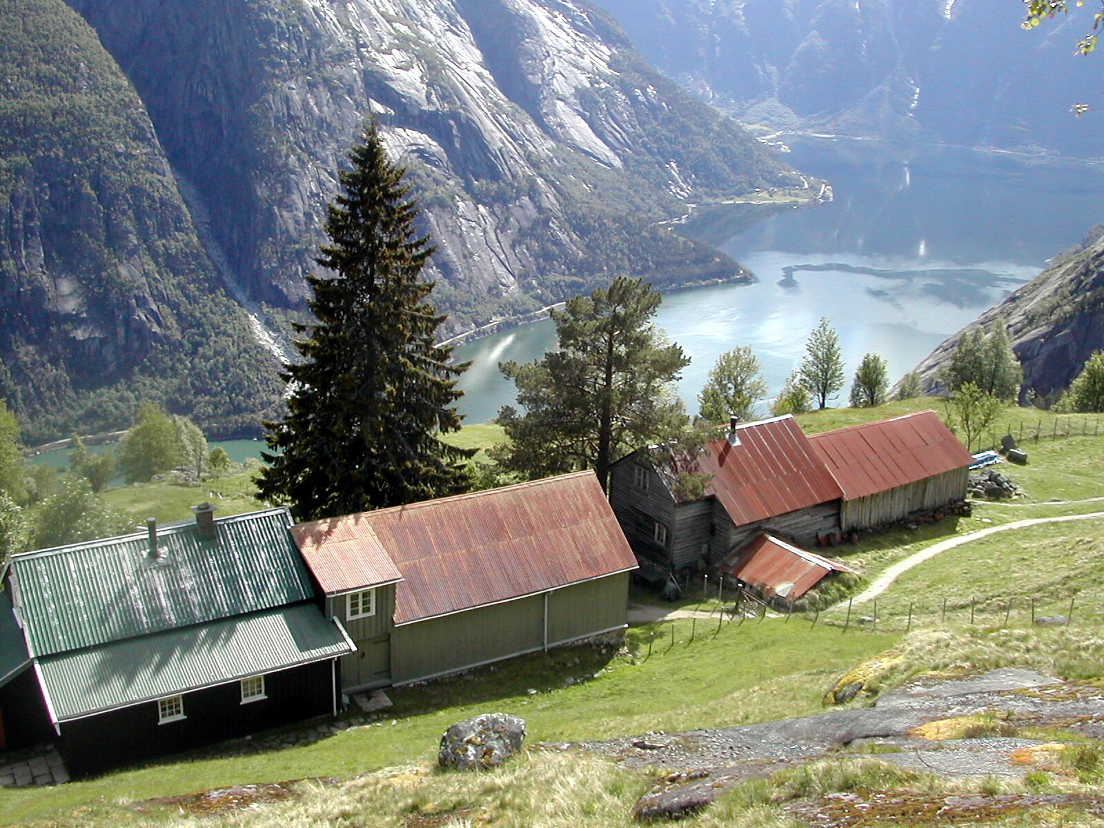
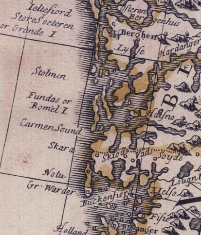
The Hardangerfjord ( en, Hardanger Fjord) is the fifth longest fjord in the world, and the second longest fjord in Norway. It is located in Vestland county in the Hardanger region. The fjord stretches from the Atlantic Ocean into the mountainous interior of Norway along the Hardangervidda plateau. The innermost point of the fjord reaches the town of Odda. Location The Hardangerfjord starts at the Atlantic Ocean about south of the city of Bergen. Here the fjord heads in a northeasterly direction between the island of Bømlo and the mainland. It passes by the larger islands of Stord, Tysnesøya, and Varaldsøy on the north/west side and the Folgefonna peninsula on the south/east side. Once it is surrounded by the mainland, it begins to branch off into smaller fjords that reach inwards towards the grand Hardangervidda mountain plateau. The longest branch of the Hardangerfjord is Sørfjorden which cuts south about from the main fjord. Its maximum depth is more than ju ... [...More Info...] [...Related Items...] OR: [Wikipedia] [Google] [Baidu] |
Sørfjorden (Hardanger)
Sørfjorden is a long fjord that is one of the innermost branches of the main Hardangerfjorden. It is located in Ullensvang Municipality in Vestland county, Norway. It is the longest arm that branches off of the Hardangerfjord. Sørfjorden stretches from just north of the village of Kinsarvik straight south to the industrial town of Odda. The Folgefonna glacier and Folgefonna National Park are located just to the west of the fjord and the Hardangervidda mountain plateau lies to its east. Some of the notable villages that line the sides of the fjord include (north to south): Kinsarvik, Lofthus, Vikebygd, Tyssedal, Eitrheim, and Odda. Norwegian National Road 13 follows the eastern shoreline of the fjord. All the villages along the fjord are filled with fruit farms and orchards, growing fruits like apples and cherries. Media gallery File:Lofthus Norwegen.JPG, View of the fjord in the Lofthus area File:Lofthus1.jpg, Orchards overlooking the fjord File:Sørfjorden, 2011 Augus ... [...More Info...] [...Related Items...] OR: [Wikipedia] [Google] [Baidu] |
Sveio
Sveio is a municipality in Vestland county, Norway. Sveio is a border district that is sometimes considered to be located in the traditional district of Haugalandet since it is located on the Haugalandet peninsula, but it is also considered to be in the traditional district of Sunnhordland since it is located in southern Hordaland county. The administrative centre of the municipality is the village of Sveio. Other villages in the municipality include Auklandshamn, Førde, Våga, and Valevåg. The municipality is the 290th largest by area out of the 356 municipalities in Norway. Sveio is the 165th most populous municipality in Norway with a population of 5,775. The municipality's population density is and its population has increased by 10.5% over the previous 10-year period. Sveio is the site of the Ryvarden Lighthouse which marks the western entrance to the Hardangerfjorden. The lighthouse is automated and the old keepers house and building have now been converted into ... [...More Info...] [...Related Items...] OR: [Wikipedia] [Google] [Baidu] |
Ullensvang
Ullensvang is a municipality in Vestland county, Norway. It is located in the traditional district of Hardanger. The administrative centre is the town of Odda. Some of the notable villages in the municipality include Lofthus, Utne, Vikebygd, Alsåker, Botnen, Eitrheim, Håra, Røldal, Seljestad, Skare, Tyssedal, Jondal, Herand, Kysnesstranda, and Torsnes. The main inhabited part of Ullensvang municipality lies just to the west of Hardangervidda National Park, which covers most of the Hardangervidda plateau, Europe's largest mountain plateau. Most inhabitants live in the narrow coastal mountainsides and valleys along the Hardangerfjorden and Sørfjorden. The largest urban areas in Ullensvang are Odda, Kinsarvik, Jondal, and Lofthus. The Norwegian National Road 13 and the European route E134 are the two main roads through the municipality. National road 13 crosses the Hardangerfjorden via the Hardanger Bridge in the far northern part of the municipality. The ... [...More Info...] [...Related Items...] OR: [Wikipedia] [Google] [Baidu] |
Tysnes
Tysnes () is a municipality in Vestland county, Norway. It is located in the traditional district of Sunnhordland. The administrative centre is the village of Uggdal. Other population centres in Tysnes include the villages of Våge and Onarheim. The island municipality is located in a group of islands near the mouth of the Hardangerfjorden. The majority of the municipal population lives on the island of Tysnesøya, the largest island in the municipality. The municipality is the 283rd largest by area out of the 356 municipalities in Norway. Tysnes is the 234th most populous municipality in Norway with a population of 2,883. The municipality's population density is and its population has increased by 4.2% over the previous 10-year period. General information The historic parish of ''Tysnæs'' was established as a municipality on 1 January 1838 (see formannskapsdistrikt law). On 1 January 1907, the small portion of Tysnes located on the mainland (population: 67) was transfer ... [...More Info...] [...Related Items...] OR: [Wikipedia] [Google] [Baidu] |
Leirvik
Leirvik is a town and the administrative centre of Stord municipality in Vestland county, Norway. The town lies along the southern coast of the large island of Stord, along the Hardangerfjorden. The town gained "town status" in 1997. The town includes the Eldøyane peninsula where the large Kværner Stord industrial area is located. Leirvik is the regional centre of the traditional district of Sunnhordland, and has many public services and offices such as the Sunnhordland District court and the Sunnhordland Museum, as well as many shops and restaurants. Stord Church and several schools such as Stord Upper Secondary School and Western Norway University of Applied Sciences are all located in the town. The town has a population (2019) of 14,126 and a population density of . The entire municipality has about 18,700 residents in it (2019), so Leirvik has about 75% of the total population of the municipality. Leirvik is also the largest urban area that is located in a mun ... [...More Info...] [...Related Items...] OR: [Wikipedia] [Google] [Baidu] |
Kvinnherad
Kvinnherad is a municipality in Vestland county, Norway. It is located in the traditional district of Sunnhordland, along the Hardangerfjorden. The municipality was the 5th in size in former Hordaland county. The administrative centre of the municipality is the village of Rosendal. The largest village is Husnes, with about 6,000 people living in or near the village. Other villages include Ænes, Åkra, Dimmelsvik, Eidsvik, Hatlestrand, Herøysund, Høylandsbygd, Ølve, Sæbøvik, Sundal, Sunde, Uskedal, and Valen. The municipality is the 104th largest by area out of the 356 municipalities in Norway. Kvinnherad is the 94th most populous municipality in Norway with a population of 13,017. The municipality's population density is and its population has decreased by 2.3% over the previous 10-year period. In the southern part of Kvinnherad you will find the typical fjord landscape of western Norway. The areas of Mauranger and Rosendal are said to have about the most beaut ... [...More Info...] [...Related Items...] OR: [Wikipedia] [Google] [Baidu] |
Kvam
Kvam is a municipality in Vestland county, Norway. The municipality is located along the Hardangerfjorden in the traditional district of Hardanger. The administrative centre of the municipality is the village of Norheimsund. Other larger settlements in the municipality include Øystese, Bru, Ålvik, Tørvikbygd, Omastranda, and Mundheim. Historically, the municipality was named ''Vikør''. The municipality is the 188th largest by area out of the 356 municipalities in Norway. Kvam is the 126th most populous municipality in Norway with a population of 8,497. The municipality's population density is and its population has decreased by 0.3% over the previous 10-year period. General information Name The Old Norse form of the name was ''Hvammr'', identical with the word ''hvammr'' which means "(small) valley", possibly referring the Steinsdalen valley west of Norheimsund. Before 1911, the municipality was named '' Vikør'', which comes from the Old Norse word ''Vikøyar''. ... [...More Info...] [...Related Items...] OR: [Wikipedia] [Google] [Baidu] |
Eidfjord
Eidfjord is a municipality in Vestland county, Norway. The municipality is located in the traditional district of Hardanger. The administrative centre of the municipality is the village of Eidfjord, where the majority of the municipal population lives. The other major population centre in the municipality is the village of Øvre Eidfjord. Eidfjord is situated at the end of the Eid Fjord, an inner branch of the large Hardangerfjorden. The village of Eidfjord is a major cruise ship port of call. Eidfjord has several tourist sites, like the Sima Power Plant which is built into the mountain itself, the Måbødalen valley, and the Vøringsfossen waterfall which has a free fall of . Large parts of the Hardangervidda (Europe's largest mountain plateau) are located in Eidfjord. The Hardangervidda Natursenter, a visitors centre and museum for Hardangervidda National Park, is located in Øvre Eidfjord. The municipality is the 57th largest by area out of the 356 municipalities in ... [...More Info...] [...Related Items...] OR: [Wikipedia] [Google] [Baidu] |
Stord (island)
Stord is an island in Vestland county, Norway. Located in the traditional district of Sunnhordland, the island is part of the municipalities of Stord (southern part) and Fitjar (northern part). The largest settlements on the island are the town of Leirvik (granted town status in 1997) and the villages of Sagvåg and Fitjar. Geography Stord has an area of and the highest point is the tall mountain Mehammarsåto. The island lies on the northern side of the mouth of the great Hardangerfjorden. The Selbjørnsfjorden lies on the north end of the island. On the east side of the island, the Langenuen strait separates Stord from the neighboring island of Tysnesøya. On the west side of the island, the Stokksundet strait separates Stord from the neighboring island of Bømlo. There are over 350 small islands and skerries lying off the northeastern coast. Most of the central part of the island is mountainous, leaving the islands population living mostly along the coasts ... [...More Info...] [...Related Items...] OR: [Wikipedia] [Google] [Baidu] |
Vestland
Vestland is a county in Norway established on 1 January 2020. The county is located in Western Norway and it is centred around the city of Bergen, Norway's second largest city. The administrative centre of the county is the city of Bergen, where the executive and political leadership is based, but the County Governor is based in Hermansverk. The county is one of two counties in Norway that have Nynorsk as their official written language form (the others are neutral as to which form people use). Vestland was created in 2020 when the former counties of Hordaland and Sogn og Fjordane (with the exception of Hornindal municipality, which became part of Volda municipality in Møre og Romsdal county) were merged. History Vestland county is a newly created county, but it has been inhabited for centuries. The area was made up of many petty kingdoms under the Gulating during the Middle Ages. The northern part was the known as ''Firdafylke'' (now the Fjordane region; Nordfjord-Sunnfjord), ... [...More Info...] [...Related Items...] OR: [Wikipedia] [Google] [Baidu] |
Stord
Stord is a municipality in Vestland county, Norway. It is located in the traditional district of Sunnhordland. Stord is sometimes called "Norway in miniature" since it has such a variety of landscapes: coastline, fjords, forests, agricultural land, and mountain areas. The administrative centre of the municipality is the town of Leirvik, which is also the largest town in the municipality and the whole region of Sunnhordland. Leirvik was declared a town in 1997. Other population centres in the municipality include the large village of Sagvåg and the smaller villages of Litlabø and Grov. The municipality is the 316th largest by area out of the 356 municipalities in Norway. Stord is the 69th most populous municipality in Norway with a population of 18,919. The municipality's population density is and its population has increased by 5.4% over the previous 10-year period. General information The parish of ''Stordøen'' was established as a municipality on 1 January 1838 (see ... [...More Info...] [...Related Items...] OR: [Wikipedia] [Google] [Baidu] |
Bømlo
Bømlo is a municipality in the southwestern part of Vestland county, Norway. It is located in the traditional district of Sunnhordland. The administrative centre of the municipality is the village of Svortland. Other villages in Bømlo include Mosterhamn, Rubbestadneset, Lykling, and Langevåg. Most of the municipal residents live on the island of Bømlo, which makes up the majority of the land in the municipality. Bømlo was actively involved in the Shetland bus operation during the Second World War. A 23-year-old male from Bømlo, Nils Nesse, was the first of the Shetland Bus men to be killed. The municipality is the 289th largest by area out of the 356 municipalities in Norway. Bømlo is the 97th most populous municipality in Norway with a population of 12,061. The municipality's population density is and its population has increased by 4.9% over the previous 10-year period. General information The municipality of Bømlo was established on 1 July 1916 when the ol ... [...More Info...] [...Related Items...] OR: [Wikipedia] [Google] [Baidu] |


