|
Hammir Dev Chauhan
Hammiradeva (IAST: Hammīra-deva; r. c. 1283–1301) was the last ruler from the Ranthambore branch of the Chauhans (Chahamanas). He is also known as Hamir Dev Chauhan in the Muslim chronicles and the vernacular literature. Hammiradeva ruled a kingdom centred around Ranthambore in present-day Rajasthan. In the 1280s, he raided several neighbouring kingdoms, which ultimately left him without allies. In the 1290s, he successfully defended his kingdom against Jalaluddin Khalji of the Delhi Sultanate. In 1299, he gave asylum to some Mongol rebels from Delhi, which prompted Jalaluddin's successor Alauddin Khalji to invade his kingdom. Hammira's forces achieved some successes against Alauddin's generals Ulugh Khan and Nusrat Khan, but he was ultimately defeated and killed in 1301 after a long siege. Hammira is celebrated as a hero in several texts composed after his death including Nayachandra Suri's ''Hammira Mahakavya'', Jodharaja's ''Hammira Raso'', and Chandrashekhara's ''Hammi ... [...More Info...] [...Related Items...] OR: [Wikipedia] [Google] [Baidu] |
Ranthambore Fort
Ranthambore Fort lies within the Ranthambore National Park, near the city of Sawai Madhopur in Sawai Madhopur district of Rajasthan, India. the park being the former hunting grounds of the Maharajahs of Jaipur until the time of India's Independence. It is a formidable fort having been a focal point of the historical developments of Rajasthan. The fort is believed to be constructed by the Chahamanas. In the 13th century the Delhi Sultanate captured it for a brief time. The fort provides a panoramic view of the surrounding Ranthambore National Park and is now a popular tourist attraction. In 2013, at the 37th session of the World Heritage Committee, Ranthambore Fort, along with 5 other forts of Rajasthan, was declared a UNESCO World Heritage Site under the group Hill Forts of Rajasthan. History The oldest settlement in the area near Sawai Madhopur was around the Ranthambhore fort. The exact origin of the Ranthambore fort is still disputed but it is generally accepted that the ... [...More Info...] [...Related Items...] OR: [Wikipedia] [Google] [Baidu] |
Prabandha Kosha
''Prabandha-Kosha'' (IAST: Prabandhakośa) is an Indian Sanskrit-language collection of ''prabandha''s (legendary biographical narratives). It was compiled by the Jain scholar Rajashekhara Suri in 1349 CE. It describes the lives of 24 people, including 10 Jain scholars, 4 Sanskrit poets, 7 kings and 3 Jain householders. It is also known as ''Chaturvinshati Prabandha''. The content of the collection is based on the information that Rajashekhara obtained from his teacher Tilakasuri. He composed the work at Delhi, under the patronage of Madanasimha, whose father had been honoured by Shri Mahamad Shahi (probably Muhammad Tughluq). Only the 7th ''prabandha'' in the collection (the one about Mallavadi-Suri) is written completely in verse form; the rest of the ''prabandha''s use colloquial Sanskrit prose. Content The ''Prabandha-Kosha'' contains 24 ''prabandha''s (anecdotes), with 4,300 shlokas (verses), on the following persons: Suris (Jain scholars) # Bhadrabahu and Varaha # Ary ... [...More Info...] [...Related Items...] OR: [Wikipedia] [Google] [Baidu] |
Pushkar
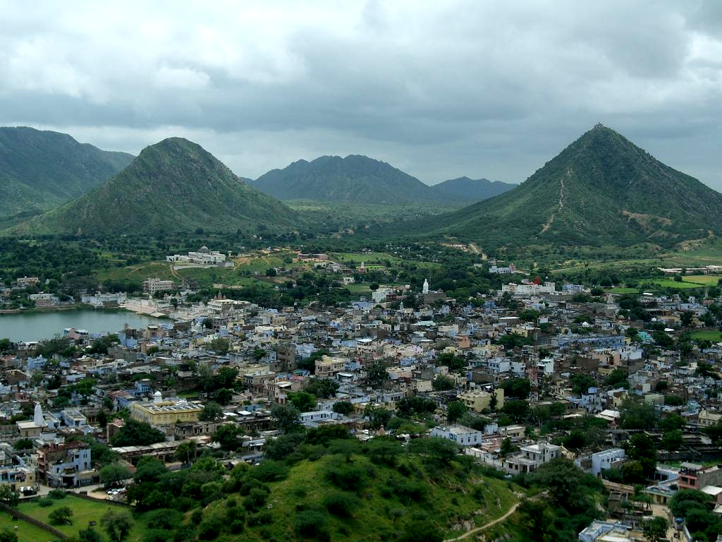
Pushkar is a city and headquarters of Pushkar tehsil in the Ajmer district in the Indian state of Rajasthan. It is situated about northwest of Ajmer and about southwest of Jaipur.Pushkar Encyclopaedia Britannica It is a pilgrimage site for s and s. Pushkar has many temples. Most of the temples and ghats in Pushkar are from the 18th century and later, because many temples were destroyed during Muslim conquests in the area. Subsequently, the destroyed temples were rebuilt. The most famous among Pushkar temples is the red spired [...More Info...] [...Related Items...] OR: [Wikipedia] [Google] [Baidu] |
Badnor, Rajasthan
Badnor or Badnore is a town and a panchayat in Bhilwara district of Rajasthan, India. It is a Tehsil (sub-division) for many villages. The town has a magistrate office, lower justice court and many administrative hub for many major villages. Landmarks Badnor Fort is an example of medieval Indian military style of architecture. This seven storied fort stands atop a hill and presents extensive views all around. There are a number of small monuments and temples within the precincts of Badnor Fort in Rajasthan India and around it. The buildings within Badnore Fort Bhilwara are all built in traditional Rajputana style of architecture, which is a local variation of the extensive Hindu style of architecture. There is also an ancient mosque built by Sultan Feroze Shah Tughluq. History Badnore was granted as a 'jagir' of Badnore along with 210 villages in 1554 to Jaimal Rathore. Jaimal Rathore is the grandson of Rao Duda and the brother of the Hindu Saint Mirabai Meera, better kn ... [...More Info...] [...Related Items...] OR: [Wikipedia] [Google] [Baidu] |
Mount Abu
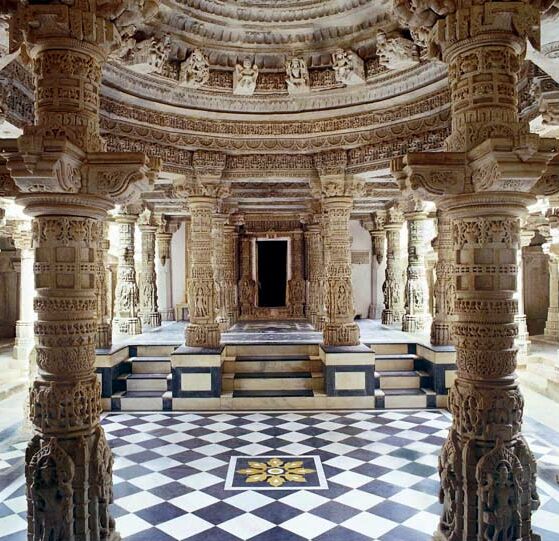
Mount Abu () is a hill station in the Aravalli Range in Sirohi district of the state of Rajasthan in western India.The mountain forms a rocky plateau 22 km long by 9 km wide. The highest peak on the mountain is Guru Shikhar at above sea level. It is referred to as 'an oasis in the desert' as its heights are home to rivers, lakes, waterfalls and evergreen forests. The nearest train station is Abu Road railway station 28 km away. History The ancient name of Mount Abu is Arbuda. In the Puranas, the region has been referred to as ''Arbudaranya'' ("forest of ''Arbhuda''") and 'Abu' is a diminutive of this ancient name. It is believed that sage Vashistha retired to the southern spur at Mount Abu following his differences with sage Vishvamitra. There is another history story according to which a serpent named "Arbuda" saved the life of Nandi (Lord Shiva's bull). The incident happened on the mountain that is currently known as Mount Abu and so the mountain is named "Arb ... [...More Info...] [...Related Items...] OR: [Wikipedia] [Google] [Baidu] |
Chittor
Chittorgarh (also Chittor or Chittaurgarh) is a major city in Rajasthan state of western India. It lies on the Berach River, a tributary of the Banas, and is the administrative headquarters of Chittorgarh District. It was a major stronghold of the Rajput State of Medapata. (modern Mewar) The city of Chittorgarh is located on the banks of river Gambhiri and Berach. Chittorgarh is home to the Chittor Fort, the largest fort in India and Asia. It was sacked thrice; first in 1303 by Alauddin Khalji, again in 1535 by Bahadur Shah of Gujarat, and lastly by the Mughal Emperor Akbar in 1568. Its Hindu Rajput rulers fought fiercely to maintain their independence. On all three occasions when faced with a certain defeat, the men fought to death, while the women committed suicide by jauhar (mass self-immolation). Chittor also has been a land of worship for Meera, It is also known for Panna Dai and Rani Padmini. History Originally called Chitrakuta, the Chittor Fort is said to ha ... [...More Info...] [...Related Items...] OR: [Wikipedia] [Google] [Baidu] |
Dhar
Dhar is a city located in Dhar district of the Malwa region in the state of Madhya Pradesh, India. The city is the administrative headquarters of the Dhar district. Before Indian independence from Great Britain, it was the capital of the Dhar princely state. Location Dhar is situated between 21°57' to 23°15' N and 74°37' to 75°37' E. The city is bordered in the north by Ratlam, to the east by parts of Indore, in the south by Barwani, and to the west by Jhabua and Alirajpur. The town is located west of Mhow. It is located above sea level. It possesses, besides its old ramparts, many buildings contain records of cultural, historical and national importance. Climate Historic places and monuments The most visible parts of ancient Dhar are the massive earthen ramparts, which are best preserved on the western and southern sides of the town. These were most likely built at beginning of the 9th century. Wall remains show that the city was circular in plan and surrounded ... [...More Info...] [...Related Items...] OR: [Wikipedia] [Google] [Baidu] |
Ujjain
Ujjain (, Hindustani language, Hindustani pronunciation: Help:IPA/Hindi and Urdu, [ʊd͡ːʒɛːn]) is a city in Ujjain district of the States and territories of India, Indian state of Madhya Pradesh. It is the fifth-largest city in Madhya Pradesh by population and is the public administration, administrative centre of Ujjain district and Ujjain division. It is one of the Hindu pilgrimage centres of Sapta Puri famous for the ''Kumbh Mela'' held there every 12 years. The famous temple of Mahakaleshwar Jyotirlinga is located in the center of the city. An ancient city situated on the eastern bank of the Shipra River, Ujjain was the most prominent city on the Malwa plateau of central India for much of its history. It emerged as the political centre of central India around 600 BCE. It was the capital of the ancient Avanti (India), Avanti kingdom, one of the sixteen Mahajanapadas. During the 18th century, the city briefly became the capital of Scindia state of the Maratha Empire, when ... [...More Info...] [...Related Items...] OR: [Wikipedia] [Google] [Baidu] |
Bhoja II (Paramara Dynasty)
Bhoja II was a 13th-century king of the Paramara dynasty in central India. He succeeded Arjuna II as the king of Dhara in Malwa region. According to ''Hammira Mahakavya'', written by the Jain poet Nayachandra Suri, the Chahmana ruler Hammira defeated Arjuna of Sarasapura and Bhoja of Dhara. Based on this, R. C. Majumdar concluded that Hammira must have invaded Malwa twice: once during the reign of Arjuna II, and again, during the reign of Bhoja II. Because Hammira ascended the Chauhan throne during 1282–83, Bhoja must have ascended the Paramara throne sometime after 1283 CE. Pratipal Bhatia, on the other hand, speculates that Arjuna II's minister Goga-deva rebelled against him, and put Bhoja II on the throne of Dhara as a titular king. The 16th-century historian Firishta Firishta or Ferešte ( fa, ), full name Muhammad Qasim Hindu Shah Astarabadi ( fa, مُحَمَّد قاسِم هِندو شاہ), was a Persian historian, who later settled in India and served the Decc ... [...More Info...] [...Related Items...] OR: [Wikipedia] [Google] [Baidu] |
Mandalgarh
Mandalgarh is a town with municipality in Bhilwara district in the Indian state of Rajasthan. Pincode of Mandalgarh is 311604. It is the tehsil headquarters of Mandalgarh tehsil. History Mandalgarh was ruled by Brahma kings , the last Brahma king of Mandalgarh was Mandiya Brahma. The place, situated at a distance of 54 km towards South-East of Bhilwara. It is sub division, tehsil and panchayat samiti of same name. The place is of historical importance because it was the scene of many a fierce battle during the mediaeval times, according to the Muslim historians. The place was taken twice by Mahmud Khilji of Malwa in the middle of the fifteenth century, and subsequently appears to have belonged alternately to the Ranas of Mewar and the Mughal emperors. In or about 1650, Emperor Shah Jahan granted it in Jagir to Raja Roop Singh of Kishangarh, who partially built a palace here, but Rana Raj Singh retook it in 1660. Twenty years later, Emperor Aurangzeb captured the palace and ... [...More Info...] [...Related Items...] OR: [Wikipedia] [Google] [Baidu] |
Malwa
Malwa is a historical region of west-central India occupying a plateau of volcanic origin. Geologically, the Malwa Plateau generally refers to the volcanic upland north of the Vindhya Range. Politically and administratively, it is also synonymous with the former state of Madhya Bharat which was later merged with Madhya Pradesh. At present the historical Malwa region includes districts of western Madhya Pradesh and parts of south-eastern Rajasthan. Sometimes the definition of Malwa is extended to include the Nimar region south of the Vindhyas. The Malwa region had been a separate political unit from the time of the ancient Malava Kingdom. It has been ruled by several kingdoms and dynasties, including the Avanti Kingdom, The Mauryans, the Malavas, the Guptas, the Paramaras, the Delhi Sultanate, the Malwa sultans, the Mughals and the Marathas. Malwa continued to be an administrative division until 1947, when the Malwa Agency of British India was merged into Madhya Bharat (a ... [...More Info...] [...Related Items...] OR: [Wikipedia] [Google] [Baidu] |
Paramara
The Paramara dynasty (IAST: Paramāra) was an Indian dynasty that ruled Malwa and surrounding areas in west-central India between 9th and 14th centuries. They belonged to the Parmara clan of the Rajputs. The dynasty was established in either the 9th or 10th century, and its early rulers most probably ruled as vassals of the Rashtrakutas of Manyakheta. The earliest extant Paramara inscriptions, issued by the 10th-century ruler Siyaka, have been found in Gujarat. Around 972 CE, Siyaka sacked the Rashtrakuta capital Manyakheta, and established the Paramaras as a sovereign power. By the time of his successor Munja, the Malwa region in present-day Madhya Pradesh had become the core Paramara territory, with Dhara (now Dhar) as their capital. The dynasty reached its zenith under Munja's nephew Bhoja, whose kingdom extended from Chittor in the north to Konkan in the south, and from the Sabarmati River in the west to Vidisha in the east. The Paramara power rose and declined several ti ... [...More Info...] [...Related Items...] OR: [Wikipedia] [Google] [Baidu] |


