|
Galloway
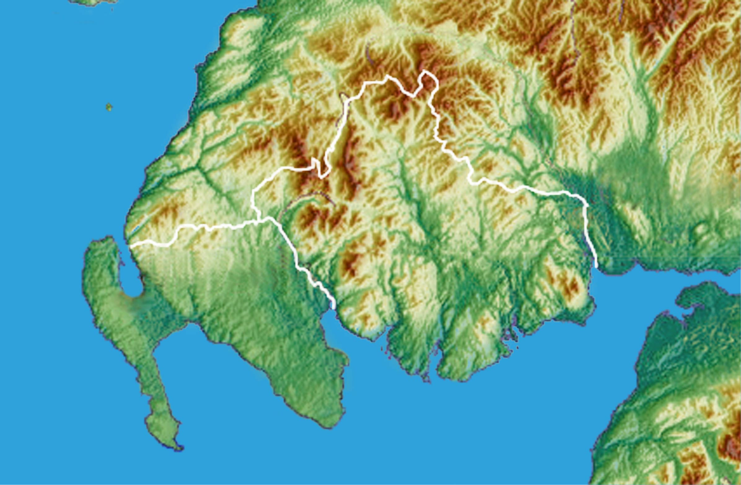
Galloway ( ; sco, Gallowa; la, Gallovidia) is a region in southwestern Scotland comprising the historic counties of Wigtownshire and Kirkcudbrightshire. It is administered as part of the council area of Dumfries and Galloway. A native or inhabitant of Galloway is called a Gallovidian. The place name Galloway is derived from the Gaelic ' ("amongst the '"). The , literally meaning "Stranger-'"; the specific identity of whom the term was applied to is unknown, but the predominant view is that it referred to an ethnic and/or cultural identity such as the Strathclyde Britons or another related but distinct population. A popular theory is that it refers to a population of mixed Scandinavian and Gaelic ethnicity that may have inhabited Galloway in the Middle Ages. Galloway is bounded by sea to the west and south, the Galloway Hills to the north, and the River Nith to the east; the border between Kirkcudbrightshire and Wigtownshire is marked by the River Cree. The definition ... [...More Info...] [...Related Items...] OR: [Wikipedia] [Google] [Baidu] |
Dumfries And Galloway
Dumfries and Galloway ( sco, Dumfries an Gallowa; gd, Dùn Phrìs is Gall-Ghaidhealaibh) is one of 32 unitary council areas of Scotland and is located in the western Southern Uplands. It covers the historic counties of Dumfriesshire, Kirkcudbrightshire, and Wigtownshire, the latter two of which are collectively known as Galloway. The administrative centre and largest settlement is the town of Dumfries. The second largest town is Stranraer, on the North Channel coast, some to the west of Dumfries. Following the 1975 reorganisation of local government in Scotland, the three counties were joined to form a single region of Dumfries and Galloway, with four districts within it. The districts were abolished in 1996, since when Dumfries and Galloway has been a unitary local authority. For lieutenancy purposes, the area is divided into three lieutenancy areas called Dumfries, Wigtown and the Stewartry of Kirkcudbright, broadly corresponding to the three historic counties. To th ... [...More Info...] [...Related Items...] OR: [Wikipedia] [Google] [Baidu] |
Galloway Hills
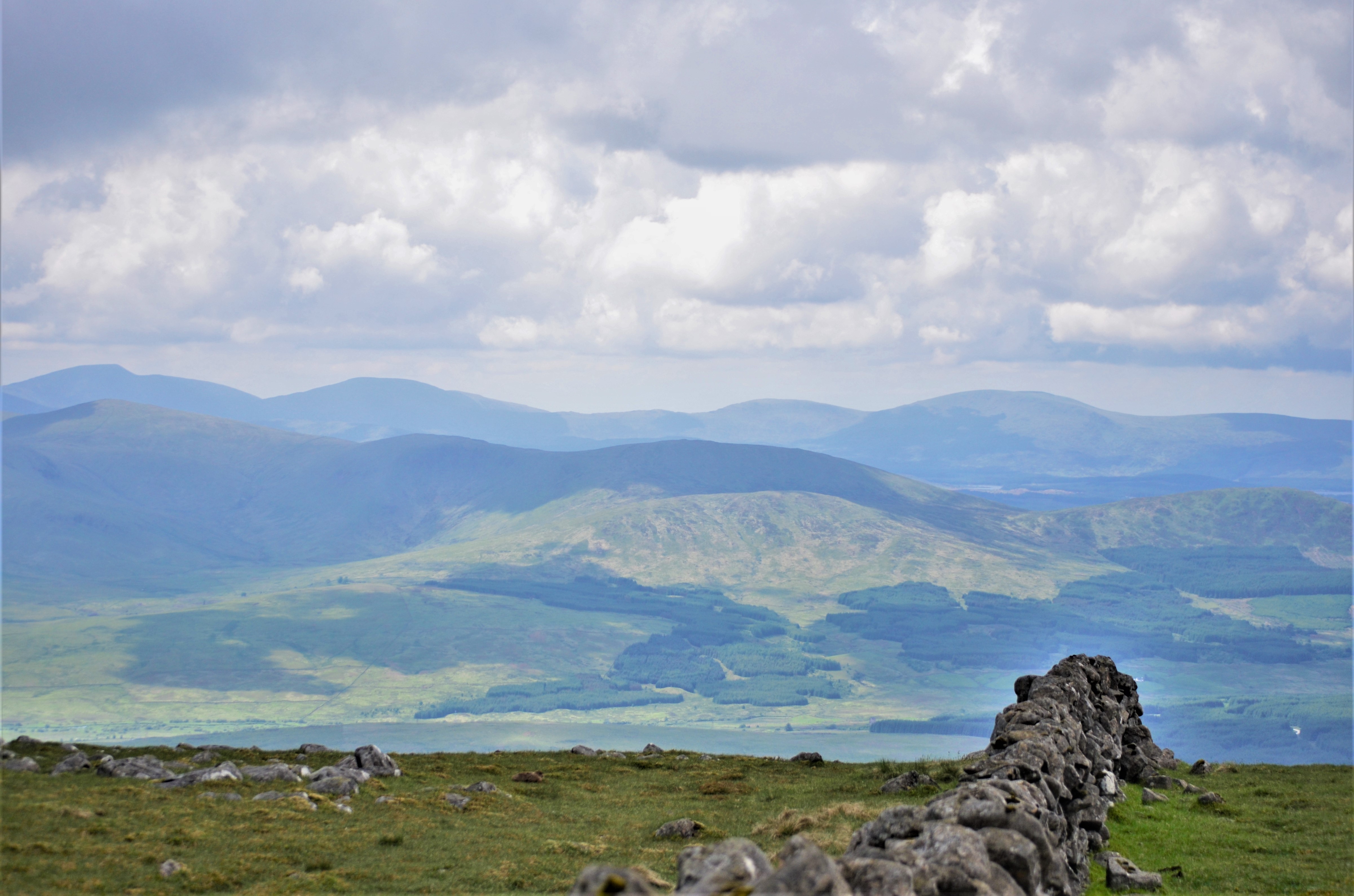
The Galloway Hills are part of the Southern Uplands of Scotland, and form the northern boundary of western Galloway. They lie within the bounds of the Galloway Forest Park, an area of some of largely uninhabited wild land, managed by Forestry and Land Scotland. The unusual place names reflect a mixture of the Old Norse and Scottish Gaelic languages and hint at the range of influences which have acted on society within the area over the centuries. Location The location of Galloway has been described as follows, "Galloway is contained by sea to the west (North Channel) and south (Solway Firth), the "Galloway Hills" to the north, and the River Nith to the east". So if we were to say "The hills of Galloway" we would be including all the hills within this area; but as the first sentence implies, the "Galloway Hills" is usually taken to mean a collection of ranges which lie mainly south of Loch Doon and which are not constrained by political boundaries. The boundary between Dumfri ... [...More Info...] [...Related Items...] OR: [Wikipedia] [Google] [Baidu] |
Galloway
Galloway ( ; sco, Gallowa; la, Gallovidia) is a region in southwestern Scotland comprising the historic counties of Wigtownshire and Kirkcudbrightshire. It is administered as part of the council area of Dumfries and Galloway. A native or inhabitant of Galloway is called a Gallovidian. The place name Galloway is derived from the Gaelic ' ("amongst the '"). The , literally meaning "Stranger-'"; the specific identity of whom the term was applied to is unknown, but the predominant view is that it referred to an ethnic and/or cultural identity such as the Strathclyde Britons or another related but distinct population. A popular theory is that it refers to a population of mixed Scandinavian and Gaelic ethnicity that may have inhabited Galloway in the Middle Ages. Galloway is bounded by sea to the west and south, the Galloway Hills to the north, and the River Nith to the east; the border between Kirkcudbrightshire and Wigtownshire is marked by the River Cree. The definition ... [...More Info...] [...Related Items...] OR: [Wikipedia] [Google] [Baidu] |
Kirkcudbrightshire
Kirkcudbrightshire ( ), or the County of Kirkcudbright or the Stewartry of Kirkcudbright is one of the historic counties of Scotland, covering an area in the south-west of the country. Until 1975, Kirkcudbrightshire was an administrative county used for local government. Since 1975, the area has formed part of Dumfries and Galloway for local government purposes. Kirkcudbrightshire continues to be used as a registration county for land registration. A lower-tier district called Stewartry covered the majority of the historic county from 1975 to 1996. The area of Stewartry district is still used as a lieutenancy area. Dumfries and Galloway Council also has a Stewartry area committee. Kirkcudbrightshire forms the eastern part of the medieval lordship of Galloway, which retained a degree of autonomy until it was fully absorbed by Scotland in the 13th century. In 1369, the part of Galloway east of the River Cree was placed under the control of a steward based in Kirkcudbright an ... [...More Info...] [...Related Items...] OR: [Wikipedia] [Google] [Baidu] |
Belted Galloway
The Belted Galloway is a traditional Scottish breed of beef cattle. It derives from the Galloway cattle of the Galloway region of south-western Scotland, and was established as a separate breed in 1921. It is adapted to living on the poor upland pastures and windswept moorlands of the region. The exact origin of the breed is unclear, although the white belt for which they are named, and which distinguishes the breed from black Galloway cattle, is often surmised to be the result of cross-breeding with the similarly-coloured Dutch Lakenvelder breed. Belted Galloways are primarily raised for their quality marbled beef, although they are sometimes milked or kept for ornament. History The Belted Galloway derives from the traditional Galloway cattle of the Galloway region of south-western Scotland, which in turn form part of a broader group of traditional Scottish cattle including the Aberdeen Angus and Highland breeds. Galloways are most often black, but other colours o ... [...More Info...] [...Related Items...] OR: [Wikipedia] [Google] [Baidu] |
Galloway Cattle
The Galloway is a Scottish breed of beef cattle, named after the Galloway region of Scotland, where it originated during the seventeenth century. It is usually black, is of average size, is naturally polled and has a thick coat suitable for the harsh climate of Scotland. It is reared mainly for beef. In 2022 the Galloway was reported by twenty-three countries. The worldwide population stood at about head, of which the majority were in Northern Europe, with the largest populations in Denmark and Germany. Etymology The word 'Galloway' derives from the name of a people, the , meaning 'Scandinavian Gaels'. History Polled black cattle were known in Scotland by the sixteenth century at the latest; one is mentioned in an instrument of sasine dated 1523. The Galloway breed comes from the cattle native to the south-west region of Scotland, first fully developed in the seventeenth century. Originally, there was much variation within this breed, including many different co ... [...More Info...] [...Related Items...] OR: [Wikipedia] [Google] [Baidu] |
Wigtownshire
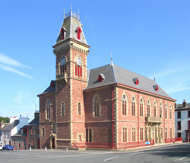
Wigtownshire or the County of Wigtown (, ) is one of the historic counties of Scotland, covering an area in the south-west of the country. Until 1975, Wigtownshire was an administrative county used for local government. Since 1975 the area has formed part of Dumfries and Galloway for local government purposes. Wigtownshire continues to be used as a territory for land registration, being a registration county. The historic county is all within the slightly larger Wigtown Area, which is one of the lieutenancy areas of Scotland and was used in local government as the Wigtown District from 1975 to 1996. Wigtownshire forms the western part of the medieval lordship of Galloway, which retained a degree of autonomy until it was fully absorbed by Scotland in the 13th century. In 1369, the part of Galloway east of the River Cree was placed under the control of a steward and so became known as the Stewartry of Kirkcudbright. The rest of Galloway remained under the authority of a sheriff, a ... [...More Info...] [...Related Items...] OR: [Wikipedia] [Google] [Baidu] |
Council Areas Of Scotland
For local government purposes, Scotland is divided into 32 areas designated as "council areas" ( gd, comhairlean), which are all governed by single-tier authorities designated as "councils". They have the option under the Local Government (Gaelic Names) (Scotland) Act 1997 of being known (but not re-designated) as a "''comhairle''" when opting for a Gaelic name; only ''Comhairle nan Eilean Siar'' (Council of the Western Isles) has chosen this option, whereas the Highland Council (''Comhairle na Gàidhealtachd'') has adopted its Gaelic form alongside its English equivalent informally. The council areas have been in existence since 1 April 1996, under the provisions of the Local Government etc. (Scotland) Act 1994. Historically, Scotland was divided into 34 counties or shires. Although these no longer have any administrative function, they are still used to some extent in Scotland for cultural and geographical purposes, and some of the current council areas are named after the ... [...More Info...] [...Related Items...] OR: [Wikipedia] [Google] [Baidu] |
River Dee, Galloway
The River Dee ( gd, Dè / Uisge Dhè), in south-west Scotland, flows from its source in Loch Dee amongst the Galloway Hills, firstly to Clatteringshaws Loch, then into Loch Ken, where it joins the Water of Ken. From there, the Dee flows southwards to Kirkcudbright, and into Kirkcudbright Bay to reach the Solway Firth. The distance is just over in total. Together with its tributaries, the Dee's total catchment area is over . The river is dammed at Tongland, two miles (3 km) upriver from Kirkcudbright. This was constructed as part of the Galloway hydro-electric power scheme in the 1930s. Also at this site is Tongland Bridge, built in 1806 by Thomas Telford. The ruins of Threave Castle stand on an island on the lower part of the Dee. In Ptolemy's 2nd century work ''Geography'' it is recorded as ''Dēoúa''. This form represents a development of Proto-Indo-European'' *deiueh2-'' 'a goddess', which occurs in many Celtic river-names. The Dee has also been known ... [...More Info...] [...Related Items...] OR: [Wikipedia] [Google] [Baidu] |
Water Of Ken
The Water of Ken is a river in the historical county of Kirkcudbrightshire in Galloway, south-west Scotland. It rises on Blacklorg Hill, north-east of Cairnsmore of Carsphairn in the Carsphairn hills, and flows south-westward into The Glenkens, passing through Kendoon, Carsfad and Earlstoun lochs, all of which are dammed to supply the Galloway Hydro Electric Scheme. At Kendoon Dam the Ken is joined by a major tributary the Water of Deugh. From there, the river flows south, passing St. John's Town of Dalry and New Galloway, before widening to form the 9-mile long Loch Ken. The Black Water of Dee also enters halfway down the loch, and from Glenlochar, at the south end of the loch, the river continues as the Dee towards Kirkcudbright and the coast. There are a number of interesting bridges over the Water of Ken. Smeaton's Bridge (Sometimes Smitton's Bridge) carries the B729 road which runs between Carsphairn and Moniaive. It crosses the Ken a half mile above the confluence of th ... [...More Info...] [...Related Items...] OR: [Wikipedia] [Google] [Baidu] |
River Cree
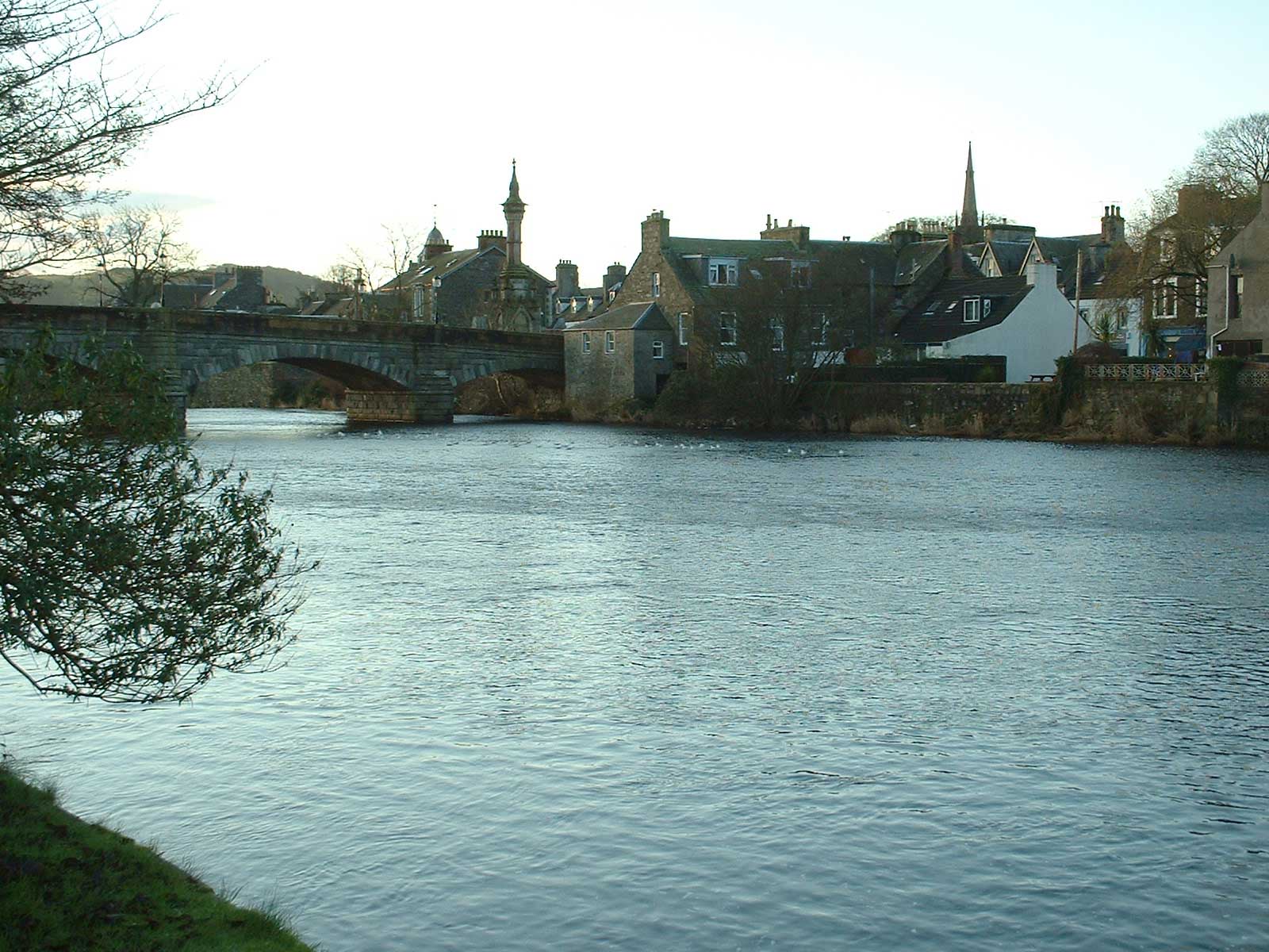
The River Cree is a river in Dumfries and Galloway, Scotland which runs through Newton Stewart and into the Solway Firth. It forms part of the boundary between the counties of Wigtownshire and Kirkcudbrightshire. The tributaries of the Cree are the Minnoch, Trool, Penkiln and Palnure which drain from the Range of the Awful Hand, the labyrinthine range of mountains and lochs, bogs, burns and crags, rising at its highest to The Merrick, Galloway ( above sea level), north and visible from Newton Stewart. The River Cree provided a route from the coast into the forested hinterland. Then it became the boundary between communities living on either side, dividing the County, or Shire, of Wigtownshire from the Stewartry of Kirkcudbright. It also divides the parish of Penninghame from the parish of Minnigaff and the town of Newton Stewart from the villages of Creebridge and Minnigaff, thus identifying a variety of administrative entities. There were very few bridges until the 18th ... [...More Info...] [...Related Items...] OR: [Wikipedia] [Google] [Baidu] |
River Nith
The River Nith ( gd, Abhainn Nid; Common Brittonic: ''Nowios'') is a river in south-west Scotland. The Nith rises in the Carsphairn hills of East Ayrshire, more precisely between Prickeny Hill and Enoch Hill, east of Dalmellington. For the majority of its course it flows in a south-easterly direction through Dumfries and Galloway and then into the Solway Firth at Airds Point. The territory through which the river flows is called Nithsdale (historically known as "Stranit" from gd, Strath Nid, "valley of the Nith"). Length For estuaries the principle followed is that the river should be visible at all times. The measurement therefore follows the centre of the river at low tide and the mouth of the river is assumed to be at the coastal high tide mark. In Scotland this does not generally make a significant difference, except for rivers draining into shallow sloping sands of the Irish Sea and Solway Firth, notably the Nith. At low tide, the sea recedes to such an extent that ... [...More Info...] [...Related Items...] OR: [Wikipedia] [Google] [Baidu] |


.jpg)


