|
Farthest South
Farthest South refers to the most southerly latitude reached by explorers before the first successful expedition to the South Pole in 1911. Significant steps on the road to the pole were the discovery of lands south of Cape Horn in 1619, Captain James Cook's crossing of the Antarctic Circle in 1773, and the earliest confirmed sightings of the Antarctic mainland in 1820. From the late 19th century onward, the quest for Farthest South latitudes became in effect a race to reach the pole, which culminated in Roald Amundsen's success in December 1911. In the years before reaching the pole was a realistic objective, other motives drew adventurers southward. Initially, the driving force was the discovery of new trade routes between Europe and the Far East. After such routes had been established and the main geographical features of the Earth had been broadly mapped, the lure for mercantile adventurers was the great fertile continent of "Terra Australis" which, according to myth, lay hi ... [...More Info...] [...Related Items...] OR: [Wikipedia] [Google] [Baidu] |
Amundsen Expedition At South Pole
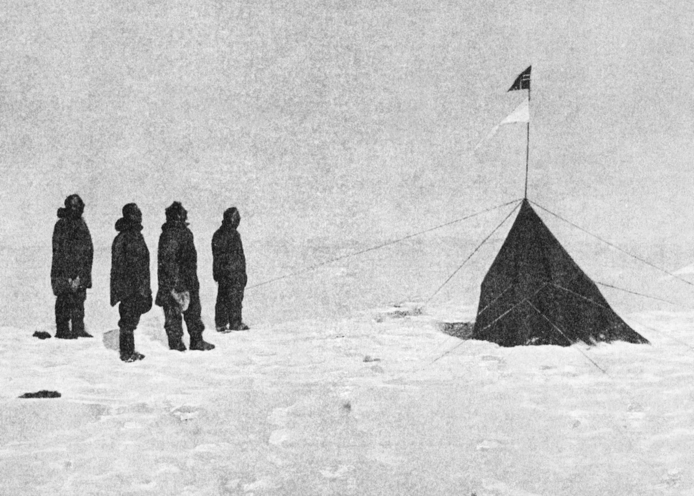
Roald Engelbregt Gravning Amundsen (, ; ; 16 July 1872 – ) was a Norwegian explorer of polar regions. He was a key figure of the period known as the Heroic Age of Antarctic Exploration. Born in Borge, Østfold, Norway, Amundsen began his career as a polar explorer as first mate on Adrien de Gerlache's Belgian Antarctic Expedition of 1897–1899. From 1903 to 1906, he led the first expedition to successfully traverse the Northwest Passage on the sloop ''Gjøa''. In 1909, Amundsen began planning for a South Pole expedition. He left Norway in June 1910 on the ship '' Fram'' and reached Antarctica in January 1911. His party established a camp at the Bay of Whales and a series of supply depots on the Barrier (now known as the Ross Ice Shelf) before setting out for the pole in October. The party of five, led by Amundsen, became the first to successfully reach the South Pole on 14 December 1911. Following a failed attempt in 1918 to reach the North Pole by traversing the No ... [...More Info...] [...Related Items...] OR: [Wikipedia] [Google] [Baidu] |
Treaty Of Tordesillas
The Treaty of Tordesillas, ; pt, Tratado de Tordesilhas . signed in Tordesillas, Spain on 7 June 1494, and authenticated in Setúbal, Portugal, divided the newly discovered lands outside Europe between the Portuguese Empire and the Spanish Empire ( Crown of Castile), along a meridian 370 leagues west of the Cape Verde islands, off the west coast of Africa. That line of demarcation was about halfway between the Cape Verde islands (already Portuguese) and the islands entered by Christopher Columbus on his first voyage (claimed for Castile and León), named in the treaty as Cipangu and Antillia (Cuba and Hispaniola). The lands to the east would belong to Portugal and the lands to the west to Castile, modifying an earlier division proposed by Pope Alexander VI. The treaty was signed by Spain, , and by Portugal, . The other side of the world was divided a few decades later by the Treaty of Zaragoza, signed on , which specified the antimeridian to the line of demarcation spec ... [...More Info...] [...Related Items...] OR: [Wikipedia] [Google] [Baidu] |
Polar Record
''Polar Record'' is a quarterly peer-reviewed academic journal covering all aspects of Arctic and Antarctic exploration and research. It is managed by the Scott Polar Research Institute and published by Cambridge University Press. The journal was established in 1931 and the Co-editors-in-chief are Dr Nikolas Sellheim (University of Helsinki) and Dr Trevor McIntyre (University of South Africa). Abstracting and indexing The journal is abstracted and indexed in: The journal had a 2019 impact factor of 0.84. History The journal was established in 1931, by The Scott Polar Research Institute which itself was founded in 1926. The foreword of the first issue in the first volume stated that the journal was created to address the challenge of "so much exploration and exploitation in the polar regions, the news of which appear in so many forms and languages", and that "in the first place an attempt will be made merely to record the chief polar events of the preceding six months; but i ... [...More Info...] [...Related Items...] OR: [Wikipedia] [Google] [Baidu] |
Falkland Islands
The Falkland Islands (; es, Islas Malvinas, link=no ) is an archipelago in the South Atlantic Ocean on the Patagonian Shelf. The principal islands are about east of South America's southern Patagonian coast and about from Cape Dubouzet at the northern tip of the Antarctic Peninsula, at a latitude of about 52°S. The archipelago, with an area of , comprises East Falkland, West Falkland, and 776 smaller islands. As a British overseas territory, the Falklands have internal self-governance, but the United Kingdom takes responsibility for their defence and foreign affairs. The capital and largest settlement is Stanley on East Falkland. Controversy exists over the Falklands' discovery and subsequent colonisation by Europeans. At various times, the islands have had French, British, Spanish, and Argentine settlements. Britain reasserted its rule in 1833, but Argentina maintains its claim to the islands. In April 1982, Argentine military forces invaded the islands. Brit ... [...More Info...] [...Related Items...] OR: [Wikipedia] [Google] [Baidu] |
Tierra Del Fuego
Tierra del Fuego (, ; Spanish for "Land of the Fire", rarely also Fireland in English) is an archipelago off the southernmost tip of the South American mainland, across the Strait of Magellan. The archipelago consists of the main island, Isla Grande de Tierra del Fuego, with an area of , and a group of many islands, including Cape Horn and Diego Ramírez Islands. Tierra del Fuego is divided between Chile and Argentina, with the latter controlling the eastern half of the main island and the former the western half plus the islands south of Beagle Channel and the southernmost islands. The southernmost extent of the archipelago is just north of latitude 56°S. The earliest known human settlement in Tierra del Fuego dates to approximately 8,000 BC. Europeans first explored the islands during Ferdinand Magellan's expedition of 1520. ''Tierra del Fuego'' and similar namings stem from sightings of the many bonfires that the natives built. Settlement by those of European descent ... [...More Info...] [...Related Items...] OR: [Wikipedia] [Google] [Baidu] |
Isla De Los Estados
Isla de los Estados (English: Staten Island, from the Dutch ''Stateneiland'') is an Argentine island that lies off the eastern extremity of Tierra del Fuego, from which it is separated by the Le Maire Strait. It was named after the Netherlands States-General, the Dutch parliament. The island is part of the Argentinian province of Tierra del Fuego, and of the department and city of Ushuaia. It has been declared an "Ecological, Historic, and Tourist Provincial Reserve" ("''Reserva provincial ecológica, histórica y turística''"), with access limited to tours from Ushuaia. The only settlement is the Puerto Parry Naval Station, located in a deep and narrow fjord on the northern coast of the island. The naval station, established in 1978, is manned by a team of four marines on a 45-day rotation. They monitor environmental conservation and ship movements, and provide emergency assistance. History Prior to European arrival, the island was visited by the Yamana people, who inhabite ... [...More Info...] [...Related Items...] OR: [Wikipedia] [Google] [Baidu] |
Haush
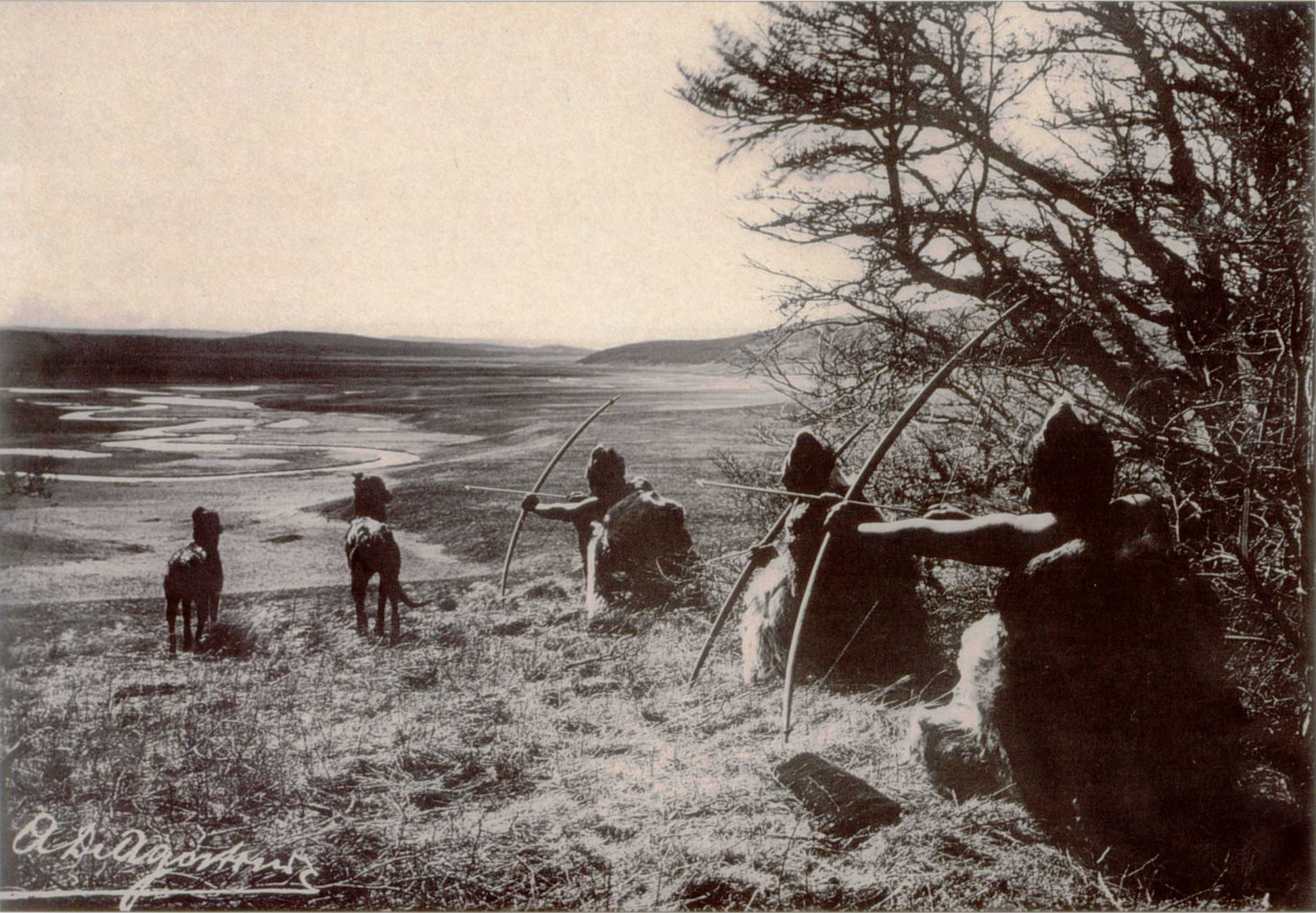
The Haush or Manek'enk were an indigenous people who lived on the Mitre Peninsula of the Isla Grande de Tierra del Fuego. They were related culturally and linguistically to the Ona or Selk'nam people who also lived on the Isla Grande de Tierra del Fuego, and to the Tehuelche people of southern mainland Patagonia. Name ''Haush'' was the name given them by the Selknam or Ona people, while the Yamana or Yaghan people called them ''Italum Ona'', meaning ''Eastern Ona''. Several authors state that their name for themselves was ''Manek'enk'' or ''Manek'enkn''. Martin Gusinde reported, however, that in the Haush language ''Manek'enkn'' simply meant ''people'' in general. Furlong notes that ''Haush'' has no meaning in the Selknam/Ona language, while ''haush'' means ''kelp'' in the Yamana/Yaghan language. Since the Selknam/Ona probably met the Yamana/Yaghan people primarily in Haush territory, Furlong speculates that the Selknam/Ona borrowed ''haush'' as the name of the people from ... [...More Info...] [...Related Items...] OR: [Wikipedia] [Google] [Baidu] |
Yaghan People
The Yahgan (also called Yagán, Yaghan, Yámana, Yamana or Tequenica) are a group of indigenous peoples in the Southern Cone. Their traditional territory includes the islands south of Isla Grande de Tierra del Fuego, extending their presence into Cape Horn, making them the world's southernmost human population. In the 19th century, the Yahgan were known in English as “ Fuegians”. The term is now avoided as it can also refer to several other indigenous peoples of Tierra del Fuego, for example the Selk'nam. The Yahgan language, also known as Yámana, is considered a language isolate. Cristina Calderón (1928–2022), who was born on Navarino Island, Chile, was known as the last full-blooded Yahgan and last native speaker of the Yahgan language. Most Yahgans speak Spanish. The Yahgan were traditionally nomads and hunter-gatherers who traveled by canoe between islands to collect food. The men hunted sea lions and the women dove to collect shellfish. The Yahgan share some simi ... [...More Info...] [...Related Items...] OR: [Wikipedia] [Google] [Baidu] |
Selknam People
The Selk'nam, also known as the Onawo or Ona people, are an indigenous people in the Patagonian region of southern Argentina and Chile, including the Tierra del Fuego islands. They were one of the last native groups in South America to be encountered by migrant Europeans in the late 19th century. In the mid-19th century, there were about 4000 Selk'nam; by 1919 there were 297, and by 1930 just over 100. They are considered extinct as a tribe. The exploration of gold and the introduction of farming in the region of Tierra del Fuego led to genocide of the Selk'nam. Joubert Yantén Gómez, a Chilean mestizo of part Selk'nam ancestry, has taught himself the language and is considered the only speaker; he uses the name ''Keyuk.''Judith Thurman, "A Loss for Words" ''The New Yorker'', 30 March 2015 W ... [...More Info...] [...Related Items...] OR: [Wikipedia] [Google] [Baidu] |
Age Of Exploration
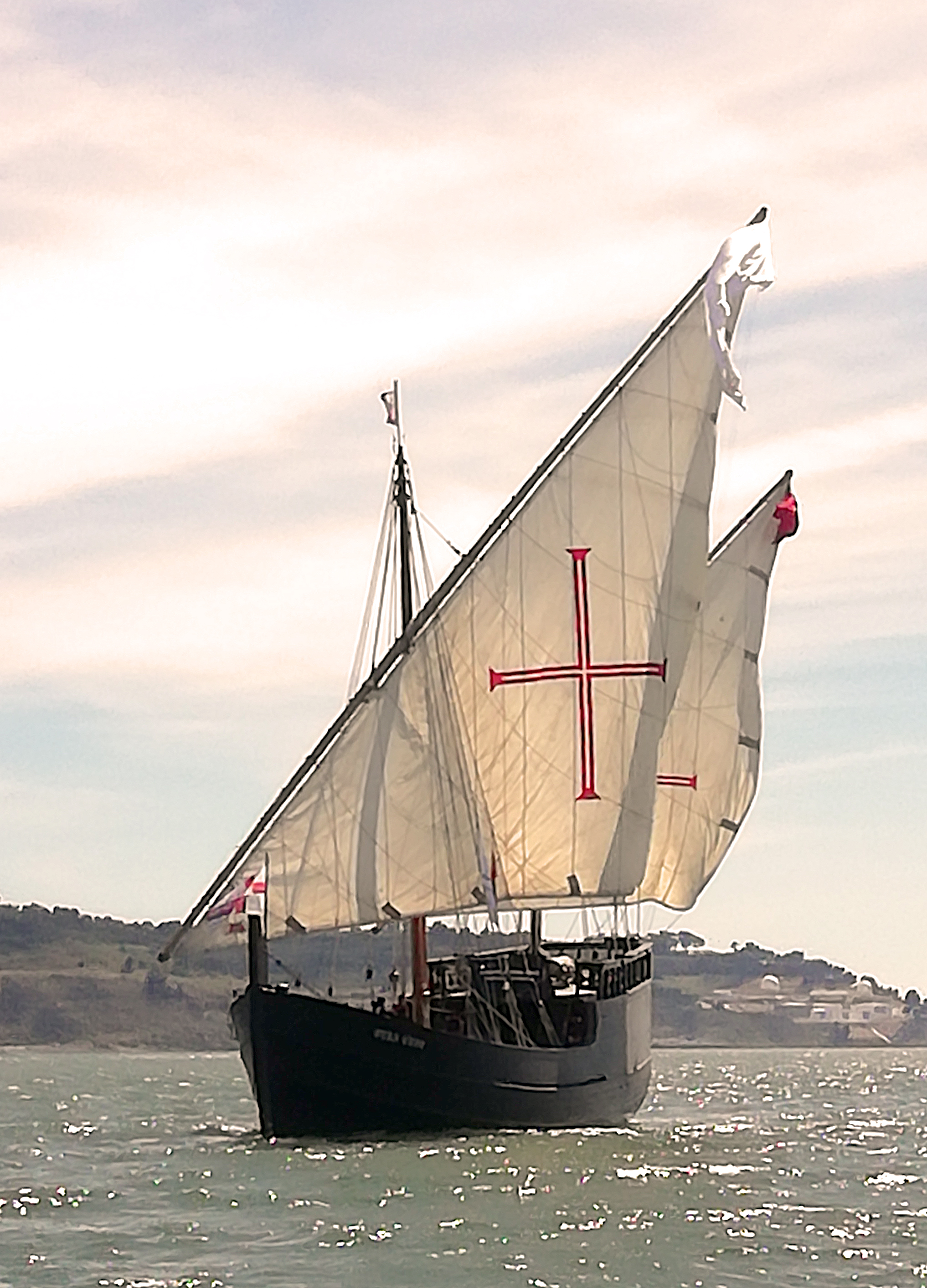
The Age of Discovery (or the Age of Exploration), also known as the early modern period, was a period largely overlapping with the Age of Sail, approximately from the 15th century to the 17th century in European history, during which seafaring Europeans explored and colonized regions across the globe. The extensive overseas exploration, with the Portuguese and Spanish at the forefront, later joined by the Dutch, English, and French, emerged as a powerful factor in European culture, most notably the European encounter and colonization of the Americas. It also marks an increased adoption of colonialism as a government policy in several European states. As such, it is sometimes synonymous with the first wave of European colonization. European exploration outside the Mediterranean started with the maritime expeditions of Portugal to the Canary Islands in 1336, and later with the Portuguese discoveries of the Atlantic archipelagos of Madeira and Azores, the coast of West Afri ... [...More Info...] [...Related Items...] OR: [Wikipedia] [Google] [Baidu] |
Pacific Ocean
The Pacific Ocean is the largest and deepest of Earth's five oceanic divisions. It extends from the Arctic Ocean in the north to the Southern Ocean (or, depending on definition, to Antarctica) in the south, and is bounded by the continents of Asia and Oceania in the west and the Americas in the east. At in area (as defined with a southern Antarctic border), this largest division of the World Ocean—and, in turn, the hydrosphere—covers about 46% of Earth's water surface and about 32% of its total surface area, larger than Earth's entire land area combined .Pacific Ocean . '' Britannica Concise.'' 2008: Encyclopædia Britannica, Inc. The centers of both the [...More Info...] [...Related Items...] OR: [Wikipedia] [Google] [Baidu] |


.jpg)