|
Carrowmore
Carrowmore ( ga, An Cheathrú Mhór, 'the great quarter') is a large group of megalithic monuments on the Coolera Peninsula to the west of Sligo, Ireland. They were built in the 4th millennium BC, during the Neolithic (New Stone Age). There are thirty surviving tombs, making Carrowmore one of the largest clusters of megalithic tombs in Ireland, and one of the 'big four' along with Carrowkeel, Loughcrew and Brú na Bóinne. Carrowmore is the heart of an ancient ritual landscape which is dominated by the mountain of Knocknarea to the west. It is a protected National Monument. Location Placed on a small plateau at an altitude of between 36.5 and 59 metres above sea level Carrowmore is the focal point of a prehistoric ritual landscape which is dominated by the mountain of Knocknarea to the west with the great cairn of Miosgán Médhbh on top. To the east, in Carns townland, two large cairns overlook Lough Gill, and along the eastern boundary of the peninsula the Ballygawley M ... [...More Info...] [...Related Items...] OR: [Wikipedia] [Google] [Baidu] |
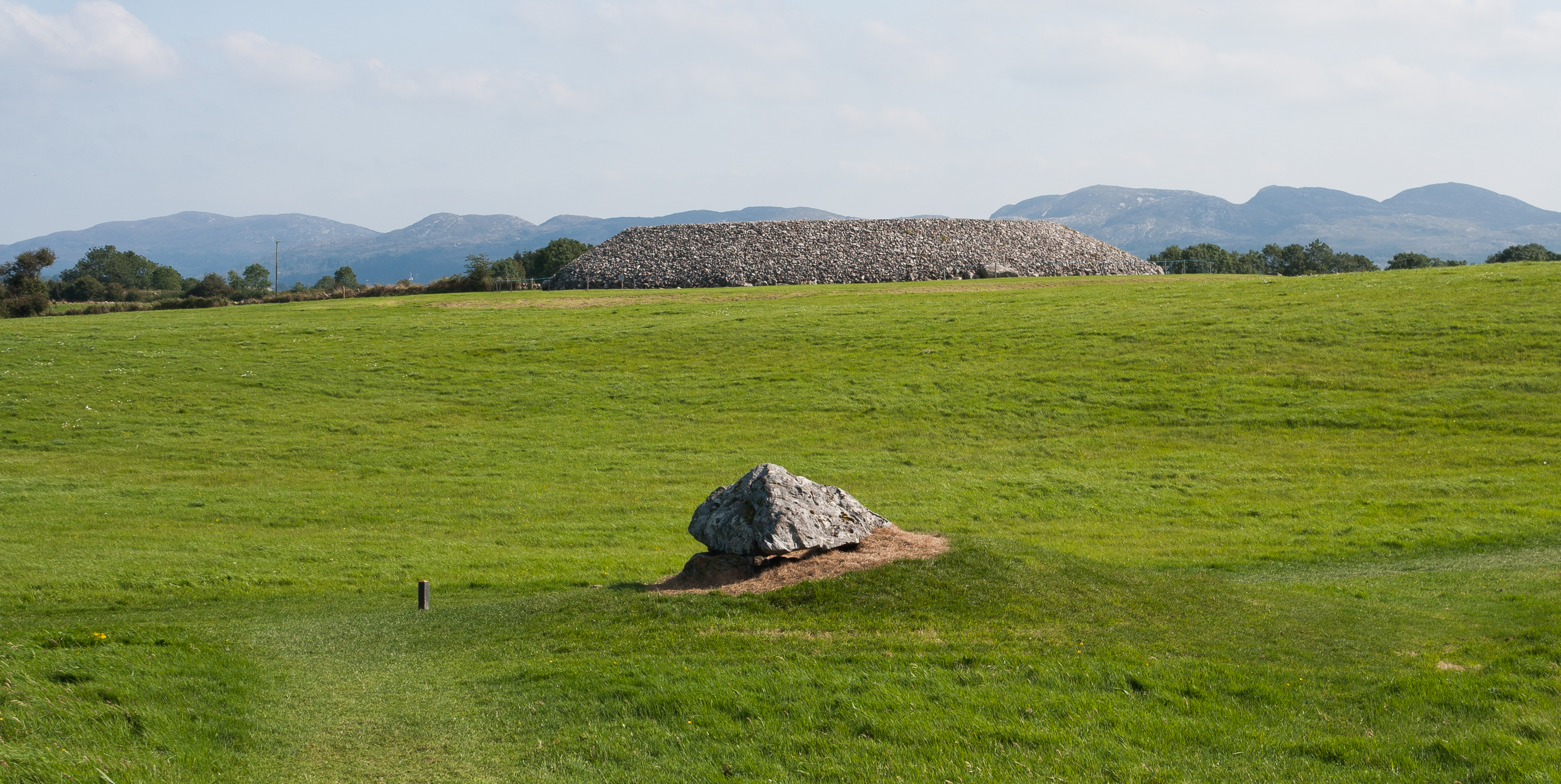
Carrowmore Megalithic Cemetery P7 2015 09 08
Carrowmore ( ga, An Cheathrú Mhór, 'the great quarter') is a large group of megalithic monuments on the Coolera Peninsula to the west of Sligo, Ireland. They were built in the 4th millennium BC, during the Neolithic (New Stone Age). There are thirty surviving tombs, making Carrowmore one of the largest clusters of megalithic tombs in Ireland, and one of the 'big four' along with Carrowkeel, Loughcrew and Brú na Bóinne. Carrowmore is the heart of an ancient ritual landscape which is dominated by the mountain of Knocknarea to the west. It is a protected National Monument. Location Placed on a small plateau at an altitude of between 36.5 and 59 metres above sea level Carrowmore is the focal point of a prehistoric ritual landscape which is dominated by the mountain of Knocknarea to the west with the great cairn of Miosgán Médhbh on top. To the east, in Carns townland, two large cairns overlook Lough Gill, and along the eastern boundary of the peninsula the Ballygawley Mou ... [...More Info...] [...Related Items...] OR: [Wikipedia] [Google] [Baidu] |
Carrowmore Megalithic Cemetery Map By W
Carrowmore ( ga, An Cheathrú Mhór, 'the great quarter') is a large group of megalithic monuments on the Coolera Peninsula to the west of Sligo, Ireland. They were built in the 4th millennium BC, during the Neolithic (New Stone Age). There are thirty surviving tombs, making Carrowmore one of the largest clusters of megalithic tombs in Ireland, and one of the 'big four' along with Carrowkeel, Loughcrew and Brú na Bóinne. Carrowmore is the heart of an ancient ritual landscape which is dominated by the mountain of Knocknarea to the west. It is a protected National Monument. Location Placed on a small plateau at an altitude of between 36.5 and 59 metres above sea level Carrowmore is the focal point of a prehistoric ritual landscape which is dominated by the mountain of Knocknarea to the west with the great cairn of Miosgán Médhbh on top. To the east, in Carns townland, two large cairns overlook Lough Gill, and along the eastern boundary of the peninsula the Ballygawley Mou ... [...More Info...] [...Related Items...] OR: [Wikipedia] [Google] [Baidu] |
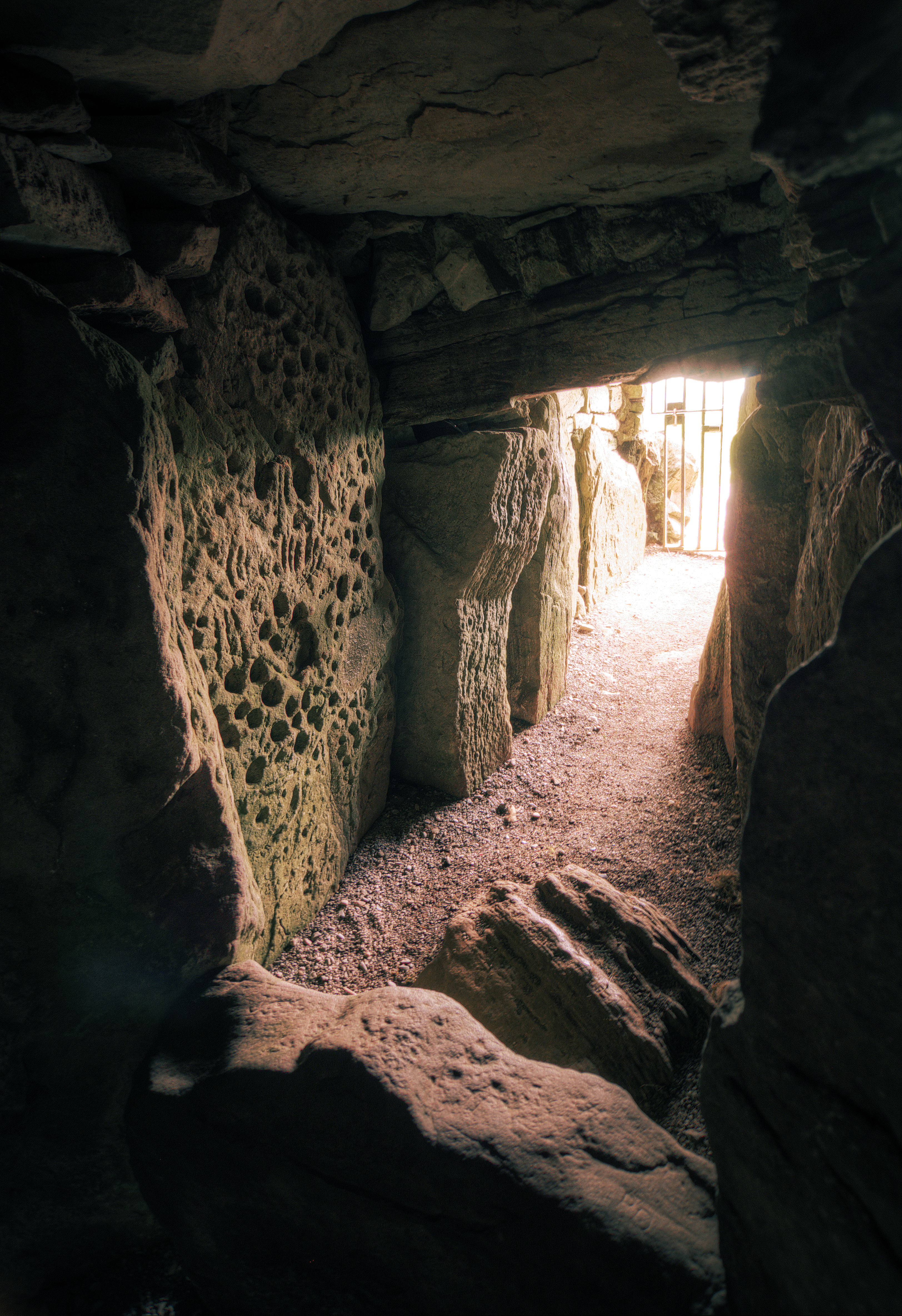
Carrowmore Megalithic Cemetery P52 In Front Of P51 2015 09 08
Carrowmore ( ga, An Cheathrú Mhór, 'the great quarter') is a large group of megalithic monuments on the Coolera Peninsula to the west of Sligo, Ireland. They were built in the 4th millennium BC, during the Neolithic (New Stone Age). There are thirty surviving tombs, making Carrowmore one of the largest clusters of megalithic tombs in Ireland, and one of the 'big four' along with Carrowkeel, Loughcrew and Brú na Bóinne. Carrowmore is the heart of an ancient ritual landscape which is dominated by the mountain of Knocknarea to the west. It is a protected National Monument. Location Placed on a small plateau at an altitude of between 36.5 and 59 metres above sea level Carrowmore is the focal point of a prehistoric ritual landscape which is dominated by the mountain of Knocknarea to the west with the great cairn of Miosgán Médhbh on top. To the east, in Carns townland, two large cairns overlook Lough Gill, and along the eastern boundary of the peninsula the Ballygawley Mou ... [...More Info...] [...Related Items...] OR: [Wikipedia] [Google] [Baidu] |
Passage Tombs In Ireland
Passage tombs are a category of Megalithic monument from the Neolithic period. They are found in most regions of Ireland but are more prevalent in the Northern half of the island. The usage period of Irish passage tombs date from c. 3750 B.C. to about 2500 B.C. About twenty clusters are recorded in Ireland, but the best known examples are found along a curved trajectory from the west coast to the east, including the centres of Carrowmore and Carrowkeel in County Sligo, and Loughcrew and the Boyne Valley in County Meath. Architectural features The term 'passage tomb' only dates back to the mid twentieth century. Before then, the monuments were called by other terms, such as "chambered cairns" "Danish mounds" or "tumuli". A number of authors of the modern era, including Alison Sheridan and Robert Hensey, have attempted to categorise passage tombs. Hensey suggests three categories; small and simple open monuments, often circular, such as found at Carrowmore, County Sligo; intermed ... [...More Info...] [...Related Items...] OR: [Wikipedia] [Google] [Baidu] |
Coolera Peninsula
The Coolera Peninsula () is a peninsula in Sligo Bay, County Sligo, Ireland. It is the most populous of County Sligo's peninsulas, and the second-largest by land area. The primary population centres on Coolera are the coastal town of Strandhill on its western shore, and Magheraboy, a suburb of Sligo town. The peninsula is characterised by a vast network of Megalithic and Neolithic tombs, cairns and ringforts spread out across its landscape. The Carrowmore Megalithic Complex dates back to the 4th millennium BC, and is one of the largest megalithic complexes in Ireland. The 30,000-tonne tomb of Queen Médb, known as Miosgán Médhbh, sits atop Knocknarea mountain and is clearly visible from much of northern Sligo, making it one of the county's most recognisable landmarks. Taken together, Sligo County Council has applied for this network of ancient monuments to be recognised as a UNESCO World Heritage Site. In contrast to its ancient history, the peninsula's main settlement, St ... [...More Info...] [...Related Items...] OR: [Wikipedia] [Google] [Baidu] |
Knocknarea
Knocknarea (; ) is a large prominent hill west of Sligo town in County Sligo, Ireland, with a height of . Knocknarea is visually striking as it has steep limestone cliffs and stands on the Cúil Irra peninsula overlooking the Atlantic coast. At the summit is one of Ireland's largest cairns, known as Queen Maeve's Cairn, which is believed to contain a Neolithic passage tomb. In recent years there has been concern that the ancient cairn, a protected National Monument, is being damaged by climbers. There are also remains of several smaller tombs on the summit. Knocknarea overlooks the Carrowmore tombs and is thought to have been part of an ancient ritual landscape. Name Knocknarea is an anglicization of an Irish name. "Knock" means hill, but the etymology of the rest of the name is disputed. The Placenames Database of Ireland gives the Irish name as ''Cnoc na Riabh'' (meaning "hill of the stripes"). However, P.W. Joyce preferred the interpretation ''Cnoc na Riaghadh'' ("hill ... [...More Info...] [...Related Items...] OR: [Wikipedia] [Google] [Baidu] |
Listoghil
Listoghil () is the large central monument in the Carrowmore group of prehistoric tombs in County Sligo in Ireland. It was numbered as ''Carrowmore 51'' by George Petrie in 1837 and this designation is still used. Although the district of Cuil Irra is steeped in legend, Listoghil has never been satisfactorily connected with the ancient legends in the way that say Newgrange has. It is the only cairn in Carrowmore. Antiquarians in the 19th century made references to another cairn nearby at Leacharail, but the site of this has never been located. Etymology According to Petrie (Letter to Larcom, Aug. 1837), the name may mean 'Ryefort' (it appears as Lios a' tSeagail, seagail meaning rye in Irish, in early maps). However ''lios'' in Irish refers generally to a court or enclosed area, so it may be that the name originally referred to the area enclosed by the dolmens, on which Listoghil stands, rather than the cairn itself. Location Listoghil stands 59m above sea level at the geograp ... [...More Info...] [...Related Items...] OR: [Wikipedia] [Google] [Baidu] |
Carrowkeel Megalithic Cemetery
Carrowkeel is a cluster of passage tombs in south County Sligo, Ireland. They were built in the 4th millennium BC, during the Neolithic era. The monuments are on the Bricklieve Hills (''An Bricshliabh'', 'the speckled hills'), overlooking Lough Arrow, and are sometimes called the Bricklieve tombs. They are named after the townland of Carrowkeel in which most of them are located. Nearby are the Caves of Kesh and Heapstown Cairn. The Carrowkeel tombs are protected National Monuments and are considered one of the "big four" passage tomb cemeteries in Ireland, along with Carrowmore, Brú na Bóinne and Loughcrew. History and research The monuments at Carrowkeel were originally excavated in 1911 by a team led by R.A.S. Macalister, accompanied by Robert Lloyd Praeger and Edmund Clarence Richard Armstrong. These excavations led to an array of findings including animal bones, cremated human remains, human bones, and tools and pottery from the Neolithic Age. The particular type of cr ... [...More Info...] [...Related Items...] OR: [Wikipedia] [Google] [Baidu] |
County Sligo
County Sligo ( , gle, Contae Shligigh) is a county in Ireland. It is located in the Border Region and is part of the province A province is almost always an administrative division within a country or state. The term derives from the ancient Roman '' provincia'', which was the major territorial and administrative unit of the Roman Empire's territorial possessions ou ... of Connacht. Sligo is the administrative capital and largest town in the county. Sligo County Council is the Local government in the Republic of Ireland, local authority for the county. The population of the county was 65,535 at the 2016 census. It is noted for Benbulben Mountain, one of Ireland's most distinctive natural landmarks. History The county was officially formed in 1585 by Sir Henry Sidney, Lord Deputy of Ireland, but did not come into effect until the chaos of the Nine Years' War (Ireland), Nine Years' War ended, in 1603. Its boundaries reflect the Ó Conchobhair Sligigh confederation of Lo ... [...More Info...] [...Related Items...] OR: [Wikipedia] [Google] [Baidu] |
Megalithic
A megalith is a large stone that has been used to construct a prehistoric structure or monument, either alone or together with other stones. There are over 35,000 in Europe alone, located widely from Sweden to the Mediterranean sea. The word was first used in 1849 by the British antiquarian Algernon Herbert in reference to Stonehenge and derives from the Ancient Greek words " mega" for great and "lithos" for stone. Most extant megaliths were erected between the Neolithic period (although earlier Mesolithic examples are known) through the Chalcolithic period and into the Bronze Age. At that time, the beliefs that developed were dynamism and animism, because Indonesia experienced the megalithic age or the great stone age in 2100 to 4000 BC. So that humans ancient tribe worship certain objects that are considered to have supernatural powers. Some relics of the megalithic era are menhirs (stone monuments) and dolmens (stone tables). Types and definitions While "megalith" i ... [...More Info...] [...Related Items...] OR: [Wikipedia] [Google] [Baidu] |
Newgrange
Newgrange ( ga, Sí an Bhrú) is a prehistoric monument in County Meath in Ireland, located on a rise overlooking the River Boyne, west of Drogheda. It is an exceptionally grand passage tomb built during the Neolithic Period, around 3200 BC, making it older than Stonehenge and the Egyptian pyramids. It is aligned on the winter solstice sunrise. Newgrange is the main monument in the Brú na Bóinne complex, a World Heritage Site that also includes the passage tombs of Knowth and Dowth, as well as other henges, burial mounds and standing stones. Newgrange consists of a large circular mound with an inner stone passageway and cruciform chamber. Burnt and unburnt human bones, and possible grave goods or votive offerings, were found in this chamber. The mound has a retaining wall at the front, made mostly of white quartz cobblestones, and it is ringed by engraved kerbstones. Many of the larger stones of Newgrange are covered in megalithic art. The mound is also ringed by a ... [...More Info...] [...Related Items...] OR: [Wikipedia] [Google] [Baidu] |
Loughcrew
Loughcrew or Lough Crew () is an area of historical importance near Oldcastle, County Meath, Ireland. It is home to a group of ancient tombs from the 4th millennium BC, some decorated with rare megalithic art, which sit on top of a range of hills. The hills and tombs are together known as Slieve na Calliagh (''Sliabh na Caillí'') and are the highest point in Meath. It is one of the four main passage tomb cemeteries in Ireland and is a protected National Monument. The area is also home to the Loughcrew Estate, from which it is named. The tombs There are remains of more than twenty ancient tombs at Loughcrew. It is one of the four main passage tomb cemeteries in Ireland along with Brú na Bóinne, Carrowkeel and Carrowmore. The megalithic monuments are spread across four hilltops: Carnbane East, Carnbane West, Carrickbrack and Patrickstown Hill. These hills and the tombs themselves are together known as Slieve na Calliagh or ''Sliabh na Caillí'', meaning "mountain of the Caill ... [...More Info...] [...Related Items...] OR: [Wikipedia] [Google] [Baidu] |


