|
Bongor
Bongor ( ar, بونقور) is a city in Chad, the capital of the region of Mayo-Kebbi Est. It is located on the eastern bank of the Logone River. During the rainy season (May–September), the Logone is navigable between Bongor and N'Djamena, Chad's capital. The population is 29,268 (2008). Bongor has a lively central market square, an airport, a post office, a hospital, and the administrative offices for the Mayo-Kebbi Prefecture. Cotton and rice are the primary cash crops of the region. There is a hotel on the bank of the Logone. The principal market day is Monday and people come from the entire region for the weekly market. Bongor was a part of German Cameroon until the 1911 German-French Treaty. In 1904, a military station was founded near Bongor by German colonial officer Herbert Kund, constituting the beginning of the city's modern history. The primary indigenous tribal group are the Masa people. The city has been an important centre of secondary education since colon ... [...More Info...] [...Related Items...] OR: [Wikipedia] [Google] [Baidu] |
Bongor Airport
Bongor Airport ( ar, مطار بونقور) is an airport serving the city of Bongor, in the Mayo-Kebbi Est Region of Chad. See also *List of airports in Chad This is a list of airports in Chad, grouped by type and sorted by location. Chad, officially known as the Republic of Chad (french: République du Tchad, ar, جمهورية تشاد or ''Jumhūriyyat Tshād''), is a landlocked country in Centra ... References External links Airport record for Bongor Airstripat Landings.com Airports in Chad Mayo-Kebbi Est Region {{Chad-airport-stub ... [...More Info...] [...Related Items...] OR: [Wikipedia] [Google] [Baidu] |
Mayo-Kebbi Est
Mayo-Kebbi Est ( ar, مايو كيبي الشرقية) is one of the 23 regions of Chad. Its capital is Bongor. It is composed of the northern areas of the former prefecture of Mayo-Kebbi (sub-prefectures of Bongor, Fianga and Gounou Gaya). Geography The region borders Chari-Baguirmi Region to the north-east, Tandjilé Region to the south-east, Mayo-Kebbi Ouest Region to the south-west, and Cameroon to the west. Settlements The region's capital is Bongor; other major settlements include Djodo Gassa, Fianga, Gam, Gounou Gaya, Guélengdeng, Hollom Gamé, Katoa, Kéra, Kim, Koyom, Moulkou, Nanguigoto, Tikem and Youé. Lake Fianga and Lake Tikem are located in the region. Demographics The region's population was 495,339 inhabitants in 1993 and 774,782 in the 2009 census. The main ethnolinguistic groups are the Bagirmi, Kanuri, Kera, Kim, Kwang, Majera, Marba, Masa ''Masa'' (or ''masa de maíz'') (; ) is a maize dough that comes from ground nixtamalized cor ... [...More Info...] [...Related Items...] OR: [Wikipedia] [Google] [Baidu] |
Departments Of Chad
The regions of Chad are divided into 61 departments. The departments are listed below, by name and by region. Departments sorted by name Departments grouped by region The following is a list of departments grouped by region. Shown next to each department is its population as of 2009, the name of its capital or main town (''chef-lieu'' in French), and a list of sub-prefectures (''sous-préfectures''). Bahr El Gazel Created in 2008 from the Kanem region's former Barh El Gazel department. Batha Borkou Created in 2008 from the Borkou-Ennedi-Tibesti region's former Borkou department. Chari-Baguirmi Ennedi-Est Ennedi-Ouest Guéra Hadjer-Lamis Kanem Lac Logone Occidental Logone Oriental Mandoul Mayo-Kebbi Est Mayo-Kebbi Ouest Moyen-Chari Ouaddaï Salamat Sila Created in 2008 from the Ouaddaï region's former Sila and Djourf Al Ahmar departments. Tandjilé Tibesti Created i ... [...More Info...] [...Related Items...] OR: [Wikipedia] [Google] [Baidu] |
Logone River
The Logon or Logone River is a major tributary of the Chari River. The Logone's sources are located in the western Central African Republic, northern Cameroon, and southern Chad. It has two major tributaries: the Pendé River (Eastern Logone) in the prefecture Ouham-Pendé in the Central African Republic and the Mbéré River (Western Logone) at the east of Cameroon. Many swamps and wetlands surround the river. Settlements on the river include Kousseri, Cameroon's northernmost city, and Chad's capital city, N'Djaména, which is located at the spot where the Logone empties into the Chari River. The Logone forms part of the international border between Chad and Cameroon. Hydrometry The flow of the river has been observed over 38 years (1951–84) in Bongor a town in Chad downstream of the union with the Pendé about above the mouth into the Chari. The Bongor observed average annual flow during this period was fed by an area of about approximately 94.5% of the total c ... [...More Info...] [...Related Items...] OR: [Wikipedia] [Google] [Baidu] |
Regions Of Chad
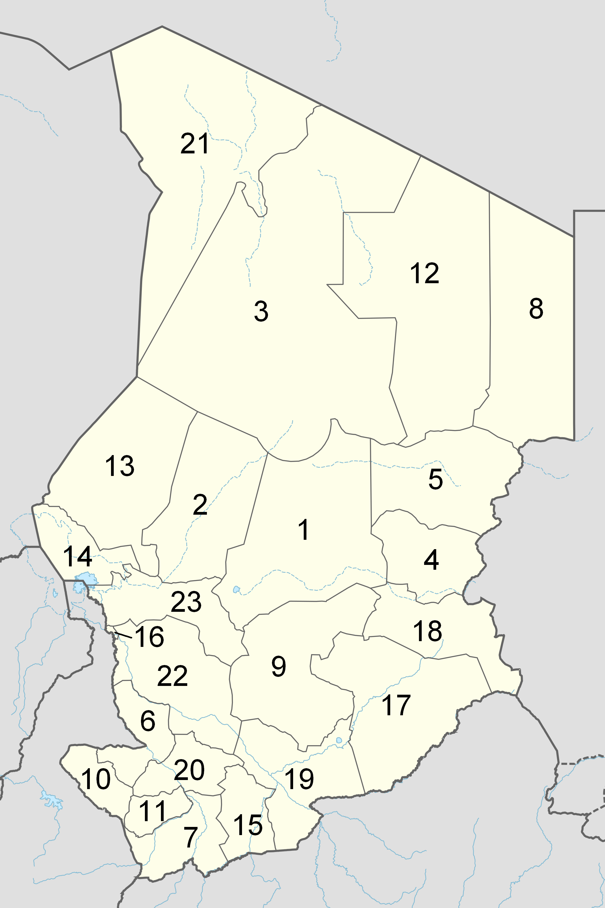
The Republic of Chad is made up of twenty-three regions. Chad was divided into regions in 2002. It was previously divided into prefectures, and then departments. Current regions This is a list of the regions of Chad since 2012, with population figures from the 2009 census. History From independence in 1960 until 1999 it was divided into 14 ''préfectures''. These were replaced in 1999 by 28 ''départements''. The country was reorganized again in 2002 to produce 18 ''régions''. In 2008, a further four ''régions'' were created, increasing the number to 22. Ennedi Region was split into Ennedi-Est and Ennedi-Ouest in 2012, producing the current 23 regions. Regions (2008–2012) Regions (2002–2008) (1) created in 2004 Regions created in 2008 On February 19, 2008, four new regions were created: * Former Borkou-Ennedi-Tibesti Region divided into: ** Borkou Region, from Borkou-Ennedi-Tibesti's former Borkou Department ** Ennedi Region, from Borkou-Ennedi-Tib ... [...More Info...] [...Related Items...] OR: [Wikipedia] [Google] [Baidu] |
Sub-prefectures Of Chad
The departments of Chad are divided into 348 sub-prefectures (''sous-préfectures''). List of sub-prefectures by department and by region * The following is a list of departments grouped by region. Shown next to each department is its population as of 2009, the name of its capital or main town (''chef-lieu'' in French), and a list of sub-prefectures (''sous-préfectures''). Bahr El Gazel Created in 2008 from the Kanem region's former Barh El Gazel department. Batha Borkou Created in 2008 from the Borkou-Ennedi-Tibesti region's former Borkou department. Chari-Baguirmi Ennedi Created in 2008 from the Borkou-Ennedi-Tibesti region's former Ennedi Est and Ennedi Ouest departments. Guéra Hadjer-Lamis Kanem Lac Logone Occidental Logone Oriental Mandoul Mayo-Kebbi Est Mayo-Kebbi Ouest Moyen-Chari Ouaddaï Salamat Sila Created in 2008 from the Ouaddaï region's former Sila and Djourf Al Ahm ... [...More Info...] [...Related Items...] OR: [Wikipedia] [Google] [Baidu] |
Mayo-Boneye
Mayo-Boneye is one of four departments in Mayo-Kebbi Est, a region of Chad. Its capital is Bongor Bongor ( ar, بونقور) is a city in Chad, the capital of the region of Mayo-Kebbi Est. It is located on the eastern bank of the Logone River. During the rainy season (May–September), the Logone is navigable between Bongor and N'Djamena, Cha .... Departments of Chad Mayo-Kebbi Est Region {{Chad-geo-stub ... [...More Info...] [...Related Items...] OR: [Wikipedia] [Google] [Baidu] |
Chad
Chad (; ar, تشاد , ; french: Tchad, ), officially the Republic of Chad, '; ) is a landlocked country at the crossroads of North and Central Africa. It is bordered by Libya to the north, Sudan to the east, the Central African Republic to the south, Cameroon to the southwest, Nigeria to the southwest (at Lake Chad), and Niger to the west. Chad has a population of 16 million, of which 1.6 million live in the capital and largest city of N'Djamena. Chad has several regions: a desert zone in the north, an arid Sahelian belt in the centre and a more fertile Sudanian Savanna zone in the south. Lake Chad, after which the country is named, is the second-largest wetland in Africa. Chad's official languages are Arabic and French. It is home to over 200 different ethnic and linguistic groups. Islam (55.1%) and Christianity (41.1%) are the main religions practiced in Chad. Beginning in the 7th millennium BC, human populations moved into the Chadian basin in great number ... [...More Info...] [...Related Items...] OR: [Wikipedia] [Google] [Baidu] |
Morocco–Congo Treaty
The Morocco–Congo Treaty was signed on 4 November 1911 in Berlin between France and Germany to recognize French domination of Morocco. This event concluded the Agadir Crisis. In it, France ceded parts of the French Congo and French Equatorial Africa to Germany, comprising the Neukamerun Neukamerun was the name of Central African territories ceded by the Third French Republic to the German Empire in 1911. Upon taking office in 1907, Theodor Seitz, governor of Kamerun, advocated the acquisition of territories from the French Co .... SourcesKAISER'S SON SHOWS ANGER AT TREATY; Openly Applauds Criticism of German Backdown by Members of Reichstag. Nov 10th, 1911. ''New York Times'' External links * {{DEFAULTSORT:Morocco-Congo Treaty 1911 in Morocco History of Africa Kamerun Treaties involving territorial changes 1911 in Africa Treaties concluded in 1911 Treaties of the German Empire Treaties of the French Third Republic France–Germany relations ... [...More Info...] [...Related Items...] OR: [Wikipedia] [Google] [Baidu] |
Populated Places In Chad
Population typically refers to the number of people in a single area, whether it be a city or town, region, country, continent, or the world. Governments typically quantify the size of the resident population within their jurisdiction using a census, a process of collecting, analysing, compiling, and publishing data regarding a population. Perspectives of various disciplines Social sciences In sociology and population geography, population refers to a group of human beings with some predefined criterion in common, such as location, race, ethnicity, nationality, or religion. Demography is a social science which entails the statistical study of populations. Ecology In ecology, a population is a group of organisms of the same species who inhabit the same particular geographical area and are capable of interbreeding. The area of a sexual population is the area where inter-breeding is possible between any pair within the area and more probable than cross-breeding with ... [...More Info...] [...Related Items...] OR: [Wikipedia] [Google] [Baidu] |
French Equatorial Africa
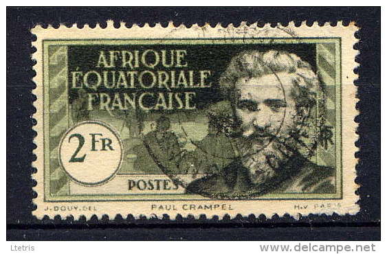
French Equatorial Africa (french: link=no, Afrique-Équatoriale française), or the AEF, was the federation of French colonial possessions in Equatorial Africa, extending northwards from the Congo River into the Sahel, and comprising what are today the countries of Chad, the Central African Republic, the Republic of the Congo, and Gabon. History Established in 1910, the Federation contained four (later five) colonial possessions: French Gabon, French Congo, Ubangi-Shari and French Chad. The Governor-General was based in Brazzaville with deputies in each territory. In 1911, France ceded parts of the territory to German Kamerun as a result of the Agadir Crisis. The territory was returned after Germany's defeat in World War I, while most of Cameroon proper became a French League of Nations mandate not integrated into the AEF. French Equatorial Africa, especially the region of Ubangi-Shari had a similar concession system as the Congo Free State and similar atrocities were a ... [...More Info...] [...Related Items...] OR: [Wikipedia] [Google] [Baidu] |


