|
Baltic Quay
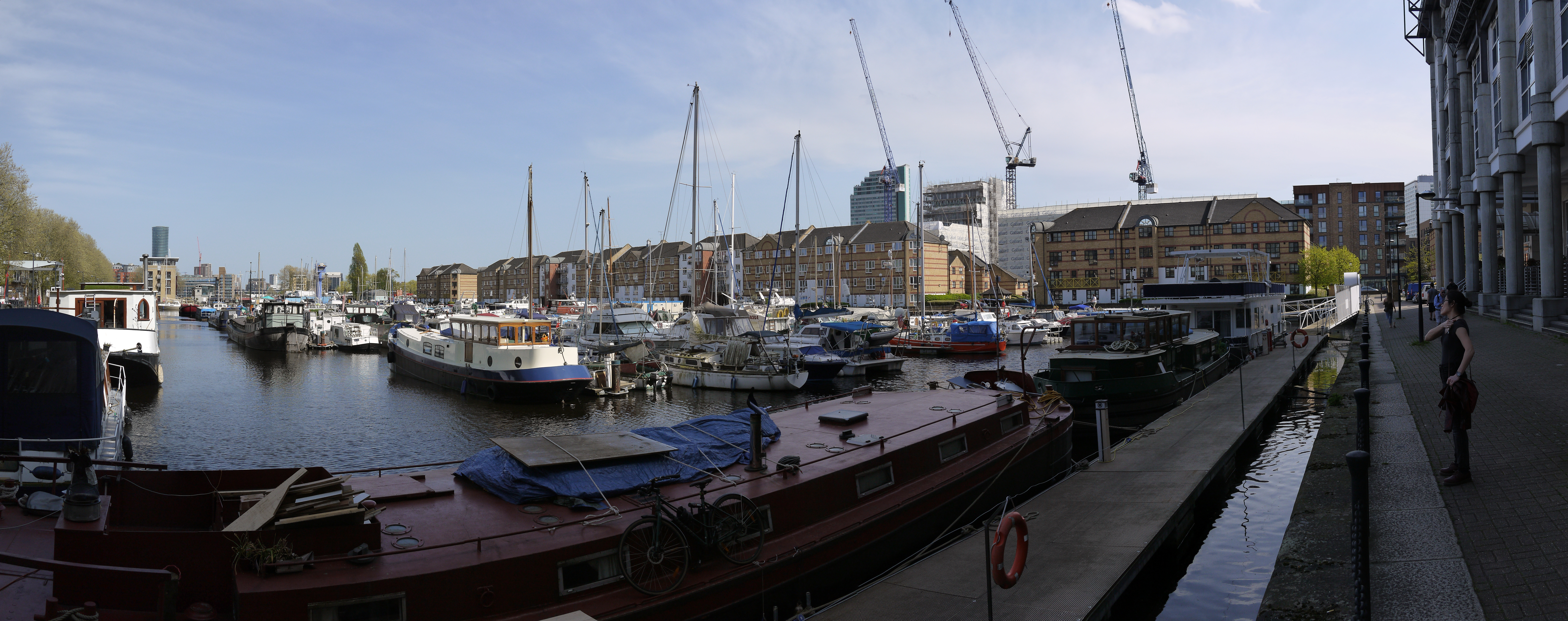
Baltic Quay is a large residential development, located in Surrey Quays in the London Borough of Southwark. Completed in 1989 during the London Docklands Development Corporation, it is largely known for its unique architecture, which won it awards from the London Docklands Development Corporation. As a result, it is considered to be a landmark development in the area. Situated between South Dock and Greenland Dock Greenland Dock is the oldest of London's riverside wet docks, located in Rotherhithe in the area of the city now known as Docklands. It used to be part of the Surrey Commercial Docks, most of which have by now been filled in. Greenland ..., the building was originally intended for mixed use; the ground floors as commercial outlets, the 1st and 2nd floors as office space and the remaining floors as residential apartments. Notable features of the development include is its vaulted roofs, circular windows and 14-storey tower. In particular the building was kn ... [...More Info...] [...Related Items...] OR: [Wikipedia] [Google] [Baidu] |
Surrey Quays
Surrey Quays is a largely residential area of Rotherhithe in south-east London, occupied until 1970 by the Surrey Commercial Docks. Previously known as Surrey Docks, the area was renamed following the construction of the Surrey Quays shopping centre. The precise boundaries of the area are somewhat amorphous, but it is generally considered to comprise the southern half of the Rotherhithe peninsula from Canada Water to South Dock; electorally, Surrey Docks is the eastern half of the peninsula. The area is served by Surrey Quays railway station. The Docks are called Surrey Docks because until 1889 the borders of Surrey and Kent met in this area. History After the closure of the docks, the area remained derelict for over a decade, with much of the warehousing demolished and over 90% of the docks filled in. The only surviving areas of open water were Greenland Dock, South Dock, part of Canada Dock (renamed Canada Water), remnants of Norway Dock, and a basin renamed Surrey Water. I ... [...More Info...] [...Related Items...] OR: [Wikipedia] [Google] [Baidu] |
London Borough Of Southwark
The London Borough of Southwark ( ) in South London forms part of Inner London and is connected by bridges across the River Thames to the City of London and London Borough of Tower Hamlets. It was created in 1965 when three smaller council areas amalgamated under the London Government Act 1963. All districts of the area are within the London postal district. It is governed by Southwark London Borough Council. The part of the South Bank within the borough is home to London Bridge terminus station and the attractions of The Shard, Tate Modern, Shakespeare's Globe and Borough Market that are the largest of the venues in Southwark to draw domestic and international tourism. Dulwich is home to the Dulwich Picture Gallery and the Imperial War Museum is in Elephant and Castle. History Southwark is the oldest part of south London. An urban area to the south of the bridge was first developed in the Roman period, but subsequently abandoned. The name Southwark dates from the establishmen ... [...More Info...] [...Related Items...] OR: [Wikipedia] [Google] [Baidu] |
London Docklands Development Corporation
The London Docklands Development Corporation (LDDC) was a quango agency set up by the UK Government in 1981 to regenerate the depressed Docklands area of east London. During its seventeen-year existence it was responsible for regenerating an area of in the London Boroughs of Newham, Tower Hamlets and Southwark. LDDC helped to create Canary Wharf, Surrey Quays shopping centre, London City Airport, ExCeL Exhibition Centre, London Arena and the Docklands Light Railway, bringing more than 120,000 new jobs to the Docklands and making the area highly sought after for housing. Although initially fiercely resisted by local councils and residents, today it is generally regarded as having been a success and is now used as an exemplar of large-scale regeneration, although tensions between older and more recent residents remain. Reason for creation London's Docklands were at one time the largest and most successful in the world. Starting with West India Docks in 1802, East India Doc ... [...More Info...] [...Related Items...] OR: [Wikipedia] [Google] [Baidu] |
South Dock, Rotherhithe
South Dock is one of two surviving docks in the former Surrey Commercial Docks in Rotherhithe, London, England. It was built in 1807–1811 just south of the larger Greenland Dock, to which it is connected by a channel now known as Greenland Cut; it also has a lock giving access to the River Thames. Originally named the ''East Country Dock'', it was renamed in 1850 when the Surrey Commercial Dock Company purchased and enlarged it. Timber and grain were the main products imported and exported in the dock. World War II The dock was seriously damaged by German attacks in World War II when the area was heavily bombed by the Luftwaffe. Due to bomb damage in Greenland Dock, South Dock became the only exit from that dock. It was emptied of shipping in 1944, drained and used for the construction of concrete sections for the Mulberry Harbours used on D-Day. After the war, it was repaired and the surrounding warehouses rebuilt. After the war The revival of the Surrey Docks proved short- ... [...More Info...] [...Related Items...] OR: [Wikipedia] [Google] [Baidu] |
Greenland Dock
Greenland Dock is the oldest of London's riverside wet docks, located in Rotherhithe in the area of the city now known as Docklands. It used to be part of the Surrey Commercial Docks, most of which have by now been filled in. Greenland Dock is now used purely for recreational purposes; it is one of only two functioning enclosed docks on the south bank of the River Thames, along with the smaller South Dock, to which it is connected by a channel now known as Greenland Cut. History Howland Great Wet Dock The dock was originally laid out between 1695 and 1699 on land owned by the aristocratic Russell family of the 1st Duke of Bedford. The Russells had been given a portion of land in lower Rotherhithe by a wealthy Streatham landowner, John Howland, as part of a wedding dowry for his daughter Elizabeth, granddaughter of Sir Josiah Child – the dictatorial chairman of the East India Company, who married Wriothesley Russell, the Marquis of Tavistock. They immediately set ab ... [...More Info...] [...Related Items...] OR: [Wikipedia] [Google] [Baidu] |
Buildings And Structures In The London Borough Of Southwark
A building, or edifice, is an enclosed structure with a roof and walls standing more or less permanently in one place, such as a house or factory (although there's also portable buildings). Buildings come in a variety of sizes, shapes, and functions, and have been adapted throughout history for a wide number of factors, from building materials available, to weather conditions, land prices, ground conditions, specific uses, prestige, and aesthetic reasons. To better understand the term ''building'' compare the list of nonbuilding structures. Buildings serve several societal needs – primarily as shelter from weather, security, living space, privacy, to store belongings, and to comfortably live and work. A building as a shelter represents a physical division of the human habitat (a place of comfort and safety) and the ''outside'' (a place that at times may be harsh and harmful). Ever since the first cave paintings, buildings have also become objects or canvasses of much arti ... [...More Info...] [...Related Items...] OR: [Wikipedia] [Google] [Baidu] |
Residential Buildings In London
A residential area is a land used in which housing predominates, as opposed to industrial and commercial areas. Housing may vary significantly between, and through, residential areas. These include single-family housing, multi-family residential, or mobile homes. Zoning for residential use may permit some services or work opportunities or may totally exclude business and industry. It may permit high density land use or only permit low density uses. Residential zoning usually includes a smaller FAR (floor area ratio) than business, commercial or industrial/manufacturing zoning. The area may be large or small. Overview In certain residential areas, especially rural, large tracts of land may have no services whatever, such that residents seeking services must use a motor vehicle or other transportation, so the need for transportation has resulted in land development following existing or planned transport infrastructure such as rail and road. Development patterns may be r ... [...More Info...] [...Related Items...] OR: [Wikipedia] [Google] [Baidu] |


_-_geograph.org.uk_-_1494181.jpg)


