|
Béchar District
Béchar ( ar, بشار) is the capital city of Béchar Province, Algeria. It is also a commune, coextensive with Béchar District, of Béchar Province. In 2008 the city had a population of 165,627, up from 134,954 in 1998, with an annual growth rate of 2.1%. The commune covers an area of . It has then thrived on the activity of the coal mines until petroleum production seized the market. Leatherwork and jewellery are notable products of Béchar. Dates, vegetables, figs, cereals and almonds are produced near Béchar. There are bituminous coal reserves near Béchar, but they are not exploited to their greatest potential because of transportation costs are too high relative to that from the oil and gas fields of eastern Algeria. The city was once the site of a French Foreign Legion post. The Kenadsa longwave transmitter, whose masts are the tallest structures in Algeria at , is found near Béchar. Location Béchar is located in the northwestern region of Algeria roughly s ... [...More Info...] [...Related Items...] OR: [Wikipedia] [Google] [Baidu] |
City
A city is a human settlement of notable size.Goodall, B. (1987) ''The Penguin Dictionary of Human Geography''. London: Penguin.Kuper, A. and Kuper, J., eds (1996) ''The Social Science Encyclopedia''. 2nd edition. London: Routledge. It can be defined as a permanent and densely settled place with administratively defined boundaries whose members work primarily on non-agricultural tasks. Cities generally have extensive systems for housing, transportation, sanitation, utilities, land use, production of goods, and communication. Their density facilitates interaction between people, government organisations and businesses, sometimes benefiting different parties in the process, such as improving efficiency of goods and service distribution. Historically, city-dwellers have been a small proportion of humanity overall, but following two centuries of unprecedented and rapid urbanization, more than half of the world population now lives in cities, which has had profound consequences for ... [...More Info...] [...Related Items...] OR: [Wikipedia] [Google] [Baidu] |
Natural Gas
Natural gas (also called fossil gas or simply gas) is a naturally occurring mixture of gaseous hydrocarbons consisting primarily of methane in addition to various smaller amounts of other higher alkanes. Low levels of trace gases like carbon dioxide, nitrogen, hydrogen sulfide, and helium are also usually present. Natural gas is colorless and odorless, so odorizers such as mercaptan (which smells like sulfur or rotten eggs) are commonly added to natural gas supplies for safety so that leaks can be readily detected. Natural gas is a fossil fuel and non-renewable resource that is formed when layers of organic matter (primarily marine microorganisms) decompose under anaerobic conditions and are subjected to intense heat and pressure underground over millions of years. The energy that the decayed organisms originally obtained from the sun via photosynthesis is stored as chemical energy within the molecules of methane and other hydrocarbons. Natural gas can be burned fo ... [...More Info...] [...Related Items...] OR: [Wikipedia] [Google] [Baidu] |
Palm (plant)
The Arecaceae is a family of perennial flowering plants in the monocot order Arecales. Their growth form can be climbers, shrubs, tree-like and stemless plants, all commonly known as palms. Those having a tree-like form are called palm trees. Currently, 181 genera with around 2,600 species are known, most of which are restricted to tropical and subtropical climates. Most palms are distinguished by their large, compound, evergreen leaves, known as fronds, arranged at the top of an unbranched stem. However, palms exhibit an enormous diversity in physical characteristics and inhabit nearly every type of habitat within their range, from rainforests to deserts. Palms are among the best known and most extensively cultivated plant families. They have been important to humans throughout much of history. Many common products and foods are derived from palms. In contemporary times, palms are also widely used in landscaping. In many historical cultures, because of their importance as ... [...More Info...] [...Related Items...] OR: [Wikipedia] [Google] [Baidu] |
Sand Dunes
A dune is a landform composed of wind- or water-driven sand. It typically takes the form of a mound, ridge, or hill. An area with dunes is called a dune system or a dune complex. A large dune complex is called a dune field, while broad, flat regions covered with wind-swept sand or dunes with little or no vegetation are called '' ergs'' or ''sand seas''. Dunes occur in different shapes and sizes, but most kinds of dunes are longer on the stoss (upflow) side, where the sand is pushed up the dune, and have a shorter ''slip face'' in the lee side. The valley or trough between dunes is called a ''dune slack''. Dunes are most common in desert environments, where the lack of moisture hinders the growth of vegetation that would otherwise interfere with the development of dunes. However, sand deposits are not restricted to deserts, and dunes are also found along sea shores, along streams in semiarid climates, in areas of glacial outwash, and in other areas where poorly cemented sa ... [...More Info...] [...Related Items...] OR: [Wikipedia] [Google] [Baidu] |
Date Palms
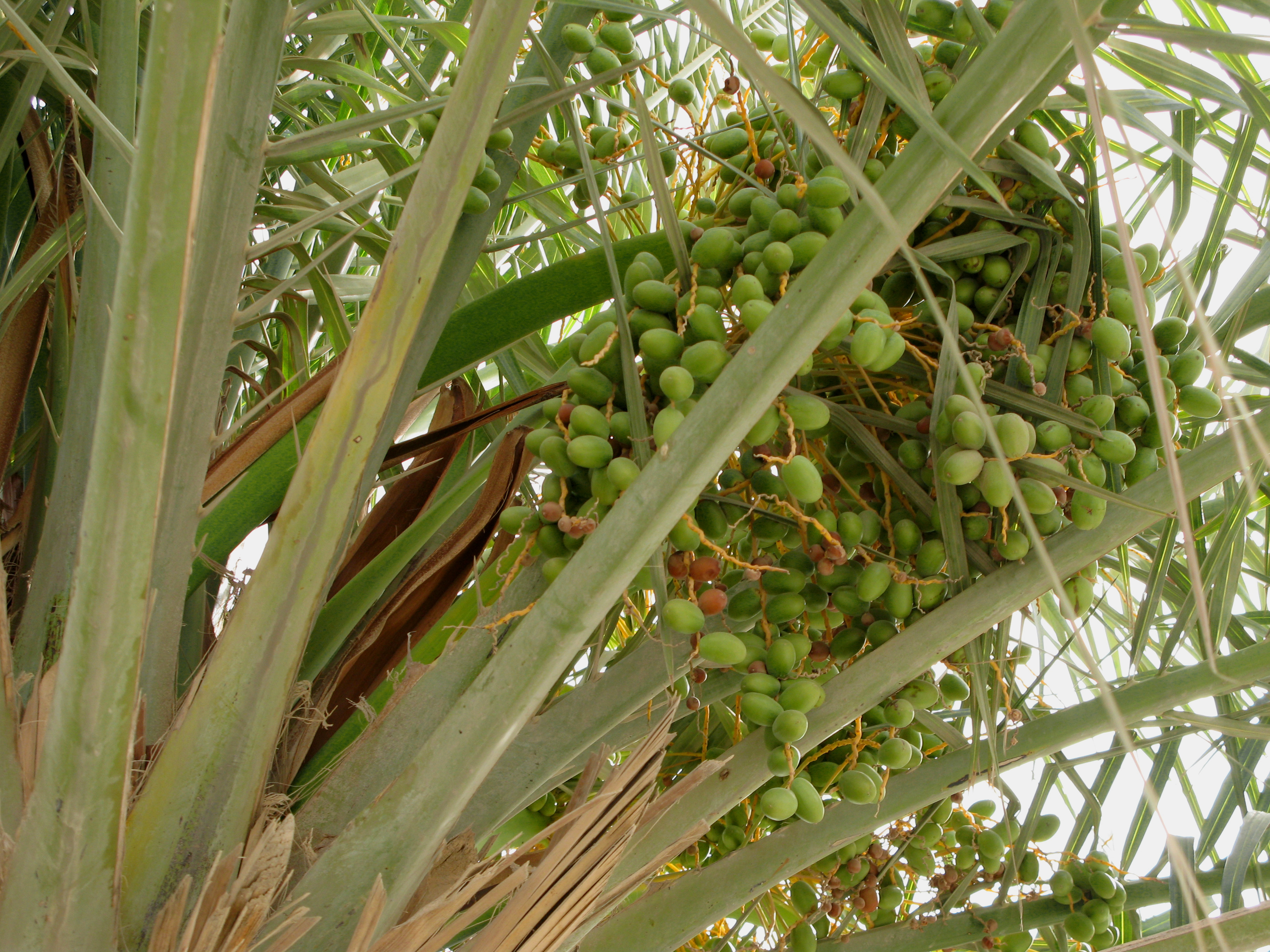
''Phoenix dactylifera'', commonly known as date or date palm, is a flowering plant species in the palm family, Arecaceae, cultivated for its edible sweet fruit called dates. The species is widely cultivated across northern Africa, the Middle East, and South Asia, and is naturalized in many tropical and subtropical regions worldwide. ''P. dactylifera'' is the type species of genus '' Phoenix'', which contains 12–19 species of wild date palms. Date trees reach up to in height, growing singly or forming a clump with several stems from a single root system. Slow-growing, they can reach over 100 years of age when maintained properly. Date fruits (dates) are oval-cylindrical, long, and about in diameter, with colour ranging from dark brown to bright red or yellow, depending on variety. Containing 61–68 percent sugar by mass when dried, dates are very sweet and are enjoyed as desserts on their own or within confections. Dates have been cultivated in the Middle East and the ... [...More Info...] [...Related Items...] OR: [Wikipedia] [Google] [Baidu] |
Irrigated
Irrigation (also referred to as watering) is the practice of applying controlled amounts of water to land to help grow crops, landscape plants, and lawns. Irrigation has been a key aspect of agriculture for over 5,000 years and has been developed by many cultures around the world. Irrigation helps to grow crops, maintain landscapes, and revegetate disturbed soils in dry areas and during times of below-average rainfall. In addition to these uses, irrigation is also employed to protect crops from frost, suppress weed growth in grain fields, and prevent soil consolidation. It is also used to cool livestock, reduce dust, dispose of sewage, and support mining operations. Drainage, which involves the removal of surface and sub-surface water from a given location, is often studied in conjunction with irrigation. There are several methods of irrigation that differ in how water is supplied to plants. Surface irrigation, also known as gravity irrigation, is the oldest form of irriga ... [...More Info...] [...Related Items...] OR: [Wikipedia] [Google] [Baidu] |
Arable Land
Arable land (from the la, arabilis, "able to be ploughed") is any land capable of being ploughed and used to grow crops.''Oxford English Dictionary'', "arable, ''adj''. and ''n.''" Oxford University Press (Oxford), 2013. Alternatively, for the purposes of agricultural statistics, the term often has a more precise definition: A more concise definition appearing in the Eurostat glossary similarly refers to actual rather than potential uses: "land worked (ploughed or tilled) regularly, generally under a system of crop rotation". In Britain, arable land has traditionally been contrasted with pasturable land such as heaths, which could be used for sheep-rearing but not as farmland. Arable land area According to the Food and Agriculture Organization of the United Nations, in 2013, the world's arable land amounted to 1.407 billion hectares, out of a total of 4.924 billion hectares of land used for agriculture. Arable land (hectares per person) Non-arable lan ... [...More Info...] [...Related Items...] OR: [Wikipedia] [Google] [Baidu] |
Danish Meteorological Institute
The Danish Meteorological Institute (DMI; da, Danmarks Meteorologiske Institut) is the official Danish meteorological institute, administrated by the Ministry of Energy, Utilities and Climate. The institute makes weather forecasts and observations for Denmark, Greenland, and the Faroe Islands. History It was founded in 1873, largely through the efforts of Ludwig A. Colding. The Danish Meteorological Institute – DMI – encompasses the combined knowledge of the former Meteorological Institute, the Meteorological Service for Civil Aviation and the Meteorological Service for Defence. The Meteorological Institute was founded in 1872 under the Ministry of the Navy. The Meteorological Service for Civil Aviation was established in 1926, and used to be part of the Civil Aviation Administration. The Meteorological Service for Defence was established in 1953. The present-day DMI was established in 1990 through the merger of the three above-mentioned institutions. DMI is organized un ... [...More Info...] [...Related Items...] OR: [Wikipedia] [Google] [Baidu] |
World Meteorological Organization
The World Meteorological Organization (WMO) is a specialized agency of the United Nations responsible for promoting international cooperation on atmospheric science, climatology, hydrology and geophysics. The WMO originated from the International Meteorological Organization, a nongovernmental organization founded in 1873 as a forum for exchanging weather data and research. Proposals to reform the status and structure of the IMO culminated in the World Meteorological Convention of 1947, which formally established the World Meteorological Organization. The Convention entered into force on 23 March 1950, and the following year the WMO began operations as an intergovernmental organization within the UN system. The WMO is made up of 193 countries and territories, and facilitates the "free and unrestricted" exchange of data, information, and research between the respective meteorological and hydrological institutions of its members. It also collaborates with nongovernmental part ... [...More Info...] [...Related Items...] OR: [Wikipedia] [Google] [Baidu] |
Hot Desert Climate
The desert climate or arid climate (in the Köppen climate classification ''BWh'' and ''BWk''), is a dry climate sub-type in which there is a severe excess of evaporation over precipitation. The typically bald, rocky, or sandy surfaces in desert climates are dry and hold little moisture, quickly evaporating the already little rainfall they receive. Covering 14.2% of earth's land area, hot deserts are the second most common type of climate on earth after the polar climate. There are two variations of a desert climate according to the Köppen climate classification: a hot desert climate (''BWh''), and a cold desert climate (''BWk''). To delineate "hot desert climates" from "cold desert climates", there are three widely used isotherms: most commonly a mean annual temperature of , or sometimes the coldest month's mean temperature of , so that a location with a ''BW'' type climate with the appropriate temperature above whichever isotherm is being used is classified as "hot arid subt ... [...More Info...] [...Related Items...] OR: [Wikipedia] [Google] [Baidu] |
Desert Pavement
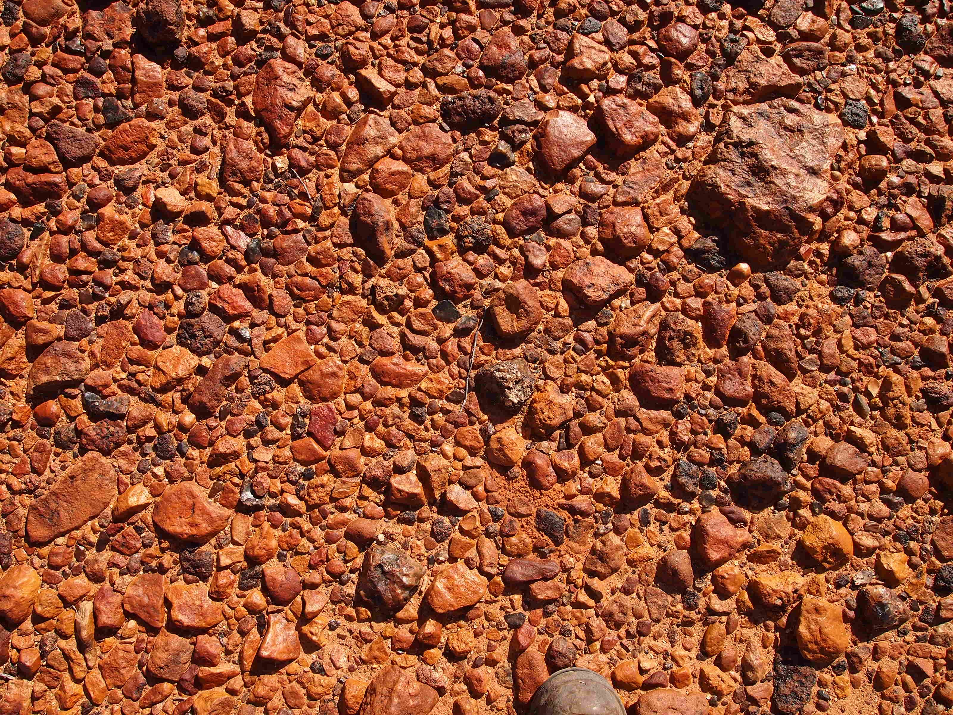
A desert pavement, also called reg (in the western Sahara), serir (eastern Sahara), gibber (in Australia), or saï (central Asia) is a desert surface covered with closely packed, interlocking angular or rounded rock fragments of pebble and cobble size. They typically top alluvial fans. Desert varnish collects on the exposed surface rocks over time. Geologists debate the mechanics of pavement formation and their age. Formation Several theories have been proposed for the formation of desert pavements. A common theory suggests that they form through the gradual removal of sand, dust and other fine-grained material by the wind and intermittent rain, leaving the larger fragments behind. The larger fragments are shaken into place through the forces of rain, running water, wind, gravity, creep, thermal expansion and contraction, wetting and drying, frost heaving, animal traffic, and the Earth's constant microseismic vibrations. The removal of small particles by wind does not contin ... [...More Info...] [...Related Items...] OR: [Wikipedia] [Google] [Baidu] |


