|
Ancient West Africa
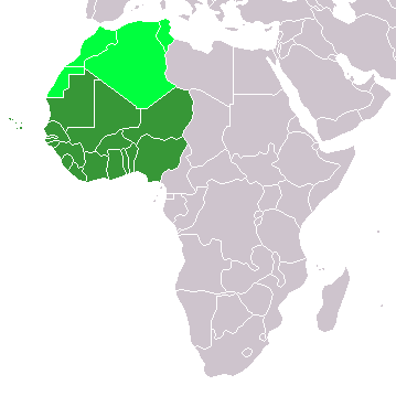
The history of West Africa has been divided into its prehistory, the Iron Age in Africa, the major polities flourishing, the colonial period, and finally the post-independence era, in which the current nations were formed. West Africa is west of an imagined north–south axis lying close to 10° east longitude, bordered by the Atlantic Ocean and Sahara Desert. Colonial boundaries are reflected in the modern boundaries between contemporary West African states, cutting across ethnic and cultural lines, often dividing single ethnic groups between two or more states. West African populations were considerably mobile and interacted with one another throughout the population history of West Africa. Acheulean tool-using archaic humans may have dwelled throughout West Africa since at least between 780,000 BP and 126,000 BP (Middle Pleistocene). During the Pleistocene, Middle Stone Age peoples (e.g., Iwo Eleru people, possibly Aterians), who dwelled throughout West Africa between M ... [...More Info...] [...Related Items...] OR: [Wikipedia] [Google] [Baidu] |
Guinean Forests Of West Africa
The Guinean forests of West Africa is a biodiversity hotspot designated by Conservation International, which includes the belt of tropical moist broadleaf forests along the coast of West Africa, running from Sierra Leone and Guinea in the west to the Sanaga River of Cameroon in the east. The Dahomey Gap, a region of savanna and dry forest in Togo and Benin, divides the Guinean forests into the Upper Guinean forests and Lower Guinean forests. The Upper Guinean forests extend from Sierra Leone and Guinea in the west through Liberia, Côte d'Ivoire, and Ghana to Togo in the east. The Lower Guinean forests extend east from Benin through Nigeria and Cameroon. The Lower Guinean forests also extend south past the Sanaga River, the southern boundary of the hotspot, into southern Cameroon, Equatorial Guinea, Gabon, Republic of the Congo, Cabinda, and Democratic Republic of the Congo. Ecoregions The World Wide Fund for Nature divides the Upper and Lower Guinean forests into a number o ... [...More Info...] [...Related Items...] OR: [Wikipedia] [Google] [Baidu] |
Sahelian Kingdoms
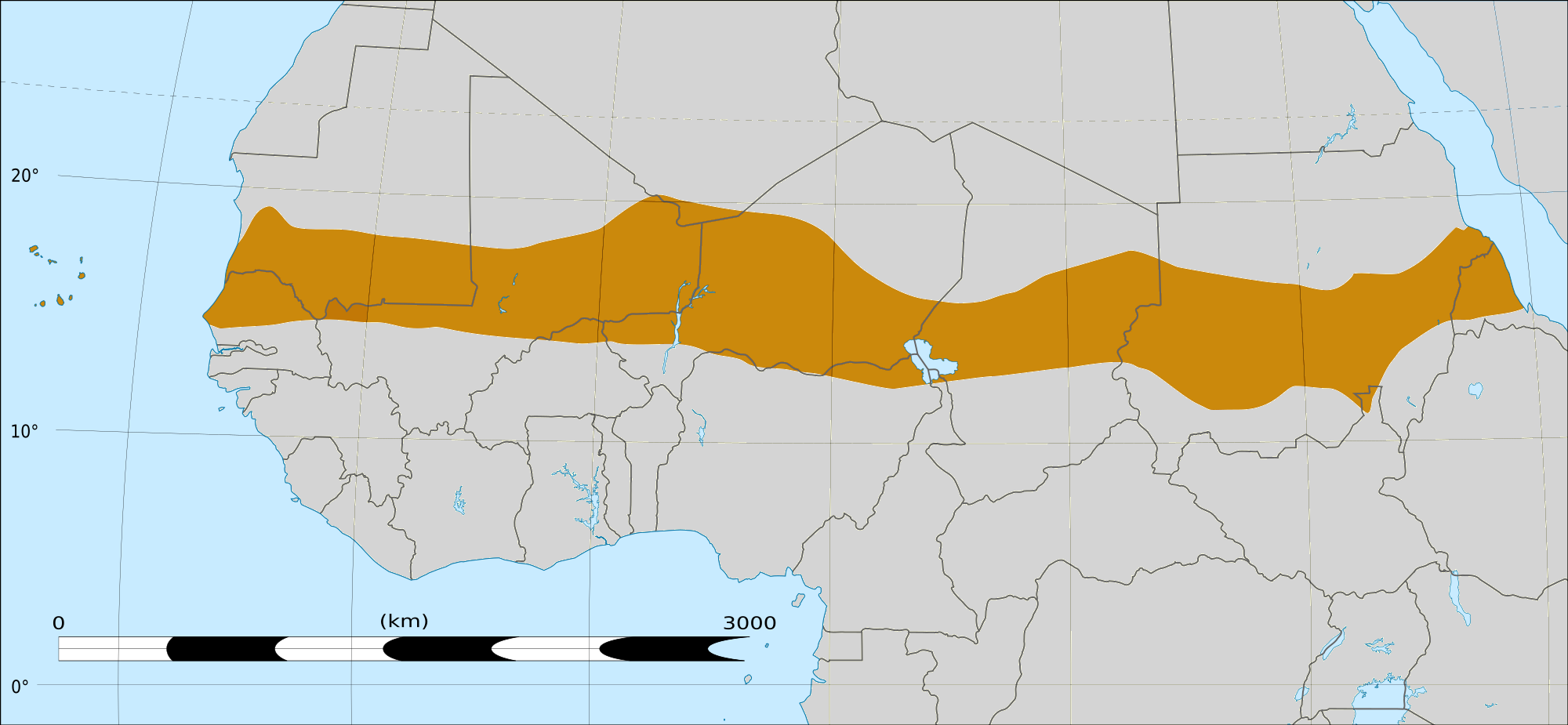
The Sahelian kingdoms were a series of centralized kingdoms or empires that were centered on the Sahel, the area of grasslands south of the Sahara, from the 8th century to the 19th. The wealth of the states came from controlling the trade routes across the desert. Their power came from having large pack animals like camels and horses that were fast enough to keep a large empire under central control and were also useful in such kind of battle. All of these empires were also quite decentralized with member cities having a great deal of autonomy. The Sahel states were limited from expanding south into the forest zone of the Bono and Yoruba as mounted warriors were all but useless in the forests and the horses and camels could not survive the diseases of the region. Economy There were integrated kingdoms and empires, with substantial cities and significant towns; and less organised territories with large scattered populations. People practised agriculture, stock-rearing, hunti ... [...More Info...] [...Related Items...] OR: [Wikipedia] [Google] [Baidu] |
Senegambian Stone Circles
The Senegambian stone circles are groups of megalithic stone circles that lie in The Gambia north of Janjanbureh and in central Senegal. With an approximate area of 30,000 km²,Laport et al. 2012, p. 410 they are sometimes divided into the Wassu (Gambian) and Sine-Saloum (Senegalese) circles, but this is purely a national division. Containing over 1000 stone circles and tumuli spread across an area 350km long and 100km wide, the Senegambian stone circles are the largest concentration of stone circles seen anywhere in the world and an extensive sacred landscape that was used for more than 1500 years. As a result, the sites were inscribed on the UNESCO World Heritage List in 2006. Description and History The stone circles and other megaliths found in Senegal and Gambia are sometimes divided into four large sites: Sine Ngayene and Wanar in Senegal, and Wassu and Kerbatch in the Central River Region in Gambia. Among these four main areas, there are approximately 29,000 sto ... [...More Info...] [...Related Items...] OR: [Wikipedia] [Google] [Baidu] |
Serer People
The Serer people are a West African ethnoreligious group."Charisma and Ethnicity in Political Context: A Case Study in the Establishment of a Senegalese Religious Clientele" Leonardo A. Villalón, Journal of the International African Institute, Vol. 63, No. 1 (1993), p. 95, on behalf of the International African Institute They are the third-largest ethnic group in Senegal, making up 15% of the Senegalese population. They are also found in ... [...More Info...] [...Related Items...] OR: [Wikipedia] [Google] [Baidu] |
Nok Culture
The Nok culture (or Nok civilization) is a population whose material remains are named after the Ham village of Nok in Kaduna State of Nigeria, where their terracotta sculptures were first discovered in 1928. The Nok culture appeared in Nigeria around 1500 BC and vanished under unknown circumstances around 500 AD, having lasted approximately 2,000 years. Iron use, in smelting and forging tools, appears in Nok culture by at least 550 BC and possibly a few centuries earlier. Data from historical linguistics suggest that iron smelting was independently discovered in the region by 1000 BC. Scientific field work began in 2005 to systematically investigate Nok archaeological sites and to better understand Nok terracotta sculptures within their Iron Age archaeological context. Origin Breunig and Rupp hypothesized, "Their origin is unknown, but since the plants they used as crops (especially millet) are indigenous to the Sahel region, a northern homeland is more probable than an ... [...More Info...] [...Related Items...] OR: [Wikipedia] [Google] [Baidu] |
Tichitt Culture
The Tichitt Culture, or Tichitt Tradition, was created by Mande peoples. In 4000 BCE, the start of sophisticated social structure (e.g., trade of cattle as valued assets) developed among herders amid the Pastoral Period of the Sahara. Saharan pastoral culture (e.g., fields of tumuli, lustrous stone rings, axes) was intricate. By 1800 BCE, Saharan pastoral culture expanded throughout the Saharan and Sahelian regions. The initial stages of sophisticated social structure among Saharan herders served as the segue for the development of sophisticated hierarchies found in African settlements, such as Dhar Tichitt. After migrating from the Central Sahara, Mande peoples established their civilization in the Tichitt region of the Western Sahara. The Tichitt Tradition of eastern Mauritania dates from 2200 BCE to 200 BCE. Tichitt culture, at Dhar Néma, Dhar Tagant, Dhar Tichitt, and Dhar Walata, included a four-tiered hierarchical social structure, farming of cereals, metallurgy, numero ... [...More Info...] [...Related Items...] OR: [Wikipedia] [Google] [Baidu] |
Mediterranean Sea
The Mediterranean Sea is a sea connected to the Atlantic Ocean, surrounded by the Mediterranean Basin and almost completely enclosed by land: on the north by Western and Southern Europe and Anatolia, on the south by North Africa, and on the east by the Levant. The Sea has played a central role in the history of Western civilization. Geological evidence indicates that around 5.9 million years ago, the Mediterranean was cut off from the Atlantic and was partly or completely desiccated over a period of some 600,000 years during the Messinian salinity crisis before being refilled by the Zanclean flood about 5.3 million years ago. The Mediterranean Sea covers an area of about , representing 0.7% of the global ocean surface, but its connection to the Atlantic via the Strait of Gibraltar—the narrow strait that connects the Atlantic Ocean to the Mediterranean Sea and separates the Iberian Peninsula in Europe from Morocco in Africa—is only wide. The Mediterranean S ... [...More Info...] [...Related Items...] OR: [Wikipedia] [Google] [Baidu] |
Sub-Saharan Africa
Sub-Saharan Africa is, geographically, the area and regions of the continent of Africa that lies south of the Sahara. These include West Africa, East Africa, Central Africa, and Southern Africa. Geopolitically, in addition to the List of sovereign states and dependent territories in Africa, African countries and territories that are situated fully in that specified region, the term may also include polities that only have part of their territory located in that region, per the definition of the United Nations (UN). This is considered a non-standardized geographical region with the number of countries included varying from 46 to 48 depending on the organization describing the region (e.g. UN, WHO, World Bank, etc.). The Regions of the African Union, African Union uses a different regional breakdown, recognizing all 55 member states on the continent - grouping them into 5 distinct and standard regions. The term serves as a grouping counterpart to North Africa, which is instead ... [...More Info...] [...Related Items...] OR: [Wikipedia] [Google] [Baidu] |
Iron Industry
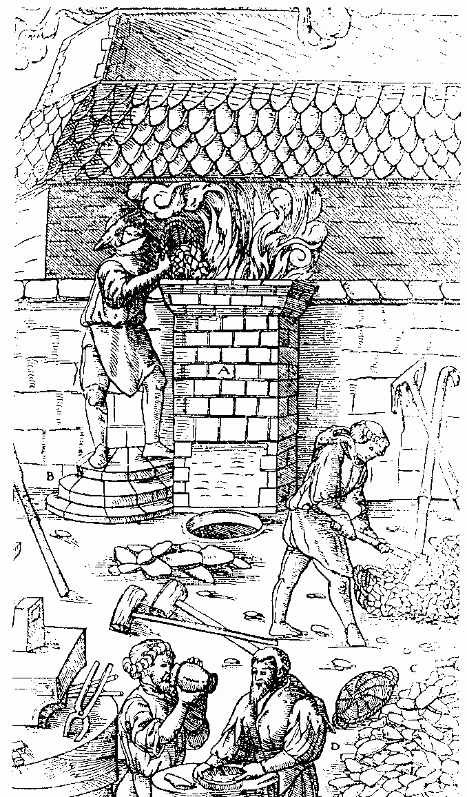
Ferrous metallurgy is the metallurgy of iron and its alloys. The earliest surviving prehistoric iron artifacts, from the 4th millennium BC in Egypt, were made from meteoritic iron-nickel. It is not known when or where the smelting of iron from ores began, but by the end of the 2nd millennium BC iron was being produced from iron ores in the region from Greece to India,Riederer, Josef; Wartke, Ralf-B.: "Iron", Cancik, Hubert; Schneider, Helmuth (eds.): Brill's New Pauly, Brill 2009Early Antiquity By I.M. Drakonoff. 1991. University of Chicago Press. . p. 372 and Sub-Saharan Africa. The use of wrought iron (worked iron) was known by the 1st millennium BC, and its spread defined the Iron Age. During the medieval period, smiths in Europe found a way of producing wrought iron from cast iron (in this context known as pig iron) using finery forges. All these processes required charcoal as fuel. By the 4th century BC southern India had started exporting Wootz steel (with a carbon conte ... [...More Info...] [...Related Items...] OR: [Wikipedia] [Google] [Baidu] |
Holocene
The Holocene ( ) is the current geological epoch. It began approximately 11,650 cal years Before Present (), after the Last Glacial Period, which concluded with the Holocene glacial retreat. The Holocene and the preceding Pleistocene together form the Quaternary period. The Holocene has been identified with the current warm period, known as MIS 1. It is considered by some to be an interglacial period within the Pleistocene Epoch, called the Flandrian interglacial.Oxford University Press – Why Geography Matters: More Than Ever (book) – "Holocene Humanity" section https://books.google.com/books?id=7P0_sWIcBNsC The Holocene corresponds with the rapid proliferation, growth and impacts of the human species worldwide, including all of its written history, technological revolutions, development of major civilizations, and overall significant transition towards urban living in the present. The human impact on modern-era Earth and its ecosystems may be considered of global ... [...More Info...] [...Related Items...] OR: [Wikipedia] [Google] [Baidu] |
Guinea (region)
Guinea is a traditional name for the region of the African coast of West Africa which lies along the Gulf of Guinea. It is a naturally moist tropical forest or savanna that stretches along the coast and borders the Sahel belt in the north. Etymology The etymology of "Guinea" is uncertain. The English term ''Guinea'' comes directly from the Spanish word ''Guinea'', which in turn derives from the Portuguese word ''Guiné''. The Portuguese term emerged in the mid-15th century to refer to the lands inhabited by the ''Guineus'', a generic term used by the Portuguese to refer to the 'black' African peoples living south of the Senegal River (in contrast to the 'tawny' Sanhaja Berbers, north of it, whom they called ''Azenegues''). The term "Guinea" is extensively used in the 1453 chronicle of Gomes Eanes de Zurara. King John II of Portugal took up the title of ''Senhor da Guiné'' (Lord of Guinea) from 1481. It is believed the Portuguese borrowed ''Guineus'' from the Berbe ... [...More Info...] [...Related Items...] OR: [Wikipedia] [Google] [Baidu] |


