|
Adullam
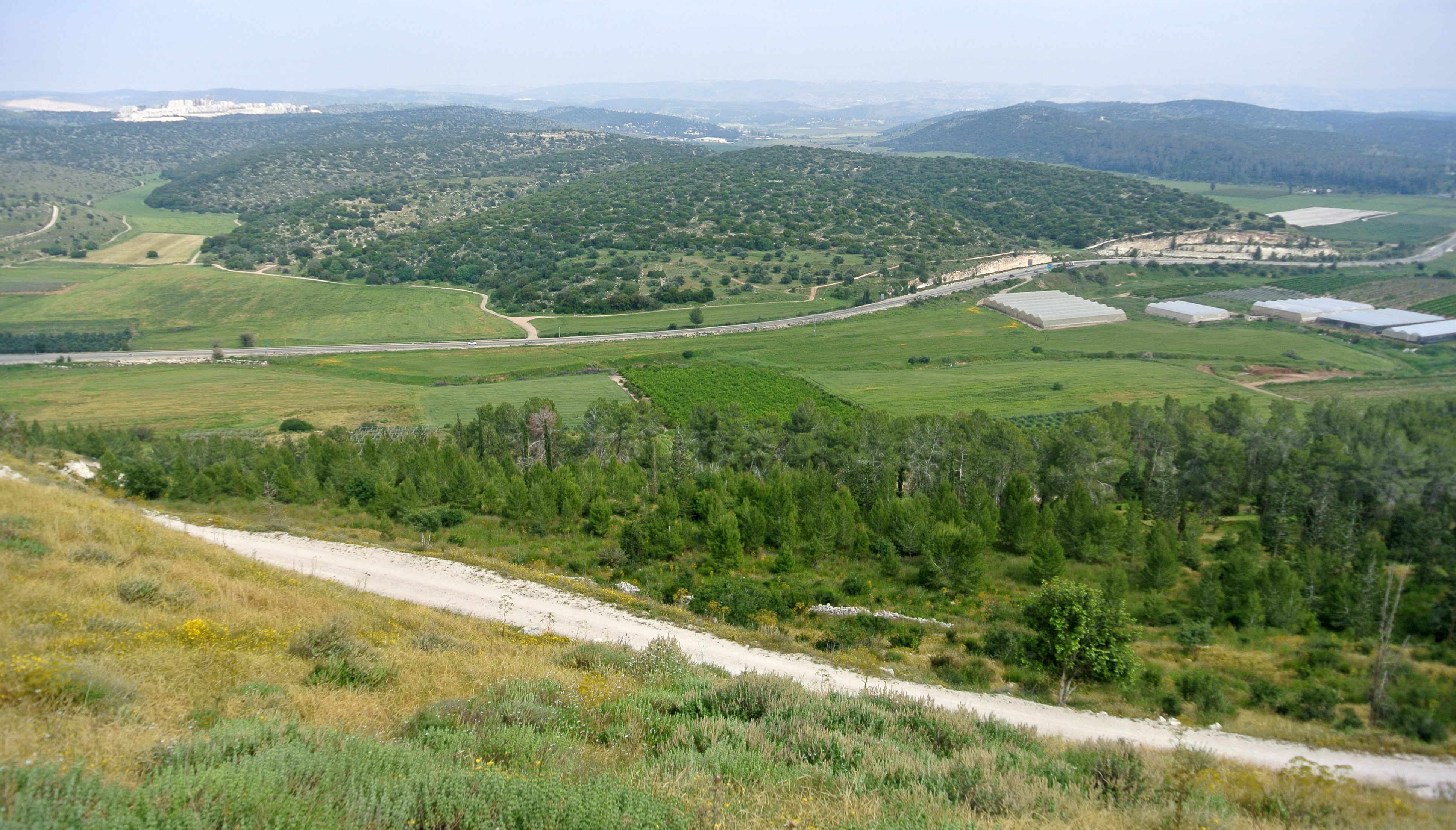
Adullam () is an ancient ruin, formerly known by the Arabic appellation ''ʿAīd el Mâ'' (or ''`Eîd el Mieh''), built upon a hilltop overlooking the Elah Valley, straddling the Green Line between Israel and the West Bank. In the late 19th century, the town was still in ruins. The hilltop ruin is also known by the name ''Khurbet esh-Sheikh Madkour'', named after Madkour, one of the sons of the Sultan Beder, for whom is built a shrine (''wely'') and formerly called by its inhabitants ''Wely Madkour''. The hilltop is mostly flat, with cisterns carved into the rock. The remains of stone structures which once stood there can still be seen. Sedimentary layers of ruins from the old Canaanite and Israelite eras, mostly potsherds, are noticeable everywhere, although olive groves now grow atop of this hill, enclosed within stone hedges. The villages of Aderet, Aviezer and Khirbet al-Deir are located nearby. The ruin lies about south of Moshav Neve Michael. The area around ancient Adul ... [...More Info...] [...Related Items...] OR: [Wikipedia] [Google] [Baidu] |
Cave Of Adullam
The Cave of Adullam was originally a stronghold referred to in the Old Testament, near the town of Adullam, where future King David sought refuge from King Saul. The word "cave" is usually used but "fortress", which has a similar appearance in writing, is used as well. Wilhelm Gesenius' work ''Hebrew and Chaldee Lexicon to the Old Testament Scriptures'' provides notes supporting ''Adullam'' as meaning "a hiding place". Brown, Driver, and Briggs' Hebrew and English Lexicon of the Old Testament cite the Arabic word '''adula'' to mean "turn aside" and suggest ''Adullam'' to mean "retreat, refuge". During this period, David passed up several opportunities to kill Saul, who in turn was attempting to kill his young rival, whose followers believed had been chosen by God to succeed King Saul. David refused to fight unethically, for instance when he had an opportunity to kill Saul in his sleep. According to the Old Testament, God honored David's high ethical standards and soon King David ... [...More Info...] [...Related Items...] OR: [Wikipedia] [Google] [Baidu] |
Elah Valley
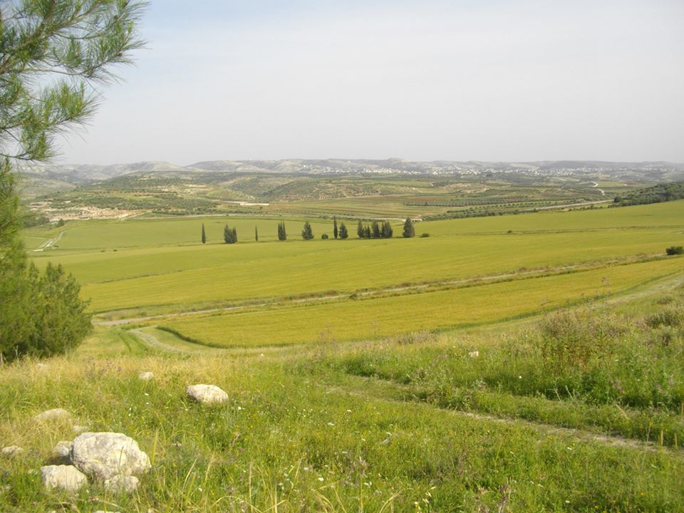
The Valley of Elah or Ella Valley ("the valley of the terebinth"; from the he, עמק האלה ''Emek HaElah''), called in ar, وادي السنط, Wadi es-Sunt, is a long, shallow valley in Israel and the West Bank best known as the place described in the Hebrew Bible (or Old Testament of Christianity) where the Israelites were encamped when David fought Goliath (; ). It is home to several important archaeological sites, including those identified as the ancient towns of Azekah and Socho (). Rising up from the valley on its extreme southeast end lies the hilltop ruin Adullam, and on its north lie the ruins of the ancient fortress city of Khirbet Qeiyafa, which is identified with the ancient town of Sha'araim (). The valley is named after the large and shady terebinth trees (''Pistacia atlantica'') which are indigenous to it. On the west side of the valley, near Socho, there is a very large and ancient tree of this kind, in height with a trunk in circumference and a canopy ... [...More Info...] [...Related Items...] OR: [Wikipedia] [Google] [Baidu] |
Valley Of Elah
The Valley of Elah or Ella Valley ("the valley of the terebinth"; from the he, עמק האלה ''Emek HaElah''), called in ar, وادي السنط, Wadi es-Sunt, is a long, shallow valley in Israel and the West Bank best known as the place described in the Hebrew Bible (or Old Testament of Christianity) where the Israelites were encamped when David fought Goliath (; ). It is home to several important archaeological sites, including those identified as the ancient towns of Azekah and Socho (). Rising up from the valley on its extreme southeast end lies the hilltop ruin Adullam, and on its north lie the ruins of the ancient fortress city of Khirbet Qeiyafa, which is identified with the ancient town of Sha'araim (). The valley is named after the large and shady terebinth trees (''Pistacia atlantica'') which are indigenous to it. On the west side of the valley, near Socho, there is a very large and ancient tree of this kind, in height with a trunk in circumference and a ca ... [...More Info...] [...Related Items...] OR: [Wikipedia] [Google] [Baidu] |
Aderet, Israel
Aderet ( he, אַדֶּרֶת) is a moshav in central Israel. Located in the Judean foothills in the Adullam region, south of Beit Shemesh, west of Gush Etzion and overlooking the Valley of Elah, it falls under the jurisdiction of Mateh Yehuda Regional Council. In it had a population of . History The moshav was founded in the early 1959 by Jewish immigrants from Romania. All of the initial settlers, however, left the site. In 1963, the government re-established the town and brought in Jewish immigrants from the Atlas Mountains in Morocco. Its name was taken from Book of Ezekiel 17:8, meaning "mighty" in the phrase "mighty vine", a symbol of reborn Israel.Bitan, Hanna: 1948-1998: Fifty Years of 'Hityashvut': Atlas of Names of Settlements in Israel, Jerusalem 1999, Carta, p.2, (Hebrew). English translation follows the Judeo-Arabic translation of the Hebrew "''aderet''" = ביזאלה (بِزاله), in Ezekiel 17:8, published in Yosef Tobi's ''Poetry, Judeo-Arabic Literature and ... [...More Info...] [...Related Items...] OR: [Wikipedia] [Google] [Baidu] |
Roglit
Neve Michael ( he, נְוֵה מִיכָאֵל, ''lit.'' Michael's Haven) also known as Roglit, is a moshav in central Israel. Located in the Adullam region and built upon an eminence in the far south-east end of the Elah Valley, it falls under the jurisdiction of Mateh Yehuda Regional Council. In it had a population of . History The village was established on 29 July 1958 (12 Av 5718 anno mundi) by Kurdish immigrants from Iran on farm land that had belonged to the depopulated Palestinian village of Bayt Nattif. The place had formerly been known as ''Khirbet Jurfah'', where archaeological finds ranged from the early Hellenistic period to the Umayyad period with evidence of a Jewish settlement in the first century CE. The newly restructured Jewish National Fund (JNF), working in concert with the Hitahdut HaIkarim agricultural organisation, settled new immigrants on the site in 1958, giving to the place the name Roglit ( he, רוֹגְלִית), meaning "tiller f the grapevine. Th ... [...More Info...] [...Related Items...] OR: [Wikipedia] [Google] [Baidu] |
Neve Michael
Neve Michael ( he, נְוֵה מִיכָאֵל, ''lit.'' Michael's Haven) also known as Roglit, is a moshav in central Israel. Located in the Adullam region and built upon an eminence in the far south-east end of the Elah Valley, it falls under the jurisdiction of Mateh Yehuda Regional Council. In it had a population of . History The village was established on 29 July 1958 (12 Av 5718 anno mundi) by Kurdish immigrants from Iran on farm land that had belonged to the depopulated Palestinian village of Bayt Nattif. The place had formerly been known as ''Khirbet Jurfah'', where archaeological finds ranged from the early Hellenistic period to the Umayyad period with evidence of a Jewish settlement in the first century CE. The newly restructured Jewish National Fund (JNF), working in concert with the Hitahdut HaIkarim agricultural organisation, settled new immigrants on the site in 1958, giving to the place the name Roglit ( he, רוֹגְלִית), meaning "tiller f the grapevine. ... [...More Info...] [...Related Items...] OR: [Wikipedia] [Google] [Baidu] |
Khirbet Al-Deir
Khirbet al-Deir ( ar, خربة الدير), or Khirbet ed-Deir, is a Palestinian village located southwest of Bethlehem, and northwest of Hebron. The town is in the Hebron Governorate of central West Bank. According to the 2007 Palestinian Central Bureau of Statistics (PCBS) Census, the village had a population of 264 people. History Late Ottoman period: the village The village was built at the site of an old monastery in the early 18th century, by residents who broke away from Surif. British Mandate period At the time of the 1931 census of Palestine, conducted by the British Mandate authorities, the population of ''Kh. ed Dair'' was counted under Dura.Mills (1932), p31 Jordanian period After the 1948 Arab-Israeli War, the area was under Jordanian rule. The Jordanian census of 1961 found 133 inhabitants in ''Kh rbetDeir''. 1967-present Since the Six-Day War in 1967, the town has been under Israeli occupation. The only institution in the village is the Village Council. The ... [...More Info...] [...Related Items...] OR: [Wikipedia] [Google] [Baidu] |
Chariton The Confessor
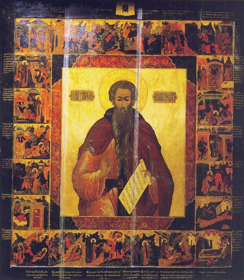
Chariton the Confessor (Greek: Χαρίτων; mid-3rd century, Iconium, Asia Minor – c. 350, Judaean desert) was a Christian saint. His remembrance day is September 28. Life Sources We know about his ''vita'' from the 6th-century "Life of Chariton", written by an anonymous monk, which holds elements supported by modern archaeological excavations. Early life Chariton was a native of Iconium in the Byzantine province of Lycaonia. Under the reign of Emperor Aurelian (270-275) he was tortured and came close to become a martyr during a persecution against Christians. Released from prison after Aurelian's death, he regretted not having died as a martyr. Pharan near Jerusalem After his release in 275, during a pilgrimage to Jerusalem and other holy places, Chariton was abducted by bandits and brought to a cave in the Pharan Valley (upper Wadi Qelt). The traditional account states that his abductors died by drinking wine that was poisoned by a snake. Chariton decided to remain a her ... [...More Info...] [...Related Items...] OR: [Wikipedia] [Google] [Baidu] |
Yoram Tsafrir
Yoram Tsafrir ( he, יורם צפריר; 30 January 1938 – 23 November 2015) was an Israeli archaeologist. His research has included the Byzantine influence on ancient synagogues, demography of Palestine in the Byzantine period, mosaics at Horvat Berachot, excavations at Beit She'an, and excavations at Rehoboth (in the Negev). A Professor Emeritus of the Institute of Archaeology at the Hebrew University of Jerusalem, he was a member of the Israel Academy of Sciences and Humanities. Biography Yoram Tsafrir was born in 1938 in Kfar Azar in Tel Aviv District. A graduate of the Hebrew University of Jerusalem in 1976, he became senior lecturer there in 1978, professor in 1987, and professor emeritus in 2006. From 1989 until 1992 he was Head of the Institute of Archaeology and was Director of the Jewish National and University Library from 2001 to 2007. He was also visiting Fellow at the Harvard University, Dumbarton Oaks, Washington DC. Yoram Tsafrir died on 23 November 2015 at a ... [...More Info...] [...Related Items...] OR: [Wikipedia] [Google] [Baidu] |
Palestine Exploration Fund
The Palestine Exploration Fund is a British society based in London. It was founded in 1865, shortly after the completion of the Ordnance Survey of Jerusalem, and is the oldest known organization in the world created specifically for the study of the Levant region, also known as Palestine. Often simply known as the PEF, its initial objective was to carry out surveys of the topography and ethnography of Ottoman Palestine – producing the PEF Survey of Palestine – with a remit that fell somewhere between an expeditionary survey and military intelligence gathering. It had a complex relationship with Corps of Royal Engineers, and its members sent back reports on the need to salvage and modernise the region.Ilan Pappé (2004) A history of modern Palestine: one land, two peoples Cambridge University Press, pp 34-35 History Following the completion of the Ordnance Survey of Jerusalem, the Biblical archaeologists and clergymen who supported the survey financed the creation ... [...More Info...] [...Related Items...] OR: [Wikipedia] [Google] [Baidu] |
Bet Guvrin
Beit Guvrin ( he, בֵּית גֻּבְרִין, ''lit.'' House of Men in Aramaic) is a kibbutz in the Lakhish region, west of the ancient city of Beit Guvrin, for which it is named. Located 14 kilometres east of Kiryat Gat, it falls under the jurisdiction of Yoav Regional Council. In it had a population of 414. History The kibbutz was established on a site with a long history. Originally an Iron Age town named Maresha, it became a town named Beit Guvrin, which was later renamed Eleutheropolis, "the city of free men" by the Romans in 200 CE. It was later the site of a Frankish colony, "Bethgibelin", before becoming the Arab village Bayt Jibrin. Kibbutz Beit Guvrin was founded in 1949, on the eve of Shavuot, by former Palmach members after the residents of Bayt Jibrin fled following a military assault by Jewish forces during the 1948 Arab–Israeli War. The first residents were members of the "Yetzivim" youth group, which emigrated from Turkey in 1945, and the "Bnei Horin" yout ... [...More Info...] [...Related Items...] OR: [Wikipedia] [Google] [Baidu] |
Félix-Marie Abel
Félix-Marie Abel (29 December 1878 – 24 March 1953) was a French archaeologist, a geographer, and a professor at the École Biblique in Jerusalem. A Dominican priest, he was one of the most prominent bible scholars in the end of Ottoman era and British Mandate era. His work "remains even today the authority on the Greek sources for Palestine", according to Benedict T. Viviano. Biography Abel was born in Saint-Uze, in the Drôme department, on 29 December 1878. He was educated at the Preparatory Seminary of Valence. He was ordained on 1 February 1897 at Saint-Maximin. In 1897 he arrived in Jerusalem to study in the École Biblique founded by Marie-Joseph Lagrange; Lagrange had recruited him (and :fr:Raphaël Savignac) to help him get "a clear grasp of physical environment and the cultural framework of the Bible". Abel graduated in 1900. In 1905 he became a professor at the École Biblique teaching Church History, Greek, topography, archaeology, and Coptic; he served th ... [...More Info...] [...Related Items...] OR: [Wikipedia] [Google] [Baidu] |


